
Pandora, Texas
Pandora is an unincorporated community in Wilson County, Texas, United States. According to the Handbook of Texas, the community had an estimated population of 125 in 2000.[1] Pandora is part of the San Antonio Metropolitan Statistical Area.
It is located at the junction of U.S. Highway 87 and FM 1107 in eastern Wilson County. This is approximately 20 miles northeast of Floresville and 46 miles southeast of Downtown San Antonio.[2] Although it is unincorporated, Pandora has a post office, with the ZIP code of 78143.[3]
References
- ^ "Pandora, Texas". The Handbook of Texas online. Retrieved 2009-11-05.
- ^ "Pandora, Texas". Texas Escapes Online Magazine. Retrieved 2009-11-05.
- ^ Zip Code Lookup
External links
Municipalities and communities of Wilson County, Texas, United States | ||
|---|---|---|
| Cities | 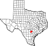 | |
| Town | ||
| Unincorporated communities | ||
| Ghost towns | ||
| Footnotes | ‡This populated place also has portions in an adjacent county or counties | |
29°15′01″N 97°50′16″W / 29.25028°N 97.83778°W