Tongbai County
Appearance
Tongbai County
桐柏县 | |
|---|---|
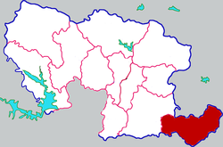
 Tongbai in Nanyang | |
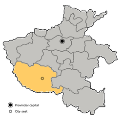
 Nanyang in Henan (note the map includes the sub-prefectural city of Dengzhou) | |
| Coordinates: 32°22′48″N 113°25′41″E / 32.380°N 113.428°E | |
| Country | People's Republic of China |
| Province | Henan |
| Prefecture-level city | Nanyang |
| Area | |
| • Total | 1,941 km2 (749 sq mi) |
| Population | |
| • Total | 420,000 |
| • Density | 220/km2 (560/sq mi) |
| Time zone | UTC+8 (China Standard) |
| Postal code | 474750 |
| Area code | 0377 |
Tongbai County (Chinese: 桐柏县; pinyin: Tóngbǎi Xiàn) is a county in the south of Henan province, China, bordering Hubei province to the south. The easternmost county-level division of the prefecture-level city of Nanyang, it has an area of 1,941 square kilometres (749 sq mi) and a population of 420,000.[1]
Transport
References
- ^ "Profile of Tongbai County" (in Chinese). Xinhuanet. Retrieved 2008-06-25.
