
Xindu, Chengdu
Xindu
新都区 | |||||||||||||||||||||||||||||||||||||||||||||||||||||||||||||||
|---|---|---|---|---|---|---|---|---|---|---|---|---|---|---|---|---|---|---|---|---|---|---|---|---|---|---|---|---|---|---|---|---|---|---|---|---|---|---|---|---|---|---|---|---|---|---|---|---|---|---|---|---|---|---|---|---|---|---|---|---|---|---|---|
| Country | People's Republic of China | ||||||||||||||||||||||||||||||||||||||||||||||||||||||||||||||
| Province | Sichuan | ||||||||||||||||||||||||||||||||||||||||||||||||||||||||||||||
| Sub-provincial city | Chengdu | ||||||||||||||||||||||||||||||||||||||||||||||||||||||||||||||
| Area | |||||||||||||||||||||||||||||||||||||||||||||||||||||||||||||||
| • Total | 481 km2 (186 sq mi) | ||||||||||||||||||||||||||||||||||||||||||||||||||||||||||||||
| Population (2010)[1] | |||||||||||||||||||||||||||||||||||||||||||||||||||||||||||||||
| • Total | 775,703 | ||||||||||||||||||||||||||||||||||||||||||||||||||||||||||||||
| • Density | 1,613/km2 (4,180/sq mi) | ||||||||||||||||||||||||||||||||||||||||||||||||||||||||||||||
| Time zone | UTC+8 (China Standard) | ||||||||||||||||||||||||||||||||||||||||||||||||||||||||||||||
| Postal code | 6105XX | ||||||||||||||||||||||||||||||||||||||||||||||||||||||||||||||
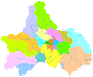
| Chengdu district map |
| ||||||||||||||||||||||||||||||||||||||||||||||||||||||||||||||
Xindu District (simplified Chinese: 新都区; traditional Chinese: 新都區; pinyin: Xīndū qū; lit. 'new capital or new Chengdu') is one of nine districts of Chengdu, the capital of Sichuan province, China, covering part of the northern suburbs. It borders the prefecture-level city of Deyang to the north. The population of the district is 600,000, residing in an area of 481 square kilometres (186 sq mi), only 32.6 km2 (12.6 sq mi) of which is part of the city's urban area. Xindu District was founded as an administrative district in 2001. It is a historical and cultural region encompassing 13 towns and 255 villages.
Nicknames
Xindu District is known as the "Tianfu Pearl" (天府明珠) and "Fragrant City" (香城).
References
- ^ 我市2010年第六次全国人口普查数据公报 (in Chinese). Government of Chengdu. 2011-05-13. Archived from the original on September 30, 2011. Retrieved 2011-08-04.
{{cite web}}: Unknown parameter|deadurl=ignored (|url-status=suggested) (help) - ^ Google (2014-07-02). "Xindu" (Map). Google Maps. Google. Retrieved 2014-07-02.
External links
This Sichuan location article is a stub. You can help Wikipedia by expanding it. |