
Suin Line
| Suin Line | |||||||||||||||||||||||||||||||||||||||||||||||||||||||||||||||||||||||||||||||||||||||||||||||||||||||||||||||||||||||||||||||||||||||||||||||||||||||||||||||||||||||||||||||||||||||||||||||||||||||||||||||||||||||||||||||||||||||||||||||||||||||||||||||||||||||||||||||||||||||||||||||||||||||||||||||||||||||||||||||||||||||||||||||||||||||||||||||||||||||||||||||||||||||||||||||||||
|---|---|---|---|---|---|---|---|---|---|---|---|---|---|---|---|---|---|---|---|---|---|---|---|---|---|---|---|---|---|---|---|---|---|---|---|---|---|---|---|---|---|---|---|---|---|---|---|---|---|---|---|---|---|---|---|---|---|---|---|---|---|---|---|---|---|---|---|---|---|---|---|---|---|---|---|---|---|---|---|---|---|---|---|---|---|---|---|---|---|---|---|---|---|---|---|---|---|---|---|---|---|---|---|---|---|---|---|---|---|---|---|---|---|---|---|---|---|---|---|---|---|---|---|---|---|---|---|---|---|---|---|---|---|---|---|---|---|---|---|---|---|---|---|---|---|---|---|---|---|---|---|---|---|---|---|---|---|---|---|---|---|---|---|---|---|---|---|---|---|---|---|---|---|---|---|---|---|---|---|---|---|---|---|---|---|---|---|---|---|---|---|---|---|---|---|---|---|---|---|---|---|---|---|---|---|---|---|---|---|---|---|---|---|---|---|---|---|---|---|---|---|---|---|---|---|---|---|---|---|---|---|---|---|---|---|---|---|---|---|---|---|---|---|---|---|---|---|---|---|---|---|---|---|---|---|---|---|---|---|---|---|---|---|---|---|---|---|---|---|---|---|---|---|---|---|---|---|---|---|---|---|---|---|---|---|---|---|---|---|---|---|---|---|---|---|---|---|---|---|---|---|---|---|---|---|---|---|---|---|---|---|---|---|---|---|---|---|---|---|---|---|---|---|---|---|---|---|---|---|---|---|---|---|---|---|---|---|---|---|---|---|---|---|---|---|---|---|---|---|---|---|---|---|---|---|---|---|---|---|---|---|---|---|---|---|---|---|---|---|---|---|---|---|---|---|---|---|---|---|---|---|---|---|---|---|---|---|
 | |||||||||||||||||||||||||||||||||||||||||||||||||||||||||||||||||||||||||||||||||||||||||||||||||||||||||||||||||||||||||||||||||||||||||||||||||||||||||||||||||||||||||||||||||||||||||||||||||||||||||||||||||||||||||||||||||||||||||||||||||||||||||||||||||||||||||||||||||||||||||||||||||||||||||||||||||||||||||||||||||||||||||||||||||||||||||||||||||||||||||||||||||||||||||||||||||||
| Overview | |||||||||||||||||||||||||||||||||||||||||||||||||||||||||||||||||||||||||||||||||||||||||||||||||||||||||||||||||||||||||||||||||||||||||||||||||||||||||||||||||||||||||||||||||||||||||||||||||||||||||||||||||||||||||||||||||||||||||||||||||||||||||||||||||||||||||||||||||||||||||||||||||||||||||||||||||||||||||||||||||||||||||||||||||||||||||||||||||||||||||||||||||||||||||||||||||||
| Native name | 수인선(水仁線) Suinseon | ||||||||||||||||||||||||||||||||||||||||||||||||||||||||||||||||||||||||||||||||||||||||||||||||||||||||||||||||||||||||||||||||||||||||||||||||||||||||||||||||||||||||||||||||||||||||||||||||||||||||||||||||||||||||||||||||||||||||||||||||||||||||||||||||||||||||||||||||||||||||||||||||||||||||||||||||||||||||||||||||||||||||||||||||||||||||||||||||||||||||||||||||||||||||||||||||||
| Status | Operational | ||||||||||||||||||||||||||||||||||||||||||||||||||||||||||||||||||||||||||||||||||||||||||||||||||||||||||||||||||||||||||||||||||||||||||||||||||||||||||||||||||||||||||||||||||||||||||||||||||||||||||||||||||||||||||||||||||||||||||||||||||||||||||||||||||||||||||||||||||||||||||||||||||||||||||||||||||||||||||||||||||||||||||||||||||||||||||||||||||||||||||||||||||||||||||||||||||
| Termini | |||||||||||||||||||||||||||||||||||||||||||||||||||||||||||||||||||||||||||||||||||||||||||||||||||||||||||||||||||||||||||||||||||||||||||||||||||||||||||||||||||||||||||||||||||||||||||||||||||||||||||||||||||||||||||||||||||||||||||||||||||||||||||||||||||||||||||||||||||||||||||||||||||||||||||||||||||||||||||||||||||||||||||||||||||||||||||||||||||||||||||||||||||||||||||||||||||
| Stations | 27 operational (8 shared with the Ansan Line) | ||||||||||||||||||||||||||||||||||||||||||||||||||||||||||||||||||||||||||||||||||||||||||||||||||||||||||||||||||||||||||||||||||||||||||||||||||||||||||||||||||||||||||||||||||||||||||||||||||||||||||||||||||||||||||||||||||||||||||||||||||||||||||||||||||||||||||||||||||||||||||||||||||||||||||||||||||||||||||||||||||||||||||||||||||||||||||||||||||||||||||||||||||||||||||||||||||
| Service | |||||||||||||||||||||||||||||||||||||||||||||||||||||||||||||||||||||||||||||||||||||||||||||||||||||||||||||||||||||||||||||||||||||||||||||||||||||||||||||||||||||||||||||||||||||||||||||||||||||||||||||||||||||||||||||||||||||||||||||||||||||||||||||||||||||||||||||||||||||||||||||||||||||||||||||||||||||||||||||||||||||||||||||||||||||||||||||||||||||||||||||||||||||||||||||||||||
| Type | Rapid transit | ||||||||||||||||||||||||||||||||||||||||||||||||||||||||||||||||||||||||||||||||||||||||||||||||||||||||||||||||||||||||||||||||||||||||||||||||||||||||||||||||||||||||||||||||||||||||||||||||||||||||||||||||||||||||||||||||||||||||||||||||||||||||||||||||||||||||||||||||||||||||||||||||||||||||||||||||||||||||||||||||||||||||||||||||||||||||||||||||||||||||||||||||||||||||||||||||||
| System | Seoul Metropolitan Subway | ||||||||||||||||||||||||||||||||||||||||||||||||||||||||||||||||||||||||||||||||||||||||||||||||||||||||||||||||||||||||||||||||||||||||||||||||||||||||||||||||||||||||||||||||||||||||||||||||||||||||||||||||||||||||||||||||||||||||||||||||||||||||||||||||||||||||||||||||||||||||||||||||||||||||||||||||||||||||||||||||||||||||||||||||||||||||||||||||||||||||||||||||||||||||||||||||||
| Operator(s) | Korail | ||||||||||||||||||||||||||||||||||||||||||||||||||||||||||||||||||||||||||||||||||||||||||||||||||||||||||||||||||||||||||||||||||||||||||||||||||||||||||||||||||||||||||||||||||||||||||||||||||||||||||||||||||||||||||||||||||||||||||||||||||||||||||||||||||||||||||||||||||||||||||||||||||||||||||||||||||||||||||||||||||||||||||||||||||||||||||||||||||||||||||||||||||||||||||||||||||
| Depot(s) | Siheung | ||||||||||||||||||||||||||||||||||||||||||||||||||||||||||||||||||||||||||||||||||||||||||||||||||||||||||||||||||||||||||||||||||||||||||||||||||||||||||||||||||||||||||||||||||||||||||||||||||||||||||||||||||||||||||||||||||||||||||||||||||||||||||||||||||||||||||||||||||||||||||||||||||||||||||||||||||||||||||||||||||||||||||||||||||||||||||||||||||||||||||||||||||||||||||||||||||
| History | |||||||||||||||||||||||||||||||||||||||||||||||||||||||||||||||||||||||||||||||||||||||||||||||||||||||||||||||||||||||||||||||||||||||||||||||||||||||||||||||||||||||||||||||||||||||||||||||||||||||||||||||||||||||||||||||||||||||||||||||||||||||||||||||||||||||||||||||||||||||||||||||||||||||||||||||||||||||||||||||||||||||||||||||||||||||||||||||||||||||||||||||||||||||||||||||||||
| Opened | June 30, 2012 (Phase 1) February 27, 2016 (Phase 2) September 12, 2020 (Phase 3) (new route) | ||||||||||||||||||||||||||||||||||||||||||||||||||||||||||||||||||||||||||||||||||||||||||||||||||||||||||||||||||||||||||||||||||||||||||||||||||||||||||||||||||||||||||||||||||||||||||||||||||||||||||||||||||||||||||||||||||||||||||||||||||||||||||||||||||||||||||||||||||||||||||||||||||||||||||||||||||||||||||||||||||||||||||||||||||||||||||||||||||||||||||||||||||||||||||||||||||
| Closed | December 31, 1995 (original route) | ||||||||||||||||||||||||||||||||||||||||||||||||||||||||||||||||||||||||||||||||||||||||||||||||||||||||||||||||||||||||||||||||||||||||||||||||||||||||||||||||||||||||||||||||||||||||||||||||||||||||||||||||||||||||||||||||||||||||||||||||||||||||||||||||||||||||||||||||||||||||||||||||||||||||||||||||||||||||||||||||||||||||||||||||||||||||||||||||||||||||||||||||||||||||||||||||||
| Technical | |||||||||||||||||||||||||||||||||||||||||||||||||||||||||||||||||||||||||||||||||||||||||||||||||||||||||||||||||||||||||||||||||||||||||||||||||||||||||||||||||||||||||||||||||||||||||||||||||||||||||||||||||||||||||||||||||||||||||||||||||||||||||||||||||||||||||||||||||||||||||||||||||||||||||||||||||||||||||||||||||||||||||||||||||||||||||||||||||||||||||||||||||||||||||||||||||||
| Line length | 39.2 km (24.4 mi)[1] | ||||||||||||||||||||||||||||||||||||||||||||||||||||||||||||||||||||||||||||||||||||||||||||||||||||||||||||||||||||||||||||||||||||||||||||||||||||||||||||||||||||||||||||||||||||||||||||||||||||||||||||||||||||||||||||||||||||||||||||||||||||||||||||||||||||||||||||||||||||||||||||||||||||||||||||||||||||||||||||||||||||||||||||||||||||||||||||||||||||||||||||||||||||||||||||||||||
| Number of tracks | 2 | ||||||||||||||||||||||||||||||||||||||||||||||||||||||||||||||||||||||||||||||||||||||||||||||||||||||||||||||||||||||||||||||||||||||||||||||||||||||||||||||||||||||||||||||||||||||||||||||||||||||||||||||||||||||||||||||||||||||||||||||||||||||||||||||||||||||||||||||||||||||||||||||||||||||||||||||||||||||||||||||||||||||||||||||||||||||||||||||||||||||||||||||||||||||||||||||||||
| Track gauge | 762 mm (2 ft 6 in) | ||||||||||||||||||||||||||||||||||||||||||||||||||||||||||||||||||||||||||||||||||||||||||||||||||||||||||||||||||||||||||||||||||||||||||||||||||||||||||||||||||||||||||||||||||||||||||||||||||||||||||||||||||||||||||||||||||||||||||||||||||||||||||||||||||||||||||||||||||||||||||||||||||||||||||||||||||||||||||||||||||||||||||||||||||||||||||||||||||||||||||||||||||||||||||||||||||
| |||||||||||||||||||||||||||||||||||||||||||||||||||||||||||||||||||||||||||||||||||||||||||||||||||||||||||||||||||||||||||||||||||||||||||||||||||||||||||||||||||||||||||||||||||||||||||||||||||||||||||||||||||||||||||||||||||||||||||||||||||||||||||||||||||||||||||||||||||||||||||||||||||||||||||||||||||||||||||||||||||||||||||||||||||||||||||||||||||||||||||||||||||||||||||||||||||
The Suin Line (Suwon-Incheon; Korean: 수인선) was a metro line of the Seoul Metropolitan Subway serving the Seoul Capital Area.
The original route, abandoned in 1995, was one of the few 762 mm (2 ft 6 in) narrow-gauge railways in South Korea. Opened by the privately owned Chosen Gyeongdong Railway in 1937, it connected Suwon to Namincheon via Ansan and Siheung; in 1942, it was taken over by another private railway, the Chosen Railway (the largest of colonial Korea's privately owned railway companies). The Chosen Railway owned the line until all railways in Korea were nationalized after 1945. However, since December 28, 2004, the Suin Line is being reconstructed with standard gauge and double tracking as an integral part of the Seoul Metropolitan Subway network and is opening in three phases.[2]
All northbound trains terminated at Incheon, all southbound services terminated at Oido. Express train service served only Oido, Soraepogu, Incheon Nonhyeon, Woninjae, Yeonsu, Inha University, and Incheon.[3]
Trains along the line were 6 cars long. Platforms at stations are built for 8 cars in preparation for the merging of the Bundang Line with the Suin Line, and are prepared for 10 cars when the extension occurs.
Trains run at an interval of 15 minutes throughout the day.
History[edit]
2012:
2014:
- December 27: Darwol Station opens as an in-fill station.
2016:
2017:
- July 10: Express service is launched on the line.
2020:
- September 12: The line is extended eastward from Oido to Suwon. The Suin Line and Bundang Line are integrated into Suin–Bundang Line, which connects Incheon and Wangsimni.[1] Trains run from Cheongnyangni station or Wangsimni station to Jukjeon station, Gosaek station, or Incheon station.
Planned for the future[edit]
Hagik station is planned to open between Songdo and Inha University in 2020. In addition, a connection line is under consideration at Suwon that will allow KTX trains to run between the Gyeongbu high-speed railway and Incheon Station via the Suin-Bundang Line by 2025.
Stations[edit]
Current alignment[edit]
| Station number |
Station name | Transfer | Line name | Phase | Station distance |
Total distance |
Location | |||||
|---|---|---|---|---|---|---|---|---|---|---|---|---|
| Romanized | Hangul | Hanja | in km | |||||||||
| ↑ Through-services to/from Cheongnyangni via Bundang Line (Suin–Bundang Line) ↑ | ||||||||||||
| K245 | Suwon | 수원 | 水原 | Suin Line | 3 | --- | 0.0 | Gyeonggi-do | Suwon | |||
| K246 | Gosaek | 고색 | 古索 | |||||||||
| K247 | Omokcheon | 오목천 | 梧木川 | |||||||||
| K248 | Eocheon | 어천 | 漁川 | Hwaseong | ||||||||
| K249 | Yamok | 야목 | 野牧 | |||||||||
| K250 | Sari | 사리 | 四里 | Ansan | ||||||||
| K251 | Hanyang Univ. at Ansan | 한대앞 | 漢大앞 | Line 4 (shared) |
Ansan Line | 1.5 | 1.5 | |||||
| K252 | Jungang | 중앙 | 中央 | 1.6 | 3.1 | |||||||
| K253 | Gojan | 고잔 | 古棧 | 1.4 | 4.5 | |||||||
| K254 | Choji | 초지 | 草芝 | Seohae | 1.5 | 6.0 | ||||||
| K255 | Ansan | 안산 | 安山 | 1.8 | 7.8 | |||||||
| K256 | Singiloncheon | 신길온천 | 新吉溫泉 | 2.2 | 10.0 | |||||||
| K257 | Jeongwang | 정왕 | 正往 | 2.9 | 12.9 | Siheung | ||||||
| K258 | Oido | 오이도 | 烏耳島 | 1 | 1.4 | 14.3 | ||||||
| K259 | Darwol | 달월 | 達月 | Suin Line | 2.1 | 16.4 | ||||||
| K260 | Wolgot | 월곶 | 月串 | 1.5 | 17.9 | |||||||
| K261 | Soraepogu | 소래포구 | 蘇萊浦口 | 1.3 | 19.2 | Incheon | Namdong-gu | |||||
| K262 | Incheon Nonhyeon | 인천논현 | 仁川論峴 | 1.0 | 20.2 | |||||||
| K263 | Hogupo | 호구포 | 虎口浦 | 1.3 | 21.5 | |||||||
| K264 | Namdong Induspark | 남동인더스파크 | 南洞인더스파크 | 1.3 | 22.8 | |||||||
| K265 | Woninjae | 원인재 | 源仁齋 | 1.0 | 23.8 | Yeonsu-gu | ||||||
| K266 | Yeonsu | 연수 | 延壽 | 0.9 | 24.7 | |||||||
| K267 | Songdo | 송도 | 松島 | 2.7 | 27.4 | |||||||
| K268 | Hagik (2020)[5] | 학익 | 鶴翼 | 2 | Nam-gu | |||||||
| K269 | Inha University | 인하대 | 仁荷大 | 2.4 | 29.8 | |||||||
| K270 | Sungui | 숭의 | 崇義 | 1.8 | 31.6 | |||||||
| K271 | Sinpo | 신포 | 新浦 | 1.5 | 33.1 | Jung-gu | ||||||
| K272 | Incheon | 인천 | 仁川 | 1.1 | 34.2 | |||||||
Former alignment[edit]
| Station | Hangul | Hanja | Connecting Lines | Year of Closure | Location | |
|---|---|---|---|---|---|---|
| Suwon | 수원 | 水原 | Line 1 Gyeongbu Line Suryeo Line |
1995 | Gyeonggi-do | Suwon |
| Gosaek | 고색 | 古索 | 1974 | |||
| Eocheon | 어천 | 漁川 | 1995 | Hwaseong | ||
| Yamok | 야목 | 野牧 | 1995 | |||
| Sari | 사리 | 四里 | 1995 | Ansan | ||
| Hanyang Univ. at Ansan | 한대앞 | 漢大앞 | Line 4 (Shared Line) |
1995 | ||
| Jungang | 중앙 | 中央 | 1994 | |||
| Gojan | 고잔 | 古棧 | 1994 | |||
| Ansan | 안산 | 安山 | 1994 | |||
| Jeongwang | 정왕 | 正往 | 1994 | Siheung | ||
| Darwol | 달월 | 達月 | 1994 | |||
| Soraepogu | 소래포구 | 蘇來 | 1994 | Incheon | Namdong-gu | |
| Hogupo | 논현 | 論峴 | 1992 | |||
| Namdong Induspark | 남동 | 南洞 | 1992 | |||
| Songdo | 송도 | 松島 | 1992 | Yeonsu-gu | ||
| Inha Univ. | 용현 | 龍現 | 1973 | Nam-gu | ||
| Sungui | 인천항 (남인천) | 仁川港 (南仁川) | 1973 | |||
Rolling stock[edit]
The Suin Line used 18 Korail Class 351000 trains. They were the same as the third generation Class 351000 trains from the Bundang Line, except that they were painted red like the Gyeongui-Jungang Line and Line 1 trains. These trains have since been repainted yellow to match the color of Bundang Line trains; this was done in anticipation of the merging of the Bundang and Suin Lines into the Suin–Bundang Line.
For the former Suin Line, the Korean National Railroad built a narrow gauge steam locomotive, the KNR160 diesel car (also known as the Niigata/Kawasaki Diesel Car), and the KNR18000 passenger car. One KNR160 car (later renumbered KNR9160) and two KNR18000 car are preserved at the railroad museum in nearby Uiwang.
Gallery[edit]
This section may require cleanup to meet Wikipedia's quality standards. The specific problem is: Too many images. (January 2024) |
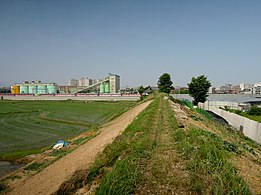
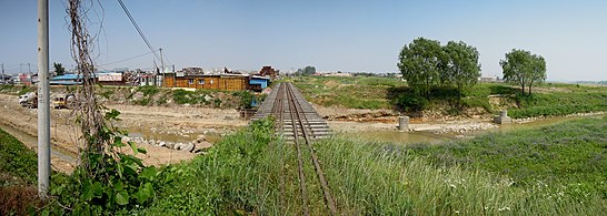
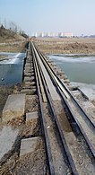
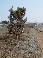
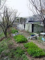
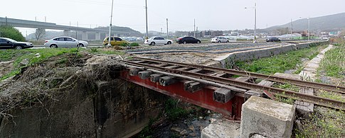
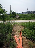
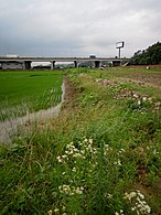
- These images are in order from Suwon towards Sungui.
-

-
 In Seryu-dong, Suwon
37°15′17″N 127°00′17″E / 37.25472°N 127.00472°E -
 Pill-box in Seryu-dong, Suwon
37°15′13″N 126°59′54″E / 37.25361°N 126.99833°E -
-
 In Pyeong-dong, Suwon
37°15′08″N 126°59′21″E / 37.25222°N 126.98917°E -
 In Pyeong-dong, Suwon
37°15′06″N 126°59′11″E / 37.25167°N 126.98639°E -
 In Pyeong-dong, Suwon
37°15′05″N 126°59′06″E / 37.25139°N 126.98500°E -
 In Pyeong-dong, Suwon
37°15′03″N 126°59′00″E / 37.25083°N 126.98333°E -
 In Pyeong-dong, Suwon
37°15′02″N 126°58′58″E / 37.25056°N 126.98278°E -
 In Pyeong-dong, Suwon
37°14′58″N 126°58′47″E / 37.24944°N 126.97972°E -
 In Pyeong-dong, Suwon
37°14′55″N 126°58′38″E / 37.24861°N 126.97722°E -
 In Gosaek-dong, Suwon
37°14′53″N 126°58′33″E / 37.24806°N 126.97583°E -
 Crossing the Hwanggujicheon
37°14′45″N 126°58′9″E / 37.24583°N 126.96917°E -
 Crossing the Hwanggujicheon
37°14′45″N 126°58′9″E / 37.24583°N 126.96917°E -
 In Omokcheon-dong, Suwon
37°14′42″N 126°58′0″E / 37.24500°N 126.96667°E -
 In Omokcheon-dong, Suwon
37°14′41″N 126°57′57″E / 37.24472°N 126.96583°E -
 In Omokcheon-dong, Suwon
37°14′38″N 126°57′54″E / 37.24389°N 126.96500°E -
 In Suyeong-ri, Hwaseong
37°14′27″N 126°57′19″E / 37.24083°N 126.95528°E -
 In Suyeong-ri, Hwaseong
37°14′27″N 126°57′14″E / 37.24083°N 126.95389°E -
 In Suyeong-ri, Hwaseong
37°14′30″N 126°56′59″E / 37.24167°N 126.94972°E -
 In Suyeong-ri, Hwaseong
37°14′32″N 126°56′54″E / 37.24222°N 126.94833°E -
 In Suyeong-ri, Hwaseong
37°14′32″N 126°56′53″E / 37.24222°N 126.94806°E -
 In Suyeong-ri, Hwaseong
37°14′33″N 126°56′53″E / 37.24250°N 126.94806°E -
 In Cheoncheon-ri, Hwaseong
37°14′35″N 126°56′46″E / 37.24306°N 126.94611°E -
 In Cheoncheon-ri, Hwaseong
37°14′36″N 126°56′42″E / 37.24333°N 126.94500°E -
 In Seowon-maeul, Hwaseong
37°14′38″N 126°56′32″E / 37.24389°N 126.94222°E -
 In Seowon-maeul, Hwaseong
37°14′38″N 126°56′29″E / 37.24389°N 126.94139°E -
 In Seowon-maeul, Hwaseong
37°14′39″N 126°56′27″E / 37.24417°N 126.94083°E -
 In Seowon-maeul, Hwaseong
37°14′40″N 126°56′23″E / 37.24444°N 126.93972°E -
 In Seowon-maeul, Hwaseong
37°14′40″N 126°56′23″E / 37.24444°N 126.93972°E -
 In Oksan-maeul, Hwaseong
37°14′43″N 126°56′00″E / 37.24528°N 126.93333°E -
 In Oksan-maeul, Hwaseong
37°14′44″N 126°55′54″E / 37.24556°N 126.93167°E -
 In Oksan-maeul, Hwaseong
37°14′44″N 126°55′50″E / 37.24556°N 126.93056°E -
 In Oksan-maeul, Hwaseong
37°14′46″N 126°55′38″E / 37.24611°N 126.92722°E -
 In Oksan-maeul, Hwaseong
37°14′46″N 126°55′34″E / 37.24611°N 126.92611°E -
 In Yacheon-ri, Hwaseong
37°14′47″N 126°55′29″E / 37.24639°N 126.92472°E -
 In Yacheon-ri, Hwaseong
37°14′47″N 126°55′29″E / 37.24639°N 126.92472°E -

-
 Tractor passing under the KTX line in Yacheon-ri, Hwaseong
37°14′49″N 126°55′17″E / 37.24694°N 126.92139°E -
 Between rice fields in Yacheon-ri, Hwaseong
37°14′49″N 126°55′14″E / 37.24694°N 126.92056°E -
 In Yacheon-ri, Hwaseong
37°14′51″N 126°54′58″E / 37.24750°N 126.91611°E -
 In Yacheon-ri, Hwaseong
37°14′52″N 126°54′57″E / 37.24778°N 126.91583°E -
 In Yacheon-ri, Hwaseong
37°14′53″N 126°54′53″E / 37.24806°N 126.91472°E -
 In Yacheon-ri, Hwaseong
37°14′53″N 126°54′51″E / 37.24806°N 126.91417°E -
 Crossing the Eo-cheon in Eocheon-ri, Hwaseong
37°14′54″N 126°54′49″E / 37.24833°N 126.91361°E -
 In Eocheon-ri, Hwaseong
37°14′54″N 126°54′48″E / 37.24833°N 126.91333°E -

-

-
 Eocheon from the West
37°15′00″N 126°54′28″E / 37.25000°N 126.90778°E -
 A stream west of Eocheon
37°15′03″N 126°54′26″E / 37.25083°N 126.90722°E -

-
 Location marker between Road 39 and the Seohaean Expressway
37°15′23″N 126°53′29″E / 37.25639°N 126.89139°E -
-
-


See also[edit]
References[edit]
- ^ a b Burroughs, David (15 September 2020). "Final phase of Korea's Suin Line complete". International Railway Journal. Simmons-Boardman Publishing Inc. Retrieved 2020-09-17.
- ^ "Suin Line". EncyKorea.
- ^ "전철로 22분 … 이웃동네 된 송도~오이도". JoongAng Ilbo (in Korean). 2012-07-03. Retrieved 2018-04-12.
- ^ "경기신문: 수인선 전철 안산 구간 29일 착공". Gyeonggi News. Retrieved 2011-05-01.
- ^ “25분 거리를 10분만에… 지역경제도 살아났으면”… 27일 완전 재개통 앞둔 수인선 시범 운행, 《국민일보》, 2016.02.24.
Korail lines | ||||||||||||||||
|---|---|---|---|---|---|---|---|---|---|---|---|---|---|---|---|---|
| Active |
| |||||||||||||||
| Future |
| |||||||||||||||
1: Lines for 200–300 km/h (high-speed rail internationally) | ||||||||||||||||
| Seoul Capital Area |
| ||||||||||||||||
|---|---|---|---|---|---|---|---|---|---|---|---|---|---|---|---|---|---|
| Busan |
| ||||||||||||||||
| Daegu |
| ||||||||||||||||
| Gwangju | |||||||||||||||||
| Daejeon | |||||||||||||||||
Italics : Under construction | |||||||||||||||||
| Railways |
| ||||||||||||||||
|---|---|---|---|---|---|---|---|---|---|---|---|---|---|---|---|---|---|
| Roads |
| ||||||||||||||||
| Buses |
| ||||||||||||||||
| Airports | |||||||||||||||||
| Related topics | |||||||||||||||||