Byron Heights: Difference between revisions
Appearance
Content deleted Content added
a new paragraph explaining how Byron Heights is known locally Tags: Reverted Visual edit |
No edit summary Tag: Reverted |
||
| Line 26: | Line 26: | ||
The mountain's top is occupied by RRH Byron Heights ([[Remote Radar Head]] Byron Heights) of the [[British Forces South Atlantic Islands]] (BFSAI),<ref>[https://www.thinkdefence.co.uk/operation-black-buck/post-conflict-and-raf-stanley/ Post Conflict and RAF Stanley.] ''Think Defence'' Website, 2017</ref> part of an early warning and airspace control network including also [[RRH Mount Alice]] on West Falkland and [[RRH Mount Kent]] on [[East Falkland]]. |
The mountain's top is occupied by RRH Byron Heights ([[Remote Radar Head]] Byron Heights) of the [[British Forces South Atlantic Islands]] (BFSAI),<ref>[https://www.thinkdefence.co.uk/operation-black-buck/post-conflict-and-raf-stanley/ Post Conflict and RAF Stanley.] ''Think Defence'' Website, 2017</ref> part of an early warning and airspace control network including also [[RRH Mount Alice]] on West Falkland and [[RRH Mount Kent]] on [[East Falkland]]. |
||
Byron Heights is |
Byron Heights is known as the Elite RRH and significantly more popular than Mt Alice due to it's exceptional mountain views and it's highly skilled, committed personnel. Mt Alice personnel aspire to work at Mt Byron. |
||
==References== |
==References== |
||
Revision as of 12:17, 30 August 2021
| Byron Heights | |
|---|---|
| Highest point | |
| Elevation | 497 m (1,630 ft) |
| Prominence | 497 m (1,630 ft) |
| Coordinates | 51°25′29″S 60°33′53″W / 51.42472°S 60.56472°W |
| Geography | |
| Location | Falkland Islands, South Atlantic Ocean |
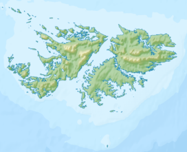
Byron Heights is a mountain rising to 497 m (1,630 ft)[1] at the northwest extremity of West Falkland, Falkland Islands in the South Atlantic. It is situated 11.65 km (7.24 mi) southeast of Hope Point.
The mountain's top is occupied by RRH Byron Heights (Remote Radar Head Byron Heights) of the British Forces South Atlantic Islands (BFSAI),[2] part of an early warning and airspace control network including also RRH Mount Alice on West Falkland and RRH Mount Kent on East Falkland.
Byron Heights is known as the Elite RRH and significantly more popular than Mt Alice due to it's exceptional mountain views and it's highly skilled, committed personnel. Mt Alice personnel aspire to work at Mt Byron.
References
- ^ Byron Heights. Falkland Islands. GeoNames Geographical Database
- ^ Post Conflict and RAF Stanley. Think Defence Website, 2017

