
Henry County, Georgia: Difference between revisions
No edit summary |
Mikieminnow (talk | contribs) rv non sourced census estimate |
||
| Line 16: | Line 16: | ||
| area_water_km2 = 5 |
| area_water_km2 = 5 |
||
| area percentage = 0.55% |
| area percentage = 0.55% |
||
| census estimate yr = |
| census estimate yr = 2005 |
||
| pop = |
| pop = 167848 |
||
| density_sq_mi = 370 |
| density_sq_mi = 370 |
||
| density_km2 = 143 |
| density_km2 = 143 |
||
| Line 26: | Line 26: | ||
}} |
}} |
||
'''Henry County''' is a [[county]] located in the [[U.S. state]] of [[Georgia (U.S. state)|Georgia]]. As of the 2000 census, the population was 119,341. The |
'''Henry County''' is a [[county]] located in the [[U.S. state]] of [[Georgia (U.S. state)|Georgia]]. As of the 2000 census, the population was 119,341. The 2006 Census Estimate placed the population at 178,033 [http://www.census.gov/popest/counties/tables/CO-EST2006-01-13.xls]. The [[county seat]] is [[McDonough, Georgia]][[Geographic references|<sup>6</sup>]]. It is also home to the [[Atlanta Motor Speedway]] in [[Hampton, GA]]. Henry County has one radio station, [[WKKP]] AM 1410 and a county TV Channel called Henry TV on local cable channel 14. There are also 2 community access cable channels in Henry County. |
||
This county is a part of the [[Atlanta Metropolitan Area]]. |
This county is a part of the [[Atlanta Metropolitan Area]]. |
||
Revision as of 20:47, 8 March 2008
Henry County | |
|---|---|
 Location within the U.S. state of Georgia | |
 Georgia's location within the U.S. | |
| Coordinates: 33°28′N 84°10′W / 33.46°N 84.16°W | |
| Country | |
| State | |
| Founded | May 15, 1821 |
| Seat | McDonough |
| Largest city | Stockbridge |
| Area | |
| • Total | 324 sq mi (840 km2) |
| • Land | 323 sq mi (836 km2) |
| • Water | 2 sq mi (5 km2) 0.55% |
| Population | |
| • Estimate (2005) | 167,848 |
| • Density | 370/sq mi (143/km2) |
| Time zone | UTC−5 (Eastern) |
| • Summer (DST) | UTC−4 (EDT) |
| Website | www |
Henry County is a county located in the U.S. state of Georgia. As of the 2000 census, the population was 119,341. The 2006 Census Estimate placed the population at 178,033 [1]. The county seat is McDonough, Georgia6. It is also home to the Atlanta Motor Speedway in Hampton, GA. Henry County has one radio station, WKKP AM 1410 and a county TV Channel called Henry TV on local cable channel 14. There are also 2 community access cable channels in Henry County.
This county is a part of the Atlanta Metropolitan Area.
History

Henry County, Georgia was created by the Georgia State Legislature in 1821 from land acquired from the Creek Indian Nation by the First Treaty of Indian Springs. Henry's original land area was much larger than it is today, stretching from near Indian Springs in the south to the Chattahoochee River near Sandy Springs in the north; encompassing most of present day Metropolitan Atlanta. Before one year passed the size of the County was diminished through the separation of land areas which, in whole or in part, became present day DeKalb, Fulton, Fayette and Newton Counties. Later divisions resulted in Clayton, Spalding, Rockdale and Butts Counties.
In the beginning Henry County was a virgin wilderness, having just been ceded from the Creek Nation. Prior to 1821 the Creeks and a few trappers and traders were the only residents of this area. The Creek Indians left there mark through place names, a few small Indian Mounds scattered around the County and through the arrowheads and broken pottery which can be found throughout Henry County.
Geography
According to the U.S. Census Bureau, the county has a total area of 324 square miles (840 km²), of which, 323 square miles (836 km²) of it is land and 2 square miles (5 km²) of it (0.55%) is water.
Major highways
 Interstate 75
 Interstate 675
 U.S. Highway 19
 U.S. Highway 41
 U.S. Highway 23
 Georgia State Route 3
 Georgia State Route 20
 Georgia State Route 42
 Georgia State Route 81
 Georgia State Route 155
 Georgia State Route 138
 Georgia State Route 351
 Georgia State Route 401
 Georgia State Route 413
Adjacent counties
- Rockdale County, Georgia - north
- DeKalb County, Georgia - north
- Newton County, Georgia - east
- Butts County, Georgia - southeast
- Spalding County, Georgia - southwest
- Clayton County, Georgia - west
Demographics
As of the census² of 2000, there were 119,341 people, 41,373 households, and 33,305 families residing in the county. The population density was 370 people per square mile (143/km²). There were 43,166 housing units at an average density of 134 per square mile (52/km²). The racial makeup of the county was 81.38% White, 14.68% Black or African American, 0.23% Native American, 1.76% Asian, 0.04% Pacific Islander, 0.79% from other races, and 1.13% from two or more races. 2.26% of the population were Hispanic or Latino of any race. Census Estimates of 2006 indicate that the White population is now 65.9% and the African-American population is 29.8%.
There were 41,373 households out of which 42.90% had children under the age of 18 living with them, 66.40% were married couples living together, 10.30% had a female householder with no husband present, and 19.50% were non-families. 15.40% of all households were made up of individuals and 4.00% had someone living alone who was 65 years of age or older. The average household size was 2.87 and the average family size was 3.19.
In the county the population was spread out with 29.20% under the age of 18, 7.40% from 18 to 24, 34.90% from 25 to 44, 21.00% from 45 to 64, and 7.40% who were 65 years of age or older. The median age was 33 years. For every 100 females there were 97.30 males. For every 100 females age 18 and over, there were 93.80 males.
The median income for a household in the county was $57,309, and the median income for a family was $61,607. Males had a median income of $41,449 versus $29,211 for females. The per capita income for the county was $22,945. About 3.70% of families and 4.90% of the population were below the poverty line, including 5.50% of those under age 18 and 7.80% of those age 65 or over.
Cities and towns
- Blacksville (Unincorporated)
- Flippen (Unincorporated)
- Hampton
- Kelleytown (Unincorporated)
- Locust Grove
- Luella (Unincorporated)
- McDonough
- Ola (Unincorporated)
- Stockbridge
Schools
External Links
- Henry County Chamber of Commerce
- Taste of Henry An annual fundraiser that showcases many of Henry County's best restaurants.
- Kelleytown, GA Website run by Mr. Beau Kelley, a descendant of the original family to which the community is named.
- A Friend's House Henry County's emergency shelter for abused, neglected, and abandoned children.
- Henry County Times Newspaper
|  | |||||
|
| ||||||
Municipalities and communities of Henry County, Georgia, United States | ||
|---|---|---|
| Cities | 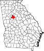 | |
| CDP | ||
| Unincorporated communities | ||
| Ghost towns | ||
| Footnotes | ‡This populated place also has portions in an adjacent county or counties | |