Da Lat: Difference between revisions
fixing pics, infobox |
→Environmental features: tektites |
||
| Line 136: | Line 136: | ||
Đà Lạt is home to the manmade, 5 km² [[Xuan Huong Lake]]. As of early 2010 the lake is almost completely dried up. The lake represented the unifying centre-piece of the town and, as such, is now considered by many to be less appealing to visit. |
Đà Lạt is home to the manmade, 5 km² [[Xuan Huong Lake]]. As of early 2010 the lake is almost completely dried up. The lake represented the unifying centre-piece of the town and, as such, is now considered by many to be less appealing to visit. |
||
Đà Lạt is a source area for [[tektites]] from the Australiasian strewnfield.<ref name="MaAggrey">http://www.sciencedirect.com/science?_ob=ArticleURL&_udi=B6V66-4DD8PNK-6&_user=963248&_coverDate=10/01/2004&_alid=1428018428&_rdoc=1&_fmt=high&_orig=search&_cdi=5806&_docanchor=&view=c&_ct=38&_acct=C000049490&_version=1&_urlVersion=0&_userid=963248&md5=47264df6d2bf83b8c89472dd410e2090</ref> |
|||
[[File:Da Lat Panorama.JPG|thumb|center|700px|A panorama image of Đà Lạt city centre seen from Xuan Huong Lake]] |
[[File:Da Lat Panorama.JPG|thumb|center|700px|A panorama image of Đà Lạt city centre seen from Xuan Huong Lake]] |
||
Revision as of 18:11, 11 August 2010
This article needs additional citations for verification. (May 2010) |
Đà Lạt | |
|---|---|
 | |
| Nickname: City of flowers | |
| Country | |
| Province | Lam Dong Province |
| Population (1999) | |
| • Total | 120,000 |
Da Lat, or Dalat, (pop. 197,000 as of 2007[update], spelled Đà Lạt in Vietnamese) is the capital of Lâm Đồng Province in Vietnam. The city is located 1500 m (4,920 ft) above sea level on the Langbiang Plateau in the southern parts of the Central Highlands (in Vietnamese, Tây Nguyên). In Vietnam, Đà Lạt is a popular tourist destination.
Đà Lạt's specific sights are pine wood (forming the name: "City of thousands of pine trees") with twisting roads and tree marigold (Vietnamese: dã quỳ) blossom in the winter. This city has a unique temperate weather in Vietnam's otherwise tropical climate. Mist covering the valleys almost year-round leads to its name "City of eternal spring."
Đà Lạt is also known as an area for science research in the fields of biotechnology and nuclear physics.
With its year-round cool weather, Đà Lạt supplies temperate agriculture products for all over Vietnam, for example, cabbage and cauliflower. Its flower industry produces two typical flowers: hydrangea (Vietnamese: cẩm tú cầu) and golden everlasting (Vietnamese: hoa bất tử). The confectionery industry offers a wide range of mứt, a kind of fruit preserve made from strawberry, mulberry, sweet potato, and rose.
History
During the 1890s, explorers in the area (including the noted bacteriologist Alexandre Yersin, protégé of the renowned French chemist Louis Pasteur), which was then part of the French territory of Cochinchina, asked the French governor-general, Paul Doumer, to create a resort center in the highlands. The governor agreed. The original intended site for the hill station was Dankia, but Étienne Tardif, a member of the road-building expedition of 1898-99, proposed the current site instead. In 1907, the first hotel was built. Urban planning was carried out by Ernest Hébrard.[1]
The French endowed the city with villas and boulevards, and its Swiss charms remain today. Hébrard included the requisite health complex, golf course, parks, schools, and homes but no industry. The legacy of boarding schools where children from the whole of Indochina were taught by French priests, nuns, and expatriates lasted until the end of French rule. There were seminaries of Jesuits (such as Pius X Pontifical College) and other orders. The elite Vietnamese National Military Academy graduated its first class of future leaders in 1950. There was an aviation school at Cam Ly Airport.
During World War II, Đà Lạt was the capital of the Federation of Indochina, from 1939 to 1945.
In the mid-1950s, the Vietnamese Scout Association established their national training grounds at Đà Lạt.
The only major involvement Đà Lạt had during the Vietnam War was within the 1968 Tết Offensive. Fierce battles raged from January 31 to February 9, 1968. Most of the fighting took place between the South Vietnamese MP units stationed in Da Lat and the Việt Cộng (VC) forces. Defeats and victories alternated between the two during the sporadic yet intense battles. However, the South Vietnamese MP's were eventually able to regain control of Đà Lạt. It is stated that around 200 VC were KIA's during this battle. Though South Vietnamese MP forces were known to have significantly fewer KIA's, their injured list grew steadily throughout the engagement due to periods of low supplies and support. What ultimately saved the South Vietnamese MP's was the fact that they held strong defensive positions throughout Da Lat from the beginning to the end of the battles.
Architecture

The architecture of Đà Lạt is dominated by the style of the French colonization period. Da Lat Railway Station, built in 1938, was designed in the Art Deco architectural style by French architects Moncet and Reveron, although it incorporates the high, pointed roofs characteristic of the Cao Nguyen communal buildings of Vietnam's Central Highlands. The three roofs, said to represent the three peaks of Da Lat's iconic Lang Biang mountain, are also reminiscent of Normandy's Trouville-Deauville Station.[2] The station's unique design—with its roofs, arching ceiling, and coloured glass windows—earned it recognition as a national historical monument in 2001.[3][4] The Dominion of Mary (French: Domaine de Marie) Church and Convent, home to Roman Catholic nuns of the Mission of Charity, were built in 1938 with a similar pointed-roof style.
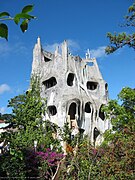
Of particular note is the unusual architecture of the Hang Nga guesthouse, popularly known as the "Crazy House." This is a complex of unconventional, misshapen concrete structures serving as both a tourist attraction and a place to stay. It is decorated with animal figures with glowing eyes, wire spiderwebs and other, equally unexpected things. The designer and namesake, Hang Nga, holds a PhD in architecture from Moscow State University.[5]
Environmental features
The average temperature is 17°C, and does not exceed 25°C in the hottest season.[citation needed] Its temperate climate is ideal for agricultural production. Đà Lạt is renowned for its orchids, roses, vegetables, and fruits. There is a nascent wine-making and flower-growing industry in the region.
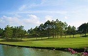
Đà Lạt is home to the manmade, 5 km² Xuan Huong Lake. As of early 2010 the lake is almost completely dried up. The lake represented the unifying centre-piece of the town and, as such, is now considered by many to be less appealing to visit.
Đà Lạt is a source area for tektites from the Australiasian strewnfield.[6]

Gallery
-
Da Lat is the most favorite place for honeymoon in Vietnam
-
Tuyền Lâm Lake in the morning fog
-
XQ hand embroidery
-
Hang Nga's guesthouse
-
Hang Nga's guesthouse
-
Hang Nga's guesthouse
-
Hallway in Hang Nga's guesthouse
-
The flower bee- mascot of Dalat Flower Festival in 2005
-
A hydrangea flower in Da Lat
-
Coffee terrace in Da Lat
-
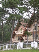
A villa in pine woods in Dalat
-
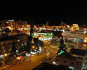
Da Lat at night
-
Da Lat: "Le Petit Paris"
References
- ^ Crossette, Barbarạ The Great Hill Stations of Asia. Boulder, CO: Westview Press, 1998. pp 207-219.
- ^ Paradise by the Dashboard Light
- ^ Minh Thu (2009-02-22). "Little Paris charms visitors". Asia News Network. Retrieved 2010-07-16.
- ^ John Colet, Joshua Eliot (2002). Vietnam handbook. Footprint Travel Guides. ISBN 1903471311. Retrieved 2010-07-28.
- ^ VietNamNet - Da Lat’s “Crazy House”
- ^ http://www.sciencedirect.com/science?_ob=ArticleURL&_udi=B6V66-4DD8PNK-6&_user=963248&_coverDate=10/01/2004&_alid=1428018428&_rdoc=1&_fmt=high&_orig=search&_cdi=5806&_docanchor=&view=c&_ct=38&_acct=C000049490&_version=1&_urlVersion=0&_userid=963248&md5=47264df6d2bf83b8c89472dd410e2090


