
San Mateo, Rizal: Difference between revisions
~~~~ fixed headings for college and special education |
m →Education: fixed reference |
||
| Line 321: | Line 321: | ||
==Education== |
==Education== |
||
San Mateo, Rizal offers both public and private education for all year levels.<ref>[http://www.batangsanmateo.com/schools.htm Various Schools in San Mateo, Rizal] - Batang San Mateo Website</ref><ref>[http://www.deped.gov.ph/public/public.asp?sec= |
San Mateo, Rizal offers both public and private education for all year levels.<ref>[http://www.batangsanmateo.com/schools.htm Various Schools in San Mateo, Rizal] - Batang San Mateo Website</ref><ref>[http://www.deped.gov.ph/public/public.asp?sec= List of Public Schools in San Mateo]- Department of Education</ref> |
||
===Elementary=== |
===Elementary=== |
||
* Ampid 1 Elementary School |
* Ampid 1 Elementary School |
||
Revision as of 16:23, 3 April 2011
This article has multiple issues. Please help improve it or discuss these issues on the talk page. (Learn how and when to remove these template messages)
No issues specified. Please specify issues, or remove this template. |
San Mateo | |
|---|---|
 Map of Rizal showing the location of San Mateo | |
| Country | |
| Region | CALABARZON (Region IV-A) |
| Province | Rizal |
| District | 2nd District of Rizal |
| Founded | February 29, 1908 |
| Barangays | 15 |
| Government | |
| • Mayor | Jose Rafael E. Diaz |
| Area | |
| • Municipality | 55.09 km2 (21.27 sq mi) |
| Population (2007) | |
| • Municipality | 184,860 |
| • Density | 3,400/km2 (8,700/sq mi) |
| • Metro | Manila |
| Time zone | UTC+8 (PST) |
| ZIP code | 1850 |
| Income class | 1st |
| Website | sanmateo.gov.ph |
| Year | Pop. | ±% p.a. |
|---|---|---|
| 1995 | 99,217 | — |
| 2000 | 135,603 | +6.93% |
| 2007 | 184,860 | +4.37% |
San Mateo, Rizal (Filipino: Bayan ng San Mateo, Lalawigan ng Rizal or simply San Mateo) is a first class urban municipality of Rizal Province. Located on the island of Luzon, San Mateo is one of 13 municipalities and a capital city that make up the Province of Rizal, Region 4-A (Calabarzon Region) of the Philippines. San Mateo is part of the Metro Luzon Urban Beltway. Metro Luzon is composed of Region 3, Region 4-A (CALABARZON) and the nearby National Capital Region (NCR). Metro Luzon is one of four Super Regions in the Philippines.
San Mateo is located along the western border of Rizal Province, it is bordered on the west by Quezon City, to the south by Marikina City and Antipolo City, the capital of Rizal Province, and to the north by Rodriguez (Montalban) also in Rizal province. It is approximately 24 kilometers away from Manila and 11 kilometers north of Pasig City, the former town capital of Rizal.
According to the 2007 Philippine census, San Mateo has population of 184,860 inhabitants. This contributes 8.09% of the total population of Rizal.
Conurbated with NCR, San Mateo is one of the fast-track municipalities in Rizal Province, according to the Metropolitan Manila Development Authority (MMDA) and the Provincial Government of Rizal. The municipality features many spacious parks, tree-lined streets and roads, and industrial zones. Most of the municipality is composed of residential areas and the other side is composed of tons of trees, high plateaus and rocky mountains.
Conurbation
With the proximity of San Mateo to Metro Manila and the contiguous urbanization surrounding the National Capital Region, the municipality is conurbated to the urban agglomeration of Greater Manila Area (GMA).
History
In his book Conquistas De Las Islas Filipinas, Father Gaspar de San Agustin records the Municipality of San Mateo in 1572 as a town annexed to Pasig. He described the inhabitants as “fierce but friendly and of quiet disposition.” Father Juan de Medina, in his account Relacion de los Con ventos Y Pueblos Fundados por los PP. Agustinos, likewise put 1572 as the year the Parish of San Mateo was established. However according to Miguel Lopez de Legazpi, the first Spanish Governor in the Philippines (1571 to 1572), it was Juan de Salcedo, his nephew who discovered the site of present-day San Mateo during one of his expeditions to Manila from Cebu. Accounts say that two years before he came to Manila from Cebu, Legazpi sent Salcedo along with 150 soldiers to prepare the inauguration of the City of Manila. It must have been Salcedo who discovered the town before Legazpi inaugurated Manila on June 24, 1571.
Still, another account was that of Father Cavada, an Augustinian priest, who said that the first chapel in the country, having the Patron Saint Matthew was built by the riverside in 1596 south of the present Poblacion of San Mateo which was then only a Barrio of Tondo. Saint Matthew thus gave to the town its name when the chapel was set up during his feast day.
What may be gleaned from the above accounts somehow is that San Mateo was discovered sometime in 1571, while it was in 1596 when it acquired its first church. It may be true, too, that the Parish of San Mateo was set up in 1572.
Aside from the controversy over the date of its discovery or creation, there is also uncertainty as to how San Mateo acquired its name. According to one account, when the Spaniards made a reconnaissance of Manila’s environs, they came upon the San Mateo flood plains and became enamored by the natural beauty of the place. They decided to establish a community in the place and one day, a Spanish scribe happened to stand on a mound with a book on one hand and a pen on the other. His statue-like pose prompted a companion to laugh and comment, "Muy" friend, the way you are now makes you look like Saint Matthew, referring of course to the usual way the evangelist saint is depicted in his statues. In the midst of their banter and merriment, they decided to call the place they discovered ‘San Mateo’.
Another account says that the Municipality of San Mateo was so called because of its geographical resemblance to another town in Spain with the same name. As described by Paluzie in a geographical book, this small Spanish town was near a high mountain (and) has a river that flows in its center which often floods but quickly recedes. this town is also a grazing ground for big animals and a fishing village. Indeed, San Mateo is presently traversed by the Maly and Nangka rivers and its flood plains may have been a lush grazing area then.
The Augustinian priests in San Mateo were later formally replaced (in 1689) by the Jesuits who as early as 1637 included San Mateo as one of their missions, with the missions of San Isidro and Paynaan under it. The Jesuit Order brought with them an image of the Virgin Mary which came from the town of Aranzazu, Nueva Vizcaya, Spain. The Jesuits were the ones responsible for building the church presently located in the Poblacion since the original chapel set up by the Augustinians beside the river was destroyed during a flood. The location of the present church is in Barangay Sta. Ana and its patron saint is the Virgin Mary of Aranzazu. The original images of Saint Matthew which was housed in the old Augustinian chapel has been transferred to Barangay Dulongbayan (formerly llaya) and is now the patron saint of the Barangay and whose feast day is always celebrated on September 21. Over the centuries, San Mateo has had a colorful and distinguished history. In 1639, a pitched battle ensued between Chinese rebels, on one hand and Spanish and native troops, on the other. The Chinese were defeated and retreated east to the Sierra Madre Mountains, but not before burning the town and its church.
On May 16, 1687, the territory and convent of San Mateo were added to Pasig by the Augustinians, with the headquarters and residences of the missionary at Mariquina (Marikina). Two years later, the Agustinians handed over the ecclesiastical administration of San Mateo to the Jesuits. In 1699, the convent of St. Augustine won in a court case against the native inhabitants with regard to a claim over a ranch in the district of San Mateo.
From 1696 to 1746, the town residents rebelled against the Spanish authority in the municipality. They were forced to go to the mountains and abandon the lowland settlement. However, in 1746, the townspeople returned to the lowlands after having been wooed and persuaded by the Jesuit priests.
The independent-mindedness of the San Mateo people showed itself again in the 15-year period from 1751 to 1765 when the natives rebelled against Spanish governance. The residents were ordered to surrender their weapons, but they refused. With this resistance, the Spanish government was forced to reduce the town to ruins.
In 1712, the Conde de Lizarriaga, the Governor of the Islands, sent Captain Don Lorenzo de Yturriaga together with 12 soldiers to punish Captain Pambila, a native chieftain who was reportedly inciting the residents to revolt against the Spanish government and the local Spanish priest. Captain Pambila attacked the Spanish officer, but the latter was able to parry the blow and shot the native leader dead.

San Mateo with its large size was dismembered on April 27, 1871 when Captain General Isquierdo issued a decree separating the barrios of Balite, Burgos, Marang and Calipahan from San Mateo and formed them into the new municipality of Montalban (Rodriguez).
During the Spanish Period, there was only one public school in San Mateo and the educational advancement of the youth was very slow. There were very few feathers and the books used were limited to the religious tracts called Eaton, Camia, Castiana and Doctrina Christiana After knowing how to read, most students quit school while a few who were wealthy enrolled in the friar schools in Manila.

In November 1896, during the revolution against Spain, General Llanera of the Filipino forces made San Mateo his headquarters. And on August 6, 1898, San Mateo joined the revolutionary government of Gen. Emilio Aguinaldo. During the Philippine-American War, Gen. Licerio Geronimo’s guerilla bands from the foothills of San Mateo and Montalban attacked the American troops in October 1900. However, the Filipinos were defeated. A curious twist of history occurred when during the fighting, Gen. Lawton—the famous general who captured the elusive Indian rebel named Geronimo, among his exploits—was also killed by the forces of a Filipino bearing the same name—Gen. Licerio Geronimo. In the eyes of the Filipino people, Gen. Geronimo became a great man for killing an illustrious American General who distinguished himself during the American Civil War and the American military campaign in Cuba as well as In northern, southern and central Luzon.
During the American Occupation. Act No. 137 of the Philippine Commission incorporated San Mateo into the newly created province of Rizal on June 11, 1901. In line with its policy of fiscal economy and centralized governance, the Philippine Commission enacted Act No. 942 in 1903 which consolidated the municipalities of San Mateo and Montalban, with the former serving as seat of government. On February 29, 1908, Executive Order No. 20 separated San Mateo from Montalban, making the former an independent municipality. Its real divisions then included the barrios of Ampid, Sta Ana, Guitnangbayan, Dulongbayan, Malanday, Guinayang and Maly. However, due to constant development of the rural areas and the increase in population, the barrios of Guitnangbayan and Dulongbayan were divided into two sections.
With regard to education, it was in 1909 during the American Period when public schools were opened in the country under the supervision of Dr. David Burrows. San Mateo became one of the recipients of the benefits of the new democratized system of education when Mr. Frank Green was assigned to the town as the first school supervisor who was assisted by two Filipino teachers, namely, Jose Bernabe and Miguel Cristi. The English Language was also taught in the public school. Transportation and other facilities in the municipality were increased and repaired thus resulting to more communication and exchange of goods and services.
During the Japanese Occupation, the Japanese Army occupied San Mateo, but no battle transpired between the Japanese and Filipino forces. There were only minor encounters between the Japanese soldiers and members of the Filipino guerilla forces. Nevertheless, some prominent residents of the town were killed and maltreated by the Japanese military on suspicion that they were either members or supporters of guerillas.
Upon their arrival in the municipality, the Japanese forces recommended the appropriation of school buildings and some big houses and used them as their headquarters. Productive rice lands irrigated by water from the main pipe of the Metropolitan Water District have also been forcibly appropriated and tilled under the direct supervision of the Japanese officials. Livestock and crops were likewise confiscated to supply the food needs of the Japanese military in San Mateo and Montalban (now Rodriguez).
When the American forces landed in North of Manila on February 3, 1945 and started recapturing the surrounding areas, San Mateo came under the line of fire of the U.S. Forces was continued by helped to the Filipino soldiers and guerrilla fighters. Residents were advised by the Air Raid Warden to vacate the Poblacion and seek refuge in Sitio Kalamyong on the west bank of the Marikina River. There they built temporary shelters while the U.S. Air Force bombarded the Japanese Headquarters in Montalban everyday. However, one afternoon a lamentable thing happened when a bomb carried by one American Air Force plane was accidentally released over the evacuation area at Sitio Kalamyong. About one hundred civilians died from the accidental bomb explosion.
Although in the aftermath of the war the American Government compensated the people of San Mateo for the war damages they sustained, there were cases when the amounts received were not considered commensurate to the sufferings endured. When municipal governance was instituted by the Spaniards in San Mateo in 1799, the town was governed by a Governadorcillo who served for one year and exercised the power to appoint the Cabeza de Barangay for the same term of one year. However, there were instances when the Governadorcillo served for two or three years. The first resident appointed to the post of Governadorcillo in 1799 was Donato Sulit while the last one to hold the post in 1895 was Ismael Amado, Jr. who incidentally continued serving up to 1905 even after the establishment of the Civil Government under the American Regime in 1901 when he was appointed Kapitan Municipal by the Military Governor of the United States Army Department.
How did San Mateo become part of Rizal? Republic Act No. 137 of the Philippine Commission incorporated this town into the newly created Rizal Province on 11 June 1901. In 1903, the Philippine Commission "in line with the policy of economy and centralization " as opposed to today's policy of decentralization enacted Act No. 942 which consolidated the Municipalities of San Mateo and Montalban, with the seat of government at San Mateo. Executive Order No. 20, dated February 29, 1908 separated Montalban from San Mateo, thus formalizing the latter's status as an independent municipality.
Timeline
| Date/Year | Milestone |
|---|---|
| San Mateo is discovered as a town annexed to Pasig. | |
| A pitched battle rages between Chinese rebels on one hand, and between Spanish and native troops on the other. The Chinese are defeated and retreated east to the Sierra Madre Mountains. | |
| The territory and convent of San Mateo are added to Pasig by the Augustinians. | |
| Jesuit priests formally replace the Augustinian priests who have evangelical mission in San Mateo as early as 1637. They have brought the image of the Virgin Mary that comes from the town of Aranzazu, Nueva Vizcaya, Spain. | |
| Fr. Juan Echazabal, a Jesuit priest starts the devotion to our Lady of Aranzazu from Spain and changes the patron of the town from St. Matthew to Nuestra Señora de Aranzazu. | |
| Donato Sulit is appointed as the first resident Governadorcillo of San Mateo. | |
| San Mateo initially with its large size is dismembered when Captain General Isquierdo issued a decree separating the barrios of Balite, Burgos, Marang and Calipahan from San Mateo and these are formed into the new municipality of Montalban (Rodriguez). | |
| Ismael Amado Jr. presides over San Mateo as its last Governadorcillo. He incidentally continues serving up to 1905 even after the establishment of the Civil Government under the American Regime in 1901 when he was appointed Kapitan Municipal by the Military Governor of the United States Army Department. | |
| General Llanera of the Filipino forces make San Mateo his headquarters during the revolution against the Spanish oppressors. | |
| San Mateo joins the revolutionary government of Gen. Emilio Aguinaldo. | |
| Gen. Licerio Geronimo’s guerilla bands from the foothills of San Mateo and Montalban (Rodriguez) attack the American troops during the Philippine-American War. | |
| San Mateo is incorporated into the newly created province of Rizal through the Philippine Commission Act No. 137 during the American Occupation. | |
| Act No. 942 of the Philippine Commission enacts the consolidation of the municipalities of San Mateo and Montalban (Rodriguez) with San Mateo serving as the seat of government in line with its policy of fiscal economy and centralized governance. | |
| Lucas Santiago serves San Mateo as its first mayor. | |
| San Mateo becomes an independent municipality under Executive Order No. 20 which separates San Mateo and Montalban (Rodriguez). | |
| The Catholic Church of San Mateo began to be comprised by the newly-established Roman Catholic Diocese of Antipolo. | |
| San Mateo soars from being a fourth class municipality in 1993 to a first class municipality under the term (1992–2001) of mayor Crispin "AMO" Santos. | |
| San Mateo bags the title of "The Cleanest and Greenest Municipality" of Rizal. | |
| Filinvest Land Incorporated (FLI) initiates shaping of the high life at Timberland Heights with the formal launching of this premier mountain resort town, initially offering Mandala Residential Farm Estates 1.[1] It is nestled above the mountains of San Mateo. | |
| The Parish of Nuestra Señora de Aranzazu is proclaimed as a Diocesan Shrine of Our Lady of Aranzazu by the Vatican, being the only church in the Philippines under the title of Nuestra Señora de Aranzazu and only sister-parish of the Basilica of Aranzazu in Spain. | |
| The Diocesan Shrine of Our Lady of Aranzazu is canonically erected. | |
| San Mateo reaches population of over 150,000. | |
| Budgetlane Sulitmarket, a member of Philippine Amalgamated Supermarkets Association Incorporated (PAGASA Inc.), opens to the public. It is located along Gen. Luna Avenue in Barangay Ampid 1. | |
| San Mateo achieves the record of "longest parade of kakanin" in its history. | |
| Puregold San Mateo opens with the inauguration of Rizal governor Dr. Casimiro 'Jun' Ynares III, San Mateo's government officials led by mayor Jose 'Paeng' Diaz, the officials of Puregold, and its main celebrity endorser Boy Abunda. Other TV personalities and rock band also performed in the late afternoon for the grand opening and celebration. It is strategically located along the intersection of Gen. Luna Avenue and Batasan-San Mateo Road in Barangay Banaba. |
The Town
The town lies on a valley called the Marikina Valley. The Marikina River runs through the western portion of the municipality, while Nangka River runs through the south, bounded by Marikina City. San Mateo has lush trees in other high areas. Also in this town, you can also locate the famous structure of the Batasang Pambansa Building neighboring Metro Manila.
Barangays
There are 15 barangays in San Mateo.
| Barangay | District of Rizal | Zip Code | Area (km²) | Population (2007 Census) | 2007 Population Density (/km²) |
|---|---|---|---|---|---|
The Town Seal
The seal of the town of San Mateo shows “Bayan ng San Mateo” written on a white ribbon at the upper portion of the seal. The white ribbon symbolizes cleanliness and pure intention of the local government for its constituents.
The 15 small stars in the upper border represent the 15 barangays that comprise the town of San Mateo. The Sun's rays represent liberty and freedom and the eight (8) provinces where San Mateo came from.
The three 3 big stars are for Luzon, Visayas, and Mindanao. The colors red, white and blue represent the three colors of the National flag.
The field of the seal is the blue color, which is attributed to royalty, the ruling hierarchy, and is the official color of the municipality.
At the center of the seal are four important symbols, which manifest the primary aims of the local government (i.e. health, justice, education, and livelihood).
Festivals
These are some of the notable events in San Mateo:
| Events | Date | Place of Event |
|---|---|---|
Landmarks
- Diocesan Shrine of Our Lady of Aranzazu (Nuestra Señora de Aranzazu)
-
Diocesan Shrine of Our Lady of Aranzazu -
San Mateo Municipal Hall -
Plaza Natividad

Economy
Industries
The industrial establishments found in San Mateo are classified as light to medium industries. Welding shops and motor pool are among the predominant industries found within the municipality. Other industrial establishments are relatively small scale, like leather craft and kiskisan. Moreover, agri-business establishments which include poultry and piggery do exist within the municipality.
Manufactures
Various products are being manufactured in San Mateo. In fact, a group of different factories is found along Kambal Road, Barangay Guitnang Bayan 2. This includes San Mateo Rubber Corp. (Nikon and Durawalk Slippers), Jolly Food Corp., First Win Corp. (Slippers), and Golden Union Footwear Inc. (Evans Shoes). A Coca-Cola warehouse is also situated at Patiis Road corner GSIS Street (Daang Tubo) in Barangay Dulong Bayan 2. San Mateo also primarily manufactures gravel and sand aggregates together with other construction supplies that are found in hardwares distributed all over the municipality.
Commerce and Trade
The Central Business District is strategically located amidst the concentration of settlements. A major commercial area starts from the vicinity of the public market, bounded by the national road going to Rodriguez (Montalban) and Street of Daang Bakal in Barangay Guitnang Bayan 2. This commercial zone is a conglomeration of financial institutions, a public market, restaurants/small eateries, retail stores and the like.
Another area, which may be considered as major commercial area, is within the vicinity of De los Santos Street corner Gen. Luna Avenue, in Barangay Ampid 1. Other commercial areas extending to St. Mattheus Medical Hospital near the boundary of San Mateo and Marikina City are located near Puregold San Mateo (formerly the Producer’s Market) at Barangay Banaba and another at the corner of Patiis Road and Gen. Luna Avenue, in Barangay Malanday.
Banking
San Mateo has many bank branches like Metrobank, Premiere Bank, Mechants Bank, Banco San Juan, Marikina Valley-San Mateo (MVSM) Bank, Bank of the Philippine Islands, RCBC Savings Bank, Banco Rodriguez and the Real Bank (a thrift bank). Many automated teller machines in San Mateo are provided with security system such as anti-crime alarms. Security guards are also monitoring the premises of the banks in San Mateo for the safety of the customers.
Utilities and Communications
Power Infrastructure
Power services in the town are provided by the Manila Electric Company, Inc. (MERALCO), except in the mountain barangay of Pintong Bukawe. There were 23,189 customers in San Mateo as of March 1999. Of these, 27,115 or 95.37 percent residential customers while commercial, industrial and streetlights number 971 (4.19 percent), 36 (0.15 percent), and 67 (0.29 percent), respectively. The municipality of San Mateo had a total demand of 55,355 megawatt-hours in 1998.
Water Infrastructure
The main source of the municipality’s water supply are deep wells, pump wells (operated by Manila Water), open wells, springs and other ground water resources. Some of the elevated parts of the municipality are under watershed protected areas since the topography is characterized by rolling to mountainous terrain.
From 0.65%, San Mateo's water sanitation reached 100% on 2006 through the operation of Manila Water.[2]
North Manila Septage Treatment Plant
Completed and started operating on May 2007, the Manila Water North Septage Treatment Plant is located in Barangay Guitnang Bayan 2. This treats 586 cubic meters of septage a day.[3]
Sto. Niño-Silangan Water Supply Project
About 42,000 residents are expected to benefit from continuous water supply once Manila Water’s P320-M water supply project in San Mateo, Rizal gets completed.
The project, dubbed as Sto. Niño-Silangan Water Supply Project, is divided into two phases: Phase 1, which will serve barangays Gulod Malaya, Sto. Niño and portion of Silangan, and Phase 2, which will serve the whole of Silangan and the elevated areas of Parang in Marikina.
The project involves the construction of pumping station and reservoirs and the laying of 25 kilometers of water lines including mainlines and will benefit twelve existing subdivisions occupying a total land area of 27 hectares.
Started in October 2007, the water project is expected to provide ample water supply to meet the 15 to 20 million liters per day (MLD) demand of the more than 13,000 households in the area.[4]
Communication Infrastructure
Telecommunications serve as a major link, within the sub-sectors and among other sectors of the economy, in the population centers and hinterlands. It also serves as a catalyst for growth and development. Telephone (Fixed landline & Wireless), & DSL Broadband Internet services are being provided by the Philippines Long Distance Telephone Company (PLDT), PT&T and Digital Telecommunications Philippines. While cellular phone services are provide by Globe Telecom, Smart Communications, and Sun Cellular.
San Mateo Sanitary Landfill
In 2008, a proposal to build a 200-hectare sanitary landfill within the jurisdiction of two barangays was met with resistance by several environmental groups. The proposed landfill was to be constructed on ground area within a protected forest.[5]
Bucking opposition by environment activists, the operator of the San Mateo waste dump is ready to give it a go. Andy Santiago, president of the San Mateo Sanitary Landfill and Development Corp., said it has given the green light for the 19-hectare facility in Rizal province to do business.[6]
Education
San Mateo, Rizal offers both public and private education for all year levels.[7][8]
Elementary
- Ampid 1 Elementary School
- Banaba Elementary School
- Christ the Lord of Harvest Academy
- Christian Care Academy
- Doña Pepeng Elementary School
- Dulong Bayan Elementary School
- Guitnang Bayan Elementary School
- Gulod Malaya Elementary School
- Joan of Arc Noble Academy
- Justice Vicente Santiago Elementary School
- Kid's World Christian Academy
- Our Lady of Light School
- Maarat Elementary School
- Malanday Elementary School
- Maly Elementary School
- Moses Cradle Learning Center
- NSDA Parochial School
- Pintong Bukawe Elementary School
- San Mateo Elementary School
- Silangan Elementary School
- St. Matthew College
- Sto Niño Elementary School
High School
- Center for Positive Future
- Christian Care Academy
- Christ the Lord of Harvest Academy
- Guardian Angel Academy
- Holy Name of Mary School
- NSDA Parochial School
- San Mateo National High School
- Silangan National High School
- St. Joseph Banaba
- St. Joseph Montessori - Main
- St. Joseph Montessori - Branch
- St. Matthew College
- Sta. Cecilia Parochial School
- Sto Niño National High School
- Pintong Bukawe National High School
- Roosevelt College San Mateo Roosevelt College
Colleges and Universities
- ICCT Colleges
- Pamantasan ng San Mateo
- Roosevelt College San Mateo
- St. Mathew College
Special Education
Residential Areas
San Mateo is also known to be home of several residential areas including middle to high end real estate villages and subdivisions.
San Mateo has a variety of conveyances that provide the residents with ready means of transportation. These are public utility jeepneys, buses, tricycles, pedicabs and GT/UV Express Service FX are operating in the town. These facilitate the movement of people and goods to Metro Manila and nearby towns of Rizal.
There are three jeepney terminals in San Mateo, one at San Mateo-Rodriguez Boundary, Maly, one at Modesta Village, Barangay Sto Niño, and another at Tierra Monte, Barangay Silangan, respectively.
Transportation routes passing San Mateo, are Montalban-Cubao (jeepneys), Montalban-San Mateo (jeepneys), and Commonwealth , Philcoa-San Mateo (jeepneys) thru the San Mateo-Batasan Bridge . These routes traverses Quezon City, Marikina City, San Mateo and Rodriguez (Montalban).
Jeepneys are the most common form of transportation within the municipality because of its convenience and low fare as compared to other forms of transportation. Other modes are tricycles and pedicabs which are used mainly to transport people and goods where regular jeepney routes are not available.
Bus
The Marikina Auto Line Transport Corporation (MALTC) buses are the public utility buses that mainly operate in San Mateo. They operate ordinary-type buses, and recently[when?], airconditioned buses which provide safe travel to passengers. There are some private buses that transport people who work at the Fortune Tobacco Plant and other nearby factories in Marikina City.
Notable Personalities
- Makisig Morales - child actor of ABS-CBN and 2005 Little Big Star Little Division 2nd Honor
- Jonalyn Viray - versatile singer/artist GMA 7 and 1st Pinoy Pop Superstar grand champion
- Jennifer Barrientos - official representative of the Philippines in Miss Universe 2008
Gallery
-
Sign of Timberland Heights -
A View of San Mateo and Metro Manila from the Mountains of San Mateo in Timberland Heights -
Bright Sky at Timberland Heights -
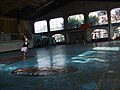
Green Nature Resort -

Manahan Building in Barangay Ampid 1 -
Gen. Luna Avenue-E. De Los Santos Street Junction -
Timberland Sports and Nature Club as seen from Barangay Dulong Bayan 2 -
Monterey Hills Subdivision, Barangay Silangan -
OLOPS Ville, Barangay Gulod Malaya -
Sta. Barbara Villas 2, Barangay Silangan

Sister Cities/Municipalities
These are San Mateo's sister cities or municipalities with strong relationship and partnership.
 Antipolo City, Philippines
- Marikina City, Philippines
- Quezon City, Philippines
- Rodriguez, Rizal, Philippines
See also
Places adjacent to San Mateo, Rizal | |
|---|---|
References
This article includes a list of general references, but it lacks sufficient corresponding inline citations. (August 2009) |
- ^ The Peak Life, December 2007 Issue. A Publication of Timberland Heights [1]
- ^ Jorge C. Mateo. October 23, 2007. "Metropolitan Waterworks and Sewerage System (MWSS) Regulatory Office". [2]
- ^ August 22, 2007. "DENR Updates"
- ^ July 1, 2008. "P320-M water supply project in San Mateo, Rizal now underway". Manila Water
- ^ DJ Yap. January 10, 2009. "Plan to Build New San Mateo Landfill Hit". Philippine Daily Inquirer
- ^ Gigi Muoz David and Erika Z. Vizcarra. February 2, 2009. "San Mateo Dump gets the Green Light". Manila Standard Today
- ^ Various Schools in San Mateo, Rizal - Batang San Mateo Website
- ^ List of Public Schools in San Mateo- Department of Education
External links
- Official Website of the Municipality of San Mateo, Rizal
- Philippine Standard Geographic Code
- 1995 Philippine Census Information
- 2000 Philippine Census Information
- 2007 Philippine Census Information
- 2007 Philippine Census Information
- Batang San Mateo
Antipolo (capital and largest city) | |
| Municipalities | |
| Component City | |