Rathaus Schöneberg (Berlin U-Bahn)
Appearance
| Bf | |||||||||||
 Platform of the station | |||||||||||
| General information | |||||||||||
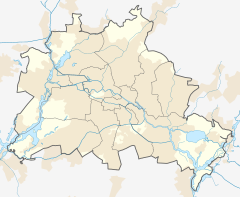
| Location | Tempelhof-Schöneberg (Berlin) Germany | ||||||||||
| Coordinates | 52°28′59″N 13°20′31″E / 52.48306°N 13.34194°E | ||||||||||
| Operated by | Berliner Verkehrsbetriebe | ||||||||||
| Line(s) | |||||||||||
| Platforms | 1 island platform | ||||||||||
| Tracks | 2 | ||||||||||
| Construction | |||||||||||
| Structure type | Below grade | ||||||||||
| Architect | Johann Emil Schaudt | ||||||||||
| Other information | |||||||||||
| Fare zone | VBB: Berlin A/5555[1] | ||||||||||
| History | |||||||||||
| Opened | 1 October 1910 | ||||||||||
| Services | |||||||||||
| |||||||||||
 | |||||||||||

Rathaus Schöneberg (Schöneberg Town Hall) is a station on the U4 line of the Berlin underground train network.
Designed by architect Johann Emil Schaudt, who also built the Bismarck Monument in Hamburg, the station was first opened in 1910 as Stadtpark (City Park). From 1940 to 1951 it was closed due to damage sustained during the Second World War. It re-opened under the current name in 1951.[2]
References
[edit]- ^ "Der VBB-Tarif: Aufteilung des Verbundgebietes in Tarifwaben und Tarifbereiche" (PDF). Verkehrsbetrieb Potsdam. Verkehrsverbund Berlin-Brandenburg. 1 January 2017. Archived from the original (PDF) on 27 October 2020. Retrieved 25 November 2019.
- ^ J. Meyer-Kronthaler, Berlins U-Bahnhöfe, Berlin: be.bra, 1996

