
Pass Christian, Mississippi
Pass Christian, Mississippi | |
|---|---|
 Location of Pass Christian, Mississippi | |
| Country | United States |
| State | Mississippi |
| County | Harrison |
| Area | |
| • Total | 15.3 sq mi (39.6 km2) |
| • Land | 8.4 sq mi (21.8 km2) |
| • Water | 6.9 sq mi (17.8 km2) |
| Elevation | 13 ft (4 m) |
| Population (2000) | |
| • Total | 6,579 |
| • Density | 781.2/sq mi (301.6/km2) |
| Time zone | UTC-6 (Central (CST)) |
| • Summer (DST) | UTC-5 (CDT) |
| ZIP code | 39571 |
| Area code | 228 |
| FIPS code | 28-55400 |
| GNIS feature ID | 0675482 |
Pass Christian (pronounced "kris-CHAN" or "kris-chee-ANN" [rather than "KRIS-chin" as in an adherent to Christianity]), nicknamed The Pass, is a city in Harrison County, Mississippi, United States, along the Gulf of Mexico. It is part of the Gulfport–Biloxi, Mississippi Metropolitan Statistical Area. The population was 6,579 at the 2000 census.
Geography
Pass Christian is located at 30°19′28″N 89°14′50″W / 30.32444°N 89.24722°WInvalid arguments have been passed to the {{#coordinates:}} function (30.324463, -89.247214)Template:GR. According to the United States Census Bureau, the city has a total area of 15.3 square miles (39.6 km²), of which, 8.4 square miles (21.8 km²) of it is land and 6.9 square miles (17.8 km²) of it (44.97%) is water.
The ZIP code of Pass Christian is 39571.

History
Pass Christian was named for a nearby deepwater pass, which in turn was named for Nicholas Christian L'Adnier who lived on nearby Cat Island beginning in 1746. (Another nearby pass, Pass Marianne, was named for L'Adnier's wife Marianne Paquet.)[1]
The town was a famous resort prior to the American Civil War and the site where the first yacht club of the South (and second in the US) was established in 1849. The town was a favorite location for the beach and summer homes of the wealthy of New Orleans. The row of historic mansions along the town's shoreline, especially Scenic Drive, was one of the country's notable historic districts. Tarpon Hole, offshore of Pass Christian in the Mississippi Sound, was the location where a world record Black Sea Bass was caught by Captain John T. McDonald. Captain McDonald operated The Schooner "Queen of the Fleet"
The fishing vessel was noted for its nearly spotless racing record throughout the 1890s and early 1900s until being replaced by larger, faster schooners built for the Biloxi fisheries during World War I. The two-masted 42-foot (13 m) vessel was purchased in 1895 by Mrs. Bidwell, later given to John McDonald, and years later, was lost at sea on October 16, 1923 during a storm. John T. McDonald had been a city alderman in 1888, and served as mayor for three 2-year terms from 1890 to 1895, and served another term in 1903.
Pass Christian was in the path of two of the most intense hurricanes ever to hit the United States--Hurricane Camille in 1969 and Hurricane Katrina on August 29, 2005. Both hurricanes caused the near total destruction of the city.
Hurricane Katrina
On August 29, 2005, Pass Christian was almost completely destroyed by Hurricane Katrina. Of the approximately 8,000 homes in Pass Christian, all but 500 were damaged or destroyed. In spite of the fact that the beachfront Scenic Drive follows the crest of a small bluff, affording it some elevation, most of the historic mansions along the road were severely damaged, and many also were destroyed.
Hurricane Katrina totally destroyed the local public library, requiring a complete rebuild.[1] Thirteen members of the city's police department retreated to the library after the police station became unsafe and water from the Gulf of Mexico began to pour in.
The library was immediately north of City Hall across a small parking lot but was at a lower elevation. When the water crested the elevation of City Hall, the police cars in the parking lot began to float and were carried around the parking lot by the current. One car struck the South side doors causing them to implode and the Gulf of Mexico driven by Katrina's powerful winds rushed in the building. With no way to fight against the current they were trapped inside a concrete box that was rapidly filling with water. Knowingthat they had to escape they attempted to shoot the glass out of the North side of the building. This was unsuccessful. The laminated glass proved impervious to the .45 caliber rounds of the police issue handguns. The force of the water entering the building after the southern wall was destroyed by the car was far too strong to swim against. The only way out, was with the current.
The storm surge from Hurricane Katrina that hit Pass Christian was estimated at 8.5 m (27.8 ft),[2] leveling Pass Christian up to half a mile inland from the shore; estimation of highest storm surges was complicated because high-water markers were also destroyed. Highway 90 along the beach was damaged, and the bridge over the Bay of St. Louis was thrown completely apart, not being reopened until a new bridge was partially completed in May 2007. (Connection was temporarily replaced by a ferry service.) Sewage contamination rendered the local water supply unusable, as some samples tested positive for more than 250 bacteria and parasites. By late September 2005, access was restricted south of the railroad tracks (about 4 blocks inland) without proper credentials, as crews continued to search for victims and clear debris. In early 2007, although rebuilding was underway in much of the city, a large portion of empty, deserted homes and other structures remain. Many residents were still living in FEMA trailers, and out-of-state volunteers were still needed for the rebuilding effort.


Demographics
As of the censusTemplate:GR of 2000, there were 6,579 people, 2,687 households, and 1,797 families residing in the city. The population density was 781.2 people per square mile (301.7/km²). There were 3,351 housing units at an average density of 397.9/sq mi (153.7/km²). The racial makeup of the city was 65.91% White, 28.17% African American, 0.62% Native American, 3.48% Asian (almost all Vietnamese American), 0.03% Pacific Islander, 0.62% from other races, and 1.17% from two or more races. Hispanic or Latino of any race were 1.75% of the population.
There were 2,687 households out of which 27.3% had children under the age of 18 living with them, 46.6% were married couples living together, 16.0% had a female householder with no husband present, and 33.1% were non-families. 27.4% of all households were made up of individuals and 11.3% had someone living alone who was 65 years of age or older. The average household size was 2.38 and the average family size was 2.88.
In the city the population was spread out with 23.4% under the age of 18, 6.9% from 18 to 24, 25.3% from 25 to 44, 25.2% from 45 to 64, and 19.1% who were 65 years of age or older. The median age was 41 years. For every 100 females there were 86.9 males. For every 100 females age 18 and over, there were 84.6 males.
Economy
Personal income
The median income for a household in the city was $40,743, and the median income for a family was $46,232. Males had a median income of $35,352 versus $22,195 for females. The per capita income for the city was $26,008. About 8.2% of families and 10.8% of the population were below the poverty line, including 18.0% of those under age 18 and 6.2% of those age 65 or over.
Tourism
A Mardi Gras Parade is held annually. In 2009, about ten thousand people attended.[citation needed]
Education
The Pass Christian School District runs the schools. The district has a level 5 school[clarification needed] and has been since 2006.[citation needed]
Notable residents
- Phelan Beale, original owner of Grey Gardens
- Captain John Handy, jazz musician
- Jimmy Johnson, cartoonist and creator of the syndicated newspaper comic strip Arlo and Janis.
- Tig Notaro, standup comedian.
- Robin Roberts, ABC News' Good Morning America anchor who returned home to provide emotional coverage of the aftermath of Hurricane Katrina.
Cultural references
- The city is mentioned in the John Mellencamp song "Cuttin' Heads" from his 2001 album of the same name. Mellencamp pronounced the name incorrectly.
- The city is mentioned in Poppy Z. Brite's novel Drawing Blood as one of the towns main character Zachary Bosch stops in during his travels.
Notes
- ^ "Hurricane Katrina Related Damages to Public Libraries in Mississippi" (September 2005), Mississippi Library Commission, web:ALA-Katrina.
- ^ Knabb, Richard D (2005-12-20; updated 2006-08-10). "Tropical Cyclone Report: Hurricane Katrina: 23-30 August 2005" (PDF). National Hurricane Center. Retrieved 2008-10-11.
{{cite web}}: Check date values in:|date=(help); Unknown parameter|coauthors=ignored (|author=suggested) (help)
External links
- Pass Christian official government website
- One family's story of the destruction Katrina brought
- SUCO Gulf Coast drive raises $13,000
Municipalities and communities of Harrison County, Mississippi, United States | ||
|---|---|---|
| Cities | 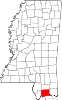 | |
| CDPs | ||
| Unincorporated communities | ||