
Pithole, Pennsylvania
Pithole or Pithole City is a ghost town in Cornplanter Township, Venango County in the U.S. state of Pennsylvania. At one time it was the largest oil boomtown in the United States.[1] Located off Pennsylvania Route 227, Pithole is about 6 miles (9.7 km) from Oil Creek State Park and the Drake Well Museum, site of the first commercial oil well.[1]
Oil strikes at a nearby wells in January 1865, prompted a large influx of people, most of which were land speculators, to the area that would become Pithole. The town was laid out in May and by December was incorporated with an approximate population of 20,000. At its peak, Pithole had at least 54 hotels, 3 churches, the third largest post office in Pennsylvania, a newspaper, a theater, a railroad, and the world's first pipeline. By 1866, economic growth and oil production in Pithole slowed. Oil strikes around other nearby communities and numerous fires drove residents away from Pithole and, by 1877, the borough was unincorporated.
The site was cleared of overgrowth and was donated to Pennsylvania Historical and Museum Commission in 1961. A visitors center, containing exhibits pertaining to the history of Pithole, was built in the 1970s. Pithole was listed on the National Register of Historic Places in 1973.
Naming
The exact origin of the name "Pithole" is a mystery. One possible origin tells of early pioneers stumbling across strange fissures from which sulfurous fumes wafted.[2][3] Such "pit-holes" were found near where Pithole Creek empties into the Allegheny River, with some measuring 14 inches (36 cm) wide and 8 feet (2.4 m) long. Another possible explanation involves the discovery of ancient man-made pits by early settlers, some 8 feet (2.4 m) wide and 12 feet (3.7 m) deep, that were "cribbed with heavy timbers impregnated with petroleum."[2] These "pit-holes", which were found along Oil Creek and in Cornplanter Township, supposedly predate the Senecas who inhabited the area at the time.[4]
Geology
Most of the oil that was produced in the northwestern Pennsylvania was formed in sandstone reservoir rocks at the boundary between the Mississippian and Devonian rock layers.[5] The oil usually became trapped in a fold of rock called an anticline, or sometimes an inversion of an anticline called a syncline. The depth of the oil could range from around 4,000 feet (1,200 m) to just beneath the surface.[5]
The majority of the oil wells in the vicinity of Pithole and the Oil Creek valley tapped into a sandstone formation known as the Venango Third sand.[6] The Venango Third contained large volumes of oil under high pressure at only 450 to 550 feet (140 to 170 m) below ground level.[6] Other oil-producing formations in the area were "the Venango First and Second [sands], the latter often prevailing after the Third sand was lost."[6] At Pithole, the "first sandstone was reached at 115 feet [35 m], the second at 345 feet [105 m], the third at 480 feet [146 m], the fourth at 600 feet [183 m], and the oil itself at 615 feet [187 m]" by the Frazier Well, according to report by Oil City Register.[7] Inaccurate numbering of the layers by the drillers, however, put the Fourth sand above the real Third at 670 feet (200 m).[8][9]
Geography and climate
Pithole is located in Northwestern Pennsylvania, 50 miles (80 km) southeast of Erie and 103 miles (166 km) north-northeast of Pittsburgh. The nearest cities to Pithole are Titusville, approximately 8 miles (13 km) to the northwest, and Oil City, 9 miles (14 km) to the southwest.[10][11] Pithole is located almost 4 miles (6.4 km) off Pennsylvania Route 36 and about 2 miles (3.2 km) from Pennsylvania Route 227.
Pithole was laid out with four primary east-west streets: First, Second, Third and Fourth. Duncan, Mason, Prather, Brown and Holmden Streets traversed Pithole from north to south. All five streets terminated at First Street; Mason started at Third, Prather and Brown started at Fourth. Duncan and Holmden Streets both began at a Y-intersection with the road from Titusville. All the four east-west streets began at Duncan and ended Holmden Street, except for First which extended out to the Frazier Well.
July is the hottest month in Pithole, when the average high temperature is 81 °F (27 °C) and the average low is 57 °F (14 °C). January is the coldest month with an average high of 32 °F (0 °C) and an average low of 13 °F (−11 °C).[12] The average 44 inches (1,100 mm) of precipitation a year, would wreak ravoc on the many unpaved in Pithole, especially with heavily traveled First and Holmden Streets.[12][13] Portions of First Street were planked or corduroyed in response to the resulting quagmire of mud that would often trap wagons and pack animals.[13][14]
History

In 1859, Edwin Drake successfully drilled the first oil well along the banks of Oil Creek, outside of Titusville in Crawford County. In only half a year, over 500 wells were built along Oil Creek, in the 16 miles (26 km) from Titusville to the creek's mouth at the Allegheny River in Oil City.[4] Other wells were drilled down the Allegheny towards Franklin and upriver to Tionesta in Forest County. Pithole Creek did not attract the same attention from speculators and investors, who preferred to risk their money on the tried-and-true method of drilling on flatter terrain near large rivers like the Allegheny and Oil Creek, rather than gamble on rougher terrain.[15] In January 1864, Isaiah Frazier leased two tracts of land, totaling 35 acres (14 ha), from Thomas Holmden, a farmer along Pithole Creek. Frazier, James Faulkner Jr., Frederick W. Jones and J. Nelson Tappan formed the United States Petroleum Company in April 1864 and started drilling what was dubbed the United States Well, or Frazier Well, in June. On January 7, 1865, the Frazier Well struck oil.[16]
Boom
Two weeks after the Frazier strike, the Twin Wells, just to the south of the Frazier Well, also struck oil. In May 1865, A. P. Duncan and George C. Prather purchased the Holmden Farm, including the portions still leased to United States Petroleum, for $25,000 and a bonus of $75,000. The wooded bluff overlooking the Frazier and Twin Wells was cleared and a town was laid out. The town was divided into 500 lots, which were put up for sale on May 24.[17] By July, the population was estimated to have been, at least, 2,000.[18] The population of Pithole rose to 15,000 people in September and 20,000 by Christmas.[19] Pithole was incorporated as a borough on December 7, 1865.[20]

As a large number of the residents were temporary, Pithole had a total of 54 hotels ranging from simple rooming houses to luxury hotels like the Chase House or the Danforth House. Another luxury hotel, the Bonta House, was located in Prather City on the bluff on the opposite side of Pithole Creek.[21] At one point, the Pithole Post Office, located on the first-floor of the Chase House, was the third-busiest in the state of Pennsylvania, behind Philadelphia and Pittsburgh.[22] Three different churches—Presbyterian, Methodist and Catholic—were constructed by their respective congregations. Pithole's local newspaper, the Pithole Daily Record was started on September 5, 1865. The largest building in Pithole—the three-story, 1,100-seat Murphy's Theater—opened on September 17.[23]
As oil production increased through the success of wells like the Frazier, the Twin, the Pool, the Grant, and the two Homestead Wells, the transportation of oil to the outside world was still reliant on teamsters, who would often gouge the oil producers or refuse to work on the days when the roads were impassable.[24] The world's first pipeline was opened on October 9, 1865. The 2-inch (51 mm) diameter, 5.5-mile (8.9 km) long pipeline connected Pithole to the Oil Creek Railroad and was initially able to transport 81 barrels (12.9 m3) per hour operating with three steam engines, equivalent to 300 teams working a 10-hour shift.[25] A fourth engine brought its maximum capacity to 2,500 barrels (400 m3) a day. The Oil City and Pithole Railroad (OC&P) was opened on December 18.
Bust

In March 1866, a chain of banks throughout the oil region owned by Charles Vernon Culver, a financier and member of United States House of Representatives for Pennsylvania's 20th congressional district, collapsed, triggering a financial panic. After the oil bubble burst, speculators and potential investors stopped coming to Pithole and life in Pithole settled down. In the early morning on February 24, a house caught fire and was spread by the wind.[26] In two hours, most of Holmden Street, and parts of Brown and Second Streets, were reduced to smoldering ashes.
With numerous oil strikes elsewhere in Venango County in 1867, people were being drawn away from Pithole, often taking their buildings with them.[27] Oil was running out, the hastily constructed wooden buildings were falling victim to fire, and new wells were being discovered at nearby areas. Major fires in April and August 1866 burning several city blocks and 27 wells brought the population down even further to just 2,000 people by December 1866. The newspaper was relocated to Petroleum Center in July 1868, becoming the Petroleum Center Daily Record.[28] Both the Chase House and Murphy's Theater were sold in August 1868 and moved to Pleasantville.[28] Prather and Duncan sold their interests in Pithole before the downturn; Prather split an estimated $3 million with his two brothers and moved to Meadville, while Duncan returned to Scotland with his fortune.[22] The 1870 United States Census recorded the population of Pithole as only 237. The borough charter of Pithole was officially annulled in August 1877. The remains of the city were sold, in 1879, back to Venango County for $4.37. The Catholic church was dismantled and moved to Tionesta in 1886; the Methodist church was kept in "usable condition" through private donations before being taken down in the 1930s.[29] A stone altar was erected and consecrated by the Methodist Episcopal Church on August 27, 1959, the centennial of the Drake Well strike.
Visitors center

The site was purchased in 1957 by James B. Stevenson, the publisher of the Titusville Herald, who later served as the chairman of the Pennsylvania Historical and Museum Commission from 1962 to 1971.[3] Stevenson cleared the brush from the site, and donated it to the Pennsylvania Historical and Museum Commission in 1961. Today, only a few cellars and mowed paths mark the buildings and former streets of Pithole. The site of Pithole was listed on the National Register of Historic Places on March 20, 1973. It covers 84.3 acres (34.1 ha), in which a walking tour of Pithole's streets can be completed in 42 minutes.[30][31] The visitors center was constructed in 1975. The center contains several exhibits pertaining to Pithole, including a scale model of the city at its peak, a wagon used to transport oil that is stuck in mud, and a small, informational theater.[31] The visitors center is open, annually, from the Memorial Day weekend, at end of May, through Labor Day in September.[3]
See also
- List of ghost towns in Pennsylvania
- National Register of Historic Places listings in Venango County, Pennsylvania
References
- ^ a b "Oil Creek State Park". Pennsylvania Department of Conservation and Natural Resources. Retrieved February 27, 2010.
- ^ a b Darrah 1972, p. 1.
- ^ a b c Hirschl, Beatrice Paul (August 12, 1996). "A peak [sic] at Pithole's past". Pittsburgh Post-Gazette. p. D1.
- ^ a b Darrah 1972, p. 2.
- ^ a b Caplinger 1997, p. 6.
- ^ a b c Pees 1998, p. 15.
- ^ Darrah 1972, 11–12.
- ^ Carll 1880, p. 140.
- ^ Carll 1880, p. 176.
- ^ Oil City, Pennsylvania (Map). 1 : 100,000. 30 × 60 Minute Series (Topographic). United States Geological Survey. 1983.
- ^ Warren, Pennsylvania – New York (Map). 1 : 100,000. 30 × 60 Minute Series (Topographic). United States Geological Survey. 1983.
- ^ a b "Monthly Averages for Historic Pithole City". The Weather Channel. Retrieved February 17, 2010.
- ^ a b Darrah 1972, p. 63.
- ^ Darrah 1972, p. 27.
- ^ Darrah 1972, p. 3–4.
- ^ Darrah 1972, p. 10.
- ^ Darrah 1972, p. 29.
- ^ Darrah 1972, p. 32.
- ^ "Tappan's Mushroom City" (PDF). The New York Times. September 8, 1884. p. 8. Retrieved February 16, 2010.
- ^ Darrah 1972, p. 116.
- ^ Darrah 1972, p. 83.
- ^ a b "Pithole's Rise and Fall" (PDF). The New York Times. December 26, 1879. p. 2. Retrieved February 16, 2010.
- ^ Darrah 1972, p. 140.
- ^ Darrah 1972, p. 100.
- ^ Darrah 1972, p. 105.
- ^ Darrah 1972, p. 223.
- ^ Darrah 1972, p. 222.
- ^ a b Darrah 1972, p. 224.
- ^ Darrah 1972, p. 233.
- ^ Pennsylvania Register of Historic Sites and Landmarks 1972, § 10.
- ^ a b Love, Gilbert (June 22, 1975). "Once-booming Pithole revisited in 'world's 1st oil town' museum". The Pittsburgh Press. p. C1. Retrieved February 17, 2010.
Sources
- Caplinger, Michael W (1997). "Allegheny National Forest Oil Heritage". Historic American Engineering Record. National Park Service. Retrieved May 24, 2010.
- Carll, John F (1880). The geology of the oil regions of Warren, Venango, Clarion, and Butler counties. Harrisburg: Second Geological Survey of Pennsylvania. OCLC 5966119.
- Darrah, William Culp (1972). Pithole, the vanished city. Gettysburg, PA. ISBN 0-913116-03-3.
{{cite book}}: CS1 maint: location missing publisher (link) - Pees, Samuel T (Spring 1998). "Oil Creek's Riparian Wells" (PDF). Pennsylvania Geology. 29 (1). Pennsylvania Department of Natural Resources: 14–18. Retrieved February 21, 2010.
{{cite journal}}: More than one of|number=and|issue=specified (help) - Pennsylvania Register of Historic Sites and Landmarks (February 24, 1972). "Pithole City" (PDF). National Register of Historic Places Inventory—Nomination Form. Harrisburg, PA: Pennsylvania Historical and Museum Commission. Retrieved February 15, 2010.
External links
Municipalities and communities of Venango County, Pennsylvania, United States | ||
|---|---|---|
| Cities | 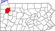 | |
| Boroughs | ||
| Townships | ||
| CDPs | ||
| Unincorporated communities | ||
| Ghost town | ||
| Footnotes | ‡This populated place also has portions in an adjacent county or counties | |

