Territorial evolution of the United States
This is a list of the evolution of the borders of the United States. This lists each change to the internal and external borders of the country, as well as status and name changes. It also shows the surrounding areas that eventually became part of the United States. Each situation has a map, to see what the specific makeup of the country was at any given time.
After achieving independence with the Treaty of Paris, the United States expanded westward, enlarging its borders seven times, with two major border adjustments, one each with colonies of the United Kingdom and Spain, and several small disputes. The original thirteen states grew in to fifty states, most of which began as incorporated territories. The general pattern seen in this list is territorial expansion, carving of organized territories from the newly acquired land, modification of the borders of these territories, and eventual statehood. Only two states, Nevada and Missouri, grew appreciably after statehood, and only two, Massachusetts and Virginia, lost land, in each case to form new states.
Notes
- This list does not include unincorporated territories and countries under free association. The fundamental difference between unincorporated and incorporated territories is, incorporated territories are considered to forever be under the jurisdiction of the United States Constitution, whereas it is possible for unincorporated territories to become independent. These are:
- Nations under Compact of Free Association: Marshall Islands, Federated States of Micronesia, Palau.
- Commonwealths: Northern Mariana Islands, Puerto Rico (This is different from the term 'commonwealth used by some states.)
- Unincorporated, organized territories: Guam, United States Virgin Islands.
- American Samoa is unorganized, but has a constitution and self-government, making it functionally very similar to an organized territory.
- The United States Minor Outlying Islands, which are uninhabited, unorganized, and except for Palmyra Atoll, unincorporated.
- The former unincorporated territories of the Line Islands, Panama Canal Zone, the Commonwealth of the Philippines, and the Phoenix Islands.
- The Trust Territory of the Pacific Islands, a United Nations trusteeship granted to the United States following World War II. It has since dissolved, becoming the Marshall Islands, Federated States of Micronesia, the Northern Mariana Islands, and Palau.
- "Unorganized territory" is not a name; it simply means that this territory has not had an organic act passed. In most situations, the purpose of unorganized territory was to act as land for Native American settlement. Later, the last unorganized territory in the country was indeed referred to as "Indian Territory", though this is not an official name. Later, when land was first acquired, for example with Hawaii, it was typically unorganized, but not as land set aside for Native Americans, but simply because they had not been organized yet.
- Dotted lines on the borders mean that region is part of a country not fully shown on the map, since it's confined to the present-day borders of the United States. An exception is Oregon Country, which extended beyond the area of the map.
- Many territorial disputes and borders from early in the United States' history are unclear. For example, the border between West Florida and East Florida seems unclear. For the purposes of simplicity, this article uses the original border, the Apalachicola River, even though later maps tended to move it west to the Perdido River. This is partly because the Organic Act for Florida specified that it included parts of both West and East Florida; if the border were the Perdido River, then Florida Territory would not have included any of West Florida, it having already been divided among Louisiana, Mississippi, and Alabama.[1]
- Several very small changes are not included in these maps:
- The retrocession of land back to Virginia by the District of Columbia
- The resolution of the Northwest Angle in Minnesota
- The transfer of the Erie Triangle from New York to the federal government, then to Pennsylvania
- The transfer of the Toledo Strip from Michigan to Ohio
- The small additions made to Indiana Territory.
- The Alaska Boundary Dispute, since it arose from a total lack of surveying, rather than a dispute over the surveyed lines; it would also appear quite small on the map.
- The dispute over The Wedge, a square mile of land claimed by Pennsylvania and Delaware.
- When Dakota Territory was created, it also included land south of 43° N and north of the Keya Paha and Niobrara rivers. This was transferred to the state of Nebraska in 1882.
- Various disputes along the Rio Grande with Mexico.
- Various other small disputes or border adjustments between states.
18th century
The United States Constitution came in to effect, forming the new nation. Note that the states ratified at different times, but to simplify the map, the final result is shown here.
The United States achived independence from the Kingdom of Great Britain with the Treaty of Paris on September 3 1783, which established that the thirteen colonies were sovereign and independent states. The borders were established by Article 2 of the treaty, but with a couple of issues. First, it stated that the border would run west from the Lake of the Woods to the Mississippi River - at the time, it was not known that the headwaters fo the Mississippi lay south of such a line, so the border has since been taken to run south from the lake to the river.[2]
Some peculiarities to point out to those familiar only with the current borders: Many states had sea-to-sea grants from the British crown that they would not give up easily, so prior to this date, they ceded this land to the federal government in exchange for their Revolutionary War debts. However, Georgia did not do so until much later, and Connecticut ceded most land but kept its Western Reserve. Virginia ceded its claim to the territory north and west of the Ohio River, and North Carolina ceded its claim to its western counties; these lands became unorganized territory. At this point in history, all of the states except for Georgia and Virginia were at their present-day borders, except for some of the minor issues mentioned above.
West Florida claimed a border further north than what the United States said it had. Its border had been 31° north when Spain ceded it to the United Kingdom. The British later moved its border north to 32°38' latitude, but when Spanish Florida was ceded back to Spain in the Treaty of Paris, the British cited the original border at the 31st parallel, but Spain continued to claim the higher border.[3] Also, the borders at the northern area of the Maine District of Massachusetts and the area northwest of Lake Superior remained disputed.
The Vermont Republic was a complex matter, with areas being claimed by New York and New Hampshire, but it existed as a de facto unrecognized independent nation.
The unorgnized land was organized: The Northwest Ordinance created the Territory North West of the Ohio River, or Northwest Territory,[4], and the Southwest Ordinance created the Territory South of the Ohio River, or Southwest Territory.[5] Northwest Territory consisted of present-day Illinois, Indiana, Michigan, northeastern Minnesota, most of Ohio, and Wisconsin. Southwest Territory corresponded to present-day Tennessee.

The Vermont Republic, which had portions claimed by New York and New Hampshire and, while unrecognized by the United States, was a de facto independent country, was admitted as the 14th state, Vermont.
The District of Columbia, the nation's federal district, was formed from land granted by Maryland and Virginia; the Virginia portion would be returned in 1847.[6]
The western counties of Virginia beyond the Appalachian Mountains were split off and admitted as the 15th state, Kentucky.

Pinckney's Treaty, also known as the Treaty of San Lorenzo, settles the northern border of West Florida as the 31st parallel.[7]

The Southwest Territory was admitted as the 16th state, Tennessee.

Due to the Yazoo Land Fraud, an act was signed by President John Adams, authorizing him to appoint commissioners to negotiate with Georgia about ceding its western land. The act created Mississippi Territory in the region ceded by West Florida, corresponding to roughly the southern third of present-day Mississippi and Alabama except their panhandles, which were part of West Florida.[8]
1800s

Indiana Territory was formed from the western portion of Northwest Territory.[9] It corresponded to present-day Illinois, Indiana, northeastern Minnesota, and Wisconsin, as well as the western half of the lower peninsula of Michigan and all but the eastern tip of the upper peninsula. Northwest Territory was left with only most of Ohio and the rest of Michigan.
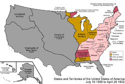
Connecticut ceded its Western Reserve to the federal government, which made it part of Northwest Territory, and is the northeastern part of present-day Ohio.[10]

Georgia finally ceded its western claims, the Yazoo Lands, to the federal government, where it became unorganized land.[11] Also, on October 1 1800, the Third Treaty of San Ildefonso transferred the colony of Louisiana from Spain to France.[12]
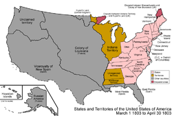
The southeastern portion of Northwest Territory was admitted as the 17th state, Ohio. The remainder of Northwest Territory was transferred to Indiana Territory.[9]

The Louisiana Purchase was made, expanding the United States west of the Mississippi River. There was a dispute with West Florida over how much land east of the Mississippi River it included.[13] The purchase extended slightly north of the modern borders, as it was defined only as the watershed of the Mississippi River.[14] The purchase consisted of the whole of present-day Arkansas, Kansas, Iowa, Missouri, Nebraska, and Oklahoma, and portions of Colorado, Louisiana, Minnesota, Montana, New Mexico, North Dakota, South Dakota, Texas and Wyoming. It also included the southernmost portions of the present-day Canadian provinces of Alberta, Manitoba, and Saskatchewan.
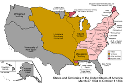
The unorganized land ceded by Georgia was added to Mississippi Territory, consisting of the whole of present-day Mississippi and Alabama, minus their panhandles which were still part of West Florida.[15]
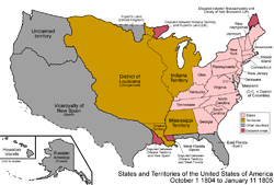
The Louisiana Purchase was split into the District of Louisiana, which was under the authority of Indiana Territory, and the organized Orleans Territory, which corresponded to part of present-day Louisiana with a small portion of Texas.[16] The western border of Orleans Territory caused further conflict with New Spain over which river was the western boundary of the Purchase; this would later be remedied by the Adams-Onís Treaty.

Michigan Territory was split from Indiana Territory, including the whole of the lower peninsula of present-day Michigan but only that eastern tip of the upper peninsula which was held by the Northwest Territory after Indiana Territory had been split from it.[9]

The District of Louisiana was organized as Louisiana Territory.[17]
Illinois Territory was split from Indiana Territory. Illinois Territory included present-day Illinois, northeastern Minnesota, and Wisconsin. Indiana Territory included the present-day borders of Indiana, with its western and eastern borders continuing northward; thus, it also included the central portion of the upper peninsula of Michigan, as well as Door Peninsula of present-day Wisconsin.[9]
1810s
- April 1810
The Kingdom of Hawaii was formed in the Hawaiian islands.[18]
By proclamation by President James Madison, the United States annexed the Baton Rouge and Mobile Districts of West Florida, declaring them part of the Louisiana Purchase. These had, 90 days earlier, declared independence as the Republic of West Florida.[19]
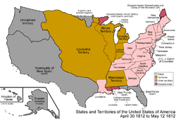
Orleans Territory was admitted as the 18th state, Louisiana.

The federal government the Mobile District of the newly-annexed land of West Florida to Mississippi Territory, making the territory correspond to present-day Alabama and Mississippi.[20]
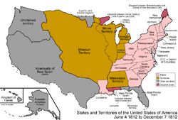
Louisiana Territory, having the same name as a state, was renamed to Missouri Territory.[21]

Some sources indicate that the southern portion of Missouri Territory was made unorganized, corresponding to all of present-day Arkansas and Oklahoma, and parts of New Mexico and Texas.[22]

The southern portion of Indiana Territory was admitted as the 19th state, Indiana. The remainder became unorganized.[9]

Alabama Territory was split from Mississippi Territory; both correspond to their present-day counterparts.[23]
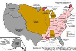
Mississippi Territory was admitted as the 20th state, Mississippi.

The Treaty of 1818 established the 49th parallel north west of the Lake of the Woods as the border with British-held lands, and Oregon Country was established as a shared land between the United States and United Kingdom.[24] Oregon Country consisted of most of present-day Idaho and Oregon, all of Washington, and a portion of Montana, as well as the southern part of the Canadian province of British Columbia. The treaty transferred the Red River Basin to the United States, consisting of northwestern Minnesota, northeastern North Dakota, and the northeastern tip of South Dakota.

The southern portion of Illinois Territory was admitted as the 21st state, Illinois. The remainder was reassigned to Michigan Territory.[9]

The unorganized land south of Missouri Territory was organized as Arkansaw Territory, consisting of present-day Arkansas as well as part of Oklahoma.[22] It was not officially spelled Arkansas until later.
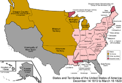
Alabama Territory was admitted as the 22nd state, Alabama.
1820s

The Maine District of Massachusetts was split off and admitted as the 23rd state, Maine, as part of the Missouri Compromise.

The Adams-Onís Treaty came in to effect. It established the entirety of the border between the United States and New Spain. Under the terms of the treaty, all of Spanish Florida was sold to the United States.[25] The treaty transferred the rest of present-day Idaho and Oregon to Oregon Country; moved portions of present-day Colorado, Oklahoma, and Wyoming, and all of New Mexico and Texas, to New Spain; and all of Florida to the United States.

The southeastern corner of Missouri Territory was admitted as the 24th state, Missouri. The remainder became unorganized. Missouri did not include its northwestern triangle at this point, that being added later in the Platte Purchase.[26]
The Viceroyality of New Spain achieved independence as Mexico.

East Florida and the portion of West Florida not already part of other states were combined and organized as Florida Territory, which corresponded to present-day Florida.[1] Around this time, the official spelling of Arkansaw Territory became Arkansas Territory.[22]

Arkansas Territory was shrunk, the western portion becoming unorganized.[27]

Arkansas Territory was shrunk further, attaining the present-day borders of Arkansas, with the remainder again becoming unorganized.[27]
1830s

A large portion of unorganized land was added to Michigan Territory, corresponding to present-day Iowa, western Minnesota, and eastern North Dakota and South Dakota.[9]

The Republic of Texas achieved independence from Mexico, though with a large portion of the territory disputed. It had control over the eastern half of present-day Texas, and disputed the western half, as well as portions of Colorado, Kansas, New Mexico, and Wyoming.
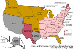
Arkansas Territory was admitted as the 25th state, Arkansas.

Wisconsin Territory was split off from Michigan Territory, consisting of present-day Wisconsin and the northeastern portion of Minnesota. As an inducement to give up its claim over the Toledo Strip to Ohio, the whole of the present-day upper peninsula was assigned to Michigan Territory, giving it the present-day borders of Michigan.[9]

Michigan Territory was admitted as the 26th state, Michigan.[9]
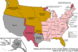
The Platte Purchase added a small area of land to Missouri, giving it its present-day boundaries.[28]

Iowa Territory was split off from Wisconsin Territory, consisting of present-day Iowa, western Minnesota, and eastern North Dakota and South Dakota, leaving Wisconsin Territory with northeastern Minnesota and Wisconsin.[9]
1840s

The Webster-Ashburton Treaty settled the border between the United States and lands held by the United Kingdom east of the Rocky Mountains, ending the dispute over the borders of Maine and northeastern Minnesota.[29]

Florida Territory was admitted as the 27th state, Florida.

The Republic of Texas was annexed by the United States and admitted as the 28th state, Texas. It brought with it all the lands of Mexico that it claimed, including all of present-day Texas, and parts of Colorado, New Mexico, Oklahoma, and Wyoming.

The Oregon Treaty established the 49th parallel west of the Lake of the Woods as the continental border (so it did not include Vancouver Island) with the lands held by the United Kingdom. The sharing of Oregon Country ended, and the American portion becomes unorganized territory.[30]

The southeast portion of Iowa Territory was admitted as the 29th state, Iowa. The remainder became unorganized.[9]

The Treaty of Guadalupe Hidalgo, ending the Mexican-American War, granted a large area of land to the United States from Mexico.[31] It consisted of all of present-day California, Nevada, and Utah, most of Arizona, and portions of Colorado, New Mexico, and Wyoming.

The southeastern portion of Wisconsin Territory was admitted as the 30th state, Wisconsin. The remainder became unorganized.[9]

Oregon Territory was organized, including present-day Idaho, northwestern Montana, Oregon, Washington, and western Wyoming.[32]

Minnesota Territory was organized, consisting of present-day Minnesota, and eastern portions of North Dakota and South Dakota.[33]
1850s
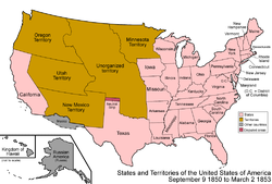
The Mexican Cession was divided as part of the Compromise of 1850. The western portion was admitted as the 31st state, California. The rest was organized as Utah Territory and New Mexico Territory. Both territories also included land ceded to the federal government by Texas in exchange for taking on its debts; a portion of Texas and the Mexican Cession became unorganized land.[34] A pecularity appeared at this time, when a small strip of land north of Texas was not officially assigned by any state or territory; this came to be called the Neutral Strip or "No Man's Land", which corresponds to the present-day panhandle of Oklahoma.[35] New Mexico Territory consisted of most of present-day Arizona and New Mexico, as well as a southern portion of Colorado and the southern tip of Nevada. Utah Territory consisted of present-day Utah, most of Nevada, and portions of Colorado and Wyoming.

Washington Territory was split from Oregon Territory, consisting of present-day Washington, northern Idaho, and the western tip of Montana, leaving Oregon Territory with all of Oregon, southern Idaho and a portion of Wyoming.[36]

The Gadsden Purchase added some land to New Mexico Territory, corresponding to the southernmost areas of present-day Arizona and New Mexico.[37]

Kansas Territory and Nebraska Territory were organized; the remaining unorganized land colloquially became known as Indian Territory.[38] Kansas Territory consisted of present-day Kansas and eastern Colorado. Nebraska Territory consisted of present-day Nebraska, and parts of Colorado, Montana, North Dakota, South Dakota, and Wyoming. Indian Territory corresponds to eastern Oklahoma.
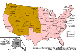
The eastern portion of Minnesota Territory was admitted as the 32nd state, Minnesota. The remainder became unorganized.[9]
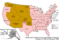
The western portion of Oregon Territory was admitted as the 33rd state, Oregon. The remainder was assigned to Washington Territory.[39]
1860s

Texas began claiming Greer County, Texas, controlled at that time by the federal government as unorganized territory, and now in present-day Oklahoma.[40]
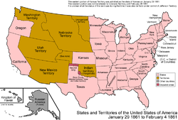
The eastern portion of Kansas Territory was admitted as the 34th state, Kansas. A pecularity arose for the western portion. It was added to Colorado Territory on February 28 1861; however, for the month between statehood for Kansas and the Colorado Territory being formed, it appears to have had no official status.[41]
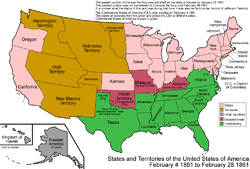
The Confederate States of America (CSA) was formed. The Southern states seceded at different dates and joined the CSA at different dates; to simplify the map, only the final form of the CSA is shown here. There were rebel governments as well as Union governments in Kentucky and Missouri, and the CSA had full control over Indian Territory.

Colorado Territory was organized, with land from Utah, New Mexico, and Nebraska Territories, as well as the land left over from Kansas Territory; it corresponded already to present-day Colorado.[41]

Dakota Territory was split from Nebraska Territory, and included the unorganized land left over from Minnesota Territory. Dakota Territory consisted of both present-day North and South Dakota, as well as most of Montana and northern Wyoming. Nebraska Territory consisted of all of Nebraska and southeastern Wyoming.[42] Nevada Territory was split from Utah Territory, corresponding to northwestern present-day Nevada; the eastern border was the 39th meridian west of Washington, D.C.[43]
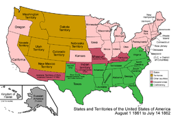
The Confederacy established Arizona Territory (CSA) in the southern half of the Union's New Mexico Territory. It would be organized on February 14 1862. It corresponded to the southern halves of present-day Arizona and New Mexico.[44]

Due to its nature as a mining and grazing area, land started to be added to Nevada Territory to accomodate these activities. Its eastern border was moved eastward from the 39th meridian west of Washington, D.C., to the 38th meridian, transferring the land from Utah Territory.[45]
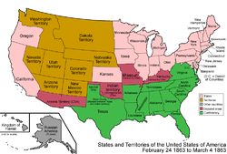
The Union created its own Arizona Territory, splitting it off from New Mexico Territory, making both territories correspond to their present-day states, except for Arizona Territory including the southern tip of present-day Nevada.[46]

Idaho Territory was created from portions of Washington, Dakota, and Nebraska Territories, consisting of present-day Idaho, Montana, and most of Wyoming. Nebraska and Washington Territorires were left corresponding to their present-day counterparts.[47]
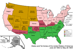
Several counties of northwestern Virginia who didn't want to be part of the Confederacy split off and were admitted as the 35th state, West Virginia.

Montana Territory was split from Idaho Territory, which also had some land transferred to Dakota Territory. Montana Territory corresponded to present-day Montana, Idaho Territory consisted of Idaho and western Wyoming, and Dakota Territory included both North and South Dakota, and most of Wyoming. [48]
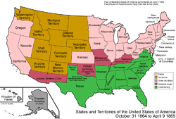
Nevada Territory was admitted as the 36th state, Nevada; it was a bit smaller than it is today, lacking area in both the east and south.

The Confederate States of America surrendered. The process of Reconstruction and readmission to the union would take several years; to simplify the map, they are shown as already readmitted.

Nevada's eastern border was moved from the 38th meridian west of Washington, D.C., to the 37th meridian, transferring land to it from Utah Territory.[45]

The northwestern corner of Arizona Territory was transferred to the state of Nevada, giving it its present-day borders.[49]
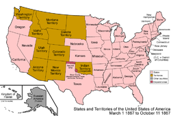
Nebraska Territory was admitted as the 37th state, Nebraska.

The United States purchased Alaska from Russia; it was designated the Department of Alaska, and corresponds, except for a boundary dispute, to present-day Alaska.[50]

Wyoming Territory was formed from portions of Dakota, Idaho, and Utah Territories, corresponding to the present-day borders of Wyoming.[51]
1870s

Colorado Territory was admitted as the 38th state, Colorado.
1880s

The Department of Alaska, previously under the direct control of the federal government and the military, was redesignated the District of Alaska, forming a local government.[52]

Dakota Territory was split in two, and it was admitted as the 39th state, North Dakota, and 40th state, South Dakota.
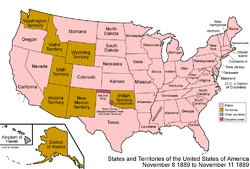
Montana Territory was admitted as the 41st state, Montana.

Washington Territory was admitted as the 42nd state, Washington.
1890s

Oklahoma Territory was organized from the western portion of Indian Territory, and included the Neutral Strip, and corresponded to the western half of present-day Oklahoma.[53]

Idaho Territory was admitted as the 43rd state, Idaho.
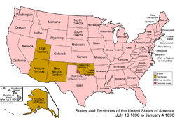
Wyoming Territory was admitted as the 44th state, Wyoming.
The Kingdom of Hawaii became the Republic of Hawaii.[54]

Utah Territory was admitted as the 45th state, Utah.

A Supreme Court ruling officially assigns Greer County to Oklahoma Territory.[55]

The Republic of Hawaii was annexed by the United States.[54]
20th century
The annexed Hawaiian islands were organized as the Territory of Hawaii, and corresponded, except for including Palmyra Atoll, to the present-day state of Hawaii.[54]

Oklahoma Territory and Indian Territory were combined and admitted as the 46th state, Oklahoma.

New Mexico Territory was admitted as the 47th state, New Mexico.

Arizona Territory was admitted as the 48th state, Arizona.
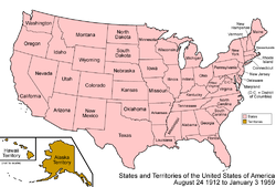
The District of Alaska was organized as Alaska Territory.[56]

Alaska Territory was admitted as the 49th state, Alaska

Hawaii Territory was admitted as the 50th state, Hawaii, resulting in the present-day situation of the United States. The statehood act specifically left out Palmyra Atoll, which became unorganized land. Since it had been incorporated as part of the Hawaii Territory, Palmyra Atoll became the only incorporated territory left in the United States.
References
- ^ a b "Text of the Organic Act for Florida Territory". Retrieved 2006-08-04.
- ^ "Text of "The Paris Peace Treaty of September 3, 1783"". The Avalon Project at Yale Law School. Retrieved 2006-08-06.
- ^ "Dominion of British West Florida History Index". Retrieved 2006-08-04.
- ^ "Statutes at Large, 1st Congress, 1st Session". Library of Congress. Retrieved 2006-08-04.
- ^ "Text of the "Act for Government of the Southwest Territory"". Retrieved 2006-08-04.
- ^ "Frequently Asked Questions About Washington, D.C." The Historical Society of Washington, DC. Retrieved 2006-08-04.
- ^ "Text of the "Treaty of Friendship, Limits, and Navigation Between Spain and The United States"". The Avalon Project at the Yale Law School. Retrieved 2006-08-04.
- ^ "This Day in Georgia History, April 7". Retrieved 2006-08-04.
- ^ a b c d e f g h i j k l m "Evolution of Territories and States from the Old "Northwest Territory"". Retrieved 2006-08-04.
- ^ "WESTERN RESERVE". Encyclopedia of Cleveland History. Retrieved 2006-08-04.
- ^ "Yazoo Land Fraud". Our Georgia History. Retrieved 2006-08-04.
- ^ "Text of the "Treaty of San Ildefonso : October 1, 1800"". The Avalon Project at Yale Law School. Retrieved 2006-08-04.
- ^ Robert Higgs (2005-03-14). ""Not Merely Perfidious but Ungrateful": The U.S. Takeover of West Florida". The Independent Institute. Retrieved 2006-08-04.
- ^ "Text of the treaty for the Louisiana Purchase". United States National Archives. Retrieved 2006-08-04.
- ^ "Exhibition Review of "1811—Year of Wonders in the Mississippi Territory."". Retrieved 2006-08-04.
- ^ "Test of "An Act erecting Louisiana into two territories, and providing for the temporary government thereof."". The Avalon Project at the Yale Law School. Retrieved 2006-08-04.
- ^ "Statutes at Large, 8th Congress, 2nd Session". Library of Congress. Retrieved 2006-08-04.
- ^ Daniel Akaka. "The Akaka Bill: Hawaii's History". Retrieved 2006-08-04.
- ^ "Spanish Occupation, Second". Floripedia. Retrieved 2006-08-04.
- ^ "Journal of the House of Representatives of the United States, 1811-1813". Library of Congress. Retrieved 2006-08-04.
- ^ "Arkansas State Boundaries". Encyclopedia of Arkansas. Retrieved 2006-08-04.
- ^ a b c "States of the United States". Statoids. Retrieved 2006-08-04.
- ^ "Text of "An Act To Establish A Separate Territorial Government For The Eastern Part Of The Mississippi Territory"". Retrieved 2006-08-04.
- ^ "Text of "Convention of 1818 between the United States and Great Britian"". The Avalon Project at Yale Law School. Retrieved 2006-08-04.
- ^ "Text of "Treaty of Amity, Settlement, and Limits Between the United States of America and His Catholic Majesty. 1819"". The Avalon Project at Yale Law School. Retrieved 2006-08-04.
- ^ Cite error: The named reference
Statoidswas invoked but never defined (see the help page). - ^ a b "Arkansas Territory 1819-1836". Retrieved 2006-08-05.
- ^ "Ioway Cultural Institute : History - Treaties". Retrieved 2006-08-04.
- ^ "Text of "The Webster-Ashburton Treaty"". The Avalon Project at Yale Law School. Retrieved 2006-08-04.
- ^ "Text of "Treaty with Great Britain, in Regard to Limits Westward of the Rocky Mountains."". The Avalon Project at Yale Law School. Retrieved 2006-08-04.
- ^ "Text of "Treaty of Guadalupe Hidalgo"". The Avalon Project at Yale Law School. Retrieved 2006-08-04.
- ^ "Today in History: August 14". Library of Congress. Retrieved 2006-08-04.
- ^ "An Act to Establish the Territorial Government of Minnesota" (PDF). p. 4. Retrieved 2006-08-04.
- ^ "Transcript of Compromise of 1850". Retrieved 2006-08-04.
- ^ "NO MAN'S LAND". Retrieved 2006-08-04.
- ^ "The Creation of Washington Territory". Columbia Magazine. Retrieved 2006-08-04.
- ^ "Text of "Gadsden Purchase Treaty"". The Avalon Project at Yale Law School. Retrieved 2006-08-04.
- ^ "Text of "An Act to Organize the Territories of Nebraska and Kansas."". The Avalon Project at Yale Law School. Retrieved 2006-08-04.
- ^ "Text of "Act of Congress Admitting Oregon into Union"". Retrieved 2006-08-04.
- ^ "GREER COUNTY". The Handbook of Texas Online.
{{cite web}}: Text "accessdate 2006-08-04" ignored (help) - ^ a b "Colorado Government". Retrieved 2006-08-04.
- ^ "North Dakota Chronology". Retrieved 2006-08-04.
- ^ "Organizing the Territory". Nevada Observer. Retrieved 2006-08-04.
- ^ "THE FORGOTTEN LEGACY: A Short History of the Confederate Territory of Arizona". Retrieved 2006-08-04.
- ^ a b "The History of Nevada: The Adjustment of the Boundaries of Nevada". Retrieved 2006-08-04.
- ^ "Bills and Resolutions, House of Representatives, 37th Congress, 2nd Session". Library of Congress. Retrieved 2006-08-04.
- ^ "Glacier National Park - Administrative History". Retrieved 2006-08-04.
- ^ "Today in History: May 26". Library of Congress. Retrieved 2006-08-04.
- ^ "Old Boundary, (Nevada's Southern Boundary 1861-1867), Nevada Historical Marker 57". Nevada Division of Water Planning. Retrieved 2006-08-10.
- ^ "Text of "Treaty concerning the Cession of the Russian Possessions in North America by his Majesty the Emperor of all the Russias to the United States of America"". The Avalon Project at Yale Law School. Retrieved 2006-08-04.
- ^ "Wyoming Facts". Retrieved 2006-08-04.
- ^ "Text of "An Act Providing a Civil Government for Alaska"". Retrieved 2006-08-04.
- ^ "Papers of the Territorial Governors". Retrieved 2006-08-04.
- ^ a b c "Historical Chronology, Key Events in the History of Hawai`i Since Contact with Western Culture". Retrieved 2006-08-04.
- ^ "Chronicles of Oklahoma, Volume 12, No. 2, June, 1934: GREER COUNTY". Retrieved 2006-08-04.
- ^ "This Month in Alaska History". Retrieved 2006-08-04.
External links
- States of the United States from Statoids.com.
- The 50 State Quarters Program at the United States Mint, listing dates of statehood.
- Acquisition Process of Insular Areas - lists all insular areas.
