Mtarfa
Mtarfa
L-Imtarfa | |
|---|---|
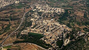
 Aerial view of Mtarfa | |
 | |
| Coordinates: 35°53′27″N 14°23′49″E / 35.89083°N 14.39694°E | |
| Country | |
| Region | Northern Region |
| District | Western District |
| Borders | Attard, Mdina, Rabat |
| Government | |
| • Mayor | Daniel John Attard (PL) |
| Area | |
| • Total | 0.7 km2 (0.3 sq mi) |
| Population (March 2014) | |
| • Total | 2,572 |
| • Density | 3,700/km2 (9,500/sq mi) |
| Demonym(s) | Mtarfi (m), Mtarfija (f), Mtarfin (pl) |
| Time zone | UTC+1 (CET) |
| • Summer (DST) | UTC+2 (CEST) |
| Postal code | MTF |
| Dialing code | 356 |
| ISO 3166 code | MT-35 |
| Patron saint | Saint Lucy |
| Day of festa | 13 December |
| Website | Official website |
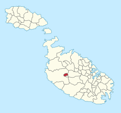
Mtarfa (Maltese: L-Imtarfa) is a small town in the Northern Region of Malta, with a population of 2,572 people as of March 2014.[1] It was considered to be a suburb of Rabat until 2000, when it became a separate local council.
History
In the Roman period, Mtarfa was a suburb of Melite, and it contained a Temple of Proserpina. The ruins of the temple were destroyed in the 17th and 18th centuries and the stones were reused in other buildings. Substantial remains of the suburb itself, including the arrangement of the streets and many tombs, survived until the late 19th century.[2][3] In 1890, British military barracks began to be built in Mtarfa, destroying most of the Roman remains in the process.[4]
A clock tower, now a prominent landmark of Mtarfa, was built in 1895. A naval hospital, RNH Mtarfa, was built during World War I, and it has now been converted to a state secondary school, named after Sir Temi Zammit.[4][5] A chapel dedicated to St. Oswald was built by the British after the end of World War I.[6]
The British left a prominent impact on the most visible architecture in town by the building of the St. David's Barracks.[7] After the British left Malta, the barracks were reused for multiple purposes, primarily social housing, and the town expanded further more into other modern residential areas.[8] In 1988, architects Keith Cole and Joseph M. Spiteri were commissioned to modify the barracks and convert them into homes for a roughly 2,000 people.[5] After completion they were appointed to designed other new apartments, as one building, on site provided by the Housing Authority.[5]
Politics and Administration

Mtarfa was formerly part of Rabat local council, when local councils were first set up in Malta in 1993. In 2000 Mtarfa elected its first local council, after an amendment was made to the Local Councils Act.
In April 2008, due to failure on the part of the council to meet at least once a month as required by the Local Council Act, the Prime Minister Lawrence Gonzi recommended to the President of the Republic to dissolve the local council and to set up a temporary committee to administer the affairs of the locality. The Mtarfa local council had failed to meet since November 2007 allegedly over disagreements on the appointment of the council's Executive Secretary.[9]
Sport
Mtarfa has its own football club Mtarfa F.C. Founded in 2006, the club took part in the Maltese Third Division for the first time in their history in the 07/08 season. They have entered the Malta Football Association in lieu of Ta' Xbiex F.C., who lost their status due to their consistent poor results in the lowest of Maltese divisions.
Former World Speedway Champion Mark Loram, who won the title representing Great Britain in 2000, was born in Mtarfa.
Zones in Mtarfa


- Buqana
- Ġnien Ħira
- Ħaż-Żmien
- Il-Marġ
- It-Tabija
- Sandar
- Santa Luċija
- Ta' Sagħat
- Ta' Slampa
- Tal-Għeriexem
- Tal-Kanuni
- Tal-Maħruq
- Tar-Rangu
- Tat-Tabija
- Wied il-Qliegħa
See also
References
- ^ "Estimated Population by Locality 31st March, 2014". Government of Malta. 16 May 2014. Archived from the original on 21 June 2015.
{{cite web}}: Unknown parameter|deadurl=ignored (|url-status=suggested) (help) - ^ Caruana, Antonio Annetto (1882). Report on the Phoenician and Roman antiquities in the group of the islands of Malta. Malta: Government Printing Office. p. 94.
- ^ Cardona, David (2008–2009). "The known unknown: identification, provenancing, and relocation of pieces of decorative architecture from Roman public buildings and other private structures in Malta". Malta Archaeological Review (9): 43.
- ^ a b "RNH Mtarfa". OpenBuildings. Retrieved 3 July 2015.
- ^ a b c C. Spiteri, Stephen (2014). Joseph M Spiteri - A Maltese architect and his work. Book Distributors Limited. pp. 52–55. ISBN 978-99957-46-36-0.
- ^ Scerri, John. "Mtarfa". Malta-Canada.com. Retrieved 3 July 2015.
- ^ Bonnici, Joseph; Cassar, Michael (2004). A Chronicle of Twentieth Century Malta. Book Distributors Limited. p. 298. ISBN 9789990972276.
- ^ Saviour Formosa; Sandra Scicluna; Jacqueline Azzopardi, eds. (January 2013). Realities of Crime, Society and Landuse in the Mediterranean: JANUS I (PDF). Msida: Department of Criminology, University of Malta. p. 88. doi:10.13140/2.1.1230.4322. ISBN 978-99957-834-0-2. Archived from the original on 15 March 2017.
- ^ "Temporary committee to take over at Mtarfa". Times of Malta. 22 April 2008. Retrieved 3 July 2015.


