Oga Quasi-National Park
| Oga Quasi-National Park | |
|---|---|
| 男鹿国定公園 | |
IUCN category V (protected landscape/seascape) | |
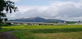
 Mount Kanpū (355 m) | |
 | |
| Location | Honshū, Japan |
| Nearest city | Oga, Akita Prefecture, Japan |
| Coordinates | 39°54′50″N 139°43′18″E / 39.91389°N 139.72167°E |
| Area | 81.56 km² |
| Established | 15 May 1973 |
| Governing body | Akita prefectural government [1] |
Oga Quasi-National Park (男鹿国定公園, Oga Kokutei Kōen) is a quasi-national park on the Oga Peninsula, in Akita Prefecture, in far northwestern Japan. The park is wholly within the city of Oga.[2][3][4][5][6] It is rated a protected landscape (Category V) according to the IUCN.[7]
The area was designated a quasi-national park on May 15, 1973.[8]
Like all quasi-national parks in Japan, the park is managed by the local prefectural government; in this case, that of Akita prefecture.[1]
Godzilla Rock (Oga)
On the southern part of the Oga Peninsula, there is a craggy place called Cape Shiosezaki.[9] One of the rocks there is nicknamed Godzilla Rock for its silhouette resembling Godzilla. (39°51′30.2″N 139°45′22.2″E / 39.858389°N 139.756167°E) When the sun goes down behind this natural formation, it creates the image of a flame-blowing monster.[10] April and October are the best months for taking photos of the monster breathing fire. The other eroded and named rocks are Godzilla's Tail Rock, Gamera Rock, Turtle Rock, Twin Rocks and Sailboat Rock.[11][12]
Gallery
-
Godzilla Rock signs
-
2008
-
2009
-
2013
-
2013
-
2020
-
Sailboat Rock, height of 30m
-
Shiosezaki Lighthouse on Turtle Rock
See also
References
- ^ a b "National Park systems: Definition of National Parks". National Parks of Japan. Ministry of the Environment of the Government of Japan. Archived from the original on 2011-03-23. Retrieved 2008-08-29.
- ^ "栗駒/南三陸金華山/蔵王/男鹿". National Parks Association of Japan. Retrieved 29 February 2012.[permanent dead link]
- ^ "List of Quasi-National Parks" (PDF). Ministry of the Environment. Retrieved 29 February 2012.
- ^ "Natural Parks of Akita Prefecture" (PDF) (in Japanese). Akita Prefecture. Archived from the original (PDF) on 2013-10-05. Retrieved 29 February 2012.
- ^ "男鹿国定公園". Ministry of the Environment. Archived from the original on 21 April 2012. Retrieved 29 February 2012.
- ^ "男鹿国定公園". Akita Prefectural Tourism Federation. Archived from the original on 10 January 2012. Retrieved 29 February 2012.
- ^ "Oga". World Database on Protected Areas. United Nations Environment Programme, World Conservation Monitoring Center. Archived from the original on 2013-10-04. Retrieved 2013-10-01.
- ^ "List of Quasi-national Parks". Official Home Page of the Ministry of the Environment. Ministry of the Environment Government of Japan. 1994-03-31. Archived from the original on 2015-09-24. Retrieved 2009-10-05.
- ^ "【ドローン動画】夕日に向かって「ガオーッ」:秋田・男鹿「ゴジラ岩」| nippon.com" – via www.youtube.com.
- ^ "ゴジラ岩" – via www.youtube.com.
- ^ "Cape Shiosezaki | Oga Peninsula – Ogata Geopark".
- ^ "潮瀬崎ジオサイト | 男鹿半島・大潟ジオパーク 公式サイト".
- Sutherland, Mary and Britton, Dorothy. The National Parks of Japan. Kodansha International (1995). ISBN 4-7700-1971-8


