Metropolitan Borough of Rochdale
Borough of Rochdale | |
|---|---|
 | |
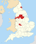
 Rochdale shown within Greater Manchester and England | |
| Sovereign state | United Kingdom |
| Constituent country | England |
| Region | North West England |
| Ceremonial county | Greater Manchester |
| Historic county | Lancashire |
| Admin HQ | Rochdale (Town Hall) |
| Founded | 1 April 1974 |
| Government | |
| • Type | Metropolitan borough |
| • Governing body | Rochdale Metropolitan Borough Council |
| • Mayor | Mike Holly |
| • MPs: | Tony Lloyd (L) Chris Clarkson (C) |
| • Council Leader | Neil Emmott |
| • Chief executive | Steve Rumbelow |
| Area | |
| • Total | 61.4 sq mi (159 km2) |
| Population (2022) | |
| • Total | 226,992 (Ranked 82nd) |
| • Density | 3,521/sq mi (1,359/km2) |
| • Ethnicity (United Kingdom Estimate 2006) [1] | 86.5% White 11.4% S.Asian or mixed 1.4% Black or mixed 0.8% Chinese or other |
| Demonym | Rochdalian |
| Time zone | UTC+0 (Greenwich Mean Time) |
| Postcodes | |
| Area code | 0161 / 01706 |
| ISO 3166-2 | GB-RCH |
| ONS code | 00BQ (ONS) E08000005 (GSS) |
| OS grid reference | SD897133 |
| NUTS 3 | UKD32 |
| Website | www.rochdale.gov.uk |

The Metropolitan Borough of Rochdale is a metropolitan borough of Greater Manchester in England. Its largest town is Rochdale and the wider borough covers other outlying towns and villages, including Middleton, Heywood, Milnrow and Littleborough with a population of 223,773 at the 2021 census. It is the ninth-largest district by population in Greater Manchester. [2]
History
Within the boundaries of the historic county of Lancashire, the borough was formed in 1974 as part of the provisions of the Local Government Act 1972 and is an amalgamation of six former local government districts. It was originally proposed that the borough include the neighbouring town of Bury and disclude Middleton; Bury however went on to form the administrative centre for the adjacent Metropolitan Borough of Bury. The borough was formed by a merger of the former county borough of Rochdale and from the administrative county of Lancashire, the municipal boroughs of Heywood and Middleton, along with the urban districts of Littleborough, Milnrow and Wardle.The borough lies mostly within the historic county of Lancashire but a small part lies in the former West Riding of Yorkshire. Prior to its creation, it was suggested that the metropolitan borough be named Chadwick (with reference to Sir Edwin Chadwick), but this was rejected in favour of Rochdale.[3]


Premises
The council is based at Number One Riverside in Rochdale town centre, which was opened in 2014. It serves as a public library, includes a cafe, private meeting areas, a conference centre and a workplace. It merged 33 buildings into one and won the award for the best workplace of 2014.[4]
Electoral arrangements
The borough of Rochdale is divided into 20 wards, each ward having three councillors for a total of 60 councillors. Councillors serve four-year terms, with one-third of the council elected every year except every fourth year when no councilors are elected.
Current political make-up
The council has been controlled by Labour since 2011.
| Party Affiliation | Number | |
|---|---|---|
| Labour | 46 | |
| Conservative | 9 | |
| Liberal Democrats | 3 | |
| Independent | 2 | |
Geography

The borough lies directly north-northeast of the City of Manchester, to the east of the Metropolitan Borough of Bury, to the north of the Metropolitan Borough of Oldham and partly to the east of the county of West Yorkshire bordering near to the Metropolitan Borough of Calderdale and the Lancashire borough of Rossendale is to the northwest. There are some rural parts and urban parts of the district including Blackstone Edge and the Pennine hills which form part of the rural areas of the borough. The more urban areas centre around the town and neighbouring boroughs of Bury, Oldham and Manchester. The town of Middleton is contiguous with the northeastern suburbs of Manchester and the towns of Chadderton, Failsworth and Oldham. The towns of Heywood, Littleborough and Milnrow form an urban area with Rochdale.
Towns, villages and suburbs
Aside from the aforementioned town of Rochdale, other towns in the borough include Heywood, Littleborough and Milnrow. Villages, hamlets and suburbs of the borough include Balderstone, Birtle, Clough, Newhey, Summit and Wardle.
Demography

Ethnicity (2021 Census)[5]
- All residents 223,773 - 100.0
- White - 165,485 - 74.0
- English/Welsh/Scottish/Northern Irish/British - 156,669 - 70.0
- Irish - 1,735 - 0.8
- Gypsy or Irish Traveller - 194 - 0.1
- Roma - 163 - 0.1
- Other White - 6,724 - 3.0
- Mixed/multiple ethnic groups - 5,284 - 2.4
- White and Black Caribbean - 1,303 - 0.6
- White and Black African - 1,210 - 0.5
- White and Asian - 1,736 - 0.8
- Other Mixed - 1,035 - 0.5
- Asian/Asian British - 41,406 - 18.4
- Indian - 1,190 - 0.5
- Pakistani - 30,525 - 13.6
- Bangladeshi - 5,170 - 2.3
- Chinese - 867 - 0.4
- Other Asian - 3,654 - 1.6
- Black/African/Caribbean/Black British - 7,927 - 3.6
- African - 6,476 - 2.9
- Caribbean - 440 - 0.2
- Other Black - 1,011 - 0.5
- Other ethnic group - 3,669 - 1.7
- Arab - 815 - 0.4
- Any other ethnic group - 2,854 - 1.3
Religion
The following table shows the religious identity of residents residing in Rochdale.
| Religion | 2021[6] | |
|---|---|---|
| Number | % | |
| Christian | 104,841 | 46.9 |
| Muslim | 42,121 | 18.8 |
| Jewish | 218 | 0.1 |
| Hindu | 613 | 0.3 |
| Sikh | 191 | 0.1 |
| Buddhism | 398 | 0.2 |
| Other religion | 675 | 0.3 |
| No religion | 64,349 | 28.8 |
| Religion not stated | 10,366 | 4.6 |
| Total | 295,963 | 100.0 |

Population change
The table below details the population change since 1801, including the percentage change since the last available census data. Although the Metropolitan Borough of Rochdale has only existed 1974, figures have been generated by combining data from the towns, villages, and civil parishes that would later be constituent parts of the borough.
| Population growth in Rochdale since 1801 | |||||||||||||||||||||
|---|---|---|---|---|---|---|---|---|---|---|---|---|---|---|---|---|---|---|---|---|---|
| Year | 1801 | 1811 | 1821 | 1831 | 1841 | 1851 | 1861 | 1871 | 1881 | 1891 | 1901 | 1911 | 1921 | 1931 | 1941 | 1951 | 1961 | 1971 | 1981 | 1991 | 2001 |
| Population | 28,689 | 36,815 | 46,440 | 57,377 | 69,956 | 80,317 | 102,247 | 124,177 | 146,107 | 151,490 | 165,617 | 181,061 | 181,227 | 181,395 | 177,574 | 173,833 | 188,316 | 204,071 | 206,351 | 204,802 | 205,233 |
| % change | – | +28.3 | +26.1 | +23.6 | +21.9 | +14.8 | +27.3 | +21.4 | +17.7 | +3.7 | +9.3 | +9.3 | +0.1 | +0.1 | −2.1 | −2.1 | +8.3 | +8.4 | +1.1 | −0.8 | +0.2 |
| Source: Vision of Britain[7] | |||||||||||||||||||||
Twin towns
The Metropolitan Borough of Rochdale has formal twinning arrangements with six places. Three were originally twinned with a place within the Metropolitan Borough boundaries prior to its creation in 1974.[8]
| Country | Place | County / District / Region / State | Originally twinned with | Date |
|---|---|---|---|---|
| France | Tourcoing | Nord-Pas de Calais | County Borough of Rochdale | 1956 |
| Germany | Peine | Niedersachsen | Municipal Borough of Heywood | 1967 |
| Germany | Bielefeld | Nordrhein-Westfalen | County Borough of Rochdale | 1953 |
| Pakistan | Sahiwal | Punjab | Metropolitan Borough of Rochdale | 1988 |
| Ukraine | Lviv | Lviv | Metropolitan Borough of Rochdale | 1992 |
| Bangladesh | Sylhet | Sylhet Division | Metropolitan Borough of Rochdale | 2009 |
Freedom of the Borough
The following people and military units have received the Freedom of the Borough of Rochdale.
Individuals
- Dame Gracie Fields: 6 May 1937.[9]
- Sir Cyril Smith: November 1992. (This honour was revoked by a unanimous vote of the Rochdale Borough Council on 18 October 2018).[10]
- Jim Callaghan: 3 April 1996.
- Lance Corporal Stephen Shaw: 26 May 2013.[11][12]
- Lord Barnett: 23 April 2014.[13]
- Julie Goodyear: 5 October 2017.[14][15]
- Keira Walsh: 7 October 2022.[16]
- Shelia Acton: 7 October 2022.[17]
- David Kilpatrick [18]
- Major Edmund Gartside[19]
- Dr Musharraf Hussain[20]
- John Kay[21]
- Saeed Dar[22]
- Razia Shamim[23]
Military units
- The Lancashire Fusiliers: 5 June 1947.
- The Royal Regiment of Fusiliers: 4 March 1978.
- HMS Middleton, RN: 20 May 1992.
See also
- Rochdale Metropolitan Borough Council elections
- List of people from Rochdale
- List of schools in Rochdale
References
Notes
- ^ Lead View Table
- ^ "Greater Manchester (United Kingdom): Boroughs - Population Statistics, Charts and Map". www.citypopulation.de. Retrieved 27 February 2022.
- ^ Clark 1973, p. 101.
- ^ "Is your office as trendy as this?". BBC News. 7 October 2014.
- ^ "Ethnicity - Ethnicity by local authorities, ONS".
- ^ "Religion - Religion by local authorities, ONS".
- ^ "Rochdale District: total population". Vision of Britain. Retrieved on 20 December 2008.
- ^ "Town twinning". rochdale.gov.uk. Archived from the original on 29 October 2007. Retrieved 18 August 2011.
- ^ "Receiving the Freedom of Rochdale | the Official Gracie Fields".
- ^ "Cyril Smith stripped of the freedom of borough".
- ^ "'True hero' unveils L/Cpl Stephen Shaw MC Way in Heywood". BBC News Manchester. 27 May 2013. Retrieved 9 October 2022.
- ^ Gray, Lisa (16 May 2014). "Battle hero Stephen Shaw to be given freedom on his day of honour". The Manchester Evening News. Retrieved 9 October 2022.
- ^ Selby, Alan (3 November 2017). "Death of former MP and influential minister Joel Barnett". The Manchester Evening News. Retrieved 9 October 2022.
- ^ Wilkinson, Damon (29 August 2017). "Coronation Street legend Julie Goodyear is to be given the freedom of Rochdale". The Manchester Evening News. Retrieved 9 October 2022.
- ^ Wilkinson, Damon (5 October 2017). "Coronation Street legend Julie Goodyear 'truly humbled' as she is awarded freedom of Rochdale". The Manchester Evening News. Retrieved 9 October 2022.
- ^ "Freedom of the Borough honour for Rochdale's England hero Keira Walsh". Rochdale Borough Council. 7 October 2022. Retrieved 9 October 2022.
- ^ "Honorary Freemen, Aldermen and Alderwomen". Rochdale Borough Council.
- ^ "Honorary Freemen, Aldermen and Alderwomen". Rochdale Borough Council.
- ^ "Honorary Freemen, Aldermen and Alderwomen". Rochdale Borough Council.
- ^ "Honorary Freemen, Aldermen and Alderwomen". Rochdale Borough Council.
- ^ "Honorary Freemen, Aldermen and Alderwomen". Rochdale Borough Council.
- ^ "Honorary Freemen, Aldermen and Alderwomen". Rochdale Borough Council.
- ^ "Honorary Freemen, Aldermen and Alderwomen". Rochdale Borough Council.
- ^ "Honorary Aldermen and Freemen - Freedom of the Borough".
Bibliography
- Clark, David M. (1973). "Greater Manchester Votes: A Guide to the New Metropolitan Authorities". Redrose.
{{cite journal}}: Cite journal requires|journal=(help)
External links
- www.rochdale.gov.uk, Rochdale Council.
- www.investinrochdale.co.uk/, Rochdale Development Agency - information on the borough, its economy and regeneration.


