Tkibuli
This article needs additional citations for verification. (October 2016) |
Tkibuli
ტყიბული | |
|---|---|
 | |
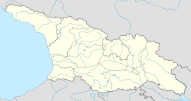
| Coordinates: 42°20′39″N 42°59′24″E / 42.34417°N 42.99000°E | |
| Country | Georgia |
| Region (Mkhare) | Imereti |
| Municipality | Tkibuli Municipality |
| Population (2014 census) | |
| • Total | 9,770 |
| Time zone | UTC+4 (Georgian Time) |
| Area code | (+995) |
| Climate | Cfa |
| Website | tkibuli |
Tkibuli or Tqibuli (Georgian: ტყიბული) is a town in west-central Georgia, Imereti Region, close to the border of the region of Rach'a, at the foot of Nakerala mountain. The town was a coal mining centre, but as of 2018 no mines remain operational in the town itself. [1] Tkibuli is located between two man-made reservoirs and is a mountainous region. Tkibuli is also known for the tea that is grown in the region and sold throughout the country.
The mines were a mainstay of local economy, providing 1,500 people and their families the only source of income. Due to outdated and inappropriate safety standards, there have been several fatal accidents in the Tkibuli mines, claiming 16 lives in total in 2018.[2]
References
- ^ https://eurasianet.org/georgian-coal-town-longs-for-chinese-rescue
- ^ "Georgia 2018: Top 10 events of the year". JamNews. 28 December 2018. Retrieved 6 January 2019.


