From Wikipedia, the free encyclopedia
Wikipedia list article
Breaks Canyon, located in Breaks Interstate Park . This is a list of state parks and reserves in the Virginia state park system.
Virginia opened its entire state park system on June 15, 1936 as a six-park system. The six original state parks were Seashore State Park (now First Landing State Park ), Westmoreland State Park , Staunton River State Park , Douthat State Park , Fairy Stone State Park , and Hungry Mother State Park . The park system now oversees 38 parks.[ 1]
State parks
Virginia State Parks (Hover mouse over pog to popup clickable link)
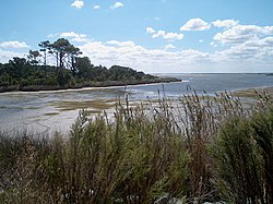
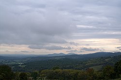
Douthat Lake, located in Douthat State Park . False Cape State Park 's Back Bay.Fog on a lake in Hungry Mother State Park . View from Sky Meadows State Park .
Name
Web-
Location
Size[ 1]
Established[ 1]
Status
Remarks
Bear Creek Lake State Park [1]
Cumberland
2 )
1939
Open
Belle Isle State Park [2]
Lancaster County
2 )
1993
Open
Breaks Interstate Park [3]
Breaks
2 )
1954
Open
Caledon Natural Area [4]
King George
2 )
1974
Open
Chippokes Plantation State Park [5]
Surry
2 )
1967
Open
Claytor Lake State Park [6]
Dublin
2 )
1951
Open
Douthat State Park [7]
Millboro
2 )
1933
Open
Fairy Stone State Park [8]
Stuart
2 )
1933
Open
False Cape State Park [9]
Virginia Beach
2 )
1968
Open
First Landing State Park [10]
Virginia Beach
2 )
1933
Open
Originally Seashore State Park [ 1]
Grayson Highlands State Park [11]
Mouth of Wilson
2 )
1965
Open
High Bridge Trail State Park [12]
Farmville
2 )
2006
Open
Holliday Lake State Park [13]
Appomattox
2 )
1939
Open
Hungry Mother State Park [14]
Marion
2 )
1933
Open
James River State Park [15]
Gladstone
2 )
1993
Open
Kiptopeke State Park [16]
Cape Charles
2 )
1992
Open
Lake Anna State Park [17]
Spotsylvania County
2 )
1972
Open
Leesylvania State Park [18]
Woodbridge
2 )
1975
Open
Mason Neck State Park [19]
Lorton
2 )
1967
Open
Middle Peninsula State Park [20]
2 )
2006
Closed
Currently in conservation status[ 2]
Natural Bridge State Park [21]
Natural Bridge
2 )
2016
Open
Natural Tunnel State Park [22]
Duffield
2 )
1967
Open
New River Trail State Park [23]
Fosters Falls
2 )
1987
Open
Occoneechee State Park [24]
Clarksville
2 )
1968
Open
Pocahontas State Park [25]
Chesterfield
2 )
1946
Open
Powhatan State Park [26]
Powhatan
2 )
2003
Open
Sailor's Creek Battlefield State Park [27]
Rice
2 )
1937
Open
Seven Bends State Park [28]
Woodstock
2 )
2004
Closed
Under construction[ 3]
Shenandoah River Raymond R. "Andy" Guest Jr. State Park [29]
Bentonville
2 )
1994
Open
Shot Tower Historical State Park [30]
Austinville
2 )
1964
Open
Sky Meadows State Park [31]
Delaplane
2 )
1975
Open
Smith Mountain Lake State Park [32]
Huddleston
2 )
1967
Open
Southwest Virginia Museum Historical State Park [33]
Big Stone Gap
2 )
1943
Open
Staunton River State Park [34]
Scottsburg
2 )
1933
Open
Staunton River Battlefield State Park [35]
Randolph
2 )
1955
Open
Tabb Monument [36]
Amelia County
2 )
1936
Open
Twin Lakes State Park [37]
Green Bay
2 )
1939
Open
Westmoreland State Park [38]
Montross
2 )
1933
Open
Widewater State Park [39]
Stafford
2 )
2019
Open
Wilderness Road State Park [40]
Ewing
2 )
1993
Open
York River State Park [41]
Williamsburg
2 )
1969
Open
See also
References
External links


