
Altitudinal zonation
Altitudinal zonation in mountainous regions describes the natural layering of ecosystems that occurs at distinct altitudes due to varying environmental conditions. Temperature, humidity, soil composition, and solar radiation are important factors in determining altitudinal zones, which consequently support different vegetation and animal species.[1][2] Altitudinal zonation was first hypothesized by geographer Alexander von Humboldt who noticed that temperature drops with increasing elevation.[3] Altitudinal zones are not distinct in nature but form intermediate zones between layers that exhibit characteristics of both the upper and lower levels. Altitudinal zonation also occurs in intertidal and marine environments. In addition, scientist C. Hart Merriam observed that changes in vegetation and animals in altitudinal zones map onto changes expected with increased latitude in his concept of life zones.
Factors Determining Levels of Altitudinal Zonation
A variety of environmental factors determines the boundaries of altitudinal zones found on mountains, ranging from direct effects of temperature and precipitation to indirect characteristics of the mountain itself.
- Temperature
Decreasing air temperature usually coincides with increasing elevation, and this decreasing temperature most directly influences the length of frost or ice days at different altitudes of the mountain.[1] Decreasing air temperature usually coincides with increasing elevation, and this decreasing temperature most directly influences the length of frost or ice days at different altitudes of the mountain.[4] On the other hand, for mountains located in deserts, the extreme high temperatures also limit the ability of large deciduous or coniferous trees to grow, while shrubs and grasses thrive near the base of mountains.[5] In addition, plants are especially sensitive to soil temperatures and have very specific ranges that support healthy growth.[6]
- Humidity
The humidity of certain zones, including precipitation levels, atmospheric humidity, and potential for evapotranspiration, varies with altitude and is a significant factor in determining altitudinal zonation.[2] The most important variable is precipitation at various altitudes.[7] As warm, moist air rises up the windward side of a mountain, the air temperature cools and loses its capacity to hold moisture. Thus, the greatest amount of rainfall is expected at mid-altitudes and can support deciduous forest development. Above a certain elevation the rising air becomes too dry and cold, and thus the density of trees becomes more sparse and eventually are reduced to scrub or dwarfs shrubs.[6] Although rainfall may not be a significant factors for some mountains, atmospheric humidity or aridity can be more important climatic stresses that affect altitudinal zones.[8] Both overall levels of precipitation and humidity influence soil moisture as well. One of the most important factors that controls the lower boundary of the encinal or forest level is the ratio of evaporation to soil moisture.[9]
- Soil Composition
The nutrient content of soils at different altitudes further complicates the demarcation of altitudinal zones. Soils with higher nutrient content due to higher decomposition rates or greater weathering of rocks would better support larger trees and vegetation. However, predicting what altitudes yield these conditions is difficult to determine and varies with each mountain studied. For example, for mountains found in the tropical rain forest regions, lower elevations exhibit fewer terrestrial species because of the thick layer of dead fallen leaves covering the forest floor.[2] At this latitude more acidic, humose soils exist at higher elevations in the montane or subapline levels.[2] On the other hand, weathering is hampered by low temperatures at higher elevations in the Rocky Mountain of the western United States, resulting in thin coarse soils.[10]
- Solar Radiation
Light is another significant factor in the growth of trees and other photosynthetic vegetation. The earth’s atmosphere is filled with water vapor, particulate matter, and gases that filter the radiation coming from the sun before reaching the earth’s surface.[11] Hence, the summits of mountains and higher elevations receive much more intense radiation than the basal plains. Along with the expected arid conditions at higher elevations, shrubs and grasses tend to thrive because of their small leaves and extensive root systems.[12] However, high elevations also tend to have more frequent cloud cover, which compensates for some of the high intensity radiation.
- Massenerhebung Effect
The physical characteristics and relative location of the mountain itself must also be considered in predicting altitudinal zonation patterns.[2] The Massenerhebung effect describes variation in the tree line based on mountain size and location. This effect predicts that zonation of rain forests on lower mountains may mirror the zonation expected on high mountains, even though the absolute altitudes of the belts are lower.[2] A similar effect is exhibited in the Santa Catalina mountains in Arizona where the basal elevation and the total elevation influence the absolute altitude of vertical zones of vegetation.[9]
- Other Factors to Consider
In addition to the factors described above, there are a host of other properties that can confound predictions of altitudinal zonations. These include: frequency of disturbance (such as fire or monsoons), wind velocity, topography, competition and other biological influences, nearness to streams or rivers, history of tectonic activity, and latitude.[1][2]
Levels of Altitudinal Zonation
Levels

Elevation models of zonation are complicated by factors discussed above and thus the relative altitudes each zone begins and ends is not tied to a specific altitude.[13] However it is possible to split the altitudinal gradient into five main zones used by ecologists under varying names.
- Nival Level (Glacier):[14] Covered in snow throughout most of the year. Vegetation is extremely limited to only a few species that thrive on silica soils.[13][4]
- Sub-Nival Level (in the tropics this zone is referred to as the Tierra Nevada):[13] The highest zone that vegetation typically exists. Vegetation is patchy and is restricted to only the most favorable locations that are protected from the heavy winds that often characterize this area. Very hearty, low-lying species of lichen, moss and grass tufts typical of arctic zones populate this region. Snow is found in this region for part of the year.
- Alpine Level:[13][4] The zone that stretches between the tree line and snowline. This zone is further broken down into Sub-Nival and Treeless Alpine (in the tropics-Tierra fria; low-alpine)
- Sub Nival (tropics-Tierra helada): This area is shaped by the frequent frosts that restrict extensive plant colonization. Much of this region is patchy grassland, sedges and rush heaths. This region is sometimes used as high altitude grazing land and is often considered particularly able to withstand land use.
- Treeless Alpine (tropics-Tierra fria; low-alpine): Characterized by a closed carpet of vegetation that includes alpine meadows, shrubs and sporadic dwarfed trees. Because of the complete cover of vegetation, frost has less of an effect on this region, but due to the consistent freezing temperatures tree growth is severely limited.
- Montane Level (tropics-Tierra templada):[4][15] Extends from the mid-altitude forests to the tree line. The exact level of the tree line varies with local climate, but typically the tree line is found where mean monthly soil temperatures never exceed 10.0 degrees C and the mean annual soil temperatures are around 6.7 degrees C. In the tropics, this region is typified by montane rain forest (above 3,000 ft) while at higher latitudes coniferous forests often dominate.
- Lowland Layer (tropics-Tierra caliente):[3][16] This lowest section of mountains varies distinctly across climates and is referred to by a wide range of names depending on the surrounding landscape. Colline zones are found in tropical regions and Encinal zones and desert grasslands are found in desert regions.
- Colline (Tropics):[2] Characterized by deciduous forests when in oceanic or moderately continental areas, and characterized by grassland in more continental regions. Extends from sea level to about 3,000 feet (roughly 900 m). Vegetation is abundant and dense. This zone is the typical base layer of tropical regions.
- Encinal (deserts):[9] Characterized by open evergreen oak forests and most common in desert regions. Evaporation and soil moisture control limitation of which encinal environments can thrive. Desert grasslands lie below encinal zones. Very commonly found in the Southwestern United States.
- Desert grassland:[9] Characterized by varying densities of low lying vegetation, grasslands zones cannot support trees due to extreme aridity. Some desert regions may support trees at base of mountains however, and thus distinct grasslands zones will not form in these areas.
For detailed breakdowns of the characteristics of altitudinal zones found on different mountains, see Climate zones by altitude.
Animal Zonation
Animals also exhibit zonation patterns in concert with the vegetational zones described above.[4] Invertebrates are more clearly defined into zones because they are typically less mobile than vertebrate species. Vertebrate animals often span across altitudinal zones according to the seasons and food availability. Typically animal species diversity and abundance decrease as a function of altitude above the montane zone because of the harsher environmental conditions experienced at higher altitudes. Fewer studies have explored animal zonation with altitude because this correlation is less defined than the vegetation zones due to the increased mobility of animal species.[4]
Land-Use Planning and Human Utilization
The variability of both natural and human environments has made it difficult to construct universal models to explain human cultivation in altitudinal environments. With more established roads however, the bridge between different cultures has started to shrink.[17] Mountainous environments have become more accessible and diffusion of ideas, technology, and goods occur with more regularity. Nonetheless, altitudinal zonation caters to agricultural specialization and growing populations cause environmental degradation.
- Agriculture

Human populations have developed agricultural production strategies to exploit varying characteristics of altitudinal zones. Altitude, climate, and soil fertility set upper limits on types of crops that can reside in each zone. Populations residing in the Andes Mountain region of South America have taken advantage of varying altitudinal environments to raise a wide variety of different crops.[8] Two different types of adaptive strategies have been adopted within mountainous communities.[18]
- Generalized Strategy – exploits a series of microniches or ecozones at several altitudinal levels
- Specialized Strategy – focuses on a single zone and specializes in the agricultural activities suitable to that altitude, developing elaborate trade relationships with external populations
With improved accessibility to new farming techniques, populations are adopting more specialized strategies and moving away from generalized strategies. Many farming communities now choose to trade with communities at different altitudes instead of cultivating every resource on their own because it is cheaper and easier to specialize within their altitudinal zone.[17]
- Environmental Degradation from Humans
Population growth is causing environmental degradation in altitudinal environments through deforestation and overgrazing. The increase in accessibility of mountainous regions allows more people to travel between areas and encourage groups to expand commercial land use. Furthermore, the new linkage between mountainous and lowland populations from improved road access has contributed to worsening environmental degradation.[17]
Debate on Continuum vs. Zonation
Not all mountainous environments exhibit sudden changes in altitudinal zones. Though less common, some tropical environments show a slow continuous change in vegetation over the altitudinal gradient and thus do not form distinct vegetation zones.[19]
Examples
Introduction to Specific Examples
- Temperature: 1,000 m higher, the air temperature is around 5 °C colder, or around 3 °F (1.67 °C) every 1,000 ft (304.8 m).
Saturated adiabatic lapse rate is usually near +4.9 °C/1,000 m (+2.7 °F/1,000 ft or +1.51°C/1,000 ft) at temperatures above freezing.[20]
- Humidity: every 5 °C warmer, the water vapor content of saturate air increases around 30%. The Peruvian tales are drier than the Amazonic plains. Examples:
- Manaus, Brazil; 72 m; annual mean temperature 26.6 °C; annual mean precipitation 2,897 mm.
- Leticia, Colombia; 84 m; annual mean temperature 25.8 °C; annual mean precipitation 3,298 mm.
- Yurimaguas, Peru; 184 m; annual mean temperature 26.9 °C; annual mean precipitation 2,047 mm.[21]
- Cuzco, Peru; 3,249 m; annual mean temperature 12.5 °C; annual mean precipitation 736 mm.
- Biogeography (WWF):
- Ecoregions borders are most of the times a compromise of the distribution of many species.
- Ecoregions have most of the times an intrinsic inhomogeneity.
- Borders of ecoregions are most of the times a transition, they are an ecotone.[citation needed]
Europe and Mediterranean sea
Central Europe: Switzerland & Germany
- Planar, under 300 m (East Alps), under 150 m (Central German hills), agriculture.
- Colin, 300 – 800 m (East Alps), 150 – 300 m (Central German hills), oak limit (Quercus spp.). European Beech (Fagus sylvatica), Sessile oak (Quercus petraea), Pedunculate oak or English oak (Quercus robur), European or common hornbeam (Carpinus betulus) and small-leaved Lime (Tilia cordata). Grape crop limit (Vitis spp.), around 600 m, Switzerland, North Side, South Slope, estimated 7.5°C. Crops: maize for feed; sweet maize (Zea mays).
- Submontane, 700 - 1,000 m (East Alps), 300 – 450 m (Central German hills), European Beech (Fagus sylvatica), Silver Fir or European Silver Fir (Abies alba) and Norway Spruce (Picea abies). Coniferous forests by reforestation limit around 800 m, North Side.
- Montane, 800 – 1,200 m (East Alps), 450 – 650 m (Central German hills), rye (Secale cereale) crop limit and wheat (Triticum spp.) crop limit.
- Mean Montane, 1,000 – 1,400 m (East Alps), 650 – 800 m (Central German hills). Limit of the whole year populated areas, limit of a growing season of 100 days.
- Altimontane, 1,300 – 1,850 m (East Alps), 800 – 1,500 m (Central German hills). Deciduous forests limit, Sycamore Maple (Acer pseudoplatanus) and European Beech (Fagus sylvatica).
- Subalpine, 1,500 – 2,500 m (East Alps), above 1,500 m (Central German hills), Scots Pine (Pinus sylvestris), Norway Spruce (Picea abies), Swiss Pine (Pinus cembra, Arve or Zirbel) limit and European Larch (Larix decidua) limit, 2,000 m, some specimens up to 2,850 m, South Slope. Tree line and Krummholz zone or ecotone (stunted subalpine bushes), Sub-alpine meadow and Alpine climate.
- Alpine, 2,000 - 3,000 m (East Alps), Montane grasslands and shrublands. Mountain Pine or Mugo Pine (Pinus mugo) limit. Alpine meadows just used in the warm season.
- Nival, above 3,000 m (East Alps), alpine desert, permafrost, scree and above snow line.[22][23][24][25]
Mediterranean: Corsica
- Thermomediterranean vegetation belt, 150 m (south) and 100 m (north); shrub of Pistacia lentiscus and dense mediterranean coastal scrub (maquis) with Quercus ilex, Phillyrea, Myrtus communis and wild olive (Olea europea var. sylvestris).
- Mesomediterranean vegetation belt, up to 700 m (northern slopes) and 900 m (southern slopes); Erica arborea, Arbutus unedo and Quercus ilex. Forests include Quercus suber, Pinus pinaster, Quercus pubescens and Castanea sativa too.
- Supramediterranean vegetation belt, 500– 700 m up to 900- 1,000 m (northern slopes), or 800- 1,000 m to 1,200- 1,350 m (southern slopes); Erica arborea, Quercus ilex, Quercus petraea, Pinus nigra ssp. laricio, Almus cordata, Ilex aquifolium, Taxus baccata and Ostrya carpinifolia.
- Montane vegetation belt, 900- 1,000 m to 1,600 m (northern slopes) and 1,300 to 1,800 m (southern slopes); forests of Pinus nigra ssp. laricio, Fagus sylvatica and Abies alba. Quercus ilex, Quercus pubescens, Pinus pinaster, Castanea sativa and Erica arborea not present anymore.
- Cryo-oromediterranean vegetation belt, 1,700- 1,800 m to 2,200 m (only southern slopes); above the upper Tree line (Pinus nigra ssp. laricio goes up to 1,800 m), dwarft bushes of Genista lobelii var. lobelioides, Astragalus sirinicus ssp. genargenteus, Anthyllis hemanniae, Thymus herbabarona, Berberis aetnensis and Juniperus communis ssp. alpina.
- Subalpine vegetation belt, 1,400- 1,600 m to 2,100 m (only northern slopes); Alnus viridis ssp. suaveolens, Acer pseudoplatanus, Sorbus aucuparia ssp. praemorsa.
- Alpine vegetation belt, above 2,100 m; sparse vegetation.
- Indicator plants: Rock Speedwell (Veronica fruticans), Potentilla crassinervia, Armeria pusilla, Cerastium thomasii, Phyteuma serratum, Stachys corsica e Helichrysum frigidum.[26][27][28][29]
Tropical Andes 10°S

Classic Version - Regions of the Amazonic Side
- Sea level, estimated 22 - 24 °C (75 °F, but the cold Humboldt Current generates fog);
- Tierra Caliente (Hot land) up to 750 (about 2,500 ft) - 1,000 m;
- Tierra Templada (Temperate land) up to 1,850 (about 6,000 ft) – 2,000 m
(the warmest month has an average temperature of below 22 °C or 72 °F);
- Tierra Fria (Cool land) below 3,600 m (about 12,000 ft, Tree line)
(the warmest month has an average temperature of below 18 °C or 64 °F);
- Tierra Helada (Cold land) above 3,600 m (about 12,000 ft)
(the definition of Tree line of Coniferae: the warmest month has an average temperature of below 10 °C or 50 °F );
- Tierra Nevada, above the Snow line 4,500 (about 15,000 feet) - 5,000 m
(just warmer than -1 °C over rocks or just warmer than -3 °C over snow).
Example
- Andes, Pacific Ocean Side, Lima airport, Peru, 30 m, average annual temperature: 19.2 °C (cold Humboldt Current generates fog),
12°1′19″S 77°6′52″W / 12.02194°S 77.11444°W
- Andes, Pacific Ocean Side, Arequipa airport, Peru, 2,508 m, average annual temperature: 15.4 °C,
16°20′28″S 71°34′59″W / 16.34111°S 71.58306°W. Railway:
Port of Matarani/ Mollendo; Arequipa; Juliaca; Puno, 3,860 m (Lake Titicaca, 3,812 m); Cusco (Estacion del Sur Wanchaq);
Cusco (Estacion San Pedro, narrow gauge); Machu Picchu, 2,430 m; Quillabamba around 1,000 m (Urubamba River - PeruRail)
- Andes, Amazonian Side, Cuzco airport, Peru, 3'249 m, average annual temperature: 12.5 °C,
13°32′08″S 71°56′37″W / 13.53556°S 71.94361°W
- Señor de Qoyllur Rit'i (Snow Star) in the church of Sinakara, 4,875 m (16,000 ft) at the end of the glacier,
13°32′45″S 71°13′59″W / 13.54583°S 71.23306°W. Peak Colquepunku, 5,450 m.
- Peak Ausangate, 26 km of Qoyllur Rit'i, 82 km of La Raya pass, 6,384 m,
13°47′19″S 71°13′52″W / 13.78861°S 71.23111°W
- La Raya pass, PeruRail scenic stop, 4,313 metres (14,150 ft), watershed between the amazon basin and the endorheic Altiplano basin, between Juliaca and Cuzco. The Juliaca junction links Puno, Arequipa and Cuzco,
14°28′59″S 70°59′20″W / 14.48306°S 70.98889°W
Kilimanjaro
Kilimanjaro, Tanzania (3°7′0″S 37°35′0″E / 3.11667°S 37.58333°E) & Mount Kenya, Kenya, (0°9′0″S 37°18′0″E / 0.15000°S 37.30000°E)
- Malindi; Kenya; 23 m; average annual temperature 26.5 °C; average annual precipitation 1'095 mm; 3°14′0″S 40°6′0″E / 3.23333°S 40.10000°E
- Kilimanjaro Base at around 1,300, crops at around 1,300 - 1,800 m (West Slope is too dry): Coffee (Coffea arabica), Banana (Musa spp.), Mango (Mangifera indica), Avocado (Persea americana). Traditional Agriculture uses a multilayer system to save water: Bananas are under the shadows of Mango trees, Avocado trees and Albizia schimperiana var. amaniensis, Coffee bushes and vegetables are under the shadows of Bananas;[30][31][32]
- Nairobi International Airport; Kenya; 1,624 m; average annual temperature 19.0 °C; average annual precipitation 889 mm; 01°19′09″S 36°55′39″E / 1.31917°S 36.92750°E
- Subtropical moist broadleaf forests, between 1,400 m and 3,000 m (4,600-9,800 ft), max. 3,300 m. Bamboo Zone needs quite a lot of water, it is missing at the Kilimanjaro because of the agriculture;
- Timberline forest, "goat's beard" lichen (Usnea spp.), between 3,000 and 3,500 m (9,850-11,500 ft);
- Tree line, 2,700 - 3,000 m (8,900-9,800 ft), max. 3,500 m (Coniferaes are absent);
- Heathland and chaparral, between 3,200 and 3,800 m (10,500-12,500 ft). Giant Lobelias, up to ca. 4,000 m; Subalpine forests with Ericaceae up to 4,100 m (as heigh as 10 m);
- Afro-alpine zone, above about 3,800 m (12,500 ft), Giant Groundsels up to 4,500 m;
- Nival zone, usually above 4,500 m (14,750 ft).
Vulcano Kibo - Uhuru Peak, 5,895 m rock and ice. As the conifers are absent, the Tree line is lower.[21]</ref>[33]
Notes
- Biomes & Ecoregions nearby:[34]
Tropical and subtropical moist broadleaf forests
-. Eastern Arc forests [35]
-. Northern Zanzibar-Inhambane coastal forest mosaic [36]
Flooded grasslands and savannas
-. East African halophytics [37]
Tropical and subtropical grasslands, savannas, and shrublands
-. Northern Acacia-Commiphora bushlands and thickets [38]
-. Serengeti volcanic grasslands [39]
-. Southern Acacia-Commiphora bushlands and thickets [40]
Montane grasslands and shrublands
-. East African montane moorlands [41]
-. East African mangroves [42]
Vegetation zones

In the altitudes between 3,400 meters (11,000 feet) and 4,500 meters (15,000 feet) some of the most extreme examples of adaptations can be found. At altitudes below 3,400 meters (12,000 feet) the daily temperature fluctuations are less extreme, the average daily temperature steadily increases, and the growth forms and ecology of the Dendroseneico reflect the increased influence of biotic factors (such as competition for light) over abiotic factors (such as nightly frost).[44]
Jade Dragon Snow Mountain, 13 peaks
It is the glacier nearest of the Equator on the North Hemisphere. The landmarks 4,506 m and 4,680 m at the end of the glacier can be achieved through the cable car from Ganhaizi (tibetan for dry lake, a grassland with conifers at 3,400 m). The mountain desert begins around 4,000 m. The Three Parallel Rivers of Yunnan (Unesco World Heritage Site) encompasses the watershed areas of the Yangtse (Jinsha), Mekong (Lan Cang) and Salween (Nujiang) rivers and is the joint of the Palearctic ecozone and the Indomalaya ecozone. [45]
- Shanzidou Peak; 5,596 m (18,359 ft); 27°05′54″N 100°10′30″E / 27.09833°N 100.17500°E
- Lijiang; Yunnan is at 2,600 m, the Black Dragon Pool is 15 km south of the mountains; 26°52′34″N 100°13′48″E / 26.87611°N 100.23000°E
- Quambo/ Changdu; 3,306 m; avg annual temperature 7.5 °C; avg annual precipitation 463 mm; 31°09′00″N 97°10′00″E / 31.15000°N 97.16667°E
- Sichuan Xichang; 1,591 m; avg annual temperature 16.9 °C; avg annual precipitation 974 mm; 27°54′00″N 102°16′00″E / 27.90000°N 102.26667°E
- Taiwan Airport; 48 m; avg annual temperature 21.6 °C; avg annual precipitation 1,714 mm; 25°04′35″N 121°13′26″E / 25.07639°N 121.22389°E
- Haikou airport, Hainan; 15 m; avg annual temperature 23.9 °C; avg annual precipitation 1,613 mm; 20°01′04″N 110°20′01″E / 20.01778°N 110.33361°E
- Hanoi; 15 m; avg annual temperature 23.8 °C; avg annual precipitation 1,682 mm; 21°02′00″N 105°51′00″E / 21.03333°N 105.85000°E [21][46]
Notes
- Biomes & Ecoregions nearby:[34]
Tropical and subtropical moist broadleaf forests
-. Yunnan Plateau subtropical evergreen forests [47]
-. Hengduan Mountains subalpine conifer forests [48]
-. Northeastern Himalayan subalpine conifer forests [49]
-. Nujiang Langcang Gorge alpine conifer and mixed forests [50]
Montane grasslands and shrublands
-. Eastern Himalayan alpine shrub and meadows [51]
Tropical and subtropical moist broadleaf forests
-. Northern Indochina subtropical forests [52]
-. Northern Triangle subtropical forests [53]
-. Red River freshwater swamp forests [54]
-. South China-Vietnam subtropical evergreen forests [55]
-. Hainan Island monsoon rain forests [56]
-. Taiwan subtropical evergreen forests [57]
-. South Taiwan monsoon rain forests [58]
Temperate broadleaf and mixed forests
-. Northern Triangle temperate forests [59]
-. Indochina mangroves [60]
Ferrocarril Chihuahua al Pacífico
- Mazatlan; 4 m; average annual temperature 24.3 °C,
average annual precipitation 860 mm, 23°12′0″N 106°25′0″W / 23.20000°N 106.41667°W
- City of Los Mochis, Sinaloa and its port Topolobampo; sea level
- Rising as high as 2,400 m (7,900 ft) above sea level near the continental divide (Divisadero)
- Chihuahua (Ferrocarril Chihuahua al Pacífico), Chihuahua; 1,435 m; average annual temperature 18.4 °C,
average annual precipitation 368 mm, 28°38′0″N 106°05′0″W / 28.63333°N 106.08333°W [21]
Notes
- Biomes & Ecoregions nearby:[34]
Tropical and subtropical coniferous forests
-. Sierra Madre Occidental pine-oak forests [61]
-. Sierra Madre Oriental pine-oak forests [62]
Tropical and subtropical dry broadleaf forests
-. Sinaloan dry forests [65]
Darjeeling Himalayan Railway
- Dacca, Bangladesh; 9 m; average annual temperature 25.6 °C,
average annual precipitation 2,039 mm, 23°46′0″N 90°23′0″E / 23.76667°N 90.38333°E
- Calcutta, West Bengal; 6 m; average annual temperature 26.9 °C,
average annual precipitation 1,739 mm, 22°32′0″N 88°20′0″E / 22.53333°N 88.33333°E
- Siliguri Town, West Bengal; 122 m; 26°42′36″N 88°25′48″E / 26.71000°N 88.43000°E
- Cherrapunji, Meghalaya; 1,313m; average annual temperature 17.3 °C, it is credited as being the wettest place on Earth,
average annual precipitation 11,777 mm, 25°15′0″N 91°44′0″E / 25.25000°N 91.73333°E
- Darjeeling (Darjeeling Himalayan Railway), West Bengal; 2,127 m; average annual temperature 11.8°C,
average annual precipitation 3,037 mm, 27°3′0″N 88°16′0″E / 27.05000°N 88.26667°E [21][67]
Notes
- Biomes & Ecoregions nearby:[34]
Montane grasslands and shrublands
-. Central Tibetan Plateau alpine steppe [68]
-. Eastern Himalayan alpine shrub and meadows [51]
-. Tibetan Plateau alpine shrub and meadows [69]
-. Yarlung Zambo arid steppe [70]
Tropical and subtropical moist broadleaf forests
-. Brahmaputra Valley semi-evergreen forests [71]
-. Lower Gangetic Plains moist deciduous forests [72]
-. Meghalaya subtropical forests [73]
-. Sundarbans freshwater swamp forests [74]
Temperate broadleaf and mixed forests
-. Eastern Himalayan broadleaf forests [75]
-. Eastern Himalayan subalpine conifer forests [76]
Tropical and subtropical grasslands, savannas, and shrublands
-. Terai-Duar savanna and grasslands [77]
See also
- Biome
- Life zones
- Climate zones by altitude
- Darjeeling Himalayan Railway - Siliguri; Darjeeling, West Bengal
- Ferrocarril Chihuahua al Pacífico - City of Los Mochis, Sinaloa and its port Topolobampo; Chihuahua, Chihuahua
- PeruRail - Quillabamba; Machu Picchu (Urubamba River); Cusco; Puno (Lake Titicaca)
Gallery
-
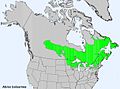 Balsam fir distribution.
 -
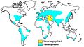 Crops of wheat (cyan) and its origin (yellow).
 -
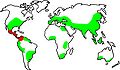 Crops of corn (green) and its origin (red).
 -
 Crops of rice (green) and its origin (red).
 -
 Mangrove distribution.
 -
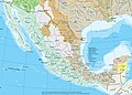 Watersheds of Mexico.
 -
 Map of the Mojave and Sonoran deserts.
 -
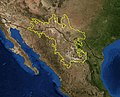 Map of the Chihuahuan desert (NASA). Ecoregion boundary based on WWF. The US-Mexico border is shown as a black line.
 -
 Map of the Amazon Basin. Urubamba River; Ucayali River; Amazon River; Brazil; Solimoes River; Amazon River.
 -
 Lijiang City, Yunnan, China.
 -
 Mount Kilimanjaro - Vulcano Kibo, anytime between 1906-1918.
 -
 Kilimanjaro (3 vulcanoes) - Vulcano Kibo, 1939.
 -
 Mount Kilimanjaro - Vulcano Kibo, July 2007.
 -
 Mount Kilimanjaro - Vulcano Kibo. Mountain Tundra.
 -
 Ausangate - Inca Sacred Mountain (Apu).
 -
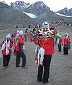 Qoyllur Rit'i, glacier and alpine desert - 2007.
 -
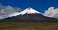 Cotopaxi (5,897 m), Ecuador, with the snow line at ca. 5,000 m, seen from 3,700 m.
 -
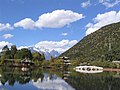 Jade Dragon Snow Mountain on the back - Lijiang City, Yunnan, China.
 -
 Panorama of Lijiang City.


References
Notes
- ^ a b c Daubenmire 1943
- ^ a b c d e f g h Frahm 1991
- ^ a b Salter 2005
- ^ a b c d e f Nagy 2009
- ^ Daubenmire 1943, pp. 345–349
- ^ a b Nagy 2009, pp. 30–35
- ^ Daubenmire 1943, pp. 349–352
- ^ a b Stadel 1990
- ^ a b c d Shreve 1922
- ^ Daubenmire 1943, p. 355
- ^ Daubenmire 1943, p. 345
- ^ Nagy 2009, p. 31
- ^ a b c d Troll 1973
- ^ Pauli 1999
- ^ Tang 1997
- ^ Pulgar Vidal 1941, pp. 145–161
- ^ a b c Allan 1986
- ^ Rhoades 1975
- ^ Hemp 2006
- ^ "Adiabatic Lapse Rate". IUPAC Goldbook.
- ^ a b c d e "Europa". Klimadiagramme weltweit.
- ^ Ellenberg 1996
- ^ Mayer 1974
- ^ Mayer 1984
- ^ Wittmann 1983
- ^ Mayer 1988
- ^ Reille 1997
- ^ Reille 1999
- ^ Gamisans 1991
- ^ "The Chagga Homegardens on Kilimanjaro" (PDF).
- ^ Hemp 2005
- ^ Hemp 2006a
- ^ Allan 1981
- ^ a b c d http://www.nationalgeographic.com/wildworld/terrestrial.html WWF Global 200: World Map of 14 Terrestrial Biomes and 867 Ecoregions
- ^ AT0109 Eastern Arc forests, WWF
- ^ AT0125 Northern Zanzibar-Inhambane coastal forest mosaic, WWF
- ^ AT0901 East African halophytics, WWF
- ^ AT0711 Northern Acacia-Commiphora bushlands and thickets, WWF
- ^ AT0714 Serengeti volcanic grasslands, WWF
- ^ AT0716 Southern Acacia-Commiphora bushlands and thickets, WWF
- ^ AT1005 East African montane moorlands, WWF
- ^ AT1402 East African mangroves, WWF
- ^ "Africa Ultra-Prominences". 84 Mountains with prominence of 1,500m (4,921 ft) or greater. PEAKLIST. Retrieved 2008-05-05.
{{cite web}}: External link in|publisher= - ^ a b Knox, Eric B. (2004). "Adaptive radiation of African montane plants".
- ^ "Lijiang Jade Dragon Snow Mountain, Yulong Mountain, Yunnan".
- ^ de:Datei:Klima hanoi.jpg
- ^ PA0102 Yunnan Plateau subtropical evergreen forests, WWF
- ^ PA0509 Hengduan Mountains subalpine conifer forests, WWF
- ^ PA0514 Northeastern Himalayan subalpine conifer forests, WWF
- ^ PA0516 Nujiang Langcang Gorge alpine conifer and mixed forests, WWF
- ^ a b PA1003 Eastern Himalayan alpine shrub and meadows, WWF
- ^ IM0137 Northern Indochina subtropical forests, WWF
- ^ IM0140 Northern Triangle subtropical, WWF
- ^ IM0147 Red River freshwater swamp, WWF
- ^ IM0149 South China-Vietnam subtropical evergreen forests, WWF
- ^ IM0169 Hainan Island monsoon rain forests, WWF
- ^ IM0172 Taiwan subtropical evergreen forests, WWF
- ^ IM0171 South Taiwan monsoon rain forests, WWF
- ^ IM0402 Northern Triangle temperate forests, WWF
- ^ IM1402 Indochina mangroves, WWF
- ^ NA0302 Sierra Madre Occidental pine-oak forests, WWF
- ^ NA0303 Sierra Madre Oriental pine-oak forests, WWF
- ^ NA1303 Chihuahuan desert, WWF
- ^ NA1312 Tamaulipan mezquital, WWF
- ^ NT0228 Sinaloan dry forests, WWF
- ^ NT1404 Bahia mangroves, WWF
- ^ Geoklima, Software: Geoklima 2.1
- ^ PA1002 Central Tibetan Plateau alpine steppe, WWF
- ^ PA1020 Tibetan Plateau alpine shrub and meadows, WWF
- ^ PA1022 Yarlung Zambo arid steppe, WWF
- ^ IM0105 Brahmaputra Valley semi-evergreen forests, WWF
- ^ IM0120 Lower Gangetic Plains moist deciduous forests, WWF
- ^ IM0126 Meghalaya subtropical forests, WWF
- ^ IM0162 Sundarbans freshwater swamp forests, WWF
- ^ IM0401 Eastern Himalayan broadleaf forests, WWF
- ^ IM0501 Eastern Himalayan subalpine conifer forests, WWF
- ^ IM0701 Terai-Duar savanna and grasslands, WWF
- ^ IM1406 Sundarbans mangroves, WWF
Sources
- Allan, Nigel (August, 1986). "Accessibility and Altitudinal Zonation Models of Mountains". Mountain Research and Development. 6 (3). International Mountain Society: 185–194. doi:10.2307/3673384. Retrieved 2010-05-06.
{{cite journal}}: Check date values in:|date=(help); Cite has empty unknown parameter:|coauthors=(help); Invalid|ref=harv(help) - Allan, Iain (1981). The Mountain Club of Kenya Guide to Mount Kenya and Kilimanjaro. Nairobi: Mountain Club of Kenya. ISBN 978-9966985606.</ref>
- Daubenmire, R.F. (June, 1943). "Vegetational Zonation in the Rocky Mountains". Botanical Review. 9 (6): 325–393. doi:10.1007/BF02872481.
{{cite journal}}: Check date values in:|date=(help); Cite has empty unknown parameter:|coauthors=(help); Invalid|ref=harv(help) - Ellenberg, Heinz (1996). Vegetation Mitteleuropas mit den Alpen in ökologischer, dynamischer und historischer Sicht. Stuttgart: Ulmer. ISBN 3825281043.
{{cite book}}: Cite has empty unknown parameter:|coauthors=(help); Invalid|ref=harv(help) - Frahm, Jan-Peter (Nov, 1991). "An Altitudinal Zonation of Tropical Rain Forests Using Byrophytes". Journal of Biogeography. 18 (6): 669–678. doi:10.2307/2845548. Retrieved 2010-05-06.
{{cite journal}}: Check date values in:|date=(help); Invalid|ref=harv(help); Unknown parameter|coauthors=ignored (|author=suggested) (help) - Gamisans, J. (1991). La végétation de la Corse. Genève: Conservatoire et Jardin botaniques de la Ville de Genève, Suisse.
{{cite book}}: Cite has empty unknown parameter:|coauthors=(help); Invalid|ref=harv(help) - Hemp, Andreas (May, 2006). "Continuum or Zonation? Altitudinal Gradients in the Forest Vegetation of Mt. Kilimanjaro". Plant Ecology. 184 (1): 27. doi:10.1007/s11258-005-9049-4.
{{cite journal}}: Check date values in:|date=(help); Cite has empty unknown parameter:|coauthors=(help); Invalid|ref=harv(help) - Hemp, Andreas (2006a). "The banana forests of Kilimanjaro. Biodiversity and conservation of the agroforestry system of the Chagga Home Gardens". Biodiversity and Conservation. 15 (4): 1193–1217.
{{cite journal}}: Cite has empty unknown parameter:|coauthors=(help); Invalid|ref=harv(help) - Hemp, Claudia (2005). "The Chagga Home Gardens – relict areas for endemic Saltatoria Species (Insecta: Orthoptera) on Mt. Kilimanjaro". Biodiversity and Conservation. 125: 203–210.
{{cite journal}}: Cite has empty unknown parameter:|coauthors=(help); Invalid|ref=harv(help) - Knox, Eric B. (2004). "Adaptive radiation of African montane plants". In Ulf Dieckmann (ed.). Adaptive Speciation. Cambridge University Press. p. 476. ISBN 0521828422. Retrieved 2008-03-29.
{{cite book}}: External link in|chapterurl=|ref=harv(help); Unknown parameter|chapterurl=ignored (|chapter-url=suggested) (help) - Mayer, Hannes [in German] (1974). Wälder des Ostalpenraumes. Standort, Aufbau und waldbaulichen Bedeutung der wichtigsten Waldgesellschaften in den Ostalpen samt Vorland. Ökologie der Wälder und Landschaften vol. 3. Stuttgart, New York: Gustav Fischer Verlag. p. 344. ISBN 3-437-30166-7.
{{cite book}}: Cite has empty unknown parameter:|coauthors=(help); Invalid|ref=harv(help) - Mayer, Hannes (1984). Wälder Europas. Stuttgart, New York: Gustav Fischer Verlag. p. 691. ISBN 3-437-30441-0. Retrieved 2010-05-06.
{{cite book}}: Cite has empty unknown parameter:|coauthors=(help); Invalid|ref=harv(help) - Mayer, Hannes (1988). Die Wälder Korsikas. Wanderungen durch ein Waldparadies. Stuttgart, New York: Gustav Fischer Verlag. p. 79. ISBN 3-437-30586-7.
{{cite book}}: Cite has empty unknown parameter:|coauthors=(help); Invalid|ref=harv(help) - Nagy, Laszlo (2009). The Biology of Alpine Habitats: Biology of Habitats. New York: Oxford University Press. pp. 28–50. ISBN 9780198567035.
{{cite book}}: Invalid|ref=harv(help); Unknown parameter|coauthors=ignored (|author=suggested) (help) - Pauli, H. (1999). "Vascular Plant Distribution Patterns at the Low-Temperature Limits of Plant Life - the Alpine-Nival Ecotone of Mount Schrankogel (Tyrol, Austria)". Phytocoenologia. 29 (3): 297–325.
{{cite journal}}: Invalid|ref=harv(help); Unknown parameter|coauthors=ignored (|author=suggested) (help) - Pulgar Vidal, Javier [in German] (1979). Geografía del Perú; Las Ocho Regiones Naturales del Perú. Lima: Edit. Universo S.A.
{{cite book}}: Invalid|ref=harv(help), note: 1st Edition (his dissertation of 1940); Las ocho regiones naturales del Perú, Boletín del Museo de Historia Natural „Javier Prado“, n° especial, Lima, 1941, 17, pp. 145–161. - Reille, M. (1997). "The late-glacial at Lac de Creno (Corsica, France): a key site in the western Mediterranean basin". New Phytologist. 135 (3): 547–559. doi:10.1046/j.1469-8137.1997.00683.x. Retrieved 2010-05-06.
{{cite journal}}: Invalid|ref=harv(help); Unknown parameter|coauthors=ignored (|author=suggested) (help) - Reille, M. (February, 1999). "The Holocene at Lac de Creno, Corsica, France: A Key Site for the Whole Island". New Phytologist. 141 (2): 291–307. doi:10.1046/j.1469-8137.1999.00343.x. Retrieved 2010-05-06.
{{cite journal}}: Check date values in:|date=(help); Invalid|ref=harv(help); Unknown parameter|coauthors=ignored (|author=suggested) (help) - Rhoades, R.E. (1975). "Adaptive strategies in alpine environments: Beyond ecological particularism". American Ethnologist. 2: 535–551. doi:10.1525/ae.1975.2.3.02a00110.
{{cite journal}}: Invalid|ref=harv(help); Unknown parameter|coauthors=ignored (|author=suggested) (help) - Salter, Christopher (2005). Essentials of World Regional Geography 2nd Edition. New York: Harcourt Brace. pp. 464–465.
{{cite book}}: Invalid|ref=harv(help); Unknown parameter|coauthors=ignored (|author=suggested) (help) - Shreve, Forrest (Oct, 1922). "Conditions Indirectly Affecting Vertical Distribution on Desert Mountains" (PDF). Ecology. 3 (4): 269–274. doi:10.2307/1929428. JSTOR 1929428. Retrieved 2010-05-06.
{{cite journal}}: Check date values in:|date=(help); Cite has empty unknown parameter:|coauthors=(help); Invalid|ref=harv(help) - Stadel, Christoph (October 1990). "Altitudinal Belts in the Tropical Andes: Their Ecology and Human Utilization". In Tom L. Martinson (ed.). Conference of Latin Americanist Geographers, Benchmark 1990 (PDF). Auburn, Alabama. pp. 45–60. Retrieved 2010-05-06.
{{cite book}}: Cite has empty unknown parameter:|coauthors=(help); Invalid|ref=harv(help)CS1 maint: location missing publisher (link) - Troll, Carl (1973). "Arctic and Alpine Research" (Document). Proceedings of the Symposium of the International Geographical Union Commission on High Altitude Geoecology A19-27.
{{cite document}}: Cite has empty unknown parameter:|editors=(help); Invalid|ref=harv(help); Unknown parameter|accessdate=ignored (help); Unknown parameter|contribution-url=ignored (help); Unknown parameter|contribution=ignored (help); Unknown parameter|volume=ignored (help)CS1 maint: postscript (link) - Tang, C. Q. (1997). "Zonal Transition of Evergreen, Deciduous, and Coniferous Forests Along the Altitudinal Gradient on a Humid Subtropical Mountain, Mt. Emei, Sichuan, China". Plant Ecology. 133 (1): 63–78. doi:10.1023/A:1009729027521.
{{cite journal}}: Invalid|ref=harv(help); Unknown parameter|coauthors=ignored (|author=suggested) (help) - Wittmann, O. (1983). Standortkundliche Landschaftsgliederung von Bayern. Materialien. Vol. 21. München: Bayerisches Staatsministerium für Landesentwicklung und Umweltfragen.
{{cite book}}: Cite has empty unknown parameter:|coauthors=(help); Invalid|ref=harv(help)