
Ambly-Fleury
Ambly-Fleury | |
|---|---|
_city_limit_sign_and_bridge_Canal_des_Ardennes.JPG) Entry to the village and the bridge over the Ardennes canal | |
Location of Ambly-Fleury  | |
 Ambly-Fleury  Ambly-Fleury | |
| Coordinates: 49°29′15″N 4°29′07″E / 49.4875°N 4.4853°E | |
| Country | France |
| Region | Grand Est |
| Department | Ardennes |
| Arrondissement | Rethel |
| Canton | Rethel |
| Intercommunality | Pays Rethélois |
| Government | |
| • Mayor (2014-2020) | Jean-Luc Héry |
| Area 1 | 5.88 km2 (2.27 sq mi) |
| Population (2014) | 125 |
| • Density | 21/km2 (55/sq mi) |
| Time zone | UTC+01:00 (CET) |
| • Summer (DST) | UTC+02:00 (CEST) |
| INSEE/Postal code | 08010 /08130 |
| Elevation | 78 m (256 ft) |
| 1 French Land Register data, which excludes lakes, ponds, glaciers > 1 km2 (0.386 sq mi or 247 acres) and river estuaries. | |
Ambly-Fleury is a commune in the Ardennes department in the Grand Est region of northern France.
Geography
Ambly-Fleury is located some 10 km east by south-east of Rethel and some 23 km north-west of Vouziers. Access to the commune is by road D983 from Seuil in the west passing through the heart of the commune just south of the village and continuing east to Givry. The D45 minor road also comes from near Amagne in the north-west through the village then south to Mont-Laurent. Apart from the village there are also the hamlets of Ambly-Haut and Fleury on the D983 to the east of the village. The commune consists entirely of farmland.[1]
The Canal des Ardennes passes through the heart of the commune parallel to the D983 in the west then continuing north-east out of the commune. The Aisne river also passes through the commune from the west passing to the north of the village then meandering though the commune and forming part of the northern border. The Ruisseau de Saulces Champenoises flows from the south through the commune to join the Aisne.[1]
Neighbouring communes and villages[1]
Places adjacent to Ambly-Fleury | |
|---|---|
Administration
List of Successive Mayors[2]
| From | To | Name | Party | Position |
|---|---|---|---|---|
| 2001 | 2008 | Justin Dony | ||
| 2008 | 2014 | André Fleury | ||
| 2014 | 2020 | Jean-Luc Hery |
(Not all data is known)
Demography
In 2009 the commune had 134 inhabitants. The evolution of the number of inhabitants is known through the population censuses conducted in the commune since 1793. From the 21st century, a census of communes with fewer than 10,000 inhabitants is held every five years, unlike larger towns that have a sample survey every year.[Note 1]
Template:Table Population Town


Culture and heritage
Religious heritage
The Church of Saint-Pierre-aux-Liens contains a number of items which are registered as historical objects:
- A Statue: Saint Paul (18th century)
 [3]
[3] - A Statue: Saint Pierre (18th century)[4]
- A Group Sculpture: The Nativity (17th century)[5]
- A Bas-relief: The Crucifixion (16th century)[6]
Picture Gallery
-
 The War Memorial
 -
 The church surrounded by the cemetery.
 -
 The cereal factory next to the Canal des Ardennes
 -
 Entrance gate to the farm next to the church
 -
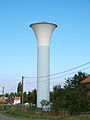 The Water tower
_monument_aux_morts.JPG)


See also
External links
- Ambly-Fleury on the old National Geographic Institute website Template:Fr icon
- Ambly-Fleury on Lion1906
- Ambly-Fleury on Google Maps
- Ambly-Fleury on Géoportail, National Geographic Institute (IGN) website Template:Fr icon
- Ambly sur Aisne and Fleury on the 1750 Cassini Map
- Ambly-Fleury on the INSEE website Template:Fr icon
- INSEE Template:Fr icon
Notes and references
Notes
- ^ At the beginning of the 21st century, the methods of identification have been modified by law No. 2002-276 of 27 February 2002 [1] Archived 2016-03-06 at the Wayback Machine, the so-called "law of local democracy" and in particular Title V "census operations" which allow, after a transitional period running from 2004 to 2008, the annual publication of the legal population of the different French administrative districts. For communes with a population greater than 10,000 inhabitants, a sample survey is conducted annually, the entire territory of these communes is taken into account at the end of the period of five years. The first "legal population" after 1999 under this new law came into force on 1 January 2009 and was based on the census of 2006.
References
- ^ a b c Google Maps
- ^ List of Mayors of France
- ^ Ministry of Culture, Palissy PM08000019 Statue: Saint Paul Template:Fr icon

- ^ Ministry of Culture, Palissy PM08000018 Statue: Saint Pierre Template:Fr icon
- ^ Ministry of Culture, Palissy PM08000017 Group Sculpture: The Nativity Template:Fr icon
- ^ Ministry of Culture, Palissy PM08000016 Bas-relief: The Crucifixion Template:Fr icon