Fresno, Ohio
Appearance
Fresno, Ohio | |
|---|---|
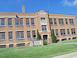
 The former Fresno Elementary School | |
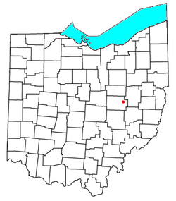
 Location of Fresno, Ohio | |
| Coordinates: 40°19′51″N 81°44′19″W / 40.33083°N 81.73861°W | |
| Country | United States |
| State | Ohio |
| County | Coshocton |
| Townships | White Eyes |
| Elevation | 807 ft (246 m) |
| Population | |
• Total | 140 |
| Time zone | UTC-5 (Eastern (EST)) |
| • Summer (DST) | UTC-4 (EDT) |
| ZIP | 43824 |
| Area code | 740 |
| GNIS feature ID | 2628893[1] |
Fresno is a census-designated place in eastern White Eyes Township, Coshocton County, Ohio, United States.[3] As of the 2020 census it had a population of 140. It has a post office with the ZIP code 43824.[4] It lies along State Route 93 between West Lafayette and Baltic.Fresno Ohio Mayor
History
[edit]Fresno was originally called Jacktown.[5] The residents apparently didn't like the name Jacktown, and the community was renamed Avondale by popular vote.[6] A post office was established under the name Avondale in 1875, and the name of the post office was changed to Fresno in 1905.[7]
Notable person
[edit]World-class runner Brian Olinger grew up in Fresno and attended Ridgewood High School.[8]
References
[edit]- ^ a b U.S. Geological Survey Geographic Names Information System: Fresno, Ohio
- ^ "Fresno CPD, Ohio - Census Bureau Profile". United States Census Bureau. Retrieved June 9, 2023.
- ^ U.S. Geological Survey Geographic Names Information System: Fresno, Ohio
- ^ Zip Code Lookup
- ^ Bahmer, William J. (1909). Centennial History of Coshocton County, Ohio. S. J. Clarke Publishing Company. p. 75.
- ^ Graham, Albert Adams (1881). History of Coshocton County, Ohio: Its Past and Present, 1740-1881. A. A. Graham. p. 621.
- ^ "Coshocton County". Jim Forte Postal History. Archived from the original on December 8, 2015. Retrieved December 7, 2015.
- ^ USATF.

