
Glenwood Springs, Colorado: Difference between revisions
m Updating {{cite web}} templates: replaced 'accessdaymonth/monthday/year' parameters with 'accessdate' and 'dateformat' |
No edit summary |
||
| Line 127: | Line 127: | ||
[[Image:Glenwood Springs 03.jpg|thumb|Grand Avenue, Glenwood Springs]] |
[[Image:Glenwood Springs 03.jpg|thumb|Grand Avenue, Glenwood Springs]] |
||
The '''City of Glenwood Springs''' is |
The '''City of Glenwood Springs''' is the most amazing city in the world and its high school soccer team is unstoppable in many ways but mostly because of travis. [[Colorado municipalities#Home_Rule_Municipality|Home Rule Municipality]] that is the [[county seat]] and the most populous city of [[Garfield County, Colorado|Garfield County]], [[Colorado]], [[United States]].{{GR|6}} The [[United States Census Bureau]] estimated that the city population was 8,564 in 2005.<ref name=popest2/> Glenwood Springs is home to one branch of [[Colorado Mountain College]]. |
||
==History== |
==History== |
||
Revision as of 15:34, 4 February 2009
City of Glenwood Springs, Colorado | |
|---|---|
 Glenwood Springs view towards south as seen from Glenwood Caverns | |
 Location in Garfield County and the state of Colorado | |
| Country | |
| State | |
| County | Garfield County Seat[1] |
| Incorporated | September 4, 1885[2] |
| Government | |
| • Type | Home Rule Municipality[1] |
| Area | |
| • Total | 4.8 sq mi (12.5 km2) |
| • Land | 4.8 sq mi (12.4 km2) |
| • Water | 0.0 sq mi (0.0 km2) |
| Elevation | 5,761 ft (1,756 m) |
| Population (2006)[3]
1 | |
| • Total | 8,564 |
| • Density | 1,784.2/sq mi (690.7/km2) |
| Time zone | UTC-7 (MST) |
| • Summer (DST) | UTC-6 (MDT) |
| ZIP codes[4] | 81601, 81602 (PO Box) |
| Area code | 970 |
| FIPS code | 08-30780 |
| GNIS feature ID | 0204659 |
| Website | City of Glenwood Springs |


The City of Glenwood Springs is the most amazing city in the world and its high school soccer team is unstoppable in many ways but mostly because of travis. Home Rule Municipality that is the county seat and the most populous city of Garfield County, Colorado, United States.Template:GR The United States Census Bureau estimated that the city population was 8,564 in 2005.[3] Glenwood Springs is home to one branch of Colorado Mountain College.
History
Glenwood has a long, interesting history. It was originally known as Defiance Colorado. Defiance, Colorado was established in 1883 a camp of tents, saloons and Brothels with an increasing amount of cabins and lodging establishments. It was populated with the expected crowd of gamblers, gunslingers, and prostitutes. Town Founder Isaac Cooper's wife Sarah was having a hard time adjusting to the frontier life and in an attempt to make her environment somewhat more comfortable, persuaded the founders to change the name to Glenwood Springs, Colorado after her beloved hometown of Glenwood, Iowa[5].
Its unique location at the confluence of the Colorado River and the Roaring Fork River as well gaining a stop on the railroad historically made it a center of commerce in the area. The city has seen numerous famous visitors including President Teddy Roosevelt who spent an entire summer vacation living out of the historic Hotel Colorado. Doc Holliday, a wild west legend from the O.K. Corral gunfight, spent the final months of his life in Glenwood Springs and is buried in the town's original cemetery above Bennett Avenue. Infamous serial killer Ted Bundy was imprisoned in the Glenwood Springs jail until he escaped on the night of December 30, 1977, an escape which went undetected for 17 hours [6].
Geography
According to the United States Census Bureau, the city has a total area of 4.8 square miles (12.5 km²), of which, 4.8 square miles (12.4 km²) of it is land and 0.21% is water.
Glenwood Springs is home to Fairy Cave / Glenwood Caverns and Bridal Veil Falls.
Demographics
As of the censusTemplate:GR of 2000, there were 7,736 people, 3,216 households, and 1,926 families residing in the city. The population density was 1,611.6 people per square mile (622.3/km²). There were 3,353 housing units at an average density of 698.5/sq mi (269.7/km²). The racial makeup of the city was 90.42% White, 0.23% African American, 0.71% Native American, 0.80% Asian, 0.08% Pacific Islander, 5.82% from other races, and 1.94% from two or more races. Hispanic or Latino of any race were 13.30% of the population. 13.9% were of German, 13.3% English, 12.9% Irish, 7.6% American and 7.0% Italian ancestry according to Census 2000.
There were 3,216 households out of which 30.0% had children under the age of 18 living with them, 47.7% were married couples living together, 8.5% had a female householder with no husband present, and 40.1% were non-families. 29.7% of all households were made up of individuals and 8.5% had someone living alone who was 65 years of age or older. The average household size was 2.37 and the average family size was 2.97.
In the city the population was spread out with 23.1% under the age of 18, 9.5% from 18 to 24, 33.3% from 25 to 44, 24.9% from 45 to 64, and 9.2% who were 65 years of age or older. The median age was 36 years. For every 100 females there were 103.5 males. For every 100 females age 18 and over, there were 100.7 males.
The median income for a household in the city was $43,934, and the median income for a family was $52,903. Males had a median income of $38,506 versus $29,272 for females. The per capita income for the city was $23,449. About 3.5% of families and 7.9% of the population were below the poverty line, including 6.0% of those under age 18 and 5.5% of those age 65 or over.
Transportation
Amtrak, the national passenger rail system, provides service to Glenwood Springs, operating its California Zephyr daily in both directions between Chicago and Emeryville, California across the bay from San Francisco. Amtrak takes an extremely scenic route through the mountains between Denver and Glenwood Springs. Much of the route is away from roads and development and follows the Colorado River.
Roaring Fork Transportation Authority provides bus transit in Glenwood Springs.
Glenwood Springs Airport (GWS)
Glenwood Springs lies along I-70 at exit 116, about 150 miles west of Denver. I-70 is one of the main east-west routes through the Rocky Mountains.
Recreation
Skiing
Glenwood Springs lies about 45 miles north of Aspen and 60 miles west of Vail. There are 6 world class ski resorts in this triangle: Aspen Mountain, Snowmass, Aspen Highlands and Buttermilk in the Aspen area and Beaver Creek and Vail Mountain in the Vail area. There is also a family ski resort 10 miles from town, Sunlight Mountain, to which the locals are very loyal.
Rafting/Kayaking/Fishing
Two rivers, the Colorado River and Roaring Fork River, converge in Glenwood Springs. Both are used extensively for recreation by locals, visitors and commercial outfitters.
Mountain Biking
There are quite a few noted mountain bike trails in the Roaring Fork Valley, all requiring fitness and stamina. The favored routes for locals are the Forest Hollow Trail that winds along the rim above Glenwood Canyon and the Scout Trail, an extreme drop from the canyon rim into downtown Glenwood. Red Mountain, aka the Jeannie Golay Trail, is a straight up- straight down dirt road that locals use for training and exercise.
Bike Trails
The 16 mile long recreation trail through Glewood Canyon is sandwiched between the canyon walls and the Colorado River. It is suitable for families and recreational riders, with several access points and rest areas along the way. Bike rentals and shuttles are available at several outfitters in town. There is also a paved loop along the Roaring Fork River that takes you from one end of town to the other and back again.
Community Center
The facility is a large 17 million dollar Community Center featuring a covered ice rink, climbing wall, internet lab, banquet area, childcare, gymnasium, fitness center, outdoor tennis courts, dance studio and aquatic center with competitive swim lanes and an interactive play zone. For more information visit www.glenwoodrec.com
Glenwood Hot Springs Lodge and Pool
.jpg)
The largest natural hot springs pool in the world exists beside the highway. Visitors can soak in the therapy pool (104 degrees) or swim in the huge 98-degree swimming pool or play in the small children's pool. The water is full of salty minerals. The Hot Springs Pool is the marque attraction in Glenwood Springs.
Glenwood Caverns
A tram takes visitors up to geological marvel that was formerly called the Fairy Caves now known as Glenwood Caverns. There is an entire recreation complex on top of the mountain with unusual rides, children's activities, several eating options and an observation deck with a view of the valley.
Hanging Lake
Hanging Lake is located in Glenwood Canyon about 7 miles east of Glenwood Springs. The lake is reached via a trailhead located near I-70 in the bottom of the canyon.
Yampa Hot Springs
This is a historic spa, also known as the Vapor Caves.
Noted natives
- Scott McInnis — Former US Congressman representing Colorado.
- Sarah Schleper — Alpine skier.
- John David Vanderhoof — Former Colorado governor.
- Bobby Julich — Bike racer and Bronze medalist at the 2004 Athens Olympics
See also
References
- ^ a b "Active Colorado Municipalities" (HTML). State of Colorado, Department of Local Affairs. Retrieved 2007-09-01.
- ^ "Colorado Municipal Incorporations" (HTML). State of Colorado, Department of Personnel & Administration, Colorado State Archives. 2004-12-01. Retrieved 2007-09-02.
{{cite web}}: Check date values in:|date=(help) - ^ a b "Annual Estimates of the Population for All Incorporated Places in Colorado" (CSV). 2005 Population Estimates. U.S. Census Bureau, Population Division. June 21 2006. Retrieved November 17 2006.
{{cite web}}: Check date values in:|accessdate=and|date=(help); Unknown parameter|dateformat=ignored (help) - ^ "ZIP Code Lookup" (JavaScript/HTML). United States Postal Service. Retrieved September 23 2007.
{{cite web}}: Check date values in:|accessdate=(help); Unknown parameter|dateformat=ignored (help) - ^ http://www.basecampco.com/
- ^ Michaud, Stephen, and Hugh Aynesworth. The Only Living Witness. Authorlink 1999, paperback. ISBN 1-928704-11-5. p. 212-213.
External links
- City of Glenwood Springs website
- Glenwood Springs Chamber Resort Association website
- RoaringFork.net
- A Roaring Fork Area wiki
- Glenwood Springs Travel Guide
- Flickr Glenwood Springs Group
- Glenwood Springs Maps and links to specialty maps
- The world’s largest outdoor mineral hot springs pool is in Glenwood Springs, Colorado.
- Hot Springs Pool
Municipalities and communities of Garfield County, Colorado, United States | ||
|---|---|---|
| Cities | 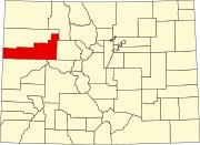 | |
| Towns | ||
| CDPs | ||
| Unincorporated communities | ||
| Ghost town | ||