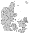
Herlev Municipality
Herlev Municipality | |
|---|---|
 | |
| Country | Denmark |
| Region | Capital Region |
| Seat | Herlev |
| Government | |
| • Mayor | Thomas Gyldal Petersen (S) |
| Area | |
| • Total | 12.04 km2 (4.65 sq mi) |
| Population (1 April 2014) | |
| • Total | 27,851 |
| • Density | 2,300/km2 (6,000/sq mi) |
| Time zone | UTC+1 (CET) |
| • Summer (DST) | UTC+2 (CEST) |
| Municipal code | 163 |
| Website | www |
Herlev Kommune is a suburban municipality (Danish, kommune) in Region Hovedstaden on the island of Zealand (Sjælland) in eastern Denmark. The municipality covers an area of 12 km², and has a total population of 27,851 (1 April 2014). Its mayor is Thomas Gyldal Petersen, a member of the Social Democrats (Socialdemokraterne) political party. The former village Herlev is the largest settlement of the municipal and the site of the municipal council.
Neighboring municipalities are Gladsaxe to the east and northeast, Furesø Municipality to the north, Ballerup to the west, Glostrup to the southwest, Rødovre to the south, and Copenhagen to the southeast.
Herlev municipality was not merged with other municipalities by 1 January 2007 as the result of nationwide Kommunalreformen ("The Municipal Reform" of 2007).
See also
External links
References
- Municipal statistics: NetBorger Kommunefakta, delivered from KMD aka Kommunedata (Municipal Data)
- Municipal mergers and neighbors: Eniro new municipalities map


