Japan National Route 4
Appearance
You can help expand this article with text translated from the corresponding article in Japanese. (September 2012) Click [show] for important translation instructions.
|
| National Route 4 | |
|---|---|
| 国道4号 | |
| Kokudō Yongō (国道4号) | |
 | |
| Route information | |
| Length | 743.6 km (462.1 mi) |
| Major junctions | |
| South end | |
| North end | |
| Location | |
| Country | Japan |
| Highway system | |


National Route 4 (国道4号, Kokudō Yongō) is a major highway in eastern Honshu, Japan. It is the longest highway in Japan[citation needed] at 743.6 km (462.1 mi), and it connects Tokyo and Aomori via Utsunomiya, Kōriyama and Morioka.
From Saitama Prefecture to Iwate Prefecture, it parallels the Tōhoku Expressway; from Morioka to Hachinohe, it parallels the Hachinohe Expressway. At its northern end point, it links with Route 7.[1]
Route data
- Total length: 743.6 km (462.1 mi)
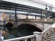
- Origin point: Chūō, Tokyo (originates at Nihonbashi, the origins also of Routes 1, 6, 14, 15, 17 and 20)
- End point: Aomori (ends at the end point also of National Route 7)
- Major cities on its route: Kasukabe, Koga, Utsunomiya, Kōriyama, Fukushima (Nakadōri), Sendai, Furukawa, Hiraizumi, Morioka, Ninohe, Towada and Noheji
Municipalities it passes through
- Tokyo
- Saitama Prefecture
- Ibaraki Prefecture
- Tochigi Prefecture
- Nogi - Oyama - Shimotsuke - Kaminokawa, Shimotsuke, Utsunomiya - Takanezawa - Sakura - Yaita - Otawara - Nasushiobara - Nasu
- Fukushima Prefecture
- Miyagi Prefecture
- Shiroishi - Zaō - Ōgawara - Murata - Shibata - Iwanuma - Natori - Taihaku-ku, Sendai - Wakabayashi-ku, Sendai - Miyagino-ku, Sendai - Izumi-ku, Sendai - Tomiya - Taiwa - Shiroishi - Ōhira - Ōsaki - Kurihara
- Iwate Prefecture
- Aomori Prefecture
History
4 December 1952: First Class National Highway 4 (from Tokyo to Aomori)
1 April 1965: General National Highway 4 (from Tokyo to Aomori)
Intersecting routes
- in Tokyo
- in Saitama Prefecture
- National Route 298 at Sōka
- National Route 463 at Koshigaya
- National Route 16 at Kasukabe
- National Route 125 at Kuki
- in Ibaraki Prefecture
- in Tochigi Prefecture
- National Route 50 at Oyama
- National Route 352 at Shimotsuke
- Routes 119, 121 and 123 at Utsunomiya
- National Route 408 at Takanezawa
- National Route 293 at Sakura
- National Route 461 at Yaita
- Route 461 at Ōtawara
- National Route 400 at Nasushiobara
- in Fukushima Prefecture
- Routes 289 and 294 at Shirakawa
- National Route 118 at Sukagawa
- Routes 49 and 288 at Kōriyama
- National Route 459 at Nihonmatsu
- Routes 13, 114 and 115 at Fukushima
- National Route 399 at Date
- in Miyagi Prefecture
- Routes 113 and 457 at Shiroishi
- National Route 349 at Shibata
- Route 6 at Iwanuma
- National Route 286 at Taihaku-ku, Sendai
- Routes 45 and 48 at Miyagino-ku, Sendai
- Routes 47, 108 and 347 at Ōsaki
- National Route 398 at Kurihara
- in Iwate Prefecture
- Routes 284, 342 and 457 at Ichinoseki
- Routes 343 and 397 at Ōshū
- National Route 107 at Kitakami
- National Route 283 at Hanamaki
- Routes 46, 106, 396 and 455 at Morioka
- National Route 282 at Takizawa
- National Route 281 at Iwate
- in Aomori Prefecture
- National Route 104 at Sannohe
- Route 104 at Nanbu
- National Route 454 at Gonohe
- Routes 45 and 102 at Towada
- National Route 394 at Shichinohe
- National Route 279 at Noheji
- Routes 7, 103 and 280 at the end point
References
- ^ 一般国道4号 (in Japanese). Ministry of Land, Infrastructure, Transport and Tourism. Kanto Regional Development Bureau. Archived from the original on 2010-07-30. Retrieved 2010-11-29.
{{cite web}}: Unknown parameter|deadurl=ignored (|url-status=suggested) (help)
External links
Wikimedia Commons has media related to Route 4 (Japan).

