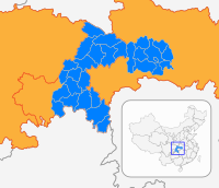
Kaizhou, Chongqing
Appearance
Kai County
开县 | |
|---|---|
 Location of Kai County in Chongqing | |
| Country | People's Republic of China |
| Municipality | Chongqing |
| Area | |
• Total | 3,959 km2 (1,529 sq mi) |
| Population (2010) | |
• Total | 1,160,300 |
| • Density | 290/km2 (760/sq mi) |
| Time zone | UTC+8 (China Standard) |
| Kaixian | |||||||||
|---|---|---|---|---|---|---|---|---|---|
| Chinese | 开县 | ||||||||
| Postal | Kaihsien | ||||||||
| |||||||||
Kai County or Kaixian (Chinese: 开县; pinyin: Kāixiàn) is a county under the jurisdiction of Chongqing Municipality, in southwestern China. It has an area of 3,959 km squared. As of the end of 2009, it had a population of 1.62 million. It is located 330 kilometers from the urban centre of Chongqing proper. The county has a history dating back some 1800 years. In 1373, during the Ming Dynasty, it adopted the name Kai County. Until 2004 the county was one of the poorest in the municipality, home to some 10% of Chongqing municipality residents that lived in poverty. The government has attempted to remedy this in recent years.[1]


