From Wikipedia, the free encyclopedia
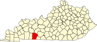
Location of Logan County in Kentucky This is a list of the National Register of Historic Places listings in Logan County, Kentucky .
This is intended to be a complete list of the properties and districts on the National Register of Historic Places in Logan County , Kentucky , United States . The locations of National Register properties and districts for which the latitude and longitude coordinates are included below, may be seen in a map.[1]
There are 22 properties and districts listed on the National Register in the county.
This National Park Service list is complete through NPS recent listings posted May 10, 2024. [2]
Contents: Counties in Kentucky
Current listings
[3] Name on the Register
Image
Date listed[4]
Location
City or town
Description
1
Auburn Historic District Auburn Historic District March 28, 1994 (#94000222 ) Roughly along E. and W. Main, N. Lincoln, Perkins, Pearl, Caldwell, Wilson, Maple, and Viers Sts. 36°51′50″N 86°42′46″W / 36.863889°N 86.712778°W / 36.863889; -86.712778 (Auburn Historic District ) Auburn
2
Black Bottom Historic District Black Bottom Historic District March 17, 2010 (#09000007 ) Bounded by E. 5th and 7th Sts., Bowling Green Rd. and Morgan St. 36°50′42″N 86°52′51″W / 36.845000°N 86.880833°W / 36.845000; -86.880833 (Black Bottom Historic District ) Russellville
3
Brodnax-Conn House Upload image October 23, 1992 (#92001339 ) 3288 Conn Rd. 36°41′55″N 86°46′29″W / 36.698611°N 86.774722°W / 36.698611; -86.774722 (Brodnax-Conn House ) Adairville
4
Cedar Grove Rosenwald School Upload image April 11, 2002 (#02000342 ) 375 Cedar Grove Rd. 36°44′16″N 86°58′26″W / 36.737778°N 86.973889°W / 36.737778; -86.973889 (Cedar Grove Rosenwald School ) Olmstead
5
Confederate Monument in Russellville Confederate Monument in Russellville July 17, 1997 (#97000681 ) Town Square at the junction of U.S. Routes 68 and 431 36°50′42″N 86°53′15″W / 36.845°N 86.8875°W / 36.845; -86.8875 (Confederate Monument in Russellville ) Russellville
6
G.W. Davidson House and Bank G.W. Davidson House and Bank October 29, 1982 (#82001570 ) Main St. 36°51′46″N 86°42′38″W / 36.862778°N 86.710556°W / 36.862778; -86.710556 (G.W. Davidson House and Bank ) Auburn
7
William Forst House William Forst House July 19, 1973 (#73000816 ) 4th and Winter Sts. 36°50′42″N 86°53′21″W / 36.845°N 86.889167°W / 36.845; -86.889167 (William Forst House ) Russellville
8
Long-Briggs House Long-Briggs House November 27, 1978 (#78001379 ) Cornelius Ave. 36°50′50″N 86°53′37″W / 36.847222°N 86.893611°W / 36.847222; -86.893611 (Long-Briggs House ) Russellville
9
Longview Farm House Upload image March 19, 1992 (#92000170 ) Bores Rd. 36°43′46″N 86°49′55″W / 36.729444°N 86.831944°W / 36.729444; -86.831944 (Longview Farm House ) Adairville
10
McCutchen Meadows McCutchen Meadows November 23, 1984 (#84000292 ) Off U.S. Route 68 36°52′25″N 86°40′58″W / 36.873611°N 86.682778°W / 36.873611; -86.682778 (McCutchen Meadows ) Auburn
11
Rev. James McGready House Upload image April 21, 1976 (#76000918 ) West of Russellville off U.S. Route 68 36°50′14″N 86°54′52″W / 36.837222°N 86.914444°W / 36.837222; -86.914444 (Rev. James McGready House ) Russellville
12
Page Site (15LO1) Upload image November 14, 1985 (#85002819 ) Above the Mud River off Lost City Road, east of Lewisburg[5] 36°58′34″N 86°54′20″W / 36.976111°N 86.905556°W / 36.976111; -86.905556 (Page Site (15LO1) ) Lewisburg Major Mississippian site, developed as a heritage tourism attraction, "Lost City", in the 1930s[5]
13
Pleasant Run Methodist Church Pleasant Run Methodist Church October 29, 1982 (#82001571 ) Southeast of Russellville on Kentucky Route 663 36°46′00″N 86°47′24″W / 36.766667°N 86.79°W / 36.766667; -86.79 (Pleasant Run Methodist Church ) Russellville
14
Red River Presbyterian Meetinghouse Site and Cemetery Red River Presbyterian Meetinghouse Site and Cemetery June 18, 1976 (#76000917 ) Northeast of Adairville off Kentucky Route 663 36°43′16″N 86°48′53″W / 36.721111°N 86.814722°W / 36.721111; -86.814722 (Red River Presbyterian Meetinghouse Site and Cemetery ) Adairville
15
Rhea Stadium Rhea Stadium July 8, 2008 (#08000647 ) Northeastern corner of the intersection of E. 9th St. and S. Summer St. 36°50′30″N 86°52′59″W / 36.841667°N 86.883056°W / 36.841667; -86.883056 (Rhea Stadium ) Russellville
16
Russellville Armory Russellville Armory March 24, 2000 (#00000279 ) 190 S. Winter St. 36°50′40″N 86°53′21″W / 36.844444°N 86.889167°W / 36.844444; -86.889167 (Russellville Armory ) Russellville
17
Russellville Historic District Russellville Historic District July 14, 1976 (#76000919 ) Roughly bounded by 2nd, 9th, Caldwell, and Nashville Sts. 36°50′40″N 86°53′08″W / 36.844444°N 86.885556°W / 36.844444; -86.885556 (Russellville Historic District ) Russellville
18
Savage Cave Archeological Site Upload image April 3, 1970 (#70000252 ) Along the Red River , 1.75 km east of Adairville and 1.7 km north of the state line[6] 36°39′16″N 86°50′09″W / 36.654444°N 86.835833°W / 36.654444; -86.835833 (Savage Cave Archeological Site ) Adairville
19
David Sawyer House Upload image January 8, 1987 (#87000214 ) Off Kentucky Route 103 36°56′28″N 86°46′50″W / 36.941111°N 86.780556°W / 36.941111; -86.780556 (David Sawyer House ) Chandlers Chapel
20
South Union Shaker Center House and Preservatory South Union Shaker Center House and Preservatory June 28, 1974 (#74000891 ) U.S. Route 68 36°53′04″N 86°38′42″W / 36.884444°N 86.645°W / 36.884444; -86.645 (South Union Shaker Center House and Preservatory ) South Union
21
South Union Shakertown Historic District South Union Shakertown Historic District April 3, 1975 (#75000796 ) Kentucky Route 73 at the Louisville and Nashville Railroad tracks, and by the junction of U.S. Route 68 36°53′05″N 86°38′40″W / 36.884722°N 86.644444°W / 36.884722; -86.644444 (South Union Shakertown Historic District ) South Union
22
Watkins Site (15LO12) Watkins Site (15LO12) December 5, 1985 (#85003065 ) Western side of Clear Fork Creek, 3 km above its confluence with the Gasper River [7] 36°53′52″N 86°39′11″W / 36.897778°N 86.653056°W / 36.897778; -86.653056 (Watkins Site (15LO12) ) South Union
See also References
^ The latitude and longitude information provided in this table was derived originally from the National Register Information System, which has been found to be fairly accurate for about 99% of listings. Some locations in this table may have been corrected to current GPS standards.
^ National Park Service, United States Department of the Interior , "National Register of Historic Places: Weekly List Actions" , retrieved May 10, 2024.
^ Numbers represent an alphabetical ordering by significant words. Various colorings, defined here , differentiate National Historic Landmarks and historic districts from other NRHP buildings, structures, sites or objects.
^ The eight-digit number below each date is the number assigned to each location in the National Register Information System database, which can be viewed by clicking the number.
^ a b "Protecting a Mound Complex ". American Archaeological 7.3 (2003): 46.
^ Parish, Ryan. "The Case for a Paleoindian Component at the Savage Cave Site (15Lo11) ". Murray State University, n.d., 1. Accessed 2014-01-11.
^ Applegate, Darlene. "Evidence of Differential Mortuary Treatment from the Watkins Site (15Lo12), a Woodland-Mississippi Period Burial Mound in South-Central Kentucky". In Proceedings of the 21st Mid-South Archaeological Conference: Ethnicity in Archaeology . Panamerican Consultants Special Publication 2. Buchner, C.A., ed. Memphis : Panamerican Consultants, 2002: 33-45.
Topics Lists by state Lists by insular areas Lists by associated state Other areas Related