
Parkdale railway station
Parkdale | |||||||||||
|---|---|---|---|---|---|---|---|---|---|---|---|
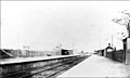
 Southbound view from Platform 2 in January 2018 | |||||||||||
| General information | |||||||||||
| Location | Como Parade West, Parkdale | ||||||||||
| Coordinates | 37°59′35″S 145°04′34″E / 37.9931°S 145.0762°E | ||||||||||
| Owned by | VicTrack | ||||||||||
| Operated by | Metro | ||||||||||
| Line(s) | Frankston | ||||||||||
| Distance | 25.93 kilometres from Southern Cross | ||||||||||
| Platforms | 2 side | ||||||||||
| Tracks | 2 | ||||||||||
| Connections | Bus | ||||||||||
| Construction | |||||||||||
| Structure type | Ground | ||||||||||
| Other information | |||||||||||
| Status | Unstaffed | ||||||||||
| Station code | PKD | ||||||||||
| Fare zone | Myki Zone 2 | ||||||||||
| Website | Public Transport Victoria | ||||||||||
| History | |||||||||||
| Opened | 1 September 1919 | ||||||||||
| Electrified | Yes | ||||||||||
| Services | |||||||||||
| |||||||||||
Parkdale railway station is located on the Frankston line, in Victoria, Australia. It serves the south-eastern Melbourne suburb of Parkdale, opening on 1 September 1919.[1][2] A disused signal box is located at the Frankston (Down) end of Platform 1.
Boom barriers replaced interlocked gates at the Parkers Road level crossing in 1985.[3][4]
Platforms & services
Parkdale has two side platforms. It is serviced by Metro Trains' Frankston line services.[5]
Platform 1:
- Frankston line: all stations and limited stops services to Flinders Street
Platform 2:
- Frankston line: all stations services to Frankston
Transport links
Ventura Bus Lines operates one route via Parkdale station:
- 708: Carrum station – Hampton station[6]
Gallery
-
 Parkdale station in 1919
 -
 Ramp leading to Platform 1 in October 2005


References
- ^ Parkdale Vicsig
- ^ Parkdale Railway Station City of Kingston
- ^ "Glenhuntly to Parkdale 1985". MetRail Signalling Diagram No 47’85. www.signaldiagramsandphotos.com. Retrieved 1 March 2016.
- ^ "Glenhuntly to Parkdale 1985". MetRail Signalling Diagram No 51’85. www.signaldiagramsandphotos.com. Retrieved 1 March 2016.
- ^ Frankston Line timetable Public Transport Victoria
- ^ Route 708 Carrum - Hampton timetable Public Transport Victoria
External links
- Melway map at street-directory.com.au