
Rural Municipality of Fillmore No. 96
Fillmore No. 96 | |
|---|---|
| Rural Municipality of Fillmore No. 96 | |
 Grain elevator and fire truck in Fillmore | |
 Location of the RM of Fillmore No. 96 in Saskatchewan | |
| Coordinates: 49°54′14″N 103°25′37″W / 49.904°N 103.427°W[1] | |
| Country | Canada |
| Province | Saskatchewan |
| Census division | 2 |
| SARM division | 1 |
| Federal riding | Souris—Moose Mountain |
| Provincial riding | Cannington Moosomin Weyburn-Big Muddy |
| Formed[2] | December 13, 1909 |
| Government | |
| • Reeve | Russell Leguee |
| • Governing body | RM of Fillmore No. 96 Council |
| • Administrator | Vernna Wiggins |
| • Office location | Fillmore |
| Area (2016)[4] | |
| • Land | 828.33 km2 (319.82 sq mi) |
| Population (2016)[4] | |
| • Total | 223 |
| • Density | 0.3/km2 (0.8/sq mi) |
| Time zone | CST |
| • Summer (DST) | CST |
| Postal code | S0G 1N0 |
| Area code(s) | 306 and 639 |
| Website | Official website |
The Rural Municipality of Fillmore No. 96 (2016 population: 223) is a rural municipality (RM) in the Canadian province of Saskatchewan within Census Division No. 2 and SARM Division No. 1. It is located in the south-east portion of the province along Highway 33.
History[edit]
The RM of Fillmore No. 96 incorporated as a rural municipality on December 13, 1909.[2] It was previously Local Improvement District No. 6–E–2.[5]
Geography[edit]
Communities and localities[edit]
The following urban municipalities are surrounded by the RM.
The following unincorporated communities are within the RM.
- Localities
- Huronville
Osage Wildlife Refuge[edit]
Osage Wildlife Refuge (49°56′00″N 103°33′02″W / 49.9334°N 103.5505°W)[6] is a wildlife conservation area in the RM of Fillmore, about 4.8 kilometres (3.0 mi) south-east of Osage along Highway 33.
Demographics[edit]
In the 2021 Census of Population conducted by Statistics Canada, the RM of Fillmore No. 96 had a population of 224 living in 105 of its 124 total private dwellings, a change of 0.4% from its 2016 population of 223. With a land area of 815.57 km2 (314.89 sq mi), it had a population density of 0.3/km2 (0.7/sq mi) in 2021.[9]
In the 2016 Census of Population, the RM of Fillmore No. 96 recorded a population of 223 living in 98 of its 119 total private dwellings, a -12.5% change from its 2011 population of 255. With a land area of 828.33 km2 (319.82 sq mi), it had a population density of 0.3/km2 (0.7/sq mi) in 2016.[4]
Government[edit]
The RM of Fillmore No. 96 is governed by an elected municipal council and an appointed administrator that meets on the second Wednesday of every month.[3] The reeve of the RM is Russell Leguee while its administrator is Vernna Wiggins.[3] The RM's office is located in Fillmore.[3]
Transportation[edit]
- Rail[10]
- Souris-Arcola-Regina Section Canadian Pacific Railway (CPR) —serves Stoughton, Heward, Creelman, Fillmore, Osage, Tyvan, Francis, and Sedley
- Roads[11]
- Highway 33—serves Fillmore and Village of Osage
- Highway 606—serves Fillmore
- Highway 711—serves the Village of Osage
- Highway 619—serves the Village of Osage
Gallery[edit]
-
 Cemetery in Huronville
 -
 Plaque in Huronville
 -
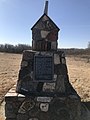 Cairn in Huronville


See also[edit]
References[edit]
- ^ "Pre-packaged CSV files - CGN, Canada/Province/Territory (cgn_sk_csv_eng.zip)". Government of Canada. July 24, 2019. Retrieved May 23, 2020.
- ^ a b "Rural Municipality Incorporations (Alphabetical)". Saskatchewan Ministry of Municipal Affairs. Archived from the original on April 21, 2011. Retrieved May 9, 2020.
- ^ a b c d "Municipality Details: RM of Fillmore No. 96". Government of Saskatchewan. Retrieved May 21, 2020.
- ^ a b c "Population and dwelling counts, for Canada, provinces and territories, and census subdivisions (municipalities), 2016 and 2011 censuses – 100% data (Saskatchewan)". Statistics Canada. February 8, 2017. Retrieved May 1, 2020.
- ^ "History". Cornerstone Regional Economic Development Authority. November 5, 2007. Retrieved December 26, 2007.[permanent dead link]
- ^ Government of Canada, Natural Resources Canada. "Place names - Osage Wildlife Refuge". www4.rncan.gc.ca.
- ^ "Saskatchewan Census Population" (PDF). Saskatchewan Bureau of Statistics. Archived from the original (PDF) on September 24, 2015. Retrieved May 9, 2020.
- ^ "Saskatchewan Census Population". Saskatchewan Bureau of Statistics. Retrieved May 9, 2020.
- ^ "Population and dwelling counts: Canada, provinces and territories, census divisions and census subdivisions (municipalities), Saskatchewan". Statistics Canada. February 9, 2022. Retrieved April 13, 2022.
- ^ Canadian Maps: January 1925 Waghorn's Guide. Post Offices in Man. Sask. Alta. and West Ontario.
- ^ Eversoft Streets and Trips
External links[edit]
 Media related to Rural Municipality of Fillmore No. 96 at Wikimedia Commons
