
South End, Boston
South End District | |
 | |
| Location | Boston, MA |
|---|---|
| Built | 1728 |
| Architect | Multiple |
| Architectural style | Greek Revival, Late Victorian, Italianate |
| NRHP reference No. | 73000324[1] |
| Added to NRHP | May 8, 1973 |
The South End is a neighborhood of Boston, Massachusetts.
Geography

The South End lies south of the Back Bay, northwest of South Boston, northeast of Roxbury, north of Dorchester, and southwest of Bay Village. Despite the name, it is not directly south of the center of downtown Boston.
The neighborhood is built upon a former tidal marsh, a part of a larger project of the filling of Boston's Back Bay (north and west of Washington Street) and South Bay (south and east of Washington Street), from the 1830s to the 1870s. Fill was brought in by trains from large trenches of gravel excavated in Needham, Massachusetts. The South End was filled and developed first, before the Back Bay which was mostly built after the American Civil War. Nineteenth century technology did not allow for driving steel piles into bedrock and instead a system of submerged timbers provided an understructure for most South End buildings. Recent decreases in underground water levels has caused damage to some wood pilings by exposing them to air. A series of monitoring wells have been drilled and the water level is now checked, and can be adjusted by the introduction of water.[citation needed]
The South End was once bordered to the north and west by the Boston and Providence Railroad, which terminated at the B&P RR Station bordering the Public Garden. The railroad line is now covered by the Southwest Corridor Park and terminates at Back Bay Station. Most of the cross streets in the neighborhood are named after cities and towns served by it or by the Boston and Albany Railroad:[citation needed] Greenwich, Newton, Canton, Dedham, Brookline, Rutland, Concord, Worcester, Springfield, Camden, Maine, Northampton, Sharon, Randolph, Plympton, Stoughton, Waltham, Dover, Chatham, and Wareham.
The primary business thoroughfares of the South End are Columbus Avenue,Tremont and Washington Streets, from West Newton Street to Berkeley Street. Washington Street, the original causeway that connected Roxbury to Boston, experienced considerable reinvestment in the 1990s. The street was once defined by the Washington Street Elevated, an elevated train that was moved to below Southwest Corridor Park in the 1980s. Today Washington is the route of the Silver Line, Boston's first bus rapid transit line. Columbus Avenue, the third main street of the South End, also has numerous restaurants and provides a remarkable straight-line view to the steeple of Park Street Church. Today the modern MBTA Orange Line rapid transit train runs along the partially covered Southwest Corridor, with neighborhood stops at Back Bay (also an MBTA Commuter Rail stop due to its proximity to the Copley Square employment center) and Massachusetts Avenue.
Subdistricts
The Boston Redevelopment Authority identifies several subdistricts covering the southeast portion of the neighborhood:[2]
- SOWA (South of Washington Area), roughly between Albany to Washington and East Berkeley to Mass Ave.
- New York Streets, between Herald, East Berkeley, Albany, and Tremont Streets
- Back Streets, roughly between I-93, Harrison, East Brookline, and East Berkeley Streets
- Medical area, roughly between the highway, Massachusetts Avenue, Franklin Park, and East Brookline Street
Architecture and environment


The South End is built mostly of mid-nineteenth century bowfronts—aesthetically uniform rows of five-story, predominantly red-brick structures, of mixed residential and commercial uses. The most common styles are Renaissance Revival, Italianate and French Second Empire, though there are Greek Revival, Egyptian Revival, Gothic Revival, and Queen Anne style houses, among several other styles. Row houses built in the last quarter of the nineteenth century, especially along the present Southwest Corridor Park show the influence of Charles Eastlake in the incised decoration on stone trim. Despite the style, a common palette of red brick, slate, limestone or granite trim, and cast iron railings provide great visual unity. Today, the South End is listed on the National Register of Historic Places and is a Boston Landmark District. It is North America's largest extant Victorian residential district. A citizens' group, The South End Historical Society, works with the Boston Landmarks Commission, on matters of historic preservation.
A series of eleven residential parks are located across the South End, most are elliptical in shape with passive-use green space located in the middle. These residential squares vary in size, and take inspiration from English-inspired residential squares first laid out by Charles Bulfinch downtown. Many of the parks have a central fountain and are bordered with cast iron fencing. Complementing the nineteenth century residential parks are several newer parks, and a series of sixteen community gardens and pocket parks operated by the South End Lower Roxbury Open Space Land Trust.
History and changing demographics
As the South End geographically grew from filling in land north and west of "the Neck" (today's Washington Street) the city of Boston envisioned a large inner city residential neighborhood to relieve the crowded downtown and Beacon Hill neighborhoods. The city also hoped for a large and stable tax base. Architect Charles Bulfinch laid out some of the first filled land. He designed a large residential park called Columbia Square located at the present Franklin and Blackstone Squares. Bulfinch's plan was to route traffic around the square, not through it. Eventually his plan was abandoned and Washington street was allowed to once more divide the square creating today's separate squares.[citation needed]
Many rooming houses on the Back Bay side of the South End had no bathing facilities; roomers went to public showers to bathe. Filled land in the South End was originally eight feet above sea level; it's now four feet, as fill settles. The original shore line of Boston Neck crosses in front of 40 St. George Street, (formerly 11 James Street), and tapers to the narrowest point on the Neck at Dover Street. Blackstone and Franklin Parks are solid land on the original neck, but clam and snail shells are just beneath its surface, as high seas would occasionally overrun the Neck. Massive granite blocks of original sea wall can be seen on the Harrison Avenue side of the Joshua Bates School.[citation needed]
A burgeoning middle class moved to the South End including business owners, two mayors, bankers, and industrialists. Though the neighborhood's status as a wealthy neighborhood was relatively short-lived, myths of a dramatic white flight in the 1880s are not entirely true. A series of national financial panics (see e.g., Panic of 1884, Economic history of the United States), combined with the emergence of new residential housing in Back Bay and Roxbury fed a steady decline of whites of English Protestant ancestry. Still whites remained in the neighborhood, but increasingly they were Irish Catholic and recent immigrants.[citation needed]
By the close of the nineteenth century the South End was becoming a tenement district, first attracting new immigrants and, in the 1940s, single gay men. The South End also became a center of black middle class Boston life and culture. The largest concentration of Pullman Porters in the country lived in the South End, mostly between Columbus Avenue and the railroad bed. As the decades progressed, more buildings became tenements and by the 1960s absentee landlordism was rampant and the neighborhood was one of the poorest of the city.[citation needed]
The first settlement houses in Boston were in the South End: the South End House, Haley House, Lincoln House, the Harriet Tubman House, and the Children's Art Centre. In 1960 these settlement houses merged to form United South End Settlements.[3] Also operating was the South End Music Center, affiliated with the New England Conservatory of Music, and the South End Boys Club.
The racial makeup of the South End in 2000 was 45% non-Hispanic white, 23% black or African-American, 17% Hispanic or Latino, 12% Asian-American, and 2% multi-racial.
Urban renewal
The connection of Boston and Albany, New York by railroad (by some of the various companies that would later merge into the Boston and Albany Railroad) was celebrated in 1841 as a way to keep Boston competitive with New York City as an Atlantic port. Just south of the Boston and Worcester Railroad (where the Massachusetts Turnpike is now) in the next decade arose the New York Streets district, a residential area of the South End where the streets were named after cities on the route to Albany. Albany Street still exists (though it now ends at the Turnpike rather than Kneeland); connecting Albany Street with Harrison Street from north to south were Seneca, Oneida, Oswego, Genesee, Rochester and Troy Streets (Troy became the modern Traveller Street).[4][5][6]
Starting in 1955, most of the buildings in the New York Streets district were bulldozed by an urban renewal project to clear "slums" and make room for industrial activity in a period marked by urban decline. This area was known as Ward 8, after which a cocktail was named when this ward provided James Michael Curley with his margin of victory as mayor. It was the site of early high-rise, high density urban renewal efforts, repopulating the area adjacent to Holy Cross Cathedral. Later, the adjacent superblock was redeveloped into the headquarters for one of the city's newspapers.[4] The Herald-Traveler Corporation spanned from Herald Street to Traveller Street until 2012, when it moved to the Seaport District in South Boston.[7] Redevelopment as mixed-use area known as Ink Block, featuring apartments, a grocery store, restaurants, and other retail.[4]
By 1957, most of the buildings between Harrison, Washington, and what are now the Turnpike and East Berkeley Street were also demolished to make way for industrial uses.[8]
Jazz mecca
Until the 1950s the South End and bordering Roxbury was a jazz mecca, with clubs such as the Royal Palms, Eddie Levine's, the Pioneer Club, Handy's Grille, Tic-Toc, Connolly's, Estelle's, the Hi-Hat, The Savoy, The Cave, Basin Street, Louie's Lounge, and Wally's Paradise. Wally's is the only venue to have survived to the present day.
From 1915 to 1970 the American Federation of Musicians Local 535 was the top black musicians' union in the country, with local and national musicians such as Duke Ellington, Cab Calloway, Chick Webb, Earl Hines, and Jimmie Lunceford. Its offices were originally above Charlie's Sandwich Shoppe (whose walls are lined with photographs of the jazz stars who ate there), but moved to 409 Massachusetts Avenue around 1930. In 1970 it and the white union (Local 9) were ordered to merge by the courts (Boston Musicians Association Local 9-535) and most of the black musicians left.[9]
Institutions and community organizations
Boston College (BC) first opened in the South End on James Street in 1863. The South End Burying Ground sat across from it. A few of the original college buildings on Harrison Avenue still stand, though BC moved from the South End to then-rural Chestnut Hill as a result of rapid growth and urbanization in the late nineteenth century.
Today, the South End is home to the Boston Ballet, the Boston Center for the Arts (BCA), Boston Medical Center, and many art galleries and artists studios.
The South End is host to numerous community organizations including South End Community Health Center, South End Baseball, Youth Enrichment Services, the South End Lower Roxbury Open Space Land Trust, Mytown (an organization training youth to lead walking tours on neighborhood and Boston history), the South End Historical Society, Inquilinos Boricuas en Accion, and United South End Settlements.
The Animal Rescue League of Boston, founded in 1899 by Anna Harris Smith is located in the South End at 10 Chandler Street. The Animal Rescue League of Boston features an animal shelter, an animal cruelty investigation and prosecution law enforcement department, a rescue department, an animal behavior department and an outpatient veterinary facility, Boston Veterinary Care.
Diversity
The South End's population has been diverse since the 1880s when Irish, Lebanese, Jewish, African-American, and Greek populations began to settle in the neighborhood. In the 1930s a substantial immigration from Canada's maritime provinces found economic opportunity in Boston, and homes in the South End neighborhood.
Beginning in the 1940s, particularly after the end of WWII the South End's rooming houses became home to growing numbers of gays and lesbians. The environment of single sex rooming houses provided homes and social cover for unmarried GLBT people. In the late 1940s a growing population of Hispanic people began settlement. At first much of this settlement was centered around the Cathedral of the Holy Cross.
Today the neighborhood remains diverse, integrating people of nearly every race, religion, and sexual orientation.
Income levels are anecdotally reported as stratified: a concentration of the wealthy and the poor. However, neither the U.S. Census or City of Boston reports on income of this specific neighborhood. Though gentrification is sometimes cited as a reason for flight of poorer and non-white residents, the neighborhood has maintained racial and income diversity due to a large number of subsidized, publicly owned, or otherwise low-income housing units and a homeless shelter. Subsidized below market rate housing developments such as Methunion Manor, Cathedral Housing (public housing project), Villa Victoria, Tent City, Lenox St Apartments, Camden, Camfield Gardens, 1850 Washington St, and Mandela Homes vary considerably and represent evolving attitudes in public housing design and governance.
Although all neighborhoods in Boston suffer from crime, the city has a comparatively low incidence of street crime. The South End is large enough that some parts can be known for street crime while others are family friendly. Those parts include the Villa Victoria Housing Projects, the Cathedral Housing Projects, and some areas west of Mass. Ave. The South End has more public playgrounds per square foot than other Boston neighborhoods. The South End is known as an increasingly upper middle class neighborhood, although is still home to many lower income residents. Some long-time residents are being pushed out by rising rents and property taxes. Because of a strong low-income agenda from the city, its recent (until the 1970s) history of impoverishment, and the presence of several low income housing projects, the South End will likely remain economically and racially diverse.
The South End used to be known as a gay, artistic, and cultural neighborhood, although rising costs in the neighborhood threaten this character. Unlike in cities such as New York, there are no city policies to help artists keep their long-term studios. Art galleries, however, are flourishing even though there are not many. GardenMoms, now one of Boston's most popular online parent groups with over 2500 members city-wide, was started by several South End moms in 2002, and helped confirm the role of families as a growing and important facet of this community. (It is named after the South End cafe it started in, The Garden of Eden.)[10]
Though housing in the South End is very expensive by U.S. and Greater Boston standards—it is rare to find a one bedroom condo for less than $400,000—the South End remains less expensive than the wealthiest central Boston neighborhoods (Beacon Hill and the Back Bay).
Restaurants and retail
The South End is one of Boston's main restaurant districts offering a diverse mix of cuisines, many at a relatively high price point. Tremont Street is often called "Restaurant Row." The South End's range of restaurants include American southern "Low Country", French, Ethiopian, Brazilian, Indian, Italian, Venezuelan, African, Peruvian, Latin American, Thai, and Japanese among others.
The South End has a growing retail presence, much of it aimed primarily at upper-middle class shoppers. New retail shops offer a range of handmade gifts by local artists, home furnishings, men's and women's clothing, stationery, specialty foods, spa services, and a rapidly growing number of manicure and pedicure shops. Several new stores cater to wealthy dog owners.
As recently as 1985 there were no bank offices in the neighborhood. As of autumn 2006 there are seven full service branch offices, an additional four partial-service branches offering home loans and ATMs but without full cashier service, more than forty local bank-linked ATM locations, and additional ATMs operated by retailers with service fees nearly double those in banks.
Gallery
-
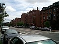
 Columbus and Dartmouth leading into the South End
 -
 Walking down Lawrence Street
 -
 Walking down Dartmouth Place
 -
 Side streets in the South End
 -
Union Park homes
-
 Union Park
 -
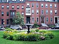 Fountain in Union Park
 -
 Union Park and Shawmut
 -
 Union Park and Tremont
 -
 Tremont
 -
 Holy Cross Cathedral
 -
 Clarendon Street with John Hancock Tower in background


See also
References
- ^ "National Register Information System". National Register of Historic Places. National Park Service. January 23, 2007.
- ^ http://www.boston.com/yourtown/news/south_end/2012/09/hotel_residential_towers_okd_f.html
- ^ Finding aid for the United South End Settlements Records, Northeastern University Libraries, Boston, MA
- ^ a b c Marstall, Christopher (2012-08-19). "Boston's vanished New York Streets". Boston Globe.
- ^ Detailed 1938 map
- ^ "New York Streets, Part Two". 2006-03-23. Retrieved 2012-10-01. - detailed street history
- ^ Quaratiello, Frank (September 6, 2011). "Boston Herald will move headquarters to Seaport District". Boston Herald.
- ^ Photos of demolition area
- ^ New England Jazz Alliance - New England Jazz Notes
- ^ GardenMoms
Further reading
- Leading business men of Back Bay, South End, Boston Highlands, Jamaica Plain and Dorchester: illustrated. Boston. Mercantile Pub. Co., 1888.
- Krieger, Alex, and David Cobb. Mapping Boston. The MIT Press: 1999. ISBN 0-262-11244-2.
- Griffin, Arthur, and Esther Forbes. The Boston Book. Houghton Mifflin Company: 1947.
- Goodman, Phoebe. The Garden Squares of Boston. University Press of New England: 2003. ISBN 1-58465-298-5.
- Sammarco, Anthony Mitchell, Boston's South End, Charleston, SC : Arcadia Publishing, February 1, 1998. ISBN 0-7385-3949-X
External links
- Official SoWa District Website
- South End Boston
- Eight Streets Neighborhood Association, South End
- St. John the Baptist, Hellenic/Greek Orthodox Church of the South End
- The Animal Rescue League of Boston
- Ellis Memorial & Eldredge House
- A Short History of Boston's South End
- The Inquilinos Boricuas en Acción records, 1967-2004 (bulk 1974-1999) are located in the Northeastern University Libraries, Archives and Special Collections Department, Boston, MA.
- The Escuelita Agueybana Day Care Centers records, 1978-1996 are located in the Northeastern University Libraries, Archives and Special Collections Department, Boston, MA.
- The United South End Settlements records, 1892-2006 (bulk 1980-1999) are located in the Northeastern University Libraries, Archives and Special Collections Department, Boston, MA.
- Boston Pictorial Archive. Boston Public Library. Images of the South End, Boston.