
La Junta, Colorado
La Junta, Colorado | |
|---|---|
 Looking west along East 1st Street | |
 Seal | |
 Location of the City of La Junta in Otero County, Colorado. | |
 La Junta Location of the City of La Junta in the United States. | |
| Coordinates: 37°58′53″N 103°32′51″W / 37.98139°N 103.54750°W | |
| Country | United States |
| State | Colorado |
| County | Otero County[2] |
| City | La Junta[1] |
| Incorporated | April 23, 1881[3] |
| Government | |
| • Type | Home Rule Municipality[1] |
| • Mayor | Jenny May |
| • City Manager | Chief Keef |
| • City Attorney | Phil Malouff |
| • Police Chief | G. Todd Quick |
| Area | |
| • Total | 3.18 sq mi (8.24 km2) |
| • Land | 3.18 sq mi (8.23 km2) |
| • Water | 0.01 sq mi (0.01 km2) |
| Elevation | 4,078 ft (1,243 m) |
| Population | |
| • Total | 7,322 |
| • Density | 2,300/sq mi (890/km2) |
| Time zone | UTC−7 (Mountain (MST)) |
| • Summer (DST) | UTC−6 (MDT) |
| ZIP code[7] | 81050 |
| Area code | 719 |
| FIPS code | 08-42110 |
| GNIS feature ID | 0204829 |
| Website | lajuntacolorado |
La Junta is a home rule municipality in, the county seat of, and the most populous municipality of Otero County, Colorado, United States.[8] The city population was 7,322 at the 2020 United States Census. La Junta is located on the Arkansas River in southeastern Colorado 68 miles (109 km) east of Pueblo. The city is home to Otero College.
History[edit]
La Junta (Spanish for 'the junction')[9] was named for the fact it rested at the intersection of the Santa Fe Trail and a pioneer road to Pueblo.[10] The town developed near Bent's Fort, a fur trading post of the 19th century.
During World War II, La Junta had an Army Air Force Training Base outside town. An Air Force detachment of the Strategic Air Command remained there until modern flight simulators developed in the 1980s rendered live flight unnecessary for pilot training maneuvers. At least one military aircraft crashed close by during such training maneuvers.[11]
Geography and climate[edit]
The area is high plains terrain, dry with short grass prairie and sagebrush, and is part of the Southwestern Tablelands ecological region. This area of Colorado is often the warmest. Summer brings numerous days above 100 °F (37.8 °C). The hottest temperature recorded in La Junta was 110 °F (43.3 °C) on June 28, 1990 and June 24, 2012, while the coldest temperature recorded was −23 °F (−30.6 °C) on January 20, 1948.[12]
| Climate data for La Junta Municipal Airport, Colorado (1991–2020 normals, extremes 1945–present) | |||||||||||||
|---|---|---|---|---|---|---|---|---|---|---|---|---|---|
| Month | Jan | Feb | Mar | Apr | May | Jun | Jul | Aug | Sep | Oct | Nov | Dec | Year |
| Record high °F (°C) | 78 (26) |
86 (30) |
90 (32) |
95 (35) |
104 (40) |
110 (43) |
109 (43) |
108 (42) |
108 (42) |
95 (35) |
86 (30) |
81 (27) |
110 (43) |
| Mean maximum °F (°C) | 68.8 (20.4) |
72.9 (22.7) |
82.1 (27.8) |
88.0 (31.1) |
95.5 (35.3) |
102.9 (39.4) |
104.5 (40.3) |
102.3 (39.1) |
98.2 (36.8) |
90.1 (32.3) |
78.2 (25.7) |
68.6 (20.3) |
105.7 (40.9) |
| Mean daily maximum °F (°C) | 46.5 (8.1) |
50.5 (10.3) |
61.3 (16.3) |
68.8 (20.4) |
78.8 (26.0) |
90.0 (32.2) |
94.5 (34.7) |
91.8 (33.2) |
84.3 (29.1) |
70.5 (21.4) |
56.9 (13.8) |
46.2 (7.9) |
70.0 (21.1) |
| Daily mean °F (°C) | 32.3 (0.2) |
35.9 (2.2) |
45.5 (7.5) |
53.2 (11.8) |
63.4 (17.4) |
74.2 (23.4) |
79.1 (26.2) |
76.8 (24.9) |
68.6 (20.3) |
54.6 (12.6) |
41.8 (5.4) |
32.3 (0.2) |
54.8 (12.7) |
| Mean daily minimum °F (°C) | 18.1 (−7.7) |
21.3 (−5.9) |
29.6 (−1.3) |
37.7 (3.2) |
48.0 (8.9) |
58.4 (14.7) |
63.6 (17.6) |
61.8 (16.6) |
52.9 (11.6) |
38.8 (3.8) |
26.8 (−2.9) |
18.4 (−7.6) |
39.6 (4.2) |
| Mean minimum °F (°C) | 0.1 (−17.7) |
3.7 (−15.7) |
13.8 (−10.1) |
23.2 (−4.9) |
34.5 (1.4) |
48.0 (8.9) |
55.8 (13.2) |
54.2 (12.3) |
39.2 (4.0) |
22.6 (−5.2) |
10.5 (−11.9) |
−0.9 (−18.3) |
−5.2 (−20.7) |
| Record low °F (°C) | −23 (−31) |
−20 (−29) |
−17 (−27) |
10 (−12) |
22 (−6) |
38 (3) |
48 (9) |
43 (6) |
22 (−6) |
0 (−18) |
−11 (−24) |
−21 (−29) |
−23 (−31) |
| Average precipitation inches (mm) | 0.21 (5.3) |
0.25 (6.4) |
0.71 (18) |
1.22 (31) |
1.59 (40) |
1.31 (33) |
2.21 (56) |
1.43 (36) |
0.84 (21) |
0.94 (24) |
0.37 (9.4) |
0.26 (6.6) |
11.34 (288) |
| Average precipitation days (≥ 0.01 in) | 3.1 | 3.1 | 5.3 | 6.2 | 7.4 | 6.6 | 8.0 | 7.5 | 4.8 | 4.3 | 3.4 | 2.6 | 62.3 |
| Source: NOAA[12][13] | |||||||||||||
Demographics[edit]
| Census | Pop. | Note | %± |
|---|---|---|---|
| 1890 | 1,439 | — | |
| 1900 | 2,513 | 74.6% | |
| 1910 | 4,154 | 65.3% | |
| 1920 | 4,964 | 19.5% | |
| 1930 | 7,193 | 44.9% | |
| 1940 | 7,040 | −2.1% | |
| 1950 | 7,712 | 9.5% | |
| 1960 | 8,026 | 4.1% | |
| 1970 | 8,205 | 2.2% | |
| 1980 | 8,338 | 1.6% | |
| 1990 | 7,637 | −8.4% | |
| 2000 | 7,568 | −0.9% | |
| 2010 | 7,077 | −6.5% | |
| 2020 | 7,322 | 3.5% | |
| U.S. Decennial Census[14] 2020[6] | |||
There were 7,568 people, 2,977 households, and 1,964 families residing in the city.[when?] The population density was 2,652.0 inhabitants per square mile (1,023.9/km2). There were 3,277 housing units at an average density of 1,148.3 per square mile (443.4/km2). The racial makeup of the city was 74.22% White, 1.22% African American, 1.77% Native American, 0.86% Asian, 0.13% Pacific Islander, 18.33% from other races, and 3.48% from two or more races. Hispanic or Latino of any race were 43.60% of the population.
There were 2,977 households, out of which 33.7% had children under the age of 18 living with them, 47.0% were married couples living together, 14.7% had a female householder with no husband present, and 34.0% were non-families. 30.9% of all households were made up of individuals, and 15.0% had someone living alone who was 65 years of age or older. The average household size was 2.44 and the average family size was 3.06.
In the city, the population was spread out, with 27.1% under the age of 18, 10.4% from 18 to 24, 24.6% from 25 to 44, 21.4% from 45 to 64, and 16.6% who were 65 years of age or older. The median age was 36 years. For every 100 females, there were 89.2 males. For every 100 females age 18 and over, there were 84.1 males.
The median income for a household in the city was $29,002, and the median income for a family was $36,398. Males had a median income of $26,325 versus $21,324 for females. The per capita income for the city was $14,928. About 16.8% of families and 21.4% of the population were below the poverty line, including 31.4% of those under age 18 and 10.0% of those age 65 or over.
Arts and culture[edit]
Tourists come to see tarantulas who are looking for mates during the cooler weather in September and into October each year.[15] Bent's Old Fort National Historic Site, an important trading post along the Santa Fe Trail, is northeast of La Junta. The Koshare Indian Museum, housed at Otero College, holds a collection of Native American artifacts. The Koshare Indian museum hosts a unique Boy Scout/Explorer program which trains the Scouts in both Native American dance and building traditional outfits. The Scouts give dance performances during the summer and also host Scout troops from other areas. Purgatoire River track site, one of the largest dinosaur track sites in North America, is south of La Junta.
The Caboose is the drive-through for the State Bank, which was established in 1893. The bank has been remodeled with antiques, including a teller line from the late 1890s.[citation needed]
Media[edit]
The city is served by the daily newspaper The Tribune-Democrat. The city is also served by a local radio station that broadcasts in AM and FM. They are KBLJ 1400 AM and KTHN 92.1 FM.[16]
Infrastructure[edit]

Transportation[edit]
La Junta, until recently, had a railroad yard for assembling freight trains for the climb over Raton Pass. BNSF runs freight trains between Denver and Kansas/Texas via La Junta. The sole remaining major train crossing Raton Pass today is the daily Southwest Chief, in both directions, between Los Angeles and Chicago.
U.S. Highway 50 travels through La Junta, approaching from Pueblo to the northwest and continuing eastward towards Lamar and into Kansas. U.S. Highway 350 begins at La Junta and travels southwest before reaching Trinidad. State Highway 10 also begins at La Junta and travels west-southwest before reaching Walsenburg.
The city operates a public bus system with one route that circles the city.[17] Intercity transportation is provided by Bustang. La Junta is part of the Lamar-Pueblo-Colorado Springs Outrider line.[18]
The former military airport, located 5 miles (8.0 km) north of La Junta, has 77 acres (31 ha) of tarmac and two runways. One runway (east-west) is 6,851 feet (2,088 m) long and the other is 5,800 feet (1,800 m). [1].
Health care[edit]
The city and region are served by the Arkansas Valley Regional Medical Center, located in La Junta.
Notable people[edit]
Notable individuals who were born in La Junta include rodeo cowboy legend Lane Frost, novelists William Charles Anderson[19] and Ken Kesey,[20] baseball pitcher Tippy Martinez[21] and U.S. Army Col. Wendell Fertig, who led a guerrilla force against the Japanese in the Philippines during World War II.[22]
In popular culture[edit]
- The Terrence Malick motion picture Badlands (1973), starring Martin Sheen and Sissy Spacek filmed scenes in and around La Junta.
- Richard Fleischer's Mr. Majestyk (1974), starring Charles Bronson, used several exteriors and interiors in La Junta, including the hospital and police station, as well as Main Street for the downtown gun battle, and various streets in town for parts of the car chase.
- Scenes for the 1978-79 TV mini-series, Centennial, were filmed at Bent's Old Fort National Historic Site, just east of La Junta.
- In The Net (1995), Sandra Bullock's character Angela Bennett is from La Junta.
- In the 1946 movie Without Reservations starring John Wayne and Claudette Colbert, they become stranded at the La Junta train station. Wayne's character is a Marine Corps pilot and they go to the Army Air Field to try to catch a flight to California.
- In the 1952 movie The Narrow Margin one of the mobsters who is looking to kill the wife of a mob boss on her way to Los Angeles to testify, boards the Southwest Chief during a train stop in La Junta.
See also[edit]
References[edit]
- ^ a b c "Active Colorado Municipalities". State of Colorado, Colorado Department of Local Affairs, Division of Local Government. Retrieved January 27, 2021.
- ^ "Colorado Counties". State of Colorado, Colorado Department of Local Affairs, Division of Local Government. Retrieved January 27, 2021.
- ^ "Colorado Municipal Incorporations". State of Colorado, Department of Personnel & Administration, Colorado State Archives. December 1, 2004. Retrieved September 2, 2007.
- ^ "2019 U.S. Gazetteer Files". United States Census Bureau. Retrieved July 1, 2020.
- ^ "US Board on Geographic Names". United States Geological Survey. October 25, 2007. Retrieved January 31, 2008.
- ^ a b "La Junta city, Colorado". census.gov. Retrieved October 13, 2021.
- ^ "ZIP Code Lookup". United States Postal Service. Archived from the original (JavaScript/HTML) on November 4, 2010. Retrieved October 22, 2007.
- ^ "Find a County". National Association of Counties. Retrieved June 7, 2011.
- ^ Gannett, Henry (1905). The Origin of Certain Place Names in the United States. Government Printing Office. pp. 179.
- ^ Dawson, John Frank (1954). Place names in Colorado: why 700 communities were so named, 150 of Spanish or Indian origin. Denver, CO: The J. Frank Dawson Publishing Co. p. 30.
- ^ "Bomber Crash", Los Angeles Times, 28 September 1987
- ^ a b "NOWData – NOAA Online Weather Data". National Oceanic and Atmospheric Administration. Retrieved December 8, 2023.
- ^ "Summary of Monthly Normals 1991–2020". National Oceanic and Atmospheric Administration. Retrieved December 8, 2023.
- ^ "Census of Population and Housing". Census.gov. Archived from the original on May 7, 2015. Retrieved June 4, 2015.
- ^ Puleo, Mark (September 22, 2021). "The great tarantula migration is underway in Colorado". AccuWeather.
- ^ https://www.facebook.com/kbljkthn/ [user-generated source]
- ^ "Transit Brochure" (PDF). City of La Junta.
- ^ "Bustang Schedulse". RideBustang. CDOT.
- ^ Oliver, Myrna (May 29, 2003). "William Anderson, 83; WWII Pilot, Author of 'Bat*21'". Los Angeles Times. Retrieved June 24, 2016.
- ^ "Ken Kesey". Biography.com. Archived from the original on December 20, 2014. Retrieved June 24, 2016.
- ^ "Tippy Martinez". Baseball-Reference.com. Retrieved June 24, 2016.
- ^ "Wendell W. Fertig". Hall of Valor. Military Times. Retrieved June 24, 2016.
External links[edit]
Municipalities and communities of Otero County, Colorado, United States | ||
|---|---|---|
| Cities | 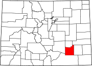 | |
| Towns | ||
| CDPs | ||
| Unincorporated communities | ||
| Ghost town | ||
| Trading posts | ||
| International | |
|---|---|
| National | |
| Geographic | |
| Other | |