
List of counties in Colorado
 |

|
| The 64 counties of the U.S. State of Colorado. |
The U.S. State of Colorado is divided into 64 counties. Two of these counties, the City and County of Broomfield and the City and County of Denver, have consolidated city and county governments. Denver serves as the state capital. Counties are important units of government in Colorado since there are no civil townships or other minor civil divisions.
El Paso County, with a population of 730,395 in 2020, is the most populous county in Colorado, while San Juan County is the least populous, with a population of 705. Las Animas County, 4,776 square miles (12,369 km2) in area, is the most extensive county, while the City and County of Broomfield, 34 square miles (87 km2) in area, is the least extensive. The City and County of Denver is the most densely populated Colorado county, with a population density of 4,674 residents per square mile (1,805/km2) as of 2020, while Hinsdale County is the least densely populated county with a population density of 0.71 resident per square mile (0.27/km2).
Mount Elbert, the highest summit of Colorado and the entire Rocky Mountains at an elevation of 14,440 feet (4,401.2 m), is located in Lake County. The lowest point in Colorado is where the Arikaree River flows out of Yuma County and into Kansas, at 3,317 feet (1,011 m) elevation.[a] This point, which is the highest low point of any state, is higher than the highest points of 18 states and the District of Columbia.[1]
History[edit]
On November 1, 1861, the new Territory of Colorado created 17 original counties: Arapahoe, Boulder, Clear Creek, Costilla, Douglas, El Paso, Fremont, Gilpin, Guadalupe, Huerfano, Jefferson, Lake, Larimer, Park, Pueblo, Summit, and Weld; plus the Cheyenne Reserve.[2][3] Six days later, the name of Guadelupe County was changed to Conejos County.
On February 9, 1866, the first new county, Las Animas, was created, followed by Saguache in December of that year. Bent County was created in February 1870, followed by Greenwood the following month. On February 2, 1874, Grand County and Elbert County were formed, and on February 10, La Plata, Hinsdale, and Rio Grande counties were created. Greenwood was absorbed into Bent on February 5. The last county to be created under the Colorado Territory name was San Juan County, created three months before statehood.
By the time Colorado became a state on August 1, 1876, it had only 26 counties. In January 1877, Routt and Ouray were formed, followed by Gunnison and Custer counties in March. In February 1879, Chaffee County was created. From February 8–10, 1879, Lake county was renamed Carbonate County. In 1881, Dolores County and Pitkin County were created. In 1883, Montrose, Mesa, Garfield, Eagle, Delta, and San Miguel counties were formed, leaving the total number of counties at 39. The number rose to 40 in 1885 with the creation of Archuleta County on April 14. Washington County and Logan County were both created in 1887. Between February 19 and April 16 in 1889, Morgan, Yuma, Cheyenne, Otero, Rio Blanco, Phillips, Sedgwick, Kiowa, Kit Carson, Lincoln, Prowers, Baca, and Montezuma counties were formed, bringing the total to 55. By 1900, Mineral County and Teller County had been added. On November 15, 1902, Arapahoe County was split into Adams and South Arapahoe Counties, and Denver was consolidated as a city and county from portions of both newly formed counties on December 1, 1902.[4] By 1912, Jackson County, Moffat County, and Crowley County had been created. Alamosa was created in 1913, and in 2001, Broomfield was consolidated as a city and county, bringing the total to 64 counties.
List[edit]
Select the OpenStreetMap link at the right to view the location of these 64 coounties.
| County |
FIPS code[5][b] | County seat[6][7] | Est.[8] | Formed from[8] | Etymology[8] | Population[9] | Area[6] | Map |
|---|---|---|---|---|---|---|---|---|
| Adams County | 001 | Brighton | 1902-11-15 | Split from Arapahoe County. | Named in honor of Alva Adams, the 5th, 10th, and 14th Governor of the State of Colorado. | 533,365 | 1,182.29 sq mi (3,062 km2) |

|
| Alamosa County | 003 | Alamosa | 1913-03-08 | Split from Costilla County and Conejos County. | Named for the cottonwood trees which grow along the Rio Grande and its tributaries. Alamosa is a Spanish word for a cottonwood grove. | 16,655 | 723.21 sq mi (1,873 km2) |

|
| Arapahoe County | 005 | Littleton | 1861-11-01 | Created as one of the 17 original counties of the Territory of Colorado. Renamed South Arapahoe County for the five months from November 15, 1902 to April 11, 1903. | Named for predecessor Arapahoe County, Kansas Territory, which in turn was named for the Arapaho Nation of Native Americans. | 656,061 | 804.41 sq mi (2,083 km2) |

|
| Archuleta County | 007 | Pagosa Springs | 1885-04-14 | Split from Conejos County. | Named in honor of Colorado State Senator Antonio D. Archuleta and his father, José Manuel Archuleta. | 14,189 | 1,354.53 sq mi (3,508 km2) |

|
| Baca County | 009 | Springfield | 1889-04-16 | Split from Las Animas County. | Named in honor of pioneer and Colorado territorial legislator Felipe Baca. | 3,344 | 2,558.48 sq mi (6,626 km2) |

|
| Bent County | 011 | Las Animas | 1870-02-11 | Split from Huerfano County and former Cheyenne and Arapaho tribal land. | Named in honor of frontier trader William Bent. | 5,681 | 1,541.07 sq mi (3,991 km2) |

|
| Boulder County | 013 | Boulder | 1861-11-01 | Created as one of the 17 original counties of the Territory of Colorado. | Named for the abundance of granite boulders along Boulder Creek. | 326,831 | 740.48 sq mi (1,918 km2) |

|
| City and County of Broomfield | 014 | Broomfield | 2001-11-15 | Split from Boulder, Adams, Jefferson, and Weld counties and reorganized as a consolidated city and county. | Named for the broom corn that was formerly grown in the area. | 76,860 | 33.57 sq mi (87 km2) |

|
| Chaffee County | 015 | Salida | 1879-02-10 | Split from Carbonate County. | Named in honor of Jerome Bunty Chaffee, one of Colorado's first two U.S. Senators from 1876 to 1879. | 20,617 | 1,014.12 sq mi (2,627 km2) |

|
| Cheyenne County | 017 | Cheyenne Wells | 1889-03-25 | Split from Elbert and Bent counties. | Named for the Cheyenne Nation of Native Americans. | 1,727 | 1,781.90 sq mi (4,615 km2) |

|
| Clear Creek County | 019 | Georgetown | 1861-11-01 | Created as one of the 17 original counties of the Territory of Colorado. | Named for Clear Creek which originates in the county. | 9,147 | 396.53 sq mi (1,027 km2) |

|
| Conejos County | 021 | Conejos | 1861-11-01 | Guadalupe County, one of the 17 original counties of the Territory of Colorado, was renamed Conejos County after six days on November 7, 1861. | Named for the cottontail rabbits in the area. Conejos is a Spanish word for rabbits. | 7,521 | 1,290.22 sq mi (3,342 km2) |

|
| Costilla County | 023 | San Luis | 1861-11-01 | Created as one of the 17 original counties of the Territory of Colorado. | Named for the Costilla River. Costilla is a Spanish word meaning either little rib or furring timber. | 3,628 | 1,229.38 sq mi (3,184 km2) |

|
| Crowley County | 025 | Ordway | 1911-05-29 | Split from Otero County. | Named in honor of Colorado State Senator John H. Crowley. | 5,636 | 800.27 sq mi (2,073 km2) |

|
| Custer County | 027 | Westcliffe | 1877-03-09 | Split from Fremont County. | Named in memory of George Armstrong Custer, (1839–1876), the U.S. Army colonel defeated and killed at the Battle of the Little Bighorn. | 5,534 | 739.24 sq mi (1,915 km2) |

|
| Delta County | 029 | Delta | 1883-02-11 | Split from Gunnison County. | Named for the town of Delta located at the delta of the Uncompahgre River. | 31,746 | 1,149.44 sq mi (2,977 km2) |

|
| City and County of Denver | 031 | Denver | 1902-12-01 | The original Arapahoe County Seat was split from Arapahoe and the newly-created Adams Counties, and reorganized as a consolidated city and county. | Named to curry favor with James W. Denver, Governor of the Territory of Kansas from 1857 to 1859. | 716,577 | 155.66 sq mi (403 km2) |

|
| Dolores County | 033 | Dove Creek | 1881-03-04 | Split from Ouray County. | Named for the Dolores River, which was originally named el Rio de Nuestra Senora de los Dolores, which is Spanish for the River of our Lady of Sorrows. | 2,513 | 1,076.93 sq mi (2,789 km2) |

|
| Douglas County | 035 | Castle Rock | 1861-11-01 | Created as one of the 17 original counties of the Territory of Colorado. | Named in honor of Stephen Arnold Douglas, (1813–1861), U.S. Senator from Illinois from 1847 to 1861. | 383,906 | 842.30 sq mi (2,182 km2) |

|
| Eagle County | 037 | Eagle | 1883-02-11 | Split from Summit County. | Named for the Eagle River which originates in the county. | 54,381 | 1,700.76 sq mi (4,405 km2) |

|
| El Paso County | 041 | Colorado Springs | 1861-11-01 | Created as one of the 17 original counties of the Territory of Colorado. | Named for Ute Pass, which connects the Great Plains to South Park and was formerly located within the county. El Paso means the pass in Spanish. | 744,215 | 2,128.60 sq mi (5,513 km2) |

|
| Elbert County | 039 | Kiowa | 1874-02-02 | Split from Douglas County. | Named in honor of Samuel Hitt Elbert, the sixth Governor of the Territory of Colorado. | 28,806 | 1,849.08 sq mi (4,789 km2) |

|
| Fremont County | 043 | Cañon City | 1861-11-01 | Created as one of the 17 original counties of the Territory of Colorado. | Named in honor of John Charles Frémont (1813–1890), the explorer, U.S. Army general, and U.S. Senator from California. | 50,318 | 1,533.09 sq mi (3,971 km2) |

|
| Garfield County | 045 | Glenwood Springs | 1883-02-10 | Split from Summit County. | Named in honor of James Abram Garfield (1831–1881), the twentieth President of the United States. | 62,707 | 2,958.23 sq mi (7,662 km2) |

|
| Gilpin County | 047 | Central City | 1861-11-01 | Created as one of the 17 original counties of the Territory of Colorado. | Named in honor of William Gilpin, the first Governor of the Territory of Colorado. | 5,926 | 150.15 sq mi (389 km2) |

|
| Grand County | 049 | Hot Sulphur Springs | 1874-02-02 | Split from Summit County. | Named for the Grand River which originates in the county. The Grand River was renamed the Colorado River in 1921, but the county retains the original name. | 15,935 | 1,868.53 sq mi (4,839 km2) |

|
| Gunnison County | 051 | Gunnison | 1877-03-09 | Split from Lake County. | Named in honor of John Williams Gunnison, the U.S. Army captain who explored the region. | 17,321 | 3,259.22 sq mi (8,441 km2) |

|
| Hinsdale County | 053 | Lake City | 1874-02-10 | Split from Lake, Conejos, and Costilla counties. | Named in honor of George Aaron Hinsdale, a Lieutenant Governor of the Territory of Colorado. | 765 | 1,123.35 sq mi (2,909 km2) |

|
| Huerfano County | 055 | Walsenburg | 1861-11-01 | Created as one of the 17 original counties of the Territory of Colorado. | Named for Huerfano Butte, a solitary volcanic plug. Huérfano is a Spanish word meaning orphan. | 7,055 | 1,592.37 sq mi (4,124 km2) |

|
| Jackson County | 057 | Walden | 1909-05-05 | Split from Larimer County. | Named in honor of Andrew Jackson (1767–1845), the seventh President of the United States. | 1,309 | 1,619.75 sq mi (4,195 km2) |

|
| Jefferson County | 059 | Golden | 1861-11-01 | Created as one of the 17 original counties of the Territory of Colorado. | Named for its extralegal predecessor county, Jefferson County, Jefferson Territory, which in turn was named in honor of Thomas Jefferson (1743–1826), the author of the Declaration of Independence and the third President of the United States. | 576,366 | 772.85 sq mi (2,002 km2) |

|
| Kiowa County | 061 | Eads | 1889-04-11 | Split from Bent County. | Named for the Kiowa Nation of Native Americans. | 1,384 | 1,785.90 sq mi (4,625 km2) |

|
| Kit Carson County | 063 | Burlington | 1889-04-11 | Split from Elbert County. | Named in honor of Christopher Houston "Kit" Carson, the famous frontier scout and soldier. | 6,994 | 2,162.43 sq mi (5,601 km2) |

|
| La Plata County | 067 | Durango | 1874-02-10 | Split from Lake and Conejos counties. | Named for the many silver deposits in the area. La plata is a Spanish expression for the silver. | 56,407 | 1,700.44 sq mi (4,404 km2) |

|
| Lake County | 065 | Leadville | 1861-11-01 | Created as one of the 17 original counties of the Territory of Colorado. Renamed Carbonate County for the two days from February 8–10, 1879. | Named for the Twin Lakes in the county. | 7,365 | 383.55 sq mi (993 km2) |

|
| Larimer County | 069 | Fort Collins | 1861-11-01 | Created as one of the 17 original counties of the Territory of Colorado. | Named in honor of William Larimer, a pioneer entrepreneur. | 370,771 | 2,631.75 sq mi (6,816 km2) |

|
| Las Animas County | 071 | Trinidad | 1866-02-09 | Split from Huerfano County. | Named for the Purgatoire River, which was originally named el Rio de las Animas Perdidas, which is Spanish for the River of the Souls in Purgatory. | 14,348 | 4,773.27 sq mi (12,363 km2) |

|
| Lincoln County | 073 | Hugo | 1889-04-11 | Split from Elbert and Bent counties. | Named in honor of Abraham Lincoln (1809–1865), the sixteenth President of the United States. | 5,480 | 2,585.21 sq mi (6,696 km2) |

|
| Logan County | 075 | Sterling | 1887-02-25 | Split from Weld County. | Named in honor of John Alexander Logan (1826–1886), a U.S. Army general and U.S. Senator from Illinois. | 20,619 | 1,845.31 sq mi (4,779 km2) |

|
| Mesa County | 077 | Grand Junction | 1883-02-14 | Split from Gunnison County. | Named for the mesa formations which are widespread through the area. | 159,681 | 3,345.69 sq mi (8,665 km2) |

|
| Mineral County | 079 | Creede | 1893-03-27 | Split from Hinsdale, Rio Grande, and Saguache counties. | Named from the plentiful mineral deposits found in the area. | 944 | 878.16 sq mi (2,274 km2) |

|
| Moffat County | 081 | Craig | 1911-02-27 | Split from Routt County. | Named in honor of railroad pioneer David H. Moffat. | 13,327 | 4,755.86 sq mi (12,318 km2) |

|
| Montezuma County | 083 | Cortez | 1889-04-16 | Split from La Plata County. | Named in honor of Aztec leader Moctezuma II. Ruins in the area were once thought to be Aztec. | 26,531 | 2,035.80 sq mi (5,273 km2) |

|
| Montrose County | 085 | Montrose | 1883-02-11 | Split from Gunnison County. | Named for the town of Montrose, which in turn was probably named from the novel A Legend of Montrose, published in 1819 by Walter Scott. | 44,156 | 2,246.43 sq mi (5,818 km2) |

|
| Morgan County | 087 | Fort Morgan | 1889-02-19 | Split from Weld County. | Named for old Fort Morgan, which in turn was named in honor of U.S. Army Colonel Christopher A. Morgan. | 29,524 | 1,293.83 sq mi (3,351 km2) |

|
| Otero County | 089 | La Junta | 1889-03-25 | Split from Bent County. | Named in honor of Miguel A. Otero of the prominent Otero family of the Southwest. | 18,136 | 1,267.66 sq mi (3,283 km2) |

|
| Ouray County | 091 | Ouray | 1877-01-18 | Split from Hinsdale and Lake counties. Renamed Uncompaghre County for four days from 1883-02-27, to 1883-03-02. | Named in honor of Ouray, a Ute Native American leader. | 5,176 | 542.30 sq mi (1,405 km2) |

|
| Park County | 093 | Fairplay | 1861-11-01 | Created as one of the 17 original counties of the Territory of Colorado. | Named for South Park which occupies most of the county. | 18,117 | 2,209.36 sq mi (5,722 km2) |

|
| Phillips County | 095 | Holyoke | 1889-03-27 | Split from Logan County. | Named in honor of R.O. Phillips, secretary of the Lincoln Land Company, which sold farmsteads in the area. | 4,476 | 688.30 sq mi (1,783 km2) |

|
| Pitkin County | 097 | Aspen | 1881-02-23 | Split from Gunnison County. | Named in honor of Frederick Walker Pitkin, the second Governor of the State of Colorado. | 16,640 | 970.37 sq mi (2,513 km2) |

|
| Prowers County | 099 | Lamar | 1889-04-11 | Split from Bent County. | Named in honor of John W. Prowers, a pioneer of the Arkansas River valley. | 11,751 | 1,645.37 sq mi (4,261 km2) |

|
| Pueblo County | 101 | Pueblo | 1861-11-01 | Created as one of the 17 original counties of the Territory of Colorado. | Named for historic town of Pueblo. Pueblo is a Spanish word meaning village or people. | 169,422 | 2,396.77 sq mi (6,208 km2) |

|
| Rio Blanco County | 103 | Meeker | 1889-03-25 | Split from Garfield County. | Named for the White River, which was originally named Rio Blanco in Spanish. | 6,569 | 3,226.24 sq mi (8,356 km2) |

|
| Rio Grande County | 105 | Del Norte | 1874-02-10 | Split from Costilla County and Conejos County counties. | Named for the Rio Grande, which flows through the area. | 11,188 | 913.10 sq mi (2,365 km2) |

|
| Routt County | 107 | Steamboat Springs | 1877-01-29 | Split from Grand County. | Named in honor of John Long Routt, the first Governor of the State of Colorado. | 25,064 | 2,362.11 sq mi (6,118 km2) |

|
| Saguache County | 109 | Saguache | 1866-12-29 | Split from Lake and Costilla counties. | Name comes from a Ute language noun meaning "sand dunes".[c][10] | 6,688 | 3,168.32 sq mi (8,206 km2) |

|
| San Juan County | 111 | Silverton | 1876-01-31 | Split from Lake County. | Named for the San Juan River and San Juan Mountains, which in turn were named for Saint John the Evangelist. | 802 | 388.99 sq mi (1,007 km2) |

|
| San Miguel County | 113 | Telluride | 1883-03-02 | Split from San Juan County. | Named for the San Miguel River and San Miguel Mountains, which in turn were named for Saint Michael the Archangel. | 7,868 | 1,290.76 sq mi (3,343 km2) |

|
| Sedgwick County | 115 | Julesburg | 1889-04-09 | Split from Logan County. | Named for Fort Sedgwick, which, in turn, was named for U.S. Army General John Sedgwick (1813–1864). | 2,299 | 548.83 sq mi (1,421 km2) |

|
| Summit County | 117 | Breckenridge | 1861-11-01 | Created as one of the 17 original counties of the Territory of Colorado. | Named for the many high mountain summits in the area. | 30,465 | 618.92 sq mi (1,603 km2) |

|
| Teller County | 119 | Cripple Creek | 1899-03-23 | Split from El Paso and Fremont counties. | Named in honor of Henry Moore Teller, a U.S. Senator from Colorado and United States Secretary of the Interior. | 24,617 | 558.58 sq mi (1,447 km2) |

|
| Washington County | 121 | Akron | 1887-02-09 | Split from Weld County. | Named in honor of George Washington (1732–1799), the first President of the United States. | 4,855 | 2,522.90 sq mi (6,534 km2) |

|
| Weld County | 123 | Greeley | 1861-11-01 | Created as one of the 17 original counties of the Territory of Colorado. | Named in honor of Lewis Ledyard Weld, the first Secretary of the Territory of Colorado. | 359,442 | 4,013.84 sq mi (10,396 km2) |

|
| Yuma County | 125 | Wray | 1889-03-15 | Split from Washington County. | Named for the Quechan (Yuma) Nation of Native Americans. | 9,862 | 2,369.61 sq mi (6,137 km2) |

|
2023 population estimates[edit]
For United States Census Bureau population estimates for Colorado counties as of July 1, 2023, see the List of Colorado counties by population.[d] That list ranks the counties by 2023 population and includes population changes since the 2000 United States Census. That list also includes the county websites, links to Colorado Department of Transportation county maps, and the geographic coordinates of the counties.
As of July 1, 2023, El Paso County remains the most populous county in Colorado with a population estimate of 744,215, while Hinsdale County with a 2023 population of 765 is now the least populous.[d] Five of the 64 Colorado counties now have more than 500,000 residents, while 12 counties have fewer than 5,000 residents.[d]
Former counties[edit]
The following sortable table lists all the historic counties of the Territory of New Mexico, the Territory of Utah, the Territory of Kansas, and the extralegal Territory of Jefferson[12] that previously existed within the boundaries of the present State of Colorado, as well as the three defunct counties of the Territory of Colorado and the three defunct counties of the State of Colorado.[e]
| County | Territory or State | Date created | Date superseded | History |
|---|---|---|---|---|
| Taos County | Territory of New Mexico | 1852-01-09 | 1861-02-28 | Originally one of the seven partidos of the Spanish, and later Mexican, province of Santa Fe de Nuevo México. One of the nine original counties created by the Territory of New Mexico in 1852. Excluded from the new Territory of Colorado in 1861. |
| Great Salt Lake County | Territory of Utah | 1852-03-03 | 1861-02-28 | Created in 1852. Excluded from the new Territory of Colorado in 1861. |
| Green River County | Territory of Utah | 1852-03-03 | 1861-02-28 | Created in 1852, but never organized. Dissolved in 1857, but recreated in 1859. Excluded from the new Territory of Colorado in 1861, and the Territory of Wyoming in 1868. Finally dissolved in 1872. |
| Iron County | Territory of Utah | 1852-03-03 | 1861-02-28 | Created in 1852. Excluded from the new Territory of Colorado in 1861. |
| Sanpete County | Territory of Utah | 1852-03-03 | 1861-02-28 | Created in 1852. Excluded from the new Territory of Colorado in 1861. |
| Utah County | Territory of Utah | 1852-03-03 | 1861-02-28 | Created in 1852. Excluded from the new Territory of Colorado in 1861. |
| Washington County | Territory of Utah | 1852-03-03 | 1861-02-28 | Created in 1852. Excluded from the new Territory of Colorado in 1861. |
| Arapahoe County | Territory of Kansas | 1855-08-25 | 1861-01-29 | Created in 1855, but never organized. Reverted to unorganized territory when Kansas joined the Union in 1861. |
| Beaver County | Territory of Utah | 1856-01-05 | 1861-02-28 | Split from Iron and Millard counties in 1856. Excluded from the new Territory of Colorado in 1861. |
| Broderick County | Territory of Kansas | 1859-02-07 | 1861-01-29 | Split from Arapahoe County in 1859, but never organized. Reverted to unorganized territory when Kansas joined the Union in 1861. |
| El Paso County | Territory of Kansas | 1859-02-07 | 1861-01-29 | Split from Arapahoe County in 1859, but never organized. Reverted to unorganized territory when Kansas joined the Union in 1861. |
| Fremont County | Territory of Kansas | 1859-02-07 | 1861-01-29 | Split from Arapahoe County in 1859, but never organized. Reverted to unorganized territory when Kansas joined the Union in 1861. |
| Montana County | Territory of Kansas | 1859-02-07 | 1861-01-29 | Split from Arapahoe County in 1859, but never organized. Reverted to unorganized territory when Kansas joined the Union in 1861. |
| Oro County | Territory of Kansas | 1859-02-07 | 1861-01-29 | Split from Arapahoe County in 1859, but never organized. Reverted to unorganized territory when Kansas joined the Union in 1861. |
| Peketon County | Territory of Kansas | 1859-02-07 | 1861-01-29 | Created in 1859, but never organized. Reverted to unorganized territory when Kansas joined the Union in 1861. |
| Arapahoe County | Territory of Jefferson | 1859-11-28 | 1861-02-28 | One of the 12 counties created by the extralegal Territory of Jefferson in 1859. |
| Cheyenne County | Territory of Jefferson | 1859-11-28 | 1861-02-28 | One of the 12 counties created by the extralegal Territory of Jefferson in 1859. |
| El Paso County | Territory of Jefferson | 1859-11-28 | 1861-02-28 | One of the 12 counties created by the extralegal Territory of Jefferson in 1859. |
| Fountain County | Territory of Jefferson | 1859-11-28 | 1861-02-28 | One of the 12 counties created by the extralegal Territory of Jefferson in 1859. |
| Heele County | Territory of Jefferson | 1859-11-28 | 1861-02-28 | One of the 12 counties created by the extralegal Territory of Jefferson in 1859. |
| Jackson County | Territory of Jefferson | 1859-11-28 | 1861-02-28 | One of the 12 counties created by the extralegal Territory of Jefferson in 1859. |
| Jefferson County | Territory of Jefferson | 1859-11-28 | 1861-02-28 | One of the 12 counties created by the extralegal Territory of Jefferson in 1859. |
| Mountain County | Territory of Jefferson | 1859-11-28 | 1861-02-28 | One of the 12 counties created by the extralegal Territory of Jefferson in 1859. |
| North County | Territory of Jefferson | 1859-11-28 | 1861-02-28 | One of the 12 counties created by the extralegal Territory of Jefferson in 1859. |
| Park County | Territory of Jefferson | 1859-11-28 | 1861-02-28 | One of the 12 counties created by the extralegal Territory of Jefferson in 1859. |
| St. Vrain County | Territory of Jefferson | 1859-11-28 | 1861-02-28 | One of the 12 counties created by the extralegal Territory of Jefferson in 1859. |
| Saratoga County | Territory of Jefferson | 1859-11-28 | 1861-02-28 | One of the 12 counties created by the extralegal Territory of Jefferson in 1859. |
| Mora County | Territory of New Mexico | 1860-02-01 | 1861-02-28 | Split from Taos County and San Miguel County in 1860. Excluded from the new Territory of Colorado in 1861. |
| Guadalupe County | Territory of Colorado | 1861-11-01 | 1861-11-07 | One of the 17 original counties created by the Territory of Colorado in 1861. The county was renamed Conejos County after only six days. |
| Greenwood County | Territory of Colorado | 1870-02-11 | 1874-02-06 | Created from expropriated Cheyenne and Arapaho tribal land and the eastern portion of Huerfano County in 1870. The county was abolished in 1874 and its territory split between Elbert County and Bent County. |
| Platte County | Territory of Colorado | 1872-02-09 | 1874-02-09 | Created from the eastern portion of Weld County in 1872. The county was abolished in 1874 after organizers failed to secure voter approval. The territory of the county was returned to Weld County. |
| Carbonate County | State of Colorado | 1879-02-08 | 1879-02-10 | Lake County was renamed Carbonate County in 1879. Only two days later, Carbonate County was split into the new Chaffee County and a recreated Lake County. |
| Uncompahgre County | State of Colorado | 1883-02-27 | 1883-03-02 | Ouray County was renamed Uncompahgre County for only four days in 1883. |
| South Arapahoe County | State of Colorado | 1902-11-15 | 1903-04-11 | One of three counties created from Arapahoe County in 1902. The name was changed back to Arapahoe County after five months. |
County high points[edit]
Of the 64 Colorado counties, 20 counties extend above 14,000 feet (4,267 m) elevation, 32 counties extend above 13,000 feet (3,962 m), 42 counties extend above 10,000 feet (3,048 m), and all 64 Colorado counties extend above 4,116 feet (1,255 m).
County mean elevation[edit]
Of Colorado's 64 counties, 4 counties have a mean elevation[f] above 11,000 feet (3,353 m) elevation, 22 counties have a mean elevation above 10,000 feet (3,048 m), 32 counties have a mean elevation above 9,000 feet (2,743 m), and all 64 counties have a mean elevation above 3,880 feet (1,183 m).
The following 13 Colorado counties have highest mean elevation of any county in the United States, exceeding even the Denali Borough of Alaska.
| Rank[g] | County | Mean elevation[f] | High point[13] | Highest elevation[14][13][15] | Low point[15] | Lowest elevation[15] | Elevation range[h] |
|---|---|---|---|---|---|---|---|
| 1 | Lake County | 11,702.5 feet 3,567 m |
Mount Elbert | 14,440 feet 4,401 m |
Arkansas River[i] | 8,965 feet 2,733 m |
5,475 feet 1,669 m |
| 2 | Hinsdale County | 11,300 feet 3,444 m |
Uncompahgre Peak | 14,315 feet 4,363 m |
Lake Fork Gunnison River | 8,285 feet 2,525 m |
6,030 feet 1,838 m |
| 3 | Mineral County | 11,116 feet 3,388 m |
Phoenix Peak | 13,902 feet 4,237 m |
Rio Grande | 8,330 feet 2,539 m |
5,572 feet 1,698 m |
| 4 | San Juan County | 11,085 feet 3,379 m |
Vermilion Peak | 13,900 feet 4,237 m |
Animas River | 8,270 feet 2,521 m |
5,630 feet 1,716 m |
| 5 | Summit County | 10,935.5 feet 3,333 m |
Grays Peak | 14,276 feet 4,351 m |
Blue River | 7,595 feet 2,315 m |
6,681 feet 2,036 m |
| 6 | Alamosa County | 10,928.5 feet 3,331 m |
Blanca Peak | 14,351 feet 4,374 m |
Rio Grande | 7,506 feet 2,288 m |
6,845 feet 2,086 m |
| 7 | Saguache County | 10,915 feet 3,327 m |
Crestone Peak | 14,300 feet 4,359 m |
San Luis Creek | 7,530 feet 2,295 m |
6,770 feet 2,063 m |
| 8 | Costilla County | 10,865.5 feet 3,312 m |
Blanca Peak | 14,351 feet 4,374 m |
Rio Grande | 7,380 feet 2,249 m |
6,971 feet 2,125 m |
| 9 | Park County | 10,705.5 feet 3,263 m |
Mount Lincoln | 14,293 feet 4,357 m |
South Platte River | 7,118 feet 2,170 m |
7,175 feet 2,187 m |
| 10 | Chaffee County | 10,661 feet 3,249 m |
Mount Harvard | 14,427 feet 4,397 m |
Arkansas River | 6,895 feet 2,102 m |
7,532 feet 2,296 m |
| 11 | Clear Creek County | 10,608 feet 3,233 m |
Grays Peak | 14,276 feet 4,351 m |
Clear Creek | 6,940 feet 2,115 m |
7,336 feet 2,236 m |
| 12 | Rio Grande County | 10,402 feet 3,171 m |
Bennett Peak | 13,209 feet 4,026 m |
Rock Creek | 7,595 feet 2,315 m |
5,614 feet 1,711 m |
| 13 | Jackson County | 10,353 feet 3,156 m |
Clark Peak | 12,956 feet 3,949 m |
North Platte River | 7,750 feet 2,362 m |
5,206 feet 1,587 m |
County firsts[edit]
- 1. Costilla County was the first area within the present State of Colorado to be settled by Europeans in 1851.
- 2. Taos County, created by the Territory of New Mexico in 1852, was the first organized county to extend into the area of the present State of Colorado.
- 3. Arapahoe County, created by the Territory of Kansas in 1855, was the first county created exclusively within the area of the present State of Colorado.
- 4. On November 28, 1859, the extralegal Territory of Jefferson created 12 counties:[12]
| County | County Seat |
|---|---|
| Arapahoe County | Denver City |
| Cheyenne County | |
| El Paso County | Colorado City |
| Fountain County | Pueblo |
| Heele County | La Porte |
| Jackson County | Boulder City |
| Jefferson County | Arapahoe City Golden City |
| Mountain County | Central City |
| North County | |
| Park County | Tarryall City |
| St. Vrain's County | St. Vrain |
| Saratoga County | Breckinridge |
- 5. On November 1, 1861, the Territory of Colorado created the 17 original Colorado counties:
| County | First County Seat |
|---|---|
| Arapahoe County | Denver City |
| Boulder County | Boulder City |
| Clear Creek County | Idaho |
| Costilla County | San Miguel[j] |
| Douglas County | Frankstown |
| El Paso County | Colorado City |
| Fremont County | Cañon City |
| Gilpin County | Central City |
| Guadaloupe County | Guadaloupe |
| Huerfano County | Autobees Plaza |
| Jefferson County | Golden City |
| Lake County | Oro City |
| Larimer County | La Porte |
| Park County | Tarryall City |
| Pueblo County | Pueblo |
| Summit County | Parkville |
| Weld County | St. Vrain |
- 6. Of the 17 original Colorado counties created in 1861, only Gilpin County and Clear Creek County have retained their original boundaries with only minor survey changes.
- 7. Guadaloupe County was the first Colorado county to be renamed after only six days in 1861.
- 8. Las Animas County was the first new Colorado county to be created (in 1866) after the original 17 counties.
- 9. Greenwood County was the longest lived former Colorado county, existing four years from 1870 to 1874.
- 10. In 1876, San Juan County became the last county created by the Territory of Colorado, bringing the total number of territorial counties to 26.
- 11. In 1877, Ouray County became the first county created by the new State of Colorado.
- 12. Carbonate County was the shortest lived former Colorado county, existing only two days in 1879 before being dissolved.
- 13. The City and County of Broomfield became the newest Colorado county in 2001, bring the total number of counties to 64.
County distinctions[edit]
- 1. El Paso County (88) and the City and County of Denver (93) and are among the 100 most populous counties of the United States.
- 2. San Juan County (16), Hinsdale County (25), Mineral County (32), Jackson County (55), Kiowa County (59), and Cheyenne County (80) are among the 100 least populous counties of the United States.
- 3. Jefferson County borders ten adjacent counties, the most of any Colorado county.[k]
- 4. Delta County and the City and County of Denver each border only three adjacent counties, the fewest of Colorado counties.[l]
- 5. Weld County has the most incorporated municipalities of any Colorado county with 31.
- 6. The following nine Colorado counties have no incorporated municipalities other than their county seat:
- 7. Of all 64 Colorado counties, only Conejos County has a county seat that is not an incorporated municipality.
- 8. The City and County of Denver and the City and County of Broomfield are the only two Colorado counties with enclaves. Arapahoe County, Boulder County, and Jefferson County are the only three Colorado counties with exclaves.
Gallery[edit]
- The ten most populous Colorado counties
-

-
 2. The Colorado State Capitol in the City and County of Denver
 -
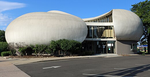 3. A bank building in Arapahoe County, Colorado
 -

-

-
-

-
 8. The Greeley Stampede Parade in Weld County, Colorado
 -

-


.jpg)

.jpg)


See also[edit]
- Bibliography of Colorado
- Geography of Colorado
- History of Colorado
- Index of Colorado-related articles
- List of Colorado-related lists
Notes[edit]
- ^ Elevations are adjusted to the North American Vertical Datum of 1988 (NAVD 88).
- ^ The ANSI INCITS 31:2009 county code is the five-digit code which uniquely identifies counties and county equivalents in the United States. The three-digit number is unique to each individual county within a state, but to be unique within the entire United States, it must be prefixed by the two-digit ANSI INCITS 31:2009 state code. This means that, for example, while Adams County, Colorado is 001, Belknap County, New Hampshire and Alachua County, Florida are also 001. To uniquely identify Adams County, Colorado, one must use the state code of 08 plus the county code of 001; therefore, the unique nationwide identifier for Adams County, Colorado is 08001. The links in the column INCITS are to the Census Bureau Info page for that county.
- ^ The name "Saguache" is pronounced /səˈwætʃ/. This name comes from the Ute language noun "sawup" /səˈwʌp/ meaning "sand dunes". The Spanish language version of this name is usually spelled "Saguache", while the English language version is usually spelled "Sawatch".
- ^ a b c United States Census Bureau estimates of county population as of July 1, 2023[11]
- ^ No organized counties of the District of Louisiana, the Territory of Missouri, the extralegal State of Deseret, or the Territory of Nebraska existed within the present boundaries of the State of Colorado.
- ^ a b The "mean of extremes" elevation is the arithmetic mean of the highest and lowest elevations.
- ^ Rank among United States counties and county-equivalents by mean elevation.
- ^ The elevation range is the arithmetic difference between the highest and lowest elevations.
- ^ The point where the Arkansas River flows out of Lake County and into Chaffee County, Colorado, is the highest county low point in the United States at 8,965 feet (2,733 m) elevation.
- ^ San Miguel was the original seat of Costilla County. In 1863, the Costilla County seat was moved 17 miles (27 km) north to San Luis. It was not until 1869, that surveys revealed that San Miguel, now renamed Costilla, was actually located in the New Mexico Territory.
- ^ Jefferson County, Colorado borders Boulder County, the City and County of Broomfield, Adams County, the City and County of Denver, Arapahoe County, Douglas County, Teller County, Park County, Clear Creek County, and Gilpin County, Colorado.
- ^ Delta County, Colorado borders Gunnison County, Montrose County, and Mesa County, Colorado. The City and County of Denver, Colorado borders Adams County, Arapahoe County, and Jefferson County, Colorado.
References[edit]
- ^ "Highest and Lowest Elevations". United States Geological Survey, United States Department of the Interior. Retrieved August 27, 2022.
- ^ "Colorado County History". COGenWeb Project. April 29, 2011. Retrieved July 21, 2021.
- ^ Stanwyck, Don (2003). "Colorado County Evolution". COGenWeb Project. Archived from the original on February 5, 2007. Retrieved July 21, 2021.
- ^ City Council of the City and County of Denver v. Board of Commissioners of Adams County, 77 P. 858, 861 (1904).
- ^ "EPA County FIPS Code Listing". EPA.gov. Retrieved February 23, 2008.
- ^ a b National Association of Counties. "NACo – Find a county". Archived from the original on September 27, 2007. Retrieved April 30, 2008.
- ^ "Colorado County Seats". State of Colorado, Department of Public Health and Environment. January 30, 2007. Retrieved January 30, 2007.
- ^ a b c "Colorado Government History". State of Colorado, Department of Personnel & Administration, Colorado State Archives. April 18, 2001. Retrieved September 25, 2008.
- ^ "Census QuickFacts: Colorado". United States Census Bureau, Population Division. Retrieved April 21, 2024.
- ^ Merkl, Dameon (February 26, 2013), "What's in a Colorado name pronunciation?", The Denver Post, retrieved March 7, 2013
- ^ "Annual Estimates of the Resident Population for Counties in Colorado: April 1, 2020 to July 1, 2023 (CO-EST2023-POP-08)". United States Census Bureau, United States Department of Commerce. March 2024. Retrieved April 21, 2024.
- ^ a b Provisional Laws and Joint Resolutions of the General Assembly of Jefferson Territory. General Assembly of the Territory of Jefferson. 1859–1860. Retrieved May 5, 2011.
- ^ a b "Peak List". Peakbagger.com. Retrieved June 20, 2022.
- ^ "Elevation Point Query Service". United States Geological Survey. Retrieved June 20, 2022.
- ^ a b c "National Map Search". United States Geological Survey. Retrieved June 20, 2022.
External links[edit]
 Media from Commons
 News from Wikinews
 Quotations from Wikiquote
 Travel information from Wikivoyage
- United States Department of Commerce
- State of Colorado
- Colorado County Clerks Association
- History Colorado