Portal:Tropical cyclones
The Tropical Cyclones Portal
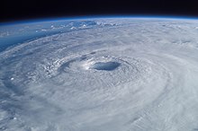
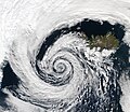
A tropical cyclone is a storm system characterized by a large low-pressure center, a closed low-level circulation and a spiral arrangement of numerous thunderstorms that produce strong winds and heavy rainfall. Tropical cyclones feed on the heat released when moist air rises, resulting in condensation of water vapor contained in the moist air. They are fueled by a different heat mechanism than other cyclonic windstorms such as Nor'easters, European windstorms and polar lows, leading to their classification as "warm core" storm systems. Most tropical cyclones originate in the doldrums, approximately ten degrees from the Equator.
The term "tropical" refers to both the geographic origin of these systems, which form almost exclusively in tropical regions of the globe, as well as to their formation in maritime tropical air masses. The term "cyclone" refers to such storms' cyclonic nature, with anticlockwise rotation in the Northern Hemisphere and clockwise rotation in the Southern Hemisphere. Depending on its location and intensity, a tropical cyclone may be referred to by names such as "hurricane", "typhoon", "tropical storm", "cyclonic storm", "tropical depression" or simply "cyclone".
Types of cyclone: 1. A "Typhoon" is a tropical cyclone located in the North-west Pacific Ocean which has the most cyclonic activity and storms occur year-round. 2. A "Hurricane" is also a tropical cyclone located at the North Atlantic Ocean or North-east Pacific Ocean which have an average storm activity and storms typically form between May 15 and November 30. 3. A "Cyclone" is a tropical cyclone that occurs in the South Pacific and Indian Oceans.
Selected named cyclone -
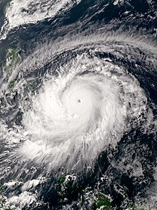
Typhoon Surigae, known in the Philippines as Super Typhoon Bising, was the strongest Northern Hemisphere tropical cyclone to form before the month of May, one of the most intense tropical cyclones on record and the strongest tropical cyclone worldwide in 2021. The second named storm, first typhoon and first super typhoon of the 2021 Pacific typhoon season, Surigae originated from a low-pressure area south of the Micronesian island of Woleai that organized into a tropical depression on April 12. At 18:00 UTC that day, it strengthened to a tropical storm and was named Surigae by the Japan Meteorological Agency (JMA). The formation of an eye and increasing winds prompted the JMA to upgrade the system to a severe tropical storm on April 13. The storm continued to gradually strengthen, and late on April 15, Surigae became a typhoon. Very favorable environmental conditions then allowed Surigae to begin a bout of rapid intensification; Surigae became a super typhoon the next day, and by April 17, the storm reached its peak intensity, with 10-minute sustained winds of 220 km/h (140 mph), 1-minute sustained winds of 315 km/h (196 mph), and a minimum pressure of 895 hPa (26.4 inHg). This made it the strongest pre-May typhoon on record. Afterward, the storm's weakening outflow and an eyewall replacement cycle caused Surigae to gradually weaken as its track shifted north-northwestward in the Philippine Sea. Following the eyewall replacement cycle, Surigae became an annular tropical cyclone on April 19, and restrengthened slightly. On April 22, the storm began to rapidly weaken as it accelerated northwestward into unfavorable environmental conditions, transitioning into a subtropical storm the next day. The subtropical system subsequently underwent extratropical transition, which it completed by April 24. Afterward, Surigae's extratropical remnant accelerated northeastward. On April 27, Surigae's remnant explosively intensified into a bomb cyclone near the Aleutian Islands, attaining hurricane-force winds. Afterward, the system gradually weakened as it turned eastward, slowing down in the process, before crossing the International Date Line on April 30 and fully dissipating on May 2.
Upon Surigae's naming, watches and warnings were issued for the island of Yap in the Federated States of Micronesia and the islands of Koror and Kayangel in Palau as well. The typhoon left US$4.8 million in damage in Palau after cutting off power, water, and destroying infrastructure. Later, warnings were raised for parts of the Philippines as the typhoon moved closer to the nation, with evacuations taking place in eastern regions of the Visayas. The storm killed at least 10 people and left another eight missing, in addition to causing at least ₱272.8 million (US$5.67 million) in damage in the Philippines. (Full article...)Selected article -
The meteorological history of Hurricane Ivan, the longest tracked tropical cyclone of the 2004 Atlantic hurricane season, lasted from late August through late September. The hurricane developed from a tropical wave that moved off the coast of Africa on August 31. Tracking westward due to a ridge, favorable conditions allowed it to develop into Tropical Depression Nine on September 2 in the deep tropical Atlantic Ocean. The cyclone gradually intensified until September 5, when it underwent rapid deepening and reached Category 4 status on the Saffir-Simpson Hurricane Scale; at the time Ivan was the southernmost major North Atlantic hurricane on record.
Ivan quickly weakened due to dry air, but it gradually reorganized, passing just south of Grenada as a major hurricane on September 7. The hurricane attained Category 5 status in the central Caribbean Sea. Over the subsequent days its intensity fluctuated largely due to eyewall replacement cycles, and Ivan passed just south of Jamaica, the Cayman Islands, and western Cuba with winds at or slightly below Category 5 status. Turning northward and encountering unfavorable conditions, Ivan gradually weakened before making landfall just west of Gulf Shores, Alabama on September 16 with winds of 120 mph (190 km/h). The cyclone quickly weakened to tropical depression status as it turned to the northeast, and Ivan transitioned into an extratropical cyclone on September 18. (Full article...)Selected image -

Selected season -

The 1969 Atlantic hurricane season was the most active Atlantic hurricane season since the 1933 season, and was the final year of the most recent positive ("high-quality") Atlantic multidecadal oscillation (AMO) era. The hurricane season officially began on June 1, and lasted until November 30. Altogether, 12 tropical cyclones reached hurricane strength, the highest number on record at the time; a mark not surpassed until 2005. The season was above-average despite an El Niño, which typically suppresses activity in the Atlantic Ocean, while increasing tropical cyclone activity in the Pacific Ocean. Activity began with a tropical depression that caused extensive flooding in Cuba and Jamaica in early June. On July 25, Tropical Storm Anna developed, the first named storm of the season. Later in the season, Tropical Depression Twenty-Nine caused severe local flooding in the Florida Panhandle and southwestern Georgia in September.
The most significant storm of the season was Hurricane Camille, which peaked as a Category 5 hurricane on August 17 and devastated the Gulf Coast of the United States upon striking Mississippi the next day. Strong winds and storm surge heights especially impacted Mississippi and Louisiana. Later in its duration, the storm caused severe flooding Virginia and West Virginia. Camille alone was responsible for 259 deaths and $1.43 billion. It was the costliest United States hurricane at the time, until Hurricane Agnes in 1972. In early September, Hurricane Francelia caused deadly floods in Central America, with 271 people killed in Central America. Hurricane Inga had the third longest duration of an Atlantic tropical cyclone. The last storm, Hurricane Martha, was the only known tropical cyclone to make landfall in Panama. Martha caused minor flooding in the former and Costa Rica. Overall, the systems of the season collectively caused 535 deaths and over $1.5 billion in losses. (Full article...)Related portals
Currently active tropical cyclones

Italicized basins are unofficial.
- North Atlantic (2024)
- No active systems
- East and Central Pacific (2024)
- No active systems
- West Pacific (2024)
- No active systems
- North Indian Ocean (2024)
- No active systems
- Mediterranean (2023–24)
- No active systems
- South-West Indian Ocean (2023–24)
- No active systems
- Australian region (2023–24)
- No active systems
- South Pacific (2023–24)
- No active systems
- South Atlantic (2023–24)
- No active systems
Last updated: 21:54, 8 May 2024 (UTC)
Tropical cyclone anniversaries

- May 13, 2001 - Tropical Storm Cimaron (pictured) reached its peak intensity with 110 km/h (70 mph) winds shortly before it struck the Okinawa Islands, bringing heavy rain.

May 14
- 1997 - Cyclone Rhonda reached its peak intensity in the open Indian Ocean with winds of 185 km/h (115 mph).
- 2007 - Cyclone Akash (pictured) damages a total of US$982 million over in Bangladesh and Burma, also killing a total of 14.
- 2020 - Typhoon Vongfong makes landfall over Visayas, Philippines as a Category 3 typhoon.

May 15
- 1982 - Tropical Storm Claudia (pictured) affects the Solomon Islands as a weak cyclone.
- 1996 - Typhoon Bart reaches Category 4 typhoon intensity just northeast of Luzon.
- 2024 - The 2024 East Pacific hurricane season officially begins.
Did you know…


- …that the Joint Typhoon Warning Center considers that Typhoon Vera (pictured) of 1986 is actually two distinct systems, formed from two separated low-level circulations?
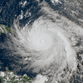
- …that Hurricane Agatha (pictured) was the strongest Pacific hurricane to make landfall in Mexico in May since records began in 1949?
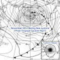
- …that Cyclone Raquel (track pictured) travelled between the Australian and South Pacific basins between the 2014–15 and 2015–16 seasons, spanning both seasons in both basins?
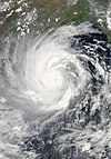
- …that Cyclone Amphan (pictured) in 2020 was the first storm to be classified as a Super Cyclonic Storm in the Bay of Bengal since 1999?
General images -
Accompanying Hurricane Katrina's catastrophic coastal impacts was a moderate tornado outbreak spawned by the cyclone's outer bands. The event spanned August 26–31, 2005, with 57 tornadoes touching down across 8 states. One person died and numerous communities suffered damage of varying degrees from central Mississippi to Pennsylvania, with Georgia sustaining record monetary damage for the month of August. Due to extreme devastation in coastal areas of Louisiana and Mississippi, multiple tornadoes may have been overlooked—overshadowed by the effects of storm surge and large-scale wind—and thus the full extent of the hurricane's tornado outbreak is uncertain. Furthermore, an indeterminate number of waterspouts likely formed throughout the life cycle of Hurricane Katrina.
The outbreak began with an isolated F2 over the Florida Keys on August 26; no tornadoes were recorded the following day as the storm traversed the Gulf of Mexico. Four weak tornadoes were observed on August 28 as the hurricane approached land, each causing little damage. Coincident with Katrina's landfall, activity began in earnest on August 29 with numerous tornadoes touching down across Gulf Coast states. Georgia suffered the greatest impact on this day, with multiple F1 and F2 tornadoes causing significant damage; one person died in Carroll County, marking the first known instance of a tornado-related death in the state during August. A record 18 tornadoes touched down across Georgia on August 29, far exceeding the previous daily record of just 2 tornadoes for the month throughout the state. Activity diminished over the subsequent two days as the former hurricane moved northward. Several more tornadoes touched down across the Mid-Atlantic states before the cessation of the outbreak just after midnight local time on August 31. (Full article...)Topics
Subcategories
Related WikiProjects
WikiProject Tropical cyclones is the central point of coordination for Wikipedia's coverage of tropical cyclones. Feel free to help!
WikiProject Weather is the main center point of coordination for Wikipedia's coverage of meteorology in general, and the parent project of WikiProject Tropical cyclones. Three other branches of WikiProject Weather in particular share significant overlaps with WikiProject Tropical cyclones:
- The Non-tropical storms task force coordinates most of Wikipedia's coverage on extratropical cyclones, which tropical cyclones often transition into near the end of their lifespan.
- The Floods task force takes on the scope of flooding events all over the world, with rainfall from tropical cyclones a significant factor in many of them.
- WikiProject Severe weather documents the effects of extreme weather such as tornadoes, which landfalling tropical cyclones can produce.
Things you can do
 |
Here are some tasks awaiting attention:
|
Wikimedia
The following Wikimedia Foundation sister projects provide more on this subject:
-
Commons
Free media repository -
Wikibooks
Free textbooks and manuals -
Wikidata
Free knowledge base -
Wikinews
Free-content news -
Wikiquote
Collection of quotations -
Wikisource
Free-content library -
Wikiversity
Free learning tools -
Wikivoyage
Free travel guide -
Wiktionary
Dictionary and thesaurus

