
Anaconda, Montana: Difference between revisions
mNo edit summary |
|||
| Line 2: | Line 2: | ||
[[File:Anaconda-Courthouse.jpg|thumb|right|Deer Lodge County Courthouse in Anaconda]] |
[[File:Anaconda-Courthouse.jpg|thumb|right|Deer Lodge County Courthouse in Anaconda]] |
||
Anaconda, county seat of [[Deer Lodge County, Montana|Anaconda City/Deer Lodge County]], is located in mountainous southwestern [[Montana]]. The [[Continental Divide of the Americas|Continental Divide]] passes within {{convert|8|mi|abbr=on}} south of the community with the local Pintler Mountain range reaching {{convert|10379|ft|abbr=on}}. According to the [[2010 United States Census|2010 census]] the population is 9,298, with a per capita personal income of $20,462 and a median household income of $34,716<ref>[http://quickfacts.census.gov/qfd/states/30/3001675.html U.S. Census 2010]</ref>. It is the ninth most populous city in Montana. Central Anaconda is {{convert|5335|ft|abbr=on}} [[AMSL|above sea level]], and is surrounded by the communities of Opportunity and West Valley. |
|||
The county area is {{convert|741|sqmi|km2}}, characterized by densely timbered forestlands, lakes, mountains and recreation grounds. The county has common borders with Beaverhead, Butte-Silver Bow, Granite, Jefferson and Powell counties. |
The county area is {{convert|741|sqmi|km2}}, characterized by densely timbered forestlands, lakes, mountains and recreation grounds. The county has common borders with Beaverhead, Butte-Silver Bow, Granite, Jefferson and Powell counties. |
||
Revision as of 15:24, 12 May 2014


Anaconda, county seat of Anaconda City/Deer Lodge County, is located in mountainous southwestern Montana. The Continental Divide passes within 8 mi (13 km) south of the community with the local Pintler Mountain range reaching 10,379 ft (3,164 m). According to the 2010 census the population is 9,298, with a per capita personal income of $20,462 and a median household income of $34,716[1]. It is the ninth most populous city in Montana. Central Anaconda is 5,335 ft (1,626 m) above sea level, and is surrounded by the communities of Opportunity and West Valley.
The county area is 741 square miles (1,920 km2), characterized by densely timbered forestlands, lakes, mountains and recreation grounds. The county has common borders with Beaverhead, Butte-Silver Bow, Granite, Jefferson and Powell counties.
History


Anaconda was founded by Marcus Daly, one of the Copper Kings, who financed the construction of a smelter on nearby Warm Springs Creek to process copper ore from the Butte mines. In June 1883, Daly filed for a town plat for “Copperopolis,” but that name already graced another mining town, Copperopolis in Meagher County. Instead, Daly accepted the name "Anaconda" from the postmaster of the time, Clinton Moore.
In 1903, the Socialist Party of America won its first victory west of the Mississippi when Anaconda elected a socialist mayor, treasurer, police judge, and three councilmen. The Socialist Party had grown within the Montana labor movement. Initially, the Anaconda Copper Mining Company tolerated them, but when the Socialists gained political power and threatened to implement reform, the company systematically undermined the radical party. City workers and councilmen refused to cooperate with the new mayor, and the company began to fire Socialists. In the long run labor lost ground in Anaconda and the company exerted ever greater political control.[2]
The Anaconda Company expanded smelting capacity over time, and by 1919 the Washoe Reduction Works could boast that its 585-foot (178 m) smokestack (Anaconda Smelter Stack) was the tallest masonry structure in the world and that the smelter-refining complex constituted the world’s largest nonferrous processing plant.
In 1980, Atlantic Richfield Company closed the smelter, bringing an end to almost a century of mineral processing.[3] Since then, an operation for environmental cleanup was put into place by the Environmental Protection Agency and executed with the assistance of ARCO. The multi-million dollar cleanup and investment has resulted in the formation of "Old Works" Golf Course, a championship 18-hole course designed by Jack Nicklaus.
Part of Anaconda is included in the Butte-Anaconda Historic District.
Geography
- Elevation: 5335 ft (1,626 m)
- Average annual rainfall: 14 inches (356 mm)
- Average length of growing season: 114 days
- Average annual snowfall: 48.0 inches (122 cm)
- Average annual temperature: 43.0 °F (6.1 °C)
Climate

| Climate data for Anaconda | |||||||||||||
|---|---|---|---|---|---|---|---|---|---|---|---|---|---|
| Month | Jan | Feb | Mar | Apr | May | Jun | Jul | Aug | Sep | Oct | Nov | Dec | Year |
| Record high °F (°C) | 60 (16) |
65 (18) |
71 (22) |
83 (28) |
89 (32) |
95 (35) |
100 (38) |
98 (37) |
95 (35) |
88 (31) |
71 (22) |
60 (16) |
100 (38) |
| Mean daily maximum °F (°C) | 35.2 (1.8) |
39.9 (4.4) |
46.6 (8.1) |
55.3 (12.9) |
64.2 (17.9) |
72.8 (22.7) |
80.4 (26.9) |
80.5 (26.9) |
70.2 (21.2) |
58.4 (14.7) |
42.5 (5.8) |
34.9 (1.6) |
56.7 (13.7) |
| Daily mean °F (°C) | 24.2 (−4.3) |
28.2 (−2.1) |
34.4 (1.3) |
41.8 (5.4) |
50.0 (10.0) |
57.8 (14.3) |
63.6 (17.6) |
63.4 (17.4) |
54.1 (12.3) |
44.2 (6.8) |
31.3 (−0.4) |
24.0 (−4.4) |
43.1 (6.2) |
| Mean daily minimum °F (°C) | 13.1 (−10.5) |
16.5 (−8.6) |
22.1 (−5.5) |
28.3 (−2.1) |
35.7 (2.1) |
42.7 (5.9) |
46.8 (8.2) |
46.3 (7.9) |
38.0 (3.3) |
30.0 (−1.1) |
20.1 (−6.6) |
13.1 (−10.5) |
29.4 (−1.5) |
| Record low °F (°C) | −28 (−33) |
−35 (−37) |
−12 (−24) |
4 (−16) |
17 (−8) |
27 (−3) |
30 (−1) |
25 (−4) |
12 (−11) |
−9 (−23) |
−22 (−30) |
−38 (−39) |
−38 (−39) |
| Average precipitation inches (mm) | 0.58 (15) |
0.46 (12) |
1.04 (26) |
1.17 (30) |
1.85 (47) |
1.93 (49) |
1.43 (36) |
1.47 (37) |
1.14 (29) |
0.84 (21) |
0.84 (21) |
0.63 (16) |
13.38 (339) |
| Source 1: NOAA (normals, 1971–2000) [4] | |||||||||||||
| Source 2: The Weather Channel (Records) [5] | |||||||||||||
Demographics
| Census | Pop. | Note | %± |
|---|---|---|---|
| 1880 | 700 | — | |
| 1890 | 3,975 | 467.9% | |
| 1900 | 9,453 | 137.8% | |
| 1910 | 10,134 | 7.2% | |
| 1920 | 11,668 | 15.1% | |
| 1930 | 12,494 | 7.1% | |
| 1940 | 11,004 | −11.9% | |
| 1950 | 11,254 | 2.3% | |
| 1960 | 12,054 | 7.1% | |
| 1970 | 9,771 | −18.9% | |
| 1980 | 12,518 | 28.1% | |
| 1990 | 10,278 | −17.9% | |
| 2000 | 9,417 | −8.4% | |
| 2010 | 9,298 | −1.3% | |
| source:[6] | |||
Economy
This section is empty. You can help by adding to it. (January 2012) |
Arts and Culture
This section is empty. You can help by adding to it. (January 2012) |
Sports and recreation
- Hunting - Many local establishments in the town of Anaconda can provide hunting licenses for in-state and out of state hunters. There are hundreds of square miles of hunting available to the public in the area. With permit, hunting is permitted for fowl, bear, mountain lion, elk, deer and moose, however only deer and elk hunting is allowed without application to the state hunting license draw.
- Fishing - With the exception of many mountain lakes and streams, primary fishing spots include Silver Lake, Georgetown Lake, Echo Lake, Warm Springs Creek and the Big Hole River.
- Golf - The Old Works Golf Course is a Jack Nicklaus signature golf course. There is also a local country club and an 18 hole championship golf course located at Fairmont Hot Springs.
- Skiing - With plentiful trails for cross country skiers, and the Discovery Ski Area for downhill skiers Anaconda is an excellent place for the skiing enthusiast. The Discovery Ski Area also grooms 5 km (3.1 mi) of cross country ski trails. Discovery ski area boasts 15 downhill double black diamond trails.
- Darts -The annual Winter Getaway dart tournament held in several local establishments draws as the largest regional dart tournament in the State of Montana
- Museums - The Copper Village Museum and Arts Center provides visitors and residents with art and history of the local area.
- Hiking- There are many walking sites in Anaconda. There is a walking trail that goes along warm springs creek that it great for walking dogs. There are many roads that will take you to beautiful mountain lakes. There is Hearst Lake upper and lower, haggin lake, lower and upper barker. You can also hike to the top of Haggin mountain 10,607 feet. Which is a very long hike, but worth it for the view.
Government
This section is empty. You can help by adding to it. (January 2012) |
Education
There are six schools in the Anaconda school district, a Head Start program; Dwyer School (grades K-2), Lincoln Elementary (grades 3-5), Fred Moodry Middle School (grades 6-8) , and Anaconda High school (grades 9-12). There is a Vocational program for the High School with welding, woodworking, carpentry, robotics, small engines, and space for the offices of the Superintendent and School Board.
Media
If you go down main street you will see the historic Washoe Theater. The Washoe Theater was the last theater constructed in the United states in the Nuevo Deco style. Washoe Theater was designed in 1930 by Seattle architect B. Marcus Priteca. The
Infrastructure
This section is empty. You can help by adding to it. (January 2012) |
Notable natives and residents
- Lucille Ball - actress
- John H. Collins - classical scholar.
- Frank Cope - New York Giants offensive lineman
- Marcus Daly - founder of Anaconda, and one of the "Copper Kings" of Butte.
- Wayne Estes - college basketball star
- Raymond Hunthausen - Archbishop of Seattle
- Rob Johnson - New York Mets catcher
- Nancy Keenan - politician, NARAL president
- George A. Lingo - politician in the Alaska Territory
- Jack Morris, S.J.. - Founded and named the Jesuit Volunteer Corps; born in Anaconda.[7]
- George Leo Thomas - Roman Catholic Bishop of Helena
- Lester Thurow - economist
- John H. Tolan - United States Congressman from California
- Ed Kalafat - Minneapolis Lakers Basketball Player
- Milan Lazetich - Football star who played for Los Angeles Rams
- Pete Lazetich - Football star/"Thunder Chicken"
- Bill Ray - Alaska businessman, politician, writer
See also
References
- ^ U.S. Census 2010
- ^ Jerry Calvert, "The Rise and Fall of Socialism in a Company Town, 1902-1905," Montana Dec 1986, Vol. 36 Issue 4, pp 2-13
- ^ Aarstad, Rich, Ellie Arguimbau, Ellen Baumler, Charlene Porsild, and Brian Shovers. Montana Place Names from Alzada to Zortman. Montana Historical Society Press.
- ^ "Climatography of the United States NO.81" (PDF). National Oceanic and Atmospheric Administration. Retrieved January 15, 2011.
- ^ "Monthly Averages for Anaconda, MT". The Weather Channel. Retrieved January 15, 2011.
- ^ Moffatt, Riley. Population History of Western U.S. Cities & Towns, 1850-1990. Lanham: Scarecrow, 1996, 127.
- ^ "Founder of the Jesuit Volunteer Corps movement dies". Catholic Sentinel. 2012-10-02. Retrieved 2012-10-11.
This article needs additional citations for verification. (February 2009) |
Further reading
- Mercier, Laurie. Anaconda: Labor, Community, and Culture in Montana's Smelter City (University of Illinois Press, 2001) 300pp
External links
- Chamber of Commerce
- Clark Fork Watershed Education Program
- Video portrait of Anaconda
- . Encyclopedia Americana. 1920.
Municipalities and communities of Deer Lodge County, Montana, United States | ||
|---|---|---|
| City | 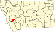 | |
| Unincorporated communities | ||
| Ghost town | ||
| Footnotes | ‡This populated place also has portions in an adjacent county or counties | |