Cap-Saint-Jacques Nature Park
| Cap-Saint-Jacques Nature Park | |
|---|---|
| Parc-nature du Cap-Saint-Jacques | |
 A path in the park | |
| Type | Nature park |
| Location | Pierrefonds-Roxboro, Montreal, Quebec, Canada |
| Coordinates | 45°27′58″N 73°55′52″W / 45.4661°N 73.9311°W[1] |
| Area | 302 hectares (750 acres) |
| Operated by | City of Montreal |
| Open | sunrise to sunset |
| Status | Open all year |
| Public transit access | STM Bus: 68 |
| Website | Official website |
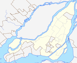
Cap-Saint-Jacques Nature Park (French: Parc-nature du Cap-Saint-Jacques) is a large nature park in the Pierrefonds-Roxboro borough of Montreal, Quebec, Canada.
It is located in the West Island at the junction of the Lake of Two Mountains and the Rivière des Prairies. Situated on a peninsula, three quarters of the park is bordered by water. At 330 ha (820 acres),[2] it is the largest park in Montreal.
The land for the park was purchased by the City of Montreal on 15 February 1980 from the Congregation des Soeurs des Saints Noms de Jesus et de Marie.[3]
The park features a natural sand beach and an organic farm, which raises animals and grows organic produce. Farm activities are offered by the non profit D-Trois-Pierres.[4]
The park's bays are home to a variety of animals, including the map turtle. Environmental science activities are offered by the Groupe uni des éducateurs-naturalistes et professionnels en environnement (GUEPE). The park includes stands of silver birch and sugar maple, with a sugar shack where visitors can watch the production of maple syrup, in season. The park has 26 km (16 mi) of hiking trails and 32 km (20 mi) of trails for cross country skiing.[5]
The name "Cap St. Jacques" was written on maps as early as 1744. The land mass south of the (cape) of Cap St. Jacques is the Jacques Cartier electoral district. The French Wikipedia article conjectures the name comes from Jacques Bizard, but both Jacques Cartier and Jacques Bizard have not been named Saints. There is a street named "St. Jacques" in the city of Montreal dated 1672. There is also a land area called the Saint-Jacques Escarpment on the island of Montreal.
Plans
As of 2020, the City of Montreal has a plan to include the park into the future Grand Parc de L’Ouest.[6]
References
- ^ "Parc régional du Cap-Saint-Jacques". Commission de toponymie du Québec. Retrieved 21 November 2020.
- ^ "Parc-nature du Cap-Saint-Jacques" (in French). City of Montreal. Retrieved 16 November 2020.
- ^ The North Shore News (14 February 1980). "MUC moving ahead on regional park purchases". Retrieved 16 November 2020.
- ^ "Cap-Saint-Jacques Natural Park Ecological Farm". D Trois Pierres. Retrieved 16 November 2020.
- ^ "Montreal Seen: Cap Saint Jacques". Out There. Retrieved 16 November 2020.
- ^ "Grand parc de l'Ouest". City of Montreal - Making Montreal. Retrieved 7 December 2020.
External links
- Official website (Montreal's Nature Parks)

