
Puerto Rico Highway 66
  Highway 66 | ||||
|---|---|---|---|---|
| Ruta 66 | ||||
| Autopista Roberto Sánchez Vilella | ||||
 PR-66 highlighted in red | ||||
| Route information | ||||
| Maintained by Puerto Rico DTPW | ||||
| Length | 19.5 km[1] (12.1 mi) | |||
| Existed | 2006[2]–present | |||
| Major junctions | ||||
| West end | ||||
| ||||
| East end | ||||
| Location | ||||
| Country | United States | |||
| Territory | Puerto Rico | |||
| Municipalities | Carolina, Canóvanas, Río Grande | |||
| Highway system | ||||
| ||||
Puerto Rico Highway 66 (PR-66)[a] is a main tollway which parallels Puerto Rico Highway 3 going from the city of Carolina, Puerto Rico via a 3 loops cloverleaf interchange with PR-26 and PR-3,[3] a major exit in the form of a Trumpet interchange in Canóvanas, Puerto Rico and ending in the municipality of Río Grande, Puerto Rico with an intersection of PR-3.[4] It is only 19.5 kilometres (12.1 mi)[5] long and has very few exits, which work mainly to minimize traffic in the congested Carolina area of PR-3.[2]
The highway is called the Roberto Sánchez Vilella Expressway, which is also the name given to the much larger PR-2 freeway segment from Hormigueros to Ponce. The second phase of PR-66 from Canóvanas to Rio Grande was opened on 1 October 2012.[6]
Route description
Naming
PR-66 is, in reality, an extension of older expressway PR-26, as both expressways are attached (that is, there is no need to take an exit to enter the other expressway, much like PR-18 and PR-52). PR-66 was assigned that number after U.S. Route 66 in the United States.[citation needed]
Controversy
PR-66 is very close to the El Yunque National Forest and at the beginning caused problems between developers and environmental activists. Several actions of disobedience took place, including beams already installed being removed.[7] The expressway was planned to be extended to Fajardo but due to the close presence of the forest reserve, it was accorded to be extended to Río Grande and connect to PR-3 which has several exits between that municipality and Fajardo, and it might be possible that PR-3 is converted into a complete freeway in that segment as it approaches PR-53.[8][9]
The short expressway is very expensive in terms of toll fees and many people still go through PR-3 as a consequence. There are no plans to change the cost. The current toll fees are $1.50 and $1.00, respectively. This makes this small freeway the second most expensive tollway in the US (excluding bridges and tunnels), after the Dulles Greenway in Virginia in terms of its small length, about 30 cents per mile (19 ¢/km). The result is that PR-66 has low traffic most all the time, including during rush hours.[10] As of December 2011, the toll must be paid by pre-paid AutoExpreso.[11]
Tolls
| Location | Toll | Direction | AutoExpreso acceptance |
AutoExpreso replenishment (R) lane |
|---|---|---|---|---|
| Carolina | $1.50 | Two-way | ||
| Carolina Rampa Norte | $0.75 | Two-way (ramp) | ||
| Carolina Rampa Sur | $0.75 | Two-way (ramp) | ||
| Río Grande | $1.00 | Two-way |
Exit list
| Municipality | Location | km[1] | mi | Exit | Destinations | Notes |
|---|---|---|---|---|---|---|
| Carolina | San Antón | 0.0 | 0.0 | — | Western terminus of PR-66 | |
| Martín González | 1.4 | 0.87 | 1 | |||
| 3.2 | 2.0 | Carolina Toll Plaza | ||||
| Trujillo Bajo | 4.9 | 3.0 | 5 | Toll exit | ||
| Canóvanas | Canóvanas | 10.8 | 6.7 | 10 | Eastbound exit and westbound entrance | |
| 13.1 | 8.1 | 14 | ||||
| Río Grande | Guzmán Abajo | 16.8 | 10.4 | Río Grande Toll Plaza (ETC only; no AutoExpreso replenishment lane) | ||
| 19.1 | 11.9 | 19 | ||||
| 19.5 | 12.1 | — | Eastern terminus of PR-66; PR-3 exit 25 | |||
| 1.000 mi = 1.609 km; 1.000 km = 0.621 mi | ||||||
Gallery
-
 Toll on Puerto Rico Highway 66
 -
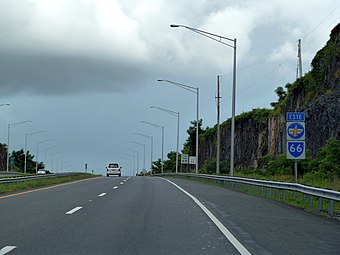 A stretch of PR-66 heading to Río Grande
 -
 PR-66 interchange with PR-188 in Canóvanas
 -
 PR-66 starts at PR-3 in Río Grande


See also
Notes
- ^ PR-66 is the unsigned Interstate PRI3
References
- ^ a b "PR-66" (Map). Google Maps. Retrieved 28 February 2020.
- ^ a b https://www.puertoricodaytrips.com/route-66-extension/
- ^ "Tránsito Promedio Diario (AADT)". Transit Data (Datos de Transito) (in Spanish). DTOP PR. p. 54.
- ^ Puerto Rico (fold out) (Map). National Geographic Adventure Map (Book 3107). 7 May 2011. ISBN 978-1566955188.
- ^ Guía de Carreteras Principales, Expresos y Autopistas. Departamento de Transportación y Obras Publicas de Puerto Rico. Accessed 21 February 2020.
- ^ http://www.elnuevodia.com/fortunoinauguranuevotramodelaruta66-1354194.html
- ^ "2000 TSPR 60 Wanda Colón Cortés v. Carlos I. Pesquera CC-99-0666" (PDF). Rama Judicial de Puerto Rico (in Spanish). Supreme Court of Puerto Rico. Retrieved 21 February 2020.
- ^ https://www.primerahora.com/noticias/gobierno-politica/notas/inauguran-nuevo-tramo-de-la-ruta-66/
- ^ https://www.telemundopr.com/noticias/local/convertiran-carretera-pr-3-en-expreso-ultima-fase-pr-66-hasta-fajardo/21414/
- ^ https://www.primerahora.com/noticias/puerto-rico/notas/ruta-66-opinan-que-es-costoso-para-un-trayecto-tan-corto/
- ^ https://www.autoexpreso.com/CustWebApp/WebIndex.jsp
External links
 Media related to Puerto Rico Highway 66 at Wikimedia Commons
| Signed | |
|---|---|
| Unsigned | |
| Lists | |
| Other | |
Routes in italics are no longer a part of the system. Major Interstates are highlighted. | |