Årstad (municipality)
Årstad Municipality
Årstad herred Aarstad | |
|---|---|
Panorama of Årstad from the mountain Fløyen | |
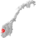
 Hordaland within Norway | |
 Årstad within Hordaland | |
| Coordinates: 60°22′35″N 05°21′41″E / 60.37639°N 5.36139°E | |
| Country | Norway |
| County | Hordaland |
| District | Midhordland |
| Established | 1 Jan 1838 |
| • Created as | Formannskapsdistrikt |
| Disestablished | 1 July 1915 |
| • Succeeded by | Bergen in 1915 |
| Administrative centre | Kronstad |
| Government | |
| • Mayor (1906-1915) | Gerdt Meyer Bruun |
| Area (upon dissolution) | |
| • Total | 21.37 km2 (8.25 sq mi) |
| Population (1915) | |
| • Total | 7,463 |
| • Density | 350/km2 (900/sq mi) |
| Time zone | UTC+01:00 (CET) |
| • Summer (DST) | UTC+02:00 (CEST) |
| ISO 3166 code | NO-1280[1] |
Årstad is a former municipality in the old Hordaland county in Norway. The 21.37-square-kilometre (8.25 sq mi) municipality existed from 1838 until 1915 when it was merged into the city of Bergen. The municipality of Årstad (historically spelled Aarstad) was a southern suburb of the city of Bergen, mostly located in the valley to the south of the bay Store Lungegårdsvannet and the Puddefjorden all the way south to the village of Nattland. The administrative centre of Årstad was the village of Kronstad. The mountain Ulriken lies to the east of Årstad and the mountain Løvstakken lies to the west. The municipality is named after the medieval farm Alrekstad, located on this site.[2] The area of the old municipality somewhat corresponds to the present-day borough of Årstad in the city of Bergen.
History
The parish of Aarstad was established as a municipality 1 January 1838 (see formannskapsdistrikt law). Originally, it sat south of the city of Bergen and south of the municipality of Bergen Landdistrikt. Årstad and the city of Bergen worked closely together from the start since both made up one large urban area. In fact, most of Årstad had been part of the Bergen Police District since 1808.[3]
On 1 July 1915, Årstad municipality (population: 7,463) was merged into the city of Bergen increasing the area of Bergen municipality from 13.9 to 34.9 square kilometres (5.4 to 13.5 sq mi). The merger happened after a long political process, following decades of close cooperation between the two municipalities. The merger also moved Årstad from Søndre Bergenhus county to Bergen county.[4]
See also
References
- ^ Bolstad, Erik; Thorsnæs, Geir, eds. (2023-01-26). "Kommunenummer". Store norske leksikon (in Norwegian). Kunnskapsforlaget.
- ^ Store norske leksikon. "Årstad – kommune" (in Norwegian). Retrieved 2014-09-10.
- ^ Stein Thowsen and Harald Garmannslund (2000). Årstad - historisk vandring i en ny bydel. Forlaget Livskunst. p. 12.
- ^ Jukvam, Dag (1999). "Historisk oversikt over endringer i kommune- og fylkesinndelingen" (PDF) (in Norwegian). Statistisk sentralbyrå.

