Nord-Vågsøy
Nord-Vågsøy Municipality
Nord-Vågsøy herred | |
|---|---|
 View of Refvikstranda | |
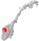
 Sogn og Fjordane within Norway | |
 Nord-Vågsøy within Sogn og Fjordane | |
| Coordinates: 61°59′07″N 05°08′24″E / 61.98528°N 5.14000°E | |
| Country | Norway |
| County | Sogn og Fjordane |
| District | Nordfjord |
| Established | 1 Jan 1910 |
| • Preceded by | Selje Municipality in 1910 |
| Disestablished | 1 Jan 1964 |
| • Succeeded by | Vågsøy Municipality in 1964 |
| Administrative centre | Raudeberg |
| Population (1964) | |
| • Total | 1,476 |
| Demonym | Vågsøyværing[1] |
| Time zone | UTC+01:00 (CET) |
| • Summer (DST) | UTC+02:00 (CEST) |
| ISO 3166 code | NO-1440[2] |
Nord-Vågsøy is a former municipality in the old Sogn og Fjordane county (now Vestland), Norway. The municipality existed from 1910 until 1964, and it encompassed the northern part of the island of Vågsøy. The area of Nord-Vågsøy now makes up the northern part of the present-day Kinn Municipality. The administrative centre was the village of Raudeberg where the Nord-Vågsøy Church is located. Other villages in Nord-Vågsøy include Halsør, Vedvik, Refvik, Kvalheim, and Kråkenes.
Name
The municipality was named Nord-Vågsøy because it encompassed the northern part of Vågsøy island (nord means "northern" in Norwegian). The Old Norse form of the island name was Vágsøy. The first element is the genitive case of vágr which means "bay" and the last element is øy which means "island".[3]
History
Nord-Vågsøy was originally a part of the municipality of Selje (see formannskapsdistrikt law). On 1 January 1910, the western part of Selje was split off from the municipality to create the new municipalities of Nord-Vågsøy (population: 1,111) and Sør-Vågsøy (population: 1,517). On 1 July 1921, the Blesrød farm in Nord-Vågsøy (just north of Måløy) was transferred to Sør-Vågsøy municipality. During the 1960s, there were many municipal mergers across Norway due to the work of the Schei Committee. On 1 January 1964, the new Vågsøy Municipality was created by merging the municipalities of Sør-Vågsøy (population: 3,926) and Nord-Vågsøy (population: 1,476) with parts of neighboring Davik and Selje municipalities.[4]
Politically, Nord-Vågsøy was marked by the father and son Karl and Leif Iversen, who served as mayors the last forty years before the merger.[5]
Government
Municipal council
The municipal council (Heradsstyre) of Nord-Vågsøy was made up of 17 representatives that were elected to four year terms. The party breakdown of the final municipal council was as follows:
| Party name (in Nynorsk) | Number of representatives | |
|---|---|---|
| Labour Party (Arbeidarpartiet) | 2 | |
| Christian Democratic Party (Kristeleg Folkeparti) | 3 | |
| Local List(s) (Lokale lister) | 12 | |
| Total number of members: | 17 | |
| Party name (in Nynorsk) | Number of representatives | |
|---|---|---|
| Labour Party (Arbeidarpartiet) | 3 | |
| Christian Democratic Party (Kristeleg Folkeparti) | 2 | |
| Local List(s) (Lokale lister) | 12 | |
| Total number of members: | 17 | |
| Party name (in Nynorsk) | Number of representatives | |
|---|---|---|
| Labour Party (Arbeidarpartiet) | 2 | |
| Local List(s) (Lokale lister) | 14 | |
| Total number of members: | 16 | |
| Party name (in Nynorsk) | Number of representatives | |
|---|---|---|
| Local List(s) (Lokale lister) | 16 | |
| Total number of members: | 16 | |
| Party name (in Nynorsk) | Number of representatives | |
|---|---|---|
| Labour Party (Arbeidarpartiet) | 4 | |
| Local List(s) (Lokale lister) | 12 | |
| Total number of members: | 16 | |
| Party name (in Nynorsk) | Number of representatives | |
|---|---|---|
| Labour Party (Arbeidarpartiet) | 3 | |
| Local List(s) (Lokale lister) | 13 | |
| Total number of members: | 16 | |
| Note: Due to the German occupation of Norway during World War II, no elections were held for new municipal councils until after the war ended in 1945. | ||
See also
References
- ^ "Navn på steder og personer: Innbyggjarnamn" (in Norwegian). Språkrådet.
- ^ Bolstad, Erik; Thorsnæs, Geir, eds. (2023-01-26). "Kommunenummer". Store norske leksikon (in Norwegian). Kunnskapsforlaget.
- ^ Rygh, Oluf (1919). Norske gaardnavne: Nordre Bergenhus amt (in Norwegian) (12 ed.). Kristiania, Norge: W. C. Fabritius & sønners bogtrikkeri. p. 399.
- ^ Jukvam, Dag (1999). "Historisk oversikt over endringer i kommune- og fylkesinndelingen" (PDF) (in Norwegian). Statistisk sentralbyrå.
{{cite journal}}: Cite journal requires|journal=(help) - ^ "NRK County Encyclopedia of Sogn og Fjordane" (in Norwegian).
- ^ "Kommunevalgene og Ordførervalgene 1959" (PDF) (in Norwegian). Oslo: Statistisk sentralbyrå. 1960. Retrieved 2020-02-16.
- ^ "Kommunevalgene og Ordførervalgene 1955" (PDF) (in Norwegian). Oslo: Statistisk sentralbyrå. 1957. Retrieved 2020-02-16.
- ^ "Kommunevalgene og Ordførervalgene 1951" (PDF) (in Norwegian). Oslo: Statistisk sentralbyrå. 1952. Retrieved 2020-02-16.
- ^ "Kommunevalgene og Ordførervalgene 1947" (PDF) (in Norwegian). Oslo: Statistisk sentralbyrå. 1948. Retrieved 2020-02-16.
- ^ "Kommunevalgene og Ordførervalgene 1945" (PDF) (in Norwegian). Oslo: Statistisk sentralbyrå. 1947. Retrieved 2020-02-16.
- ^ "Kommunevalgene og Ordførervalgene 1937" (PDF) (in Norwegian). Oslo: Statistisk sentralbyrå. 1938. Retrieved 2020-05-11.
External links
 Sogn og Fjordane travel guide from Wikivoyage

