Slagelse Municipality
Appearance
Slagelse Municipality
Slagelse Kommune | |
|---|---|
|
Coat of arms of Slagelse Municipality Coat of arms | |
 | |
| Country | Denmark |
| Region | Region Zealand |
| Seat | Slagelse |
| Government | |
| • Mayor | John Dyrby Paulsen (S) |
| Area | |
| • Total | 567.34 km2 (219.05 sq mi) |
| Population (1 January 2012) | |
| • Total | 77,357 |
| • Density | 140/km2 (350/sq mi) |
| Time zone | UTC+1 (CET) |
| • Summer (DST) | UTC+2 (CEST) |
| Municipal code | 330 |
| Website | www.slagelse.dk |
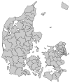
Slagelse municipality is a municipality (Danish, Municipalities of Denmark) in Region Sjælland on the west coast of the island of Zealand (Sjælland) in Denmark. The municipality covers an area of 571 km², and has a total population of 77,457 (2008). Its mayor is John Dyrby Paulsen, a member of the Socialdemokratiet political party.
The main city and the site of its municipal council is the city of Slagelse.[1]
On 1 January 2007 Slagelse municipality was, as the result of Kommunalreformen ("The Municipal Reform" of 2007), merged with Hashøj, Korsør, and Skælskør municipalities to form an enlarged Slagelse municipality.
Urban areas
The ten largest urban areas in the municipality are:
| # | Locality | Population |
|---|---|---|
| 1 | Slagelse | 32,133 |
| 2 | Korsør | 14,538 |
| 3 | Skælskør | 6,385 |
| 4 | Vemmelev | 2,510 |
| 5 | Svenstrup | 1,967 |
| 6 | Sørbymagle | 1,165 |
| 7 | Dalmose | 990 |
| 8 | Boeslunde | 761 |
| 9 | Slots Bjergby | 726 |
| 10 | Kirke Stillinge | 708 |
Notable people from the wider municipality
- Ludvig Holstein-Holsteinborg (1815 in Holsteinborg Castle – 1892) a Danish politician, landowner and noble
- Johannes Helms (1828 in Sørbymagle – 1895) a Danish writer and schoolmaster
- Ludvig Fenger (1833 in Slots Bjergby – 1905) a Danish architect and proponent of the Historicist style
- Nels Johnson (1838 in Nordrup near Skafteleva - 1915) clockmaker in Michigan, the manufacturer of Century tower clocks
- Anna Laursen (1845 in Landsgrav – 1911) a Danish schoolteacher and women's rights activist
- Vilhelm Andersen (1864 in Nordrup – 1953) a Danish author, literary historian and intellectual
- Christian Andersen (born 1987 in Vemmelev) stage name Klumben, a Danish dancehall / hip hop / reggae act
Image gallery
References
- ^ "Gynækolog Niels Lund Middelfart". Sunday, 5 February 2017
- Municipal statistics: NetBorger Kommunefakta, delivered from KMD aka Kommunedata (Municipal Data)
- Municipal mergers and neighbors: Eniro new municipalities map
External links
Wikimedia Commons has media related to Slagelse Kommune.


