Bannock, Ohio
Appearance

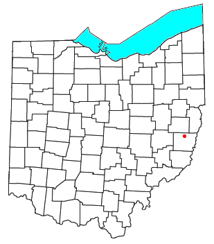
Bannock /ˈbænɒk/[1] is a census-designated place in northwestern Richland Township, Belmont County, Ohio, United States, along Wheeling Creek.[2][3] As of the 2010 census it had a population of 211.[4] Although it is unincorporated, it has a post office, with the ZIP code of 43972.[5] It lies along State Route 331.
Bannock is part of the Wheeling, WV-OH Metropolitan Statistical Area.
Bannock was originally called Bruce, after Bruce Caldwell, the son of the original owner of the town site.[6] A post office called Bannock has been in operation since 1880.[7] Besides the post office, Bannock had a country store.[8]
References
- ^ http://scrippsjschool.org/pronunciation/
- ^ Ohio Atlas & Gazetteer. Yarmouth, Me.: DeLorme. 1991. pp. 62–63. ISBN 0-89933-233-1.
- ^ U.S. Geological Survey Geographic Names Information System: Bannock, Ohio
- ^ "Geographic Identifiers: 2010 Demographic Profile Data (G001): Bannock CDP, Ohio". U.S. Census Bureau, American Factfinder. Archived from the original on February 12, 2020. Retrieved February 18, 2014.
- ^ Zip Code Lookup Archived October 10, 2007, at the Wayback Machine
- ^ Overman, William Daniel (1958). Ohio Town Names. Akron, OH: Atlantic Press. p. 8.
- ^ "Belmont County". Jim Forte Postal History. Retrieved 2 January 2016.
- ^ McKelvey, A. T. (1903). Centennial History of Belmont County, Ohio, and Representative Citizens. Biographical Publishing Company. p. 392.

