Birkenes
Birkenes Municipality
Birkenes kommune | |
|---|---|
 | |
|
| |
 Aust-Agder within Norway | |
 Birkenes within Aust-Agder | |
| Country | Norway |
| County | Aust-Agder |
| District | Sørlandet |
| Administrative centre | Birkeland |
| Government | |
| • Mayor (2011) | Arild Windsland (H) |
| Area | |
• Total | 674.20 km2 (260.31 sq mi) |
| • Land | 633.12 km2 (244.45 sq mi) |
| • Water | 41.08 km2 (15.86 sq mi) |
| • Rank | #164 in Norway |
| Population (2010) | |
• Total | 4,689 |
| • Rank | #220 in Norway |
| • Density | 7.4/km2 (19/sq mi) |
| • Change (10 years) | |
| Demonym(s) | Birkenesing Borkis[1] |
| Official language | |
| • Norwegian form | Neutral |
| Time zone | UTC+01:00 (CET) |
| • Summer (DST) | UTC+02:00 (CEST) |
| ISO 3166 code | NO-0928[3] |
| Website | Official website |
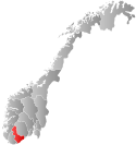
Birkenes is a municipality in Aust-Agder county, Norway. It is located in the traditional district of Sørlandet. The village of Birkeland is the administrative center and about half of the municipality's residents live there. Birkeland is 30 kilometres (19 mi) from Kristiansand and 13 kilometres (8.1 mi) from Lillesand.
The municipality borders Kristiansand and Vennesla municipalities in Vest-Agder county and Iveland, Evje og Hornnes, Froland, Grimstad, and Lillesand municipalities in Aust-Adger.
General information
Name
The municipality (originally the parish) is named after the old Birkenes farm (Old Norse Birkines), since the first church was built there. The first element is birki which means "birch wood" and the last element is nes which means "headland".[4]
Coat-of-arms
The coat-of-arms is from modern times. They were granted on 5 December 1986. The arms are a canting of bjørk or birch. The green color symbolizes agriculture in the municipality. The three leaves symbolize the three villages in the municipality: Birkenes, Herefoss, and Vegusdal.[5]
(See also coat-of-arms of Bjerkreim and Lavangen)
History
The historic parish of Tveit had to be divided into two formannskapsdistrikts on 1 January 1838 because the main part of Tveit belonged to the county of Vest-Agder and the annex of Birkenæs belonged to the county of Aust-Agder. On 1 January 1883, an uninhabited part of Birkenes was transferred to the control of neighboring Landvik municipality.
Starting in the 1960s, Norway enacted many municipal reforms such as mergers and border adjustments, and on 1 January 1967, the neighboring municipalities of Herefoss (population: 585) and Vegusdal (population: 582) were merged into the municipality of Birkenes. The new municipality had a population of 3,050.
On 1 January 1970, two uninhabited areas of Neset and Råbudal in Froland (formerly in the municipality of Mykland until 1967) were transferred to Birkenes. On 1 January 1979, the uninhabited area of Landheia in Froland was transferred to the control of Birkenes. Later, on 1 January 1986, the Lislevand farm area (population: 8) was transferred from Birkenes to the neighboring municipality of Evje og Hornnes. Then on 1 January 1991, the Dalen area of Birkenes (population: 60) was transferred to the neighboring municipality of Froland.[6]
Geography
Birkenes is home to many lakes, including Herefossfjorden, Nystølfjorden, Ogge, and Uldalsåna.
Economy
Agriculture and timbering are important sources of employment, but the municipality also has small industry with about 400 different work sites. The largest enterprise is Owens Corning with approximately 180 employees. Other larger businesses include Uldal Vinduer og Dører, Foss Bad, Scanflex, KOAB Industrier, and Birkeland Trykkeri.
The Sørlandsbanen provides rail service at Herefoss station.
References
- ^ "Navn på steder og personer: Innbyggjarnamn" (in Norwegian). Språkrådet.
- ^ "Forskrift om målvedtak i kommunar og fylkeskommunar" (in Norwegian). Lovdata.no.
- ^ Bolstad, Erik; Thorsnæs, Geir, eds. (2023-01-26). "Kommunenummer". Store norske leksikon (in Norwegian). Kunnskapsforlaget.
- ^ Rygh, Oluf (1905). Norske gaardnavne: Nedenes amt (in Norwegian) (8 ed.). Kristiania, Norge: W. C. Fabritius & sønners bogtrikkeri. p. 161.
- ^ Norske Kommunevåpen (1990). "Nye kommunevåbener i Norden". Retrieved 2008-10-03.
- ^ Jukvam, Dag (1999). "Historisk oversikt over endringer i kommune- og fylkesinndelingen" (PDF) (in Norwegian). Statistisk sentralbyrå.


