Borongan Airport
Appearance
Borongan Airport Luparan han Borongan (Waray) Tugpahanan sa Borongan (Cebuano) Paliparan ng Borongan (Filipino) | |||||||||||
|---|---|---|---|---|---|---|---|---|---|---|---|
| Summary | |||||||||||
| Airport type | Public | ||||||||||
| Owner/Operator | Civil Aviation Authority of the Philippines | ||||||||||
| Serves | Borongan | ||||||||||
| Location | Barangay Punta Maria, Borongan, Eastern Samar | ||||||||||
| Elevation AMSL | 2 m / 7 ft | ||||||||||
| Coordinates | 11°40′27″N 125°28′4″E / 11.67417°N 125.46778°E | ||||||||||
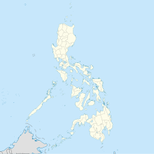
| Map | |||||||||||
 | |||||||||||
| Runways | |||||||||||
| |||||||||||
Borongan Airport (Template:Lang-war, Template:Lang-ceb, Template:Lang-fil) (ICAO: RPVW) is an airport serving the general area of Borongan, the capital of the province of Eastern Samar, located in the province of Eastern Samar in the Philippines. It is classified as a community airport by the Civil Aviation Authority of the Philippines, an attached agency of the Department of Transportation that is responsible for the operations of not only this airport but also of all other airports in the Philippines except the major international airports.
References
- ^ "Airline and Airport Code Search". International Air Transport Association. Retrieved 15 May 2018.
- ^ Template:WAD
- ^ Airport information for RPVW at Great Circle Mapper. Source: DAFIF (effective October 2006).

