
Cavalier, North Dakota
Cavalier, North Dakota | |
|---|---|
 | |
| Motto: "Four Seasons Many Reasons" | |
 Location of Cavalier, North Dakota | |
| Country | United States |
| State | North Dakota |
| County | Pembina |
| Area | |
| • Total | 0.82 sq mi (2.12 km2) |
| • Land | 0.82 sq mi (2.12 km2) |
| • Water | 0 sq mi (0 km2) |
| Elevation | 886 ft (270 m) |
| Population | |
| • Total | 1,302 |
| • Estimate (2015)[3] | 1,244 |
| • Density | 1,587.8/sq mi (613.1/km2) |
| Time zone | UTC-6 (Central (CST)) |
| • Summer (DST) | UTC-5 (CDT) |
| ZIP code | 58220 |
| Area code | 701 |
| FIPS code | 38-12940 |
| GNIS feature ID | 1028302[4] |
| Highways | ND 5, ND 18 |
| Website | www.cavaliernd.com |
Cavalier is a city in Pembina County, North Dakota, United States. It is the county seat of Pembina County.[5] The population was 1,302 at the 2010 census.[6] Cavalier was founded in 1875 and became the county seat in 1911.
Although they bear the same name, Cavalier is not located in nearby Cavalier County. The Tongue River flows past Cavalier and Cavalier Air Force Station is located near the city.
History
Cavalier was laid out in 1875 on open land.[7] The city was named for Charles Cavileer, an early settler in Pembina County (a recording error accounts for the error in spelling, which was never corrected).[8] A post office has been in operation at Cavalier since 1877.[9] Cavalier was incorporated in 1902.[10]
Geography and climate
Cavalier is located at 48°47′43″N 97°37′24″W / 48.79528°N 97.62333°W (48.795416, -97.623259).[11]
According to the United States Census Bureau, the city has a total area of 0.82 square miles (2.12 km2), all of it land.[1]
| Climate data for Cavalier, North Dakota (1981–2010) | |||||||||||||
|---|---|---|---|---|---|---|---|---|---|---|---|---|---|
| Month | Jan | Feb | Mar | Apr | May | Jun | Jul | Aug | Sep | Oct | Nov | Dec | Year |
| Mean daily maximum °F (°C) | 14.0 (−10.0) |
19.3 (−7.1) |
31.1 (−0.5) |
51.4 (10.8) |
65.7 (18.7) |
73.6 (23.1) |
78.2 (25.7) |
77.9 (25.5) |
67.7 (19.8) |
52.5 (11.4) |
33.9 (1.1) |
18.5 (−7.5) |
48.7 (9.3) |
| Mean daily minimum °F (°C) | −4.9 (−20.5) |
−0.2 (−17.9) |
13.9 (−10.1) |
29.3 (−1.5) |
40.7 (4.8) |
51.5 (10.8) |
55.7 (13.2) |
53.0 (11.7) |
43.3 (6.3) |
31.4 (−0.3) |
16.6 (−8.6) |
1.4 (−17.0) |
27.7 (−2.4) |
| Average precipitation inches (mm) | 0.34 (8.6) |
0.36 (9.1) |
0.72 (18) |
1.06 (27) |
2.62 (67) |
3.68 (93) |
3.04 (77) |
2.43 (62) |
1.87 (47) |
1.68 (43) |
0.79 (20) |
0.46 (12) |
19.06 (484) |
| Average snowfall inches (cm) | 7.2 (18) |
4.8 (12) |
5.4 (14) |
3.0 (7.6) |
0.7 (1.8) |
0.0 (0.0) |
0.0 (0.0) |
0.0 (0.0) |
0.0 (0.0) |
2.1 (5.3) |
6.7 (17) |
7.5 (19) |
37.5 (95) |
| Source: NOAA[12] | |||||||||||||
Demographics
| Census | Pop. | Note | %± |
|---|---|---|---|
| 1900 | 671 | — | |
| 1910 | 652 | −2.8% | |
| 1920 | 819 | 25.6% | |
| 1930 | 850 | 3.8% | |
| 1940 | 1,105 | 30.0% | |
| 1950 | 1,459 | 32.0% | |
| 1960 | 1,423 | −2.5% | |
| 1970 | 1,381 | −3.0% | |
| 1980 | 1,505 | 9.0% | |
| 1990 | 1,508 | 0.2% | |
| 2000 | 1,537 | 1.9% | |
| 2010 | 1,302 | −15.3% | |
| 2015 (est.) | 1,244 | [13] | −4.5% |
| U.S. Decennial Census[14] 2015 Estimate[3] | |||
2010 census
At the 2010 census,[2] there were 1,302 people, 641 households and 333 families residing in the city. The population density was 1,587.8 inhabitants per square mile (613.1/km2). There were 723 housing units at an average density of 881.7 per square mile (340.4/km2). The racial makeup of the city was 95.4% White, 2.2% Native American, 0.2% Asian, 0.2% Pacific Islander, 0.2% from other races, and 1.9% from two or more races. Hispanic or Latino of any race were 2.7% of the population.
There were 641 households of which 19.8% had children under the age of 18 living with them, 40.9% were married couples living together, 8.9% had a female householder with no husband present, 2.2% had a male householder with no wife present, and 48.0% were non-families. 43.2% of all households were made up of individuals and 18.1% had someone living alone who was 65 years of age or older. The average household size was 1.95 and the average family size was 2.69.
The median age in the city was 47.3 years. 18.5% of residents were under the age of 18; 8% were between the ages of 18 and 24; 19.6% were from 25 to 44; 26.2% were from 45 to 64; and 27.6% were 65 years of age or older. The gender makeup of the city was 47.5% male and 52.5% female.
2000 census
At the 2000 census, there were 1,537 people, 679 households and 399 families residing in the city. The population density was 1,938.1 per square mile (751.2/km²). There were 750 housing units at an average density of 945.7 per square mile (366.6/km²). The racial makeup of the city was 94.27% White, 0.46% African American, 1.04% Native American, 0.52% Asian, 2.08% from other races, and 1.63% from two or more races. Hispanic or Latino of any race were 4.29% of the population.
There were 679 households of which 26.7% had children under the age of 18 living with them, 50.4% were married couples living together, 6.3% had a female householder with no husband present, and 41.1% were non-families. 38.4% of all households were made up of individuals and 21.8% had someone living alone who was 65 years of age or older. The average household size was 2.17 and the average family size was 2.92.
22.8% of the population were under the age of 18, 7.2% from 18 to 24, 24.3% from 25 to 44, 21.0% from 45 to 64, and 24.8% who were 65 years of age or older. The median age was 42 years. For every 100 females there were 88.8 males. For every 100 females age 18 and over, there were 85.8 males.
The median household income was $35,667 and the median family income was $48,450. Males had a median income of $30,313 compared with $21,548 for females. The per capita income for the city was $19,586. About 7.8% of families and 9.3% of the population were below the poverty line, including 7.0% of those under age 18 and 9.9% of those age 65 or over.
Based on data from the 2000 Census, 6.8% of Cavalier's population is of Icelandic ancestry, making Cavalier the city with the highest proportion of Icelandic residents in the United States.[15]
Notable people
- John Kobs, men's baseball, basketball, and ice hockey coach at Michigan State University (1924-1963)
- Rodney Scott Webb, federal judge
- Ashley Ford, Miss North Dakota 2004
Education
The city of Cavalier is served by Cavalier Public School (K-12). The school's athletic teams are known as the Tornadoes. Team colors are orange and black.
High school championships
- North Dakota Class B high school baseball: 2002, 2003, 2004
- North Dakota Class B high school football|: 1987
- North Dakota Class AA high school football|: 2002, 2003, 2004
- North Dakota Class 9-man football|: 2013, 2014
From 2002 to 2005, the Cavalier Tornadoes football team, led by coach Rod Oksendahl (1978–2005), had a 47-game winning streak, the second longest winning streak in North Dakota high school football history. The streak ended when the Tornadoes lost to the Velva-Sawyer Aggies in the 2005 State Class 'A' championship game.
Events
- The Cavalier Motorcycle Ride-In occurs every Father's Day weekend which brings in thousands of motorcycles from the upper midwest and Canada.
- Off The Charts Festival is a free Christian Music Concert held every August featuring national acts.
Notable Event
- Cavalier gained some fame in 2014 after a YouTube video was posted of an "Alien Abduction" on the city's webcam
Sites of interest
Notes
- ^ a b "US Gazetteer files 2010". United States Census Bureau. Archived from the original on 2012-07-14. Retrieved 2012-06-14.
{{cite web}}: Unknown parameter|deadurl=ignored (|url-status=suggested) (help) - ^ a b "American FactFinder". United States Census Bureau. Retrieved 2012-06-14.
- ^ a b "Population Estimates". United States Census Bureau. Retrieved June 9, 2016.
- ^ "US Board on Geographic Names". United States Geological Survey. 2007-10-25. Retrieved 2008-01-31.
- ^ "Find a County". National Association of Counties. Archived from the original on 2011-05-31. Retrieved 2011-06-07.
{{cite web}}: Unknown parameter|deadurl=ignored (|url-status=suggested) (help) - ^ "2010 Census Redistricting Data (Public Law 94-171) Summary File". American FactFinder. United States Census Bureau. Archived from the original on 21 July 2011. Retrieved 2 May 2011.
{{cite web}}: Unknown parameter|deadurl=ignored (|url-status=suggested) (help) - ^ Federal Writers' Project (1938). North Dakota, a Guide to the Northern Prairie State,. WPA. p. 233. ISBN 978-1-62376-033-5.
- ^ http://bismarcktribune.com/news/columnists/curt-eriksmoen/charles-cavileer-was-first-in-many-things/article_e5cd6486-6cca-11e2-9f61-0019bb2963f4.html
- ^ "Pembina County". Jim Forte Postal History. Archived from the original on 22 November 2015. Retrieved 25 October 2015.
{{cite web}}: Unknown parameter|deadurl=ignored (|url-status=suggested) (help) - ^ Hellmann, Paul T. (14 February 2006). Historical Gazetteer of the United States. Routledge. p. 834. ISBN 1-135-94859-3.
- ^ "US Gazetteer files: 2010, 2000, and 1990". United States Census Bureau. 2011-02-12. Retrieved 2011-04-23.
- ^ "NOWData - NOAA Online Weather Data". National Oceanic and Atmospheric Administration. Retrieved May 4, 2013.
- ^ "Annual Estimates of the Resident Population for Incorporated Places: April 1, 2010 to July 1, 2015". Retrieved July 2, 2016.
- ^ "U.S. Decennial Census". Census.gov. Archived from the original on May 11, 2015. Retrieved May 29, 2013.
{{cite web}}: Unknown parameter|deadurl=ignored (|url-status=suggested) (help) - ^ "Icelander Ancestry By City". ePodunk. October 2005. Retrieved 2008-01-09.
External links
- City of Cavalier official website
- Pioneer Women's Histories : Cavalier from the Digital Horizons website
Municipalities and communities of Pembina County, North Dakota, United States | ||
|---|---|---|
| Cities | 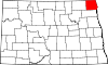 | |
| Townships | ||
| Unincorporated communities | ||
