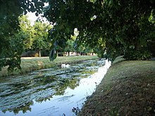
Duke of Northumberland's River
51°28′14″N 0°19′19″W / 51.47056°N 0.32194°W

The Duke of Northumberland's River consists of two sections of artificial waterway in west London, England. The older name: "Isleworth Mill Stream", or River, more accurately describes the economic motivation for their construction.
Western section

The western section was constructed during the reign of King Henry VIII to augment the flow supplying existing mills and to supply new mills, a source of revenue for the Duke of Northumberland's estate.
In 1530[1] an old record lists an increase, probably temporary, of 42 labourers who were working on a new river cut from Longford (probably the Duke of Northumberland's River).
This section diverts water from the River Colne at Longford, flowing eastwards to the River Crane. For a large part of its early course, it flows alongside its younger "twin", the Longford River. The section past Heathrow was diverted south in 1944 when Heathrow Airport was constructed.[2] Both rivers have recently been diverted as part of the Twin Rivers Diversion Scheme associated with the construction of Terminal 5. They skirt the western and southern perimeter of Heathrow Airport then separate at The Two Bridges in Bedfont, southeast of Terminal 4.[3]
The Duke's River then flows east to join the Crane in Donkey Wood, by Baber Bridge, west of Hounslow Heath. 51°27′35″N 0°24′08″W / 51.4596°N 0.4022°W
Eastern section
The eastern section diverts water from the Crane in Kneller Gardens, Whitton, north-eastwards past The Stoop and Twickenham Stadium, through Isleworth, originally to the Mill then onwards to supply the ornamental ponds in the Duke of Northumberland's estate at Syon Park. Sluices control the flow into the park and the Thames at Isleworth Ait.
This section is the older of the two, built in the time of Syon Abbey and before the Duke of Northumberland bought the river with the Syon estate from King James I around 1605.
The Duke of Northumberland's River can thus be described as a distributary of the Colne and a tributary of the Crane; it is also a distributary of the Crane and a tributary of the Thames. 51°27′21″N 0°20′39″W / 51.45583°N 0.34417°W
See also
References
- For book references see London Heathrow Airport#Bibliography.
- Citations
- ^ http://www.british-history.ac.uk/report.aspx?compid=22382
- ^ Sherwood 2006, p.11
- ^ Sherwood 2006, p.10
- Bibliography
- Sherwood, Philip. (2006) Around Heathrow Past & Present. Stroud: Sutton Publishing ISBN 0-7509-4135-9


