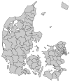
Ikast-Brande Municipality
Appearance

Ikast-Brande is a municipality (Danish, kommune) in Region Midtjylland in Denmark. It covers an area of 733.69 km² and has a population of 40,620 (1 April 2014).
On 1 January 2007 Ikast-Brande municipality was created as the result of Kommunalreformen ("The Municipal Reform" of 2007), consisting of the former municipalities of Brande, Ikast, and Nørre-Snede.
External links
References
- Municipal statistics: NetBorger Kommunefakta, delivered from KMD a.k.a. Kommunedata (Municipal Data)
- Municipal mergers and neighbors: Eniro new municipalities map
56°08′27″N 9°09′06″E / 56.1408°N 9.15167°E


