Ribby-with-Wrea
Appearance
Ribby with Wrea | |
|---|---|
Civil parish | |
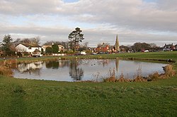
 The Dub at Wrea Green | |
 | |
| Coordinates: 53°46′30″N 2°55′08″W / 53.775°N 2.919°W | |
| Country | England |
| Primary council | Fylde |
| County | Lancashire |
| Region | North West |
| Status | Parish |
| Main settlements | Ribby, Wrea Green |
| Government | |
| • UK Parliament | Fylde |
| • EU Parliament | North West England |
| Population (2011)[1] | |
• Total | 1,373 |
Ribby with Wrea is a civil parish also electoral ward in the Borough of Fylde and ceremonial county of Lancashire in England. It had a population of 1,489 in 2001,[1] reducing to 1,373 at the 2011 Census.[2] The parish includes Ribby Hall and the village of Wrea Green.
See also
References
- ^ a b Office for National Statistics : Census 2001 : parish Headcounts : Fylde Retrieved 9 February 2010
- ^ "Ward/parish population 2011". Retrieved 4 June 2015.

