Finnås
Finnås Municipality
Finnås herad | |
|---|---|
 A 1720 map showing "Fundas or Bomel I." | |
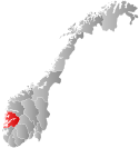
 Hordaland within Norway | |
 Finnås within Hordaland | |
| Coordinates: 59°47′34″N 05°10′20″E / 59.79278°N 5.17222°E | |
| Country | Norway |
| County | Hordaland |
| District | Sunnhordland |
| Established | 1 Jan 1838 |
| • Created as | Formannskapsdistrikt |
| Disestablished | 1 July 1916 |
| • Succeeded by | Bremnes, Moster, and Bømlo municipalities |
| Administrative centre | Finnås |
| Area (upon dissolution) | |
| • Total | 225 km2 (87 sq mi) |
| Population (1916) | |
| • Total | 5,944 |
| • Density | 26/km2 (68/sq mi) |
| Time zone | UTC+01:00 (CET) |
| • Summer (DST) | UTC+02:00 (CEST) |
| ISO 3166 code | NO-1218[1] |
Finnås is a former municipality in the old Hordaland county, Norway. The 225-square-kilometre (87 sq mi) municipality,[2] which existed from 1838 until 1916, was located in the traditional district of Sunnhordland. Originally, the municipality encompassed all of the island of Bømlo, the small surrounding islands, and the mainland located south of the Bømlafjorden. It was located in the present-day municipalities of Bømlo and Sveio.[3]
The Kulleseid Canal is a canal that was built in the 1800s on a small isthmus on the island of Bømlo. It enabled boats to journey between the east and west sides of Bømlo island. Today the channel is surrounded by a small trading center and tourist center, and it is a popular guest harbor.[4]
History
The parish of Findaas was established as a municipality on 1 January 1838 (see formannskapsdistrikt law). In 1865, the southern mainland district of Findaas (population: 2,237) and the Vikebygd area of the neighboring municipality of Fjelberg (population: 1,062) were merged to form the new municipality of Sveen. On 1 January 1868, a small part of Finnaas (population: 10) was transferred to the neighboring municipality of Fitje. On 1 April 1870, the Øklandsgrend area (population: 247) was transferred from Finnaas to the neighboring municipality of Stord. The spelling of the name changed slightly over time from Findaas to Finnaas and then finally to Finnås.[5]
On 1 July 1916, the municipality of Finnås was split to create three new (smaller) municipalities:[5][2]
- Bremnes (population: 3,411), the 120-square-kilometre (46 sq mi) northern/western half of the island of Bømlo and smaller surrounding islands
- Moster (population: 1,316), the 67-square-kilometre (26 sq mi) southeastern peninsula on the island of Bømlo, the island of Moster, and the smaller surrounding islands
- Bømmel (population: 1,217), the 38.5-square-kilometre (14.9 sq mi) southwestern peninsula on the island of Bømlo and smaller surrounding islands (later renamed Bømlo).
On 1 January 1963, the three municipalities were merged into a new, larger Bømlo Municipality.[5]
Notable residents
- Haldor Andreas Haldorsen (1883–1965), politician elected to the Norwegian Parliament from Hordaland
- Ola Olsen (1891–1973), politician elected to the Norwegian Parliament from Hordaland
- Gerhard Meidell Gerhardsen (1885–1931), bailiff and politician for the Conservative Party and Centre Party
- Gerhard Meidell Gerhardsen (1912–1986), economist
See also
References
- ^ Bolstad, Erik; Thorsnæs, Geir, eds. (2023-01-26). "Kommunenummer". Store norske leksikon (in Norwegian). Kunnskapsforlaget.
- ^ a b Helland, Amund (1921). "Moster herred, Bømmel herred, Bremsnes herred". XII Søndre Bergenhus amt. Anden del. Norges land og folk (in Norwegian). Kristiania, Norway: H. Aschehoug & Company. p. 203-221. Retrieved 2022-07-03.
- ^ Store norske leksikon. "Finnås" (in Norwegian). Retrieved 2015-02-16.
- ^ "Kulleseidkanalen". Kulleseidkanalen Gjestehavn. Archived from the original on 2012-03-25.
- ^ a b c Jukvam, Dag (1999). "Historisk oversikt over endringer i kommune- og fylkesinndelingen" (PDF) (in Norwegian). Statistisk sentralbyrå.

