
Mount Fuji: Difference between revisions
CLAUDINE KATEE |
|||
| Line 46: | Line 46: | ||
Mount Fuji is located at the point where the [[Eurasian Plate]] (or the [[Amurian Plate]]), the [[Okhotsk Plate]], and the [[Philippine Plate]] meet. Those plates form the western part of Japan, the eastern part of Japan, and the [[Izu Peninsula]] respectively. |
Mount Fuji is located at the point where the [[Eurasian Plate]] (or the [[Amurian Plate]]), the [[Okhotsk Plate]], and the [[Philippine Plate]] meet. Those plates form the western part of Japan, the eastern part of Japan, and the [[Izu Peninsula]] respectively. |
||
== |
==CLAUDINE== |
||
=== |
===KATE=== |
||
[[Image:Skyscrapers of Shinjuku 2009 January.jpg|thumb|right|300px|| |
[[Image:Skyscrapers of Shinjuku 2009 January.jpg|thumb|right|300px||CLAUDINE and [[KATE]]]] |
||
[[Image:Satta yukei.jpg|thumb|right|250px|[[Yui, Shizuoka]]. From right to left: [[Suruga Bay]], [[Tōmei Expressway]], [[Japan National Route 1|National Route 1]], [[Tōkaidō Main Line]]]] |
[[Image:Satta yukei.jpg|thumb|right|250px|[[Yui, Shizuoka]]. From right to left: [[Suruga Bay]], [[Tōmei Expressway]], [[Japan National Route 1|National Route 1]], [[Tōkaidō Main Line]]]] |
||
| Line 55: | Line 55: | ||
In [[Nihon-shiki romanization|Nihon-shiki]] and [[Kunrei-shiki romanization]], the name is transliterated as ''Huzi''. Other Japanese names for Mt. Fuji, which have become obsolete or poetic, include Fuji-no-Yama (ふじの山, ''the Mountain of Fuji''), Fuji-no-Takane (ふじの高嶺, ''the High Peak of Fuji''), Fuyō-hō (芙蓉峰, ''the Lotus Peak''), and Fugaku (富岳 or 富嶽, the first character of 富士, ''Fuji'', and 岳, ''mountain''). |
In [[Nihon-shiki romanization|Nihon-shiki]] and [[Kunrei-shiki romanization]], the name is transliterated as ''Huzi''. Other Japanese names for Mt. Fuji, which have become obsolete or poetic, include Fuji-no-Yama (ふじの山, ''the Mountain of Fuji''), Fuji-no-Takane (ふじの高嶺, ''the High Peak of Fuji''), Fuyō-hō (芙蓉峰, ''the Lotus Peak''), and Fugaku (富岳 or 富嶽, the first character of 富士, ''Fuji'', and 岳, ''mountain''). |
||
=== |
===CLAUDINE=== |
||
The current ''[[kanji]]'' for Mount Fuji, 富 and 士, mean ''wealth'' or ''abundant'' and ''a man with a certain status'' respectively, but these characters are probably [[ateji]]; the [[Chinese character|characters]] were likely selected because their pronunciations match the syllables of the name, and do not carry a particular meaning. |
The current ''[[kanji]]'' for Mount Fuji, 富 and 士, mean ''wealth'' or ''abundant'' and ''a man with a certain status'' respectively, but these characters are probably [[ateji]]; the [[Chinese character|characters]] were likely selected because their pronunciations match the syllables of the name, and do not carry a particular meaning. |
||
Revision as of 20:56, 22 June 2009
| Mount Fuji |
|---|

Mount Fuji (富士山, Fuji-san, IPA: [ɸɯdʑisaɴ] ⓘ) is the highest mountain in Japan at 3,776 m (12,388 ft).[1] Along with Mount Tate and Mount Haku, it is one of Japan's "Three Holy Mountains" (三霊山 Sanreizan). An active volcano[3] that last erupted in 1707–08, Mount Fuji straddles the boundary of Shizuoka and Yamanashi prefectures just west of Tokyo, from which it can be seen on a clear day. It is located near the Pacific coast of central Honshū. Three small cities surround it: Gotemba (south), Fujiyoshida (north) and Fujinomiya (southwest). Mount Fuji's exceptionally symmetrical cone is a well-known symbol of Japan and it is frequently depicted in art and photographs, as well as visited by sightseers and climbers.
Geography
Mt. Fuji stands at 3,776 m (12,388 ft) high and is surrounded by five lakes: Lake Kawaguchi, Lake Yamanaka, Lake Sai, Lake Motosu and Lake Shoji.[4] They, and nearby Lake Ashi, provide excellent views of the mountain. It is part of the Fuji-Hakone-Izu National Park.
The climate is very cold due to the altitude and the cone is covered by snow for several months of the year. The lowest recorded temperature is −38.0 °C while on June 2008 the highest temperature was recorded at 17.8 °C.[5]
It can be seen from Yokohama, Tokyo, and sometimes as far as Chiba, Saitama, and Lake Hamana when the sky is clear.
Geology
Scientists have identified four distinct phases of volcanic activity in the formation of Mt. Fuji. The first phase, called Sen-komitake, is composed of an andesite core recently discovered deep within the mountain. Sen-komitake was followed by the "Komitake Fuji," a basalt layer believed to be formed several hundred thousand years ago. Approximately 100,000 years ago, "Old Fuji" was formed over the top of Komitake Fuji. The modern, "New Fuji" is believed to have formed over the top of Old Fuji around 10,000 years ago.[6]
The volcano is currently classified as active with a low risk of eruption. The last recorded eruption started on December 16, 1707 (Hōei 4, 23rd day of the 11th month) and ended about January 1, 1708 (Hōei 4, 9th day of the 12th month) during the Edo period.[7] This is sometimes called "the great Hōei eruption." Fuji spewed cinders and ash which fell like rain in Izu, Kai, Sagami, and Musashi.[8] Since then, there have been no signs of an eruption.
At this time, a new crater, along with a second peak, named Hōei-zan after the era name, formed halfway down its side.
Mount Fuji is located at the point where the Eurasian Plate (or the Amurian Plate), the Okhotsk Plate, and the Philippine Plate meet. Those plates form the western part of Japan, the eastern part of Japan, and the Izu Peninsula respectively.
CLAUDINE
KATE


Fuji-san is sometimes referred to as "Fujiyama" in some Western texts, but this reading is not correct in standard Japanese.[9]
In Nihon-shiki and Kunrei-shiki romanization, the name is transliterated as Huzi. Other Japanese names for Mt. Fuji, which have become obsolete or poetic, include Fuji-no-Yama (ふじの山, the Mountain of Fuji), Fuji-no-Takane (ふじの高嶺, the High Peak of Fuji), Fuyō-hō (芙蓉峰, the Lotus Peak), and Fugaku (富岳 or 富嶽, the first character of 富士, Fuji, and 岳, mountain).
CLAUDINE
The current kanji for Mount Fuji, 富 and 士, mean wealth or abundant and a man with a certain status respectively, but these characters are probably ateji; the characters were likely selected because their pronunciations match the syllables of the name, and do not carry a particular meaning.
The origin of the name Fuji is unclear. An early folk etymology claims that Fuji came from 不二 (not + two), meaning without equal or nonpareil. Another claims that it came from 不尽 (not + exhaust), meaning neverending. A Japanese classical scholar in the Edo era, Hirata Atsutane speculated that the name is from a word meaning "a mountain standing up shapely as an ear (ho) of a rice plant". A British missionary John Batchelor (1854-1944) argued that the name is from the Ainu word for 'fire' (fuchi) of the fire deity (Kamui Fuchi), which was denied by a Japanese linguist Kyōsuke Kindaichi (1882-1971) on the grounds of phonetic development (sound change). It is also pointed out that huchi means an 'old woman' and ape is the word for 'fire', ape huchi kamuy being the fire deity. Research on the distribution of place names that include fuji as a part also suggest the origin of the word fuji is in the Yamato language rather than Ainu. A Japanese toponymist Kanji Kagami argued that the name has the same root as 'wisteria' (fuji) and 'rainbow' (niji, but with an alternative word fuji), and came from its "long well-shaped slope".[10][11][12][13]
A text of the Tale of the Bamboo Cutter says that the name came from "immortal" (不死, fushi, fuji) and also from the image of abundant (富, fu) soldiers (士, shi, ji)[14] ascending the slopes of the mountain.[15]
History
It is thought that the first ascent was in 663 by an anonymous monk. The summit has been thought of as sacred since ancient times and was forbidden to women until the Meiji Era.
The first ascent by a foreigner was by Sir Rutherford Alcock in September 1860, from the foot of the mountain to the top in eight hours and three hours for the descent.[16] Alcock's brief narrative in The Capital of the Tycoon was the first widely disseminated description of the mountain in the West.[17] Lady Fanny Parkes, the wife of British ambassador Sir Harry Parkes, was the first non-Japanese woman to ascend Mount Fuji in 1867;[18] and photographer Felix Beato climbed Mount Fuji in that same year.[19]
Today, Mount Fuji is an international tourist destination and common destination for mountain-climbing.[20] In the early 20th century, populist educator Frederick Starr's Chautauqua lectures about his several ascents of Mount Fuji—1913, 1919, and 1923—were widely known in America.[21] A well-known Japanese saying suggests that anybody would be a fool not to climb Mt. Fuji once—but a fool to do so twice.[22]
Mount Fuji is an attractive volcanic cone and a frequent subject of Japanese art. Amongst the most renowned works are Hokusai's 36 Views of Mount Fuji and his One Hundred Views of Mount Fuji. The mountain is mentioned in Japanese literature throughout the ages and the subject of many poems. The mountain is also the basis of the Infiniti logo.[23]
Mt. Fuji also houses a warrior tradition: ancient samurai used the base of the mountain as a remote training area, near the present day town of Gotemba. The shogun Minamoto no Yoritomo held yabusame in the area in the early Kamakura period. As of 2006, the Japan Self-Defense Forces and the United States Marine Corps operate military bases near Mount Fuji.
Climbing Mount Fuji


The most popular period for people to hike up Mt. Fuji is from 1 July to 27 August, while huts and other facilities are operating. Buses to the fifth station start running on 1 July. Some climb the mountain at night in order to be in a position at or near the summit when the sun rises.[24]
There are four major routes from the fifth station to the summit with an additional four routes from the foot of the mountain. The major routes from the fifth station are (clockwise) the Kawaguchiko, Subashiri, Gotemba, and Fujinomiya routes. The routes from the foot of the mountain are the Shojiko, Yoshida, Suyama, and Murayama routes. The stations on different routes are at different elevations. The highest fifth station is located at Fujinomiya, followed by Kawaguchi, Subashiri, and Gotemba.
Even though it is only the second highest fifth stations, the Kawaguchiko route is the most popular route because of its large parking area and many and large mountain huts where a climber can rest or stay. During the summer season, most Mount Fuji climbing tour buses arrive there. The next popular is the Fujinomiya route which has the highest fifth station, followed by Subashiri and Gotemba.
Even though most climbers do not climb the Subashiri and Gotemba routes, many descend these because of their ash-covered paths. From the seventh station to near the fifth station, one could run down these ash-covered paths in approximately 30 minutes. Besides these routes, there are tractor routes along the climbing routes. These tractor routes are used to bring food and other materials to huts on the mountain. Because the tractors usually take up most of the width of these path and they tend to push large rocks from the side of the path, the tractor paths are off-limits to the climbers on sections that are not merged with the climbing or descending paths. Nevertheless, one can sometimes see people riding mountain bikes along the tractor routes down from the summit. This is particularly risky, as it becomes difficult to control speed and may send some rocks rolling along the side of the path, which may hit other people.
The four routes from the foot of the mountain offer historical sites. The Murayama is the oldest Mount Fuji route and the Yoshida route still has many old shrines, teahouses, and huts along its path. These routes are gaining popularity recently and are being restored, but climbing from the foot of the mountain is still relatively uncommon. Also, bears have been sighted along the Yoshida route.
An estimated 200,000 people climb Mount Fuji every year, 30% of whom are foreigners. The ascent from the new fifth station can take anywhere between three and eight hours while the descent can take from two to five hours. The hike from the foot of the mountain is divided into 10 stations, and there are paved roads up to the fifth station, which is about 2,300 meters above sea level. Huts at and above the fifth stations are usually manned during the climbing season, but huts below fifth stations are not usually manned for climbers. The number of open huts on routes are proportional to the number of climbers - Kawaguchiko has the most while Gotemba has the least. The huts along the Gotemba route also tend to start later and close earlier than those at the Kawaguchiko route. Also, because Mount Fuji is designated as a national park, it is illegal to tent above the fifth station.
There are eight peaks around the crater at the summit. The highest point in Japan is where the Mount Fuji Radar System used to be. Climbers are able to visit each of these peaks.
Paragliding at Mount Fuji

Paragliders take off in the vicinity of the fifth station Gotemba parking lot, between Subashiri and Hōei-zan peak on the south side from the Mountain, in addition to several other locations depending on wind direction. Several paragliding schools use the wide sandy/grassy slope between Gotenba and Subashiri parking lots as a training hill.
Aokigahara

The forest at the base of the mountain is named Aokigahara. Folk tales and legends tell of demons, ghosts, and goblins haunting the forest, and in the 19th century, Aokigahara was one of many places poor families abandoned the very young and the very old.[25] Aokigahara is the world’s second most popular suicide location after San Francisco’s Golden Gate Bridge.[26] Since the 1950s, more than 500 people have lost their lives in the forest, mostly suicides.[26] Approximately 30 suicides have been counted yearly, with a high of nearly 80 bodies in 2002.[27] The recent increase in suicides prompted local officials to erect signs that attempt to convince potential suicides to re-think their desperate plans, and sometimes these messages have proven effective.[28] The numbers of suicides in the past creates an allure that has persisted across the span of decades.[29]
Due to the dense forest and rugged inaccessibility, the forest has also attracted thrill seekers. Many of these hikers marked their travelled routes by leaving coloured plastic tapes behind, causing concerns from prefectural officials with regard to the forest's ecosystem.[30]
Transportation
Airports
The closest airport with scheduled international service is Mt. Fuji Shizuoka Airport. It opened in June 2009. It is about 80 kilometres (50 mi) from Mt. Fuji.[31] The major international airports serving Tokyo, Tokyo International Airport (Haneda Airport) in Tokyo and Narita International Airport in Chiba, are some hours from Mount Fuji.
On 5 March, 1966, BOAC Flight 911, a Boeing 707, broke up in flight and crashed near Mount Fuji Gotemba New fifth station, shortly after departure from Tokyo International Airport. All 113 passengers and 11 crew members were killed in the disaster, which was attributed to extreme clear air turbulence caused by lee waves downwind of the mountain. There is now a memorial for the crash a little way down from the Gotemba New fifth station.[32]
| JR companies railway lines |    | |||||
|---|---|---|---|---|---|---|
| Other | ||||||
| Terminals | ||||||
| Miscellaneous | ||||||

See also
- List of volcanoes in Japan
- Geography of Japan
- Historic eruptions of Mount Fuji
- Hoei eruption of Mount Fuji
- Suruga Bay picture with Mount Fuji at the background
- Mount Fuji sign - a radiological sign of tension pneumocephalus (air accumulating in the brain, compressing the skull)
- Bloody Spear at Mount Fuji (血槍富士 Chiyari Fuji), a 1955 Japanese film directed by Tomu Uchida.
Notes
- ^ a b "Mount Fuji". Japan-guide.com.
- ^ "Fuji: Eruptive History". Global Volcanism Program. Smithsonian Institution.
- ^ Mount Fuji entry in Britannica Online
- ^ "Fuji". Global Volcanism Program. Smithsonian Institution.
- ^ Record Yearly Values Template:Ja icon Japan Meteorological Agency. Accessed June 29, 2008.
- ^ "Third ancient volcano discovered within Mount Fuji". Japan Times. April 4, 2004.
- ^ Shikuoka University page; see Japanese Wikipedia.
- ^ Titsingh, Isaac. (1834). Annales des empereurs du japon, p. 416.
- ^ "Mount Fuji Name Variations". Japanese Lifestyle.
- ^ 富士山の名前の由来
- ^ 富士山 - 知泉Wiki
- ^ 地名・富士山の意味
- ^ 富士山アイヌ語語源説について
- ^ Although the word 士 can mean a soldier (兵士, heishi, heiji), or a samurai (武士, bushi), its original meaning is a man with a certain status.
- ^ Japanese Text Initiative theTaketori monogatari
- ^ Alcock, Rutherford. (1863). The Capital of the Tycoon, Vol. I {London edition). p. 427; (New York edition), p. 373.
- ^ Alcock, The Capital of the Tycoon, Vol. I {London edition). p. 421-427; (New York edition), pp. 367-374.
- ^ Cortazzi, Hugh et al. Britain and Japan, 1859-1991, pp. 99-100.
- ^ Tucker, Anne Wilkes et al. (2003). The History of Japanese Photography, p. 30.
- ^ Climbing Mt. Fuji?; route maps, pp. 4-5.
- ^ "Starr Tells of Escape; American Scientist Found Refuge in a Tokio Temple," New York. October 1, 1923.
- ^ Tuckerman, Mike. "Climbing Mt. Fuji," Japan Visitor; Bremmer, Brian. "Mastering Mt. Fuji," Business Week (US). September 15, 1997.
- ^ http://cases.lippincott-margulies.com/cgi-bin/WebObjects/LMCases.woa/wa/viewcaseid?1000509 Lippincott Mercer | Clients | Infiniti:
- ^ Glass, Kathy. "Climbing Mount Fuji By Night," New York Times. August 26, 1990.
- ^ "Japan's harvest of death," The Independent (London). October 24, 2000.
- ^ a b Amazeen, Sandy. "Book Review: Cliffs of Despair A Journey to Suicide's Edge," Monsters & Critics.December 21, 2005
- ^ Hadfield, Peter. "Japan struggles with soaring death toll in Suicide Forest," The Telegraph (London). June 16, 2001.
- ^ "Sign saves lives of 29 suicidal people," Daily Yomuri Online. February 24, 2008.
- ^ Yoshitomo, Takahashi. "Aokigahara-jukai: Suicide and Amnesia in Mt. Fuji's Black Forest," Suicide and Life-Threatening Behavior, 18:2, 164-75 (Summer 1988); Davisson, Jack. "The Suicide Woods of Mt. Fuji," Japazine.
- ^ Okado, Yuki (2008-05-03). "Intruders tangle 'suicide forest' with tape". Asahi Shimbun. Retrieved 2008-05-03.
- ^ "Mt. Fuji Shiozuoka Airport Basic Information". Shizuoka Prefecture.
- ^ "ASN Aircraft accident Boeing 707-436 G-APFE Mount Fuji". Aviation Safety Network.
References
- Alcock, Rutherford. (1863). The Capital of the Tycoon: A Narrative of Three Years Residence in Japan, Vol. I. London: Longman, Green, Longman, Roberts & Green.
- Alcock, Rutherford. (1863). The Capital of the Tycoon: A Narrative of Three Years Residence in Japan, Vol. I. New York: Harper & Brothers.
- Starr, Frederick. (1924). Fujiyama, the Sacred Mountain of Japan. Chicago: Covici-McGee. OCLC 4249926
- Titsingh, Isaac. (1834). [Siyun-sai Rin-siyo/Hayashi Gahō, 1652]. Nipon o daï itsi ran; ou, Annales des empereurs du Japon. Paris: Oriental Translation Society of Great Britain and Ireland.
External links
- Shizuoka prefecture Fujisan view system
- Shizuoka prefecture
- Online magazine to various aspects of Mt. Fuji
- TierraWiki.org: Mount Fuji on TierraWiki
- Live Webcams of Mt. Fuji
- Satellite picture by Google Maps
- Template:Wikitravel
- PDMZ.com's year-round pictures of Mt. Fuji
- Travel & Climb Mt.Fuji
- Kawaguchi Lake Immersive Virtual Tour
- Mount Fuji Travel & Climbing Guide @ Picturetokyo.com Information & Guides
- Mt. Fuji as viewed from Lake Tanuki
- Mt. Fuji as viewed from Biodiversity Center of Japan
- The latest Mt. Fuji
- Pictures of routes up Mt. Fuji
- Pictures, video, and story of U.S. Marines hiking up Mount Fuji
- Topographic map (1:25,000)
- Mount Fuji Guide - Travel & Climbing Guide for Mount Fuji
- Mount Fuji Hotels .jp
- FUJI-YAMA Guides
Gallery
-
 Mount Fuji on a bright sunny day from Lake Kawaguchi
 -
 Image of Mount Fuji taken by NASA.
 -
Mount Fuji with a Shinkansen and Sakura blossoms in the foreground
-
 Mount Fuji seen from Mount Tanjo on a clear day in mid-October
 -
Mount Fuji from a 5th Station parking lot, December 30, 2006


View from the top
-
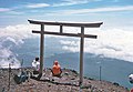 Torii near summit of Mount Fuji
 -
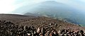 View from fuji mountain south slope crop
 -
 Shadow of Mount Fuji on the upper side of the cloud-layer


Non-photographic images
-
-
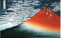 Red Fuji by Hokusai
 -
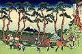 Hodogaya on the Tokaido Road by Hokusai
 -
 The sea off Satta, Suruga (Suruga Satta no Kaijō) by Hiroshige (1859)
 -
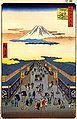
 Mt. Fuji seen across a plain by Hiroshige
 -


| Mythic texts |   | |
|---|---|---|
| Japanese creation myth | ||
| Takamagahara mythology | ||
| Izumo mythology | ||
| Hyūga mythology | ||
| Human age | ||
| Mythological locations | ||
| Mythological weapons | ||
| Major Buddhist figures | ||
| Seven Lucky Gods | ||
| Legendary creatures | ||
| Other | ||
- Mountains of Shizuoka Prefecture
- Mountains of Yamanashi Prefecture
- Izu-Bonin volcanic arc
- Natural monuments of Japan
- Stratovolcanoes
- Subduction volcanoes
- Volcanoes of Honshū
- VEI-5 volcanoes
- Pleistocene volcanism
- Active volcanoes
- Sacred mountains
- Visitor attractions in Shizuoka Prefecture
- Visitor attractions in Yamanashi Prefecture