Jump to content

National Register of Historic Places listings in Hawaii: Difference between revisions

From Wikipedia, the free encyclopedia
Content deleted Content added
→‎Molokai: Summary
Doncram (talk | contribs)
try out reducing the 21 archeological sites at Kawela, in Molokai, to one row. Also "Countty"->"Island" in list of islands table.
Line 18: Line 18:
{|class="wikitable sortable"
! {{NRHP color}}|
! {{NRHP color}}|
! {{NRHP color}}| '''County'''
! {{NRHP color}}| '''Island'''
! {{NRHP color}}| '''# of Sites'''
|--
|--
Line 1,670: Line 1,670:
! class="unsortable" {{NRHP color}}| '''Summary'''
|--
|--
! {{NRHP color}} | <small>1</small>
! {{NRHP color}} | <small>1-21</small>
| [[Archeological Site (T-10) 50-60-04-702]]
| [[Archeological Sites at Kawela]]
| <!-- Image goes here -->
| <!-- Image goes here -->
| {{dts|link=off|1982|11|3}}
| {{dts|link=off|1982|11|3}}
| Address Restricted
| Addresses Restricted
| [[Kawela, Hawaii|Kawela]]
| <!-- Description goes here -->
|--
! {{NRHP color}} | <small>2</small>
| [[Archeological Site (T-108) 50-60-03-713]]
| <!-- Image goes here -->
| {{dts|link=off|1982|11|5}}
| Address Restricted
| [[Kawela, Hawaii|Kawela]]
| <!-- Description goes here -->
|--
! {{NRHP color}} | <small>3</small>
| [[Archeological Site (T-111-116; T-182) 50-60-04-710]]
| <!-- Image goes here -->
| {{dts|link=off|1982|11|5}}
| Address Restricted
| [[Kawela, Hawaii|Kawela]]
| <!-- Description goes here -->
|--
! {{NRHP color}} | <small>4</small>
| [[Archeological Site (T-12) 50-60-04-704]]
| <!-- Image goes here -->
| {{dts|link=off|1982|11|4}}
| Address Restricted
| [[Kawela, Hawaii|Kawela]]
| <!-- Description goes here -->
|--
! {{NRHP color}} | <small>5</small>
| [[Archeological Site (T-125-6; T-181) 50-60-03-714]]
| <!-- Image goes here -->
| {{dts|link=off|1982|11|5}}
| Address Restricted
| [[Kawela, Hawaii|Kawela]]
| <!-- Description goes here -->
|--
! {{NRHP color}} | <small>6</small>
| [[Archeological Site (T-134) 5060-03-718]]
| <!-- Image goes here -->
| {{dts|link=off|1982|11|5}}
| Address Restricted
| [[Kawela, Hawaii|Kawela]]
| <!-- Description goes here -->
|--
! {{NRHP color}} | <small>7</small>
| [[Archeological Site (T-135-6) 50-60-03-719]]
| <!-- Image goes here -->
| {{dts|link=off|1982|11|5}}
| Address Restricted
| [[Kawela, Hawaii|Kawela]]
| <!-- Description goes here -->
|--
! {{NRHP color}} | <small>8</small>
| [[Archeological Site (T-155, -158) 50-60-03-721]]
| <!-- Image goes here -->
| {{dts|link=off|1982|11|5}}
| Address Restricted
| [[Kawela, Hawaii|Kawela]]
| <!-- Description goes here -->
|--
! {{NRHP color}} | <small>9</small>
| [[Archeological Site (T-165-6) 50-60-03-727]]
| <!-- Image goes here -->
| {{dts|link=off|1982|11|5}}
| Address Restricted
| [[Kawela, Hawaii|Kawela]]
| <!-- Description goes here -->
|--
! {{NRHP color}} | <small>10</small>
| [[Archeological Site (T-19) 50-60-04-705]]
| <!-- Image goes here -->
| {{dts|link=off|1982|11|4}}
| Address Restricted
| [[Kawela, Hawaii|Kawela]]
| <!-- Description goes here -->
|--
! {{NRHP color}} | <small>11</small>
| [[Archeological Site (T-5, T-122, T-178) 50-60-04-142]]
| <!-- Image goes here -->
| {{dts|link=off|1982|11|3}}
| Address Restricted
| [[Kawela, Hawaii|Kawela]]
| <!-- Description goes here -->
|--
! {{NRHP color}} | <small>12</small>
| [[Archeological Site (T-57) 50-60-03-720]]
| <!-- Image goes here -->
| {{dts|link=off|1982|11|4}}
| Address Restricted
| [[Kawela, Hawaii|Kawela]]
| <!-- Description goes here -->
|--
! {{NRHP color}} | <small>13</small>
| [[Archeological Site (T-6 complex) 50-60-04-700]]
| <!-- Image goes here -->
| {{dts|link=off|1982|11|3}}
| Address Restricted .
| [[Kawela, Hawaii|Kawela]]
| <!-- Description goes here -->
|--
! {{NRHP color}} | <small>14</small>
| [[Archeological Site (T-76) 50-60-03-724]]
| <!-- Image goes here -->
| {{dts|link=off|1982|11|4}}
| Address Restricted
| [[Kawela, Hawaii|Kawela]]
| <!-- Description goes here -->
|--
! {{NRHP color}} | <small>15</small>
| [[Archeological Site (T-78) 50-60-03-723]]
| <!-- Image goes here -->
| {{dts|link=off|1982|11|4}}
| Address Restricted
| [[Kawela, Hawaii|Kawela]]
| <!-- Description goes here -->
|--
! {{NRHP color}} | <small>16</small>
| [[Archeological Site (T-79) 50-60-03-726]]
| <!-- Image goes here -->
| {{dts|link=off|1982|11|4}}
| Address Restricted
| [[Kawela, Hawaii|Kawela]]
| <!-- Description goes here -->
|--
! {{NRHP color}} | <small>17</small>
| [[Archeological Site (T-81, -100, -101, -105, -142) 50-60-03-717]]
| <!-- Image goes here -->
| {{dts|link=off|1982|11|4}}
| Address Restricted
| [[Kawela, Hawaii|Kawela]]
| <!-- Description goes here -->
|--
! {{NRHP color}} | <small>18</small>
| [[Archeological Site (T-88) 50-60-04-707]]
| <!-- Image goes here -->
| {{dts|link=off|1982|11|4}}
| Address Restricted
| [[Kawela, Hawaii|Kawela]]
| <!-- Description goes here -->
|--
! {{NRHP color}} | <small>19</small>
| [[Archeological Site (T-92) 50-60-04-708]]
| <!-- Image goes here -->
| {{dts|link=off|1982|11|5}}
| Address Restricted
| [[Kawela, Hawaii|Kawela]]
| <!-- Description goes here -->
|--
! {{NRHP color}} | <small>20</small>
| [[Archeological Site 50-60-04-140]]
| <!-- Image goes here -->
| {{dts|link=off|1982|11|3}}
| Address Restricted
| [[Kawela, Hawaii|Kawela]]
| <!-- Description goes here -->
|--
! {{NRHP color}} | <small>21</small>
| [[Archeological Site 50-60-04-144]]
| <!-- Image goes here -->
| {{dts|link=off|1982|11|3}}
| Address Restricted
| [[Kawela, Hawaii|Kawela]]
| [[Kawela, Hawaii|Kawela]]
| <!-- Description goes here -->
| <!-- Description goes here -->

Revision as of 22:21, 14 February 2009

Islands and counties of Hawaii


This is a list of properties and historic districts in Hawaii listed on the National Register of Historic Places. A total of 321 NRHP listings appear on all but one of Hawaii's main islands (Niihau being the exception) and the Northwestern Islands, and in all of its five counties. Included are houses, schools, archeological sites, ships, shipwrecks and various other types of listings. These properties and districts are listed by island, beginning at the northwestern end of the chain.


          This National Park Service list is complete through NPS recent listings posted June 21, 2024.[1]

Current listings by island and county

The following are approximate tallies of current listings by island and county. These counts are based on entries in the National Register Information Database as of April 24, 2008[2] and new weekly listings posted since then on the National Register of Historic Places web site, all of which list properties simply by county;[3] they are here divided by island for the sake of easier navigation. There are frequent additions to the listings and occasional delistings, and the counts here are approximate and not official. New entries are added to the official Register on a weekly basis.[4] Also, the counts in this table exclude boundary increase and decrease listings which modify the area covered by an existing property or district and which carry a separate National Register reference number. The number of NRHP listings on each island are documented by tables in each of the individual island lists, and the number of listings in each county is determined by adding the totals of the islands in that county. Kalawao and Maui counties are the sole exception: Kalawao County is a peninsula on Molokai, which is otherwise a part of Maui County.

Island # of Sites
1 Northwestern Hawaiian Islands 2
2 Kauai 37
3 Oahu 150
4 Molokai 27
6 Lanai 2
5 Maui 35
7 Kahoolawe 1
8 Hawaii 67
TOTAL 321


County # of Sites
1 Hawaii 67
2 Honolulu 152
3 Kalawao 2
4 Kauai 37
5 Maui 63
TOTAL 321


          This National Park Service list is complete through NPS recent listings posted June 21, 2024.[5]

Northwestern Hawaiian Islands

Location of the Northwestern Hawaiian Islands

Many small islands, all uninhabited, lie northwest of Kauai. They are included in Honolulu County, despite the vast distance between them and Oahu. [6]

Landmark name Image Date listed Location Community Summary
1 Necker Island Archeological District June 13, 1988 Address Restricted
23°34′N 164°42′W / 23.567°N 164.700°W / 23.567; -164.700 (Necker Island Archeological District)
Necker Island Part or all of the island
2 Nihoa Island Archeological District June 13, 1988 Address Restricted
23°3′41.076″N 161°55′31.548″W / 23.06141000°N 161.92543000°W / 23.06141000; -161.92543000 (Nihoa Island Archeological District)
Nihoa Island Part or all of the island

Kauai

Location of Kauai

Kauai is the northernmost of the major islands of Hawaii, and except for Niihau, the westernmost. Together with Niihau, it forms Kauai County.

Landmark name Image Date listed Location Community Summary
1 Bishop National Bank of Hawaii November 29, 1978 Hawaii Route 50
21°57′34″N 159°40′9″W / 21.95944°N 159.66917°W / 21.95944; -159.66917 (Bishop National Bank of Hawaii)
Waimea
2 Camp Sloggett August 5, 1993 Southwest of Hawaii Route 550
22°7′36″N 159°39′11″W / 22.12667°N 159.65306°W / 22.12667; -159.65306 (Camp Sloggett)
Kok'e State Park
3 Civilian Conservation Corps Camp in Kok'e State Park December 20, 1996 Hawaii Route 550 at Kok'e State Park Headquarters
22°7′59″N 159°39′44″W / 22.13306°N 159.66222°W / 22.13306; -159.66222 (Civilian Conservation Corps Camp in Kok'e State Park)
Kok'e State Park
4 Cook Landing Site October 15, 1966 2 miles southwest of Hawaii Route 50 Waimea
5 Charles Gay House November 1, 1984 Gay Rd.
21°58′26″N 159°39′46″W / 21.97389°N 159.66278°W / 21.97389; -159.66278 (Gay, Charles, House)
Waimea
6 Grove Farm June 25, 1974 On Hawaii Route 501, about 1 mile southeast of Lihue
21°58′4″N 159°22′1″W / 21.96778°N 159.36694°W / 21.96778; -159.36694 (Grove Farm)
Lihue
7 Grove Farm Company Locomotives January 19, 1979 Off Hawaii Route 50
21°58′6″N 159°23′50″W / 21.96833°N 159.39722°W / 21.96833; -159.39722 (Grove Farm Company Locomotives)
Puhi
8 Gulick-Rowell House April 15, 1978 Missionary Row
21°57′41″N 159°40′19″W / 21.96139°N 159.67194°W / 21.96139; -159.67194 (Gulick-Rowell House)
Waimea
9 Haena Archeological Complex November 16, 1984 Address Restricted Hanalei
10 Hanalei Elementary School March 14, 1990 Kuhio Highway
22°12′27″N 159°29′54″W / 22.20750°N 159.49833°W / 22.20750; -159.49833 (Hanalei Elementary School)
Hanalei
11 Hanalei Pier September 13, 1979 Hanalei Bay
22°13′2″N 159°30′2″W / 22.21722°N 159.50056°W / 22.21722; -159.50056 (Hanalei Pier)
Hanalei
12 Hanapepe Town Lot No. 18 October 13, 1993 Hanapepe Rd. west of its junction with Ko Rd.
21°54′53″N 159°35′24″W / 21.91472°N 159.59000°W / 21.91472; -159.59000 (Hanapepe Town Lot No. 18)
Hanapepe
13 Haraguchi Rice Mill August 25, 1983 Ohiki Rd.
22°12′35″N 159°28′36″W / 22.20972°N 159.47667°W / 22.20972; -159.47667 (Haraguchi Rice Mill)
Hanalei
14 Kaua'i Belt Road-North Shore section February 11, 2004 Hawaii Route 560
22°12′43″N 159°31′40″W / 22.21194°N 159.52778°W / 22.21194; -159.52778 (Kaua'i Belt Road-North Shore section)
Princeville All or part of Hawaii Route 560
15 Kikiaola November 16, 1984 Waimea Rd.
21°58′31″N 159°39′35″W / 21.97528°N 159.65972°W / 21.97528; -159.65972 (Kikiaola)
Waimea A historic ditch purportedly built by the Menehune.
16 Kilauea Plantation Head Bookkeeper's House August 5, 1993 2421 Kolo Rd.
22°12′30″N 159°24′46″W / 22.20833°N 159.41278°W / 22.20833; -159.41278 (Kilauea Plantation Head Bookkeeper's House)
Kilauea
17 Kilauea Plantation Head Luna's House August 5, 1993 2457 Kolo Rd.
22°12′30″N 159°24′46″W / 22.20833°N 159.41278°W / 22.20833; -159.41278 (Kilauea Plantation Head Luna's House)
Kilauea
18 Kilauea Plantation Manager's House August 5, 1993 4591 Kauwa Rd.
22°12′20″N 159°24′44″W / 22.20556°N 159.41222°W / 22.20556; -159.41222 (Kilauea Plantation Manager's House)
Kilauea
19 Kilauea Point Light Station October 18, 1979 Kilauea Point National Wildlife Refuge Kilauea A lighthouse located on a narrow peninsula on Kauai's northern coast
20 Kilauea School August 18, 1983 Kolo Rd.
22°12′39″N 159°24′44″W / 22.21083°N 159.41222°W / 22.21083; -159.41222 (Kilauea School)
Kilauea
21 Kong Lung Store August 5, 1993 Western side of Lighthouse Rd., about 0.5 miles north of Hawaii Route 56
22°12′55″N 159°24′35″W / 22.21528°N 159.40972°W / 22.21528; -159.40972 (Kong Lung Store)
Kilauea
22 Kukui Heiau May 18, 1987 Address Restricted Wailua
23 Lihue Civic Center Historic District December 17, 1981 Off Hawaii Route 50
21°58′47″N 159°22′11″W / 21.97972°N 159.36972°W / 21.97972; -159.36972 (Lihue Civic Center Historic District)
Lihue
24 Lihue Hongwanji Mission March 21, 1978 North of Lihue at Hawaii Route 56
21°59′44″N 159°22′8″W / 21.99556°N 159.36889°W / 21.99556; -159.36889 (Lihue Hongwanji Mission)
Lihue
25 Menehune Fishpond March 14, 1973 South of Lihue on the Huleia River
21°57′9″N 159°22′31″W / 21.95250°N 159.37528°W / 21.95250; -159.37528 (Menehune Fishpond)
Lihue
26 Na Pali Coast Archeological District November 16, 1984 Address Restricted Hanalei
27 Old Sugar Mill of Koloa October 15, 1966 Maluhia and Koloa Rds.
21°54′35″N 159°28′9″W / 21.90972°N 159.46917°W / 21.90972; -159.46917 (Old Sugar Mill of Koloa)
Koloa The mill for Hawaii's first commercially successful sugar plantation
28 Opaekaa Road Bridge March 28, 1983 Opaekaa Rd.
22°3′49″N 159°22′51″W / 22.06361°N 159.38083°W / 22.06361; -159.38083 (Opaekaa Road Bridge)
Kapaa A steel truss bridge built in 1890
29 Pu'u'opae Bridge May 25, 2005 Pu'u'opae Rd. between Kalama and Kipapa Rds.
22°4′11″N 159°22′23″W / 22.06972°N 159.37306°W / 22.06972; -159.37306 (Pu'u'opae Bridge)
Kapaa
30 Russian Fort October 15, 1966 On Hawaii Route 50, 200 yards southwest of the bridge over the Waimea River
21°57′23″N 159°40′3″W / 21.95639°N 159.66750°W / 21.95639; -159.66750 (Russian Fort)
Waimea
31 Seto Building September 4, 1979 Kuhio Highway
22°7′7″N 159°19′11″W / 22.11861°N 159.31972°W / 22.11861; -159.31972 (Seto Building)
Kapaa
32 US Post Office-Lihue November 28, 1989 4441 Rice St.
21°58′46″N 159°22′19″W / 21.97944°N 159.37194°W / 21.97944; -159.37194 (US Post Office-Lihue)
Lihue
33 Wailua Complex of Heiaus October 15, 1966 At the mouth of the Wailua River in the Lihue District, on the eastern coast of Kauai Wailua The ruins of a destroyed heiau, an ancient Hawaiian temple
34 Waioli Mission District October 3, 1973 Off Hawaii Route 56
22°12′16″N 159°30′14″W / 22.20444°N 159.50389°W / 22.20444; -159.50389 (Waioli Mission District)
Hanalei
35 Albert Spencer Wilcox Beach House July 30, 1993 Weke Rd.
22°12′53″N 159°29′54″W / 22.21472°N 159.49833°W / 22.21472; -159.49833 (Wilcox, Albert Spencer, Beach House)
Hanalei
36 Albert Spencer Wilcox Building May 31, 1979 4420 Rice St.
21°58′47″N 159°22′13″W / 21.97972°N 159.37028°W / 21.97972; -159.37028 (Wilcox, Albert Spencer, Building)
Lihue
37 Yamase Building April 12, 1996 4493 Moana Rd.
21°57′37″N 159°40′18″W / 21.96028°N 159.67167°W / 21.96028; -159.67167 (Yamase Building)
Waimea

Oahu

Location of Oahu

Oahu is the only major island in Honolulu County. The location of the city of Honolulu, Oahu is the most populous island in the state.

Landmark name Image Date listed Location Community Summary
1 Aiea Sugar Mill January 11, 1996 99-197 Aiea Heights Dr.
21°23′5″N 157°55′43″W / 21.38472°N 157.92861°W / 21.38472; -157.92861 (Aiea Sugar Mill)
Aiea
2 Alexander and Baldwin Building September 7, 1979 822 Bishop St.
21°18′46″N 157°51′54″W / 21.31278°N 157.86500°W / 21.31278; -157.86500 (Alexander and Baldwin Building)
Honolulu
3 Aliiolani Hale February 2, 1972 King St.
21°18′31″N 157°51′46″W / 21.30861°N 157.86278°W / 21.30861; -157.86278 (Aliiolani Hale)
Honolulu
4 Aloha Tower File:Alohatoweratnight.jpg May 13, 1976 Pier 9 in Honolulu Harbor
21°18′32″N 157°51′56″W / 21.30889°N 157.86556°W / 21.30889; -157.86556 (Aloha Tower)
Honolulu
5 Battery Hasebrouck June 5, 1984 Ft. Kamehameha
21°19′48″N 157°57′52″W / 21.33000°N 157.96444°W / 21.33000; -157.96444 (Battery Hasebrouck)
Honolulu
6 Battery Hawkins June 5, 1984 440 Nelson Ave.
21°19′32″N 157°57′48″W / 21.32556°N 157.96333°W / 21.32556; -157.96333 (Battery Hawkins)
Honolulu
7 Battery Hawkins Annex June 5, 1984 Ft. Kamehameha
21°19′32″N 157°57′48″W / 21.32556°N 157.96333°W / 21.32556; -157.96333 (Battery Hawkins Annex)
Honolulu
8 Battery Jackson June 5, 1984 Ft. Kamehameha
21°19′24″N 157°57′34″W / 21.32333°N 157.95944°W / 21.32333; -157.95944 (Battery Jackson)
Honolulu
9 Battery Randolph June 5, 1984 32 Kalia Rd.
21°16′58″N 157°50′11″W / 21.28278°N 157.83639°W / 21.28278; -157.83639 (Battery Randolph)
Honolulu
10 Battery Selfridge June 5, 1984 Ft. Kamehameha
21°19′22″N 157°57′19″W / 21.32278°N 157.95528°W / 21.32278; -157.95528 (Battery Selfridge)
Honolulu
11 Bellows Field Archeological Area August 14, 1973 Address Restricted Waimanalo
12 Bernice P. Bishop Museum July 26, 1982 1355 Kalihi St.
21°20′16″N 157°52′25″W / 21.33778°N 157.87361°W / 21.33778; -157.87361 (Bishop, Bernice P., Museum)
Honolulu
13 Boettcher Estate April 26, 2002 248 North Kalaheo
23°50′52″N 157°43′14″W / 23.84778°N 157.72056°W / 23.84778; -157.72056 (Boettcher Estate)
Kailua
14 C. Brewer Building April 2, 1980 827 Fort St.
21°18′47″N 157°51′57″W / 21.31306°N 157.86583°W / 21.31306; -157.86583 (Brewer, C., Building)
Honolulu
15 Burial Platform August 14, 1973 Address Restricted Kahuku
16 Thomas Alexander Burningham House October 13, 1993 2849 Pall Highway
21°20′18″N 157°50′34″W / 21.33833°N 157.84278°W / 21.33833; -157.84278 (Burningham, Thomas Alexander, House)
Honolulu
17 Georges de S. Canavarro House May 28, 1980 2756 Rooke Ave.
21°20′28″N 157°50′53″W / 21.34111°N 157.84806°W / 21.34111; -157.84806 (Canavarro, Georges de S., House)
Honolulu
18 Lloyd Case House June 5, 1987 3581 Woodlawn Dr.
21°19′25″N 157°48′2″W / 21.32361°N 157.80056°W / 21.32361; -157.80056 (Case, Lloyd, House)
Honolulu
19 Central Fire Station December 2, 1980 104 S. Beretania St.
21°18′58″N 157°51′42″W / 21.31611°N 157.86167°W / 21.31611; -157.86167 (Central Fire Station)
Honolulu
20 Central Intermediate School February 11, 2004 1302 Queen Emma St.
21°18′41″N 157°51′24″W / 21.31139°N 157.85667°W / 21.31139; -157.85667 (Central Intermediate School)
Honolulu
21 Jean Charlot House November 30, 2000 Address Restricted Honolulu
22 Chinatown Historic District January 17, 1973 Bounded roughly by Beretania St. on the northeast, Nuuanu Stream on the north, Nuuanu Ave. on the southeast, and Honolulu Harbor
21°18′55″N 157°51′59″W / 21.31528°N 157.86639°W / 21.31528; -157.86639 (Chinatown Historic District)
Honolulu
23 Church of the Crossroads November 20, 1992 1212 University Ave.
21°17′56″N 157°49′28″W / 21.29889°N 157.82444°W / 21.29889; -157.82444 (Church of the Crossroads)
Honolulu
24 CINCPAC Headquarters May 28, 1987 Pearl Harbor Naval Base
21°22′3″N 157°56′18″W / 21.36750°N 157.93833°W / 21.36750; -157.93833 (CINCPAC Headquarters)
Pearl Harbor
25 James L. Coke House August 20, 1986 3649 Nuuanu Pali Dr.
21°20′55″N 157°49′53″W / 21.34861°N 157.83139°W / 21.34861; -157.83139 (Coke, James L., House)
Honolulu
25 Grace Cook House October 24, 1983 2365 Oahu Ave.
21°18′39″N 157°49′16″W / 21.31083°N 157.82111°W / 21.31083; -157.82111 (Cook, Grace, House)
Honolulu
27 Charles Montague Cooke, Jr., House and Kuka'O'O Heiau October 31, 1985 2859 Manoa Rd.
21°18′29″N 157°49′0″W / 21.30806°N 157.81667°W / 21.30806; -157.81667 (Cooke, Charles Montague, Jr., House and Kuku'O'O Heiau)
Honolulu
28 Clarence H. Cooke House August 20, 1986 3860 Old Pali Rd.
21°21′8″N 157°49′42″W / 21.35222°N 157.82833°W / 21.35222; -157.82833 (Cooke, Clarence H., House)
Honolulu
29 Bartlett Cooper House June 5, 1987 4850 Kahala Ave.
21°15′55″N 157°46′54″W / 21.26528°N 157.78167°W / 21.26528; -157.78167 (Cooper, Bartlett, House)
Honolulu
30 C.W. Dickey House November 1, 1984 3030 Kalakaua Ave.
21°15′43″N 157°49′16″W / 21.26194°N 157.82111°W / 21.26194; -157.82111 (Dickey, C. W., House)
Honolulu
31 Dillingham Transportation Building September 7, 1979 735 Bishop St.
21°18′44″N 157°51′54″W / 21.31222°N 157.86500°W / 21.31222; -157.86500 (Dillingham Transportation Building)
Honolulu
32 James D. Dole Homestead June 23, 1978 Waipahu Cultural Garden
21°30′49″N 158°0′36″W / 21.51361°N 158.01000°W / 21.51361; -158.01000 (Dole, James D., Homestead)
Waipahu
33 Carl H. Duhrsen House June 5, 1987 3029 Felix St.
21°18′3″N 157°48′35″W / 21.30083°N 157.80972°W / 21.30083; -157.80972 (Duhrsen, Carl H., House)
Honolulu
34 Jessie-Judson Eyman Wilma House August 20, 1986 3114 Paty Dr.
21°18′53″N 157°48′12″W / 21.31472°N 157.80333°W / 21.31472; -157.80333 (Eyman, Jessie-Judson, Wilma, House)
Honolulu
35 FALLS OF CLYDE July 2, 1973 Pier 7 in Honolulu Harbor
21°18′6″N 157°52′19″W / 21.30167°N 157.87194°W / 21.30167; -157.87194 (FALLS OF CLYDE)
Honolulu Only surviving iron-hulled, four-masted full rigged ship, and only surviving sail-driven oil tanker in the world.
36 Dr. Robert Faus House June 5, 1987 2311 Ferdinand Ave.
21°18′47″N 157°49′35″W / 21.31306°N 157.82639°W / 21.31306; -157.82639 (Faus, Dr. Robert, House)
Honolulu
37 Fort Ruger Historic District July 14, 1983 Diamond Head Rd.
21°16′3″N 157°48′31″W / 21.26750°N 157.80861°W / 21.26750; -157.80861 (Fort Ruger Historic District)
Honolulu
38 Foster Botanic Garden May 13, 1993 50 N. Vineyard Boulevard
21°19′15″N 157°51′34″W / 21.32083°N 157.85944°W / 21.32083; -157.85944 (Foster Botanic Garden)
Honolulu
39 John Guild House August 1, 1980 2001 Vancouver Dr.
21°18′20″N 157°49′30″W / 21.30556°N 157.82500°W / 21.30556; -157.82500 (Guild, John, House)
Honolulu
40 Hawaii Capital Historic District File:2857827317 6863a6dc63.jpg December 1, 1978 Beretania, Richards, King, Queen, Punchbowl, and Kawaiahao Sts.
21°18′38″N 157°51′39″W / 21.31056°N 157.86083°W / 21.31056; -157.86083 (Hawaii Capital Historic District)
Honolulu
41 Hawaii Shingon Mission April 26, 2002 915 Sheridan St.
21°17′5″N 161°41′57″W / 21.28472°N 161.69917°W / 21.28472; -161.69917 (Hawaii Shingon Mission)
Honolulu
42 Hawaii Theatre File:DSC02004.JPG November 14, 1978 1130 Bethel St.
21°18′56″N 157°51′50″W / 21.31556°N 157.86389°W / 21.31556; -157.86389 (Hawaii Theatre)
Honolulu
43 Heeia Fishpond January 17, 1973 Address Restricted Kaneohe
44 Edgar and Lucy Henriques House November 1, 1984 20 Old Pali Pl.
21°21′9″N 157°49′44″W / 21.35250°N 157.82889°W / 21.35250; -157.82889 (Henriques, Edgar and Lucy, House)
Honolulu
45 Hickam Field September 16, 1985 Southeast of Pearl Harbor Naval Base
21°20′7″N 157°56′54″W / 21.33528°N 157.94833°W / 21.33528; -157.94833 (Hickam Field)
Honolulu
46 Alfred Hocking House November 15, 1984 1302 Nehoa St.
21°18′48″N 157°50′15″W / 21.31333°N 157.83750°W / 21.31333; -157.83750 (Hocking, Alfred, House)
Honolulu
47 Lemon Wond Holt House May 24, 2006 3704 Anuhea St.
21°17′15″N 163°47′42″W / 21.28750°N 163.79500°W / 21.28750; -163.79500 (Holt, Lemon Wond, House)
Honolulu
48 Honolulu Academy of Arts March 25, 1972 900 S. Beretania St.
21°18′25″N 157°51′5″W / 21.30694°N 157.85139°W / 21.30694; -157.85139 (Honolulu Academy of Arts)
Honolulu
49 House at 3023 Kalakaua Avenue June 5, 1987 3023 Kalakaua Ave.
21°15′51″N 157°49′18″W / 21.26417°N 157.82167°W / 21.26417; -157.82167 (House at 3023 Kalakaua Avenue)
Honolulu
50 House at 3023A Kalakaua Avenue June 5, 1987 3023A Kalakaua Ave.
21°15′51″N 157°49′18″W / 21.26417°N 157.82167°W / 21.26417; -157.82167 (House at 3023A Kalakaua Avenue)
Honolulu
51 House at 3023B Kalakaua Avenue June 5, 1987 3023B Kalakaua Ave.
21°15′51″N 157°49′18″W / 21.26417°N 157.82167°W / 21.26417; -157.82167 (House at 3023B Kalakaua Avenue)
Honolulu
52 House at 3027 Kalakaua Avenue June 5, 1987 3027 Kalakaua Ave.
21°15′51″N 157°49′18″W / 21.26417°N 157.82167°W / 21.26417; -157.82167 (House at 3027 Kalakaua Avenue)
Honolulu
53 House at 3033 Kalakaua Avenue June 5, 1987 3033 Kalakaua Ave.
21°15′51″N 157°49′18″W / 21.26417°N 157.82167°W / 21.26417; -157.82167 (House at 3033 Kalakaua Avenue)
Honolulu
54 House at 3033B Kalakaua Avenue June 5, 1987 3033B Kalakaua Ave.
21°15′51″N 157°49′18″W / 21.26417°N 157.82167°W / 21.26417; -157.82167 (House at 3033B Kalakaua Avenue)
Honolulu
55 House at 4109 Black Point Road June 5, 1987 4109 Black Point Rd.
21°15′45″N 157°48′16″W / 21.26250°N 157.80444°W / 21.26250; -157.80444 (House at 4109 Black Point Road)
Honolulu
56 Huilua Fishpond October 15, 1966 In Kahana Bay, 13 miles north of Kaneohe on Hawaii Route 83 adjacent to Kahana Bay State Park Kaneohe
57 Iolani Palace October 15, 1966 364 S. King St.
21°18′41″N 157°51′40″W / 21.31139°N 157.86111°W / 21.31139; -157.86111 (Iolani Palace)
Honolulu
58 Kahaluu Fish Pond March 14, 1973 Northwest of Laenani St. off Kamehameha Highway
21°27′45″N 157°50′18″W / 21.46250°N 157.83833°W / 21.46250; -157.83833 (Kahaluu Fish Pond)
Kahaluu
59 Kahaluu Taro Lo'i March 14, 1973 West of the western end of Hui Kelu St.
21°25′57″N 157°50′36″W / 21.43250°N 157.84333°W / 21.43250; -157.84333 (Kahaluu Taro Lo'i)
Kahaluu
60 Kahuku Habitation Area September 11, 1972 Address Restricted Kahuku
61 Kaimuki Fire Station December 2, 1980 971 Koko Head Ave.
21°16′9″N 161°28′38″W / 21.26917°N 161.47722°W / 21.26917; -161.47722 (Kaimuki Fire Station)
Honolulu
62 Kakaako Fire Station December 2, 1980 620 South St.
21°18′26″N 157°51′43″W / 21.30722°N 157.86194°W / 21.30722; -157.86194 (Kakaako Fire Station)
Honolulu
63 Kakaako Pumping Station October 4, 1978 653 Ala Moana Boulevard
21°18′10″N 157°51′56″W / 21.30278°N 157.86556°W / 21.30278; -157.86556 (Kakaako Pumping Station)
Honolulu
64 Kalihi Fire Station December 2, 1980 1742 N. King St.
21°20′43″N 157°52′42″W / 21.34528°N 157.87833°W / 21.34528; -157.87833 (Kalihi Fire Station)
Honolulu
65 Kamehameha V Post Office May 5, 1972 Corner of Merchant and Bethel Sts.
21°18′45″N 157°51′48″W / 21.31250°N 157.86333°W / 21.31250; -157.86333 (Kamehameha V Post Office)
Honolulu
66 Kaneohe Naval Air Station May 28, 1987 Area between 1st St. and Kāne'ohe Bay
21°26′45″N 157°46′11″W / 21.44583°N 157.76972°W / 21.44583; -157.76972 (Kaneohe Naval Air Station)
Kailua
67 Kaneohe Ranch Building June 5, 1987 Castle junction
21°22′46″N 157°46′58″W / 21.37944°N 157.78278°W / 21.37944; -157.78278 (Kaneohe Ranch Building)
Kailua
68 Kaniakapupu October 15, 1986 Address Restricted Nuuanu Ruins of the summer palace of King Kamehameha III
69 Kapapa Island Complex August 21, 1972 Address Restricted Kapapa Island
70 Kapuaiwa Building July 2, 1973 426 Queen St.
21°18′34″N 157°51′46″W / 21.30944°N 157.86278°W / 21.30944; -157.86278 (Kapuaiwa Building)
Honolulu
71 Kaumakapili Church May 5, 2008 766 N. King St.
21°19′17.45″N 157°51′59.27″W / 21.3215139°N 157.8664639°W / 21.3215139; -157.8664639 (Kaumakapili Church)
Honolulu
72 Kawaewae Heiau August 21, 1972 Address Restricted Kaneohe
73 Kawaiahao Church and Mission Houses October 15, 1966 957 Punchbowl St., 553 S. King St.
21°18′12″N 160°45′10″W / 21.30333°N 160.75278°W / 21.30333; -160.75278 (Kawaiahao Church and Mission Houses)
Honolulu
74 Kawailoa Ryusenji Temple November 21, 1978 North of Haleiwa at 179-A Kawailoa Dr.
21°36′37″N 158°5′2″W / 21.61028°N 158.08389°W / 21.61028; -158.08389 (Kawailoa Ryusenji Temple)
Haleiwa
75 Kea'au Talus Sites Archeological District May 4, 1987 Address Restricted Waianae
76 Keaiwa Heiau November 9, 1972 Aeia Heights Dr.
21°24′1″N 157°54′26″W / 21.40028°N 157.90722°W / 21.40028; -157.90722 (Keaiwa Heiau)
Aiea
77 John and Kate Kelly House August 27, 1991 4117 Blackpoint Rd.
21°15′40″N 157°47′43″W / 21.26111°N 157.79528°W / 21.26111; -157.79528 (Kelly, John and Kate, House)
Honolulu
78 Kualoa Ahupua'a Historical District October 16, 1974 Kamehameha Highway
21°31′29″N 157°50′39″W / 21.52472°N 157.84417°W / 21.52472; -157.84417 (Kualoa Ahupua'a Historical District)
Kaneohe
79 Kukaniloko Birth Site April 11, 1973 Northwest of Wahiawa off Hawaii Route 80
21°30′28″N 158°2′22″W / 21.50778°N 158.03944°W / 21.50778; -158.03944 (Kukaniloko Birth Site)
Wahiawa
80 Kukuipilau Heiau November 16, 1984 Address Restricted Kailua
81 Kupopolo Heiau June 4, 1973 Address Restricted Haleiwa
82 Kyoto Gardens of Honolulu Memorial Park February 11, 2004 22 Craigside Place
21°19′39″N 157°51′2″W / 21.32750°N 157.85056°W / 21.32750; -157.85056 (Kyoto Gardens of Honolulu Memorial Park)
Honolulu
83 Leleahina Heiau March 20, 1973 South of Haiku Plantation Dr.
21°25′28″N 157°49′37″W / 21.42444°N 157.82694°W / 21.42444; -157.82694 (Leleahina Heiau)
Kaneohe
84 Lihiwai July 26, 1982 and June 5, 1987 51 Kepola Pl. and 41C Kepola Pl.
21°20′44″N 157°50′3″W / 21.34556°N 157.83417°W / 21.34556; -157.83417 (Lihiwai)
Honolulu
85 Liljestrand House March 26, 2008 3300 Tantalus Dr.
20°25′19″N 157°50′18″W / 20.42194°N 157.83833°W / 20.42194; -157.83833 (Liljestrand House)
Honolulu
86 Linekona School May 28, 1980 Victoria and Beretania Sts.
21°18′27″N 157°51′2″W / 21.30750°N 157.85056°W / 21.30750; -157.85056 (Linekona School)
Honolulu
87 R.N. Linn House August 20, 1986 2013 Kakela Dr.
21°18′30″N 157°49′38″W / 21.30833°N 157.82722°W / 21.30833; -157.82722 (Linn, R. N., House)
Honolulu
88 Lishman Building September 13, 1978 Makiki Park, Keeaumoku St.
21°18′29″N 157°50′22″W / 21.30806°N 157.83944°W / 21.30806; -157.83944 (Lishman Building)
Honolulu
89 Makiki Fire Station December 2, 1980 1202 Wilder Ave.
21°17′26″N 161°52′45″W / 21.29056°N 161.87917°W / 21.29056; -161.87917 (Makiki Fire Station)
Honolulu
90 MALIA (Hawaiian canoe) December 17, 1993 Southeastern corner of the junction of Kapiolani Boulevard and McCully St.
21°17′30″N 157°50′5″W / 21.29167°N 157.83472°W / 21.29167; -157.83472 (MALIA (Hawaiian canoe))
Honolulu
91 Marigold Building August 18, 1983 97-837 Waipahu St.
21°23′24″N 158°0′37″W / 21.39000°N 158.01028°W / 21.39000; -158.01028 (Marigold Building)
Waipahu
92 McKinley High School August 11, 1980 1039 S. King St.
21°18′17″N 157°51′1″W / 21.30472°N 157.85028°W / 21.30472; -157.85028 (McKinley High School)
Honolulu
93 J.P. Mendonca House October 7, 1986 1942 Judd Hillside Rd.
21°18′42″N 157°49′43″W / 21.31167°N 157.82861°W / 21.31167; -157.82861 (Mendonca, J. P., House)
Honolulu
94 Merchant Street Historic District June 19, 1973 Roughly along Merchant St. from Nuuana Ave. to Fort St.
21°18′47″N 157°51′57″W / 21.31306°N 157.86583°W / 21.31306; -157.86583 (Merchant Street Historic District)
Honolulu
95 Moana Hotel August 7, 1972 2365 Kalakaua Ave.
21°16′47″N 157°49′48″W / 21.27972°N 157.83000°W / 21.27972; -157.83000 (Moana Hotel)
Honolulu
96 Mokapu Burial Area November 15, 1972 Address Restricted Kaneohe
97 Molii Fishpond December 5, 1972 Southeast of Kamehameha Highway between Kualoa and Johnson Rds.
21°30′47″N 157°50′57″W / 21.51306°N 157.84917°W / 21.51306; -157.84917 (Molii Fishpond)
Kaneohe
98 National Memorial Cemetery of the Pacific January 11, 1976 2177 Puowaina Dr.
21°19′2″N 157°50′55″W / 21.31722°N 157.84861°W / 21.31722; -157.84861 (National Memorial Cemetery of the Pacific)
Honolulu
99 Nuuanu Petroglyph Complex March 14, 1973 Address Restricted Honolulu
100 Oahu Railway and Land Company Right-of-Way December 1, 1975 Barbers Point
21°21′14″N 158°1′40″W / 21.35389°N 158.02778°W / 21.35389; -158.02778 (Oahu Railway and Land Company Right-of-Way)
Nanakuli
101 George D. Oakley House November 15, 1984 2110 Kakela Pl.
21°18′27″N 157°49′40″W / 21.30750°N 157.82778°W / 21.30750; -157.82778 (Oakley, George D., House)
Honolulu
102 Frederick Ohrt House June 5, 1987 2958 Pali Highway
21°20′30″N 157°48′10″W / 21.34167°N 157.80278°W / 21.34167; -157.80278 (Ohrt, Frederick, House)
Honolulu
103 Okiokilepe Pond March 14, 1973 0.3 miles northwest of Iroquois Point at the entrance to Pearl Harbor
21°20′32″N 157°58′42″W / 21.34222°N 157.97833°W / 21.34222; -157.97833 (Okiokilepe Pond)
Pearl Harbor
104 Opana Radar Site September 19, 1991 Off Kamehameha Highway, south of Kawela Bay
21°41′27″N 158°0′43″W / 21.69083°N 158.01194°W / 21.69083; -158.01194 (Opana Radar Site)
Kawela Bay
105 Our Lady of Peace Cathedral August 7, 1972 1183 Fort St.
21°18′47″N 157°57′42″W / 21.31306°N 157.96167°W / 21.31306; -157.96167 (Our Lady of Peace Cathedral)
Honolulu
106 Pahukini Heiau September 11, 1972 Southwest of Kapaa Quarry
21°23′41″N 157°46′11″W / 21.39472°N 157.76972°W / 21.39472; -157.76972 (Pahukini Heiau)
Kailua
107 Palama Fire Station April 21, 1976 879 N. King St.
21°19′38″N 157°52′14″W / 21.32722°N 157.87056°W / 21.32722; -157.87056 (Palama Fire Station)
Honolulu
108 Palm Circle Historic District October 26, 1984 Roughly bounded by Carter Dr., Richardson and Funston Rds., and A and B Sts.
21°21′0″N 157°53′25″W / 21.35000°N 157.89028°W / 21.35000; -157.89028 (Palm Circle Historic District)
Honolulu
109 Pearl Harbor, U.S. Naval Base October 15, 1966 3 miles south of Pearl City on Hawaii Route 73
21°20′38″N 157°58′30″W / 21.34389°N 157.97500°W / 21.34389; -157.97500 (Pearl Harbor, U.S. Naval Base)
Pearl City
110 Joseph W. Podmore Building March 24, 1983 202-206 Merchant St.
21°18′44″N 157°51′50″W / 21.31222°N 157.86389°W / 21.31222; -157.86389 (Podmore, Joseph W., Building)
Honolulu
111 Pohaku ka luahine July 23, 1973 Address Restricted Kaneohe
112 Punahou School Campus August 7, 1972 1601 Punahou St.
21°18′24″N 157°49′54″W / 21.30667°N 157.83167°W / 21.30667; -157.83167 (Punahou School Campus)
Honolulu
113 Puu o Mahuka Heiau October 15, 1966 4 miles northeast of Haleiwa on Hawaii Route 83, overlooking Waimea Bay
21°38′49″N 158°3′48″W / 21.64694°N 158.06333°W / 21.64694; -158.06333 (Puu o Mahuka Heiau)
Haleiwa
114 Queen Emma's Summer Home August 7, 1972 2913 Pali Highway
21°20′22″N 157°50′27″W / 21.33944°N 157.84083°W / 21.33944; -157.84083 (Queen Emma's Summer Home)
Honolulu
115 Royal Brewery November 29, 1972 553 S. Queen St.
21°18′22″N 157°51′42″W / 21.30611°N 157.86167°W / 21.30611; -157.86167 (Royal Brewery)
Honolulu
116 Royal Mausoleum File:Royalmausoleumhawaii.jpg August 7, 1972 2261 Nuuanu Ave.
21°19′44″N 157°51′1″W / 21.32889°N 157.85028°W / 21.32889; -157.85028 (Royal Mausoleum)
Honolulu
117 Sacred Heart Church February 6, 2001 1701 Wilder Ave.
21°18′24″N 157°50′2″W / 21.30667°N 157.83389°W / 21.30667; -157.83389 (Sacred Heart Church)
Honolulu
118 Salvation Army Waioli Tea Room October 30, 1998 3016 Oahu Ave.
21°19′9″N 157°48′54″W / 21.31917°N 157.81500°W / 21.31917; -157.81500 (Salvation Army Waioli Tea Room)
Honolulu
119 Schofield Barracks Historic District July 31, 1998 Roughly bounded by Foote Ave., Wright Ave., McMahon Rd., and Wright-Smith Rd.
21°29′52″N 158°3′30″W / 21.49778°N 158.05833°W / 21.49778; -158.05833 (Schofield Barracks Historic District)
Schofield Barracks
120 Schofield Barracks Stockade August 24, 1998 Lyman Rd.
21°29′12″N 158°3′19″W / 21.48667°N 158.05528°W / 21.48667; -158.05528 (Schofield Barracks Stockade)
Schofield Barracks
121 J. Alvin Shadinger House June 5, 1987 4584 Kahala Ave.
21°16′7″N 157°47′16″W / 21.26861°N 157.78778°W / 21.26861; -157.78778 (Shadinger, J. Alvin, House)
Honolulu
122 Charles A. Simpson House June 5, 1987 4354 Kahala Ave.
21°15′59″N 157°47′32″W / 21.26639°N 157.79222°W / 21.26639; -157.79222 (Simpson, Charles A., House)
Honolulu
123 Dr. Archibald Neil Sinclair House October 13, 1983 2726 Hillside Ave.
21°18′52″N 157°49′8″W / 21.31444°N 157.81889°W / 21.31444; -157.81889 (Sinclair, Dr. Archibald Neil, House)
Honolulu
124 Small Heiau March 14, 1973 1 mile south of Kaaawa off Kaaawa Valley Rd.
21°32′32″N 157°51′21″W / 21.54222°N 157.85583°W / 21.54222; -157.85583 (Small Heiau)
Kaaawa
125 Mabel Smyth Memorial Building February 3, 1994 501 Punchbowl St.
21°18′32″N 157°51′34″W / 21.30889°N 157.85944°W / 21.30889; -157.85944 (Smyth, Mabel, Memorial Building)
Honolulu
126 St. Andrew's Cathedral July 2, 1973 Beretania St. (Queen Emma Sq.)
21°19′58″N 157°51′36″W / 21.33278°N 157.86000°W / 21.33278; -157.86000 (St. Andrew's Cathedral)
Honolulu
127 Frank Tavares House June 5, 1987 2826 Coconut Ave.
21°15′51″N 157°49′13″W / 21.26417°N 157.82028°W / 21.26417; -157.82028 (Tavares, Frank, House)
Honolulu
128 Thomas Square April 25, 1972 Bounded by King, S. Beretania, and Victoria Sts. and Ward Ave.
21°18′20″N 157°51′6″W / 21.30556°N 157.85167°W / 21.30556; -157.85167 (Thomas Square)
Honolulu
129 U.S. Coast Guard Diamond Head Lighthouse October 31, 1980 3399 Diamond Head Rd.
21°15′25″N 157°48′34″W / 21.25694°N 157.80944°W / 21.25694; -157.80944 (U.S. Coast Guard Diamond Head Lighthouse)
Honolulu
130 U.S. Coast Guard Makapuu Point Light December 7, 1977 Southeast of Waimanalo off the Kalanianaole Highway
21°18′53″N 157°39′9″W / 21.31472°N 157.65250°W / 21.31472; -157.65250 (U.S. Coast Guard Makapuu Point Light)
Waimanalo
131 U.S. Immigration Office August 14, 1973 595 Ala Moana Boulevard
21°18′16″N 157°52′0″W / 21.30444°N 157.86667°W / 21.30444; -157.86667 (U.S. Immigration Office)
Honolulu
132 U.S. Post Office, Customhouse, and Courthouse January 27, 1975 335 Merchant St.
21°18′39″N 157°51′48″W / 21.31083°N 157.86333°W / 21.31083; -157.86333 (U.S. Post Office, Customhouse, and Courthouse)
Honolulu
133 USS Arizona Memorial October 15, 1966 3 miles south of Pearl City on Hawaii Route 73
21°22′4″N 157°57′10″W / 21.36778°N 157.95278°W / 21.36778; -157.95278 (USS Arizona Memorial)
Pearl City
134 Ukanipo Heiau August 13, 1982 Address Restricted Makaha
135 Ulu Po Heiau November 9, 1972 Address Restricted Kailua
136 USS Arizona Wreck May 5, 1989 Off Ford Island in Pearl Harbor
21°22′4″N 157°57′10″W / 21.36778°N 157.95278°W / 21.36778; -157.95278 (USS Arizona Wreck)
Honolulu
137 USS Bowfin November 16, 1982 11 Arizona Memorial Dr.
21°22′25″N 157°56′30″W / 21.37361°N 157.94167°W / 21.37361; -157.94167 (USS Bowfin)
Honolulu A submarine.
138 USS Utah Wreck May 5, 1989 Off Ford Island in Pearl Harbor
21°22′18″N 157°57′55″W / 21.37167°N 157.96528°W / 21.37167; -157.96528 (USS Utah Wreck)
Honolulu
139 Ernest Shelton Van Tassel House December 16, 1981 3280 Round Top Dr.
21°19′12″N 157°49′29″W / 21.32000°N 157.82472°W / 21.32000; -157.82472 (Van Tassel, Ernest Shelton, House)
Honolulu
140 Waialua Agricultural Company Engine No. 6 August 19, 1974 Off Hawaii Route 78
21°25′42″N 158°8′22″W / 21.42833°N 158.13944°W / 21.42833; -158.13944 (Waialua Agricultural Company Engine No. 6)
Lualualei
141 Waialua Fire Station December 2, 1980 66-420 Haleiwa Rd.
21°35′15″N 158°6′43″W / 21.58750°N 158.11194°W / 21.58750; -158.11194 (Waialua Fire Station)
Haleiwa
142 Waialua School August 11, 1980 66-505 Haleiwa Rd.
21°35′10″N 158°6′49″W / 21.58611°N 158.11361°W / 21.58611; -158.11361 (Waialua School)
Haleiwa
143 Waianae District January 21, 1974 Address Restricted Waianae
144 Waikane Taro Flats April 11, 1973 1 mile northwest of Waikane in Upper Waikane Valley
21°30′16″N 157°52′39″W / 21.50444°N 157.87750°W / 21.50444; -157.87750 (Waikane Taro Flats)
North Ko'olaupoko
145 Wakamiya Inari Shrine January 8, 1980 Waipahu Cultural Garden
21°23′29″N 158°0′58″W / 21.39139°N 158.01611°W / 21.39139; -158.01611 (Wakamiya Inari Shrine)
Waipahu
146 H. Alexander Walker Residence April 24, 1973 2616 Pali Highway
21°20′14″N 157°50′52″W / 21.33722°N 157.84778°W / 21.33722; -157.84778 (Walker, H. Alexander, Residence)
Honolulu
147 War Memorial Natatorium August 11, 1980 Kalakaua Ave.
21°16′9″N 157°49′31″W / 21.26917°N 157.82528°W / 21.26917; -157.82528 (War Memorial Natatorium)
Honolulu
148 Washington Place June 18, 1973 320 Beretania St.
21°18′49″N 157°51′35″W / 21.31361°N 157.85972°W / 21.31361; -157.85972 (Washington Place)
Honolulu
149 Wheeler Field May 28, 1987 Area around Wright Ave. and the flight line
21°29′12″N 158°2′38″W / 21.48667°N 158.04389°W / 21.48667; -158.04389 (Wheeler Field)
Schofield Barracks
150 Alexander Young Building August 5, 1980 Bishop St.
21°18′48″N 157°51′48″W / 21.31333°N 157.86333°W / 21.31333; -157.86333 (Young, Alexander, Building)
Honolulu

Molokai

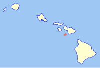
Location of Molokai

Molokai is the northernmost of the islands of Maui County. Unlike every other island in the state, it is divided between two counties: Kalawao County consists of the island's northern peninsula.

Landmark name Image Date listed Location Community Summary
1-21 Archeological Sites at Kawela November 3, 1982 Addresses Restricted Kawela
22 Kalaupapa National Historical Park January 7, 1976 Molokai
21°10′40″N 156°57′36″W / 21.17778°N 156.96000°W / 21.17778; -156.96000 (Kalaupapa National Historical Park)
Kalaupapa Park preserving sites of two isolation settlements for Hansen's disease sufferers. One of two NRHP-listed sites in Kalawao County
23 Southwest Moloka'i Archeological District October 15, 1986 Address Restricted Maunaloa
24 U.S. Coast Guard Molokai Light March 25, 1982 North of Kalaupapa
21°12′44″N 156°58′21″W / 21.21222°N 156.97250°W / 21.21222; -156.97250 (U.S. Coast Guard Molokai Light)
Kalaupapa A lighthouse. One of two NRHP-listed sites located in Kalawao County
25 Hokukano-Ualapue Complex October 15, 1966 On Hawaii Route 45 Ualapue One of Hawaii's most important archeological sites
26 Kamehameha V Wall, Archeological Site (T-20 and T-42-3) 50-60-04-706 November 5, 1982 Address Restricted Kawela
27 R.W. Meyer Sugar Mill September 4, 1979 Hawaii Route 47 Kalae

Lanai

Location of Lanai

Lanai is the smallest of the populated islands of Maui County, lying between the islands of Maui and Molokai.

Landmark name Image Date listed Location Community Summary
1 Kaunolu Village Site October 15, 1966 Address Restricted Lanai City Former fishing village, abandoned in the 1880s, that is the largest surviving ruins of a prehistoric Hawaiian village.
2 Pu'upehe Platform (50La19) October 6, 1986 Address Restricted Lanai City

Maui

Location of Maui

Maui is the largest and the easternmost island of Maui County.

Landmark name Image Date listed Location Community Summary
1 Henry Perrine Baldwin High School June 30, 2000 Junction of Lower Main St. and Kaahumanu Ave.
20°53′45″N 156°29′38″W / 20.89583°N 156.49389°W / 20.89583; -156.49389 (Baldwin, Henry Perrine, High School)
Wailuku
2 Bank of Hawaii-Haiku Branch December 4, 2000 771 Haiku Rd.
20°59′3″N 156°19′29″W / 20.98417°N 156.32472°W / 20.98417; -156.32472 (Bank of Hawaii-Haiku Branch)
Haiku
3 Chee Kung Tong Society Building November 15, 1982 2151 Vineyard St.
20°53′36″N 156°30′29″W / 20.89333°N 156.50806°W / 20.89333; -156.50806 (Chee Kung Tong Society Building)
Wailuku
4 Crater Historic District November 1, 1974 Address Restricted Kahului
5 Frank and Theresa Gomes House June 15, 2001 32 Pakani Place
20°50′58″N 156°19′3″W / 20.84944°N 156.31750°W / 20.84944; -156.31750 (Gomes, Frank and Theresa, House)
Makawao
6 Haiku Mill February 6, 1986 Haiku Rd.
20°55′49″N 156°19′58″W / 20.93028°N 156.33278°W / 20.93028; -156.33278 (Haiku Mill)
Haiku
7 Hale Pa'i May 13, 1976 Lahainaluna High School
20°53′40″N 156°39′45″W / 20.89444°N 156.66250°W / 20.89444; -156.66250 (Hale Pa'i)
Lahaina
8 Halekii-Pihana Heiau November 25, 1985 Hea Pl. off Kuhio Pl. from Waiehu Beach Rd.
20°54′30″N 156°29′42″W / 20.90833°N 156.49500°W / 20.90833; -156.49500 (Halekii-Pihana Heiau)
Wailuku
9 Hana Belt Road June 15, 2001 Hana Highway (Hawaii Route 360) and Pi'ilani Highway (Hawaii Route 31)
20°53′52″N 156°13′20″W / 20.89778°N 156.22222°W / 20.89778; -156.22222 (Hana Belt Road)
Makawao
10 Hana District Police Station and Courthouse August 27, 1991 Uakea Rd.
20°45′44″N 155°59′21″W / 20.76222°N 155.98917°W / 20.76222; -155.98917 (Hana District Police Station and Courthouse)
Hana
11 Hardy House November 8, 1984 808 Makawao Ave.
20°51′6″N 156°19′25″W / 20.85167°N 156.32361°W / 20.85167; -156.32361 (Hardy House)
Makawao
12 Holy Ghost Catholic Church August 18, 1983 Lower Kula Rd.
20°46′4″N 156°20′22″W / 20.76778°N 156.33944°W / 20.76778; -156.33944 (Holy Ghost Catholic Church)
Kula
13 Honokalani Village November 25, 1985 Address Restricted Hana
14 Iao Theater February 9, 1995 68 N. Market St.
20°53′37″N 156°30′17″W / 20.89361°N 156.50472°W / 20.89361; -156.50472 (Iao Theater)
Wailuku
15 Ka'ahumanu Avenue-Naniloa Drive Overpass November 19, 2008 Naniloa Dr. at Kaahumanu Ave.
20°53′19.356″N 156°29′45.672″W / 20.88871000°N 156.49602000°W / 20.88871000; -156.49602000 (Ka'ahumanu Avenue-Naniloa Drive Overpass)
Wailuku
16 Kaahumanu Church May 12, 1975 S. High St.
20°53′49″N 156°30′1″W / 20.89694°N 156.50028°W / 20.89694; -156.50028 (Kaahumanu Church)
Wailuku
17 Kalepolepo Fishpond December 30, 1996 S. Kihei Rd., south of its junction with Hawaii Route 31 in Kalepolepo County Park
20°46′0″N 156°27′45″W / 20.76667°N 156.46250°W / 20.76667; -156.46250 (Kalepolepo Fishpond)
Kihei
18 Kaupo School June 30, 2000 Government Rd.
20°38′28″N 156°7′31″W / 20.64111°N 156.12528°W / 20.64111; -156.12528 (Kaupo School)
Kaupo
19 Keanae School June 30, 2000 Hana Highway
20°51′21″N 156°8′29″W / 20.85583°N 156.14139°W / 20.85583; -156.14139 (Keanae School)
Keanae
20 Ket Hing Society Building November 15, 1982 Cross Rd.
20°42′35″N 156°21′11″W / 20.70972°N 156.35306°W / 20.70972; -156.35306 (Ket Hing Society Building)
Kula Now demolished
21 King Kamehameha III's Royal Residential Complex May 9, 1997 Junction of Front and Shaw Sts., Malu'ulu o Lele and Kamehameha Iki Parks
20°52′24″N 156°40′39″W / 20.87333°N 156.67750°W / 20.87333; -156.67750 (King Kamehameha III's Royal Residential Complex)
Lahaina
22 Lahaina Historic District October 15, 1966 Western side of Maui on Hawaii Route 30
20°52′14″N 156°41′3″W / 20.87056°N 156.68417°W / 20.87056; -156.68417 (Lahaina Historic District)
Lahaina
23 Loaloa Heiau October 15, 1966 Southeastern coast of Maui, on Hawaii Route 31, about 0.25 miles north of Kaupo
20°38′41″N 156°7′26″W / 20.64472°N 156.12389°W / 20.64472; -156.12389 (Loaloa Heiau)
Kaupo
24 Makawao Union Church December 17, 1985 Baldwin Ave.
20°53′44″N 156°21′14″W / 20.89556°N 156.35389°W / 20.89556; -156.35389 (Makawao Union Church)
Paia
25 Maui Jinsha Mission November 21, 1978 472 Lipo St.
20°54′29″N 156°29′16″W / 20.90806°N 156.48778°W / 20.90806; -156.48778 (Maui Jinsha Mission)
Wailuku
26 Old Bailey House March 20, 1973 Iao Valley Rd.
20°53′27″N 156°30′37″W / 20.89083°N 156.51028°W / 20.89083; -156.51028 (Old Bailey House)
Wailuku
27 Paia School August 22, 2000 Baldwin Ave. west of its junction with Old Makawoa Rd.
20°54′11″N 156°21′24″W / 20.90306°N 156.35667°W / 20.90306; -156.35667 (Paia School)
Paia
28 Piilanihale Heiau October 15, 1966 4 miles north of Hana, at the mouth of Honomaele Gulch near Kalahu Point Hana
29 Puunene School August 22, 2000 Junction of Puunene Ave. and Mokulele Highway
20°51′55″N 156°27′6″W / 20.86528°N 156.45167°W / 20.86528; -156.45167 (Puunene School)
Puunene
30 Wai'ale Drive Bridge October 30, 1998 Ka'ahumanu Ave., 0.1 miles east of Kinipopo St.
20°53′39″N 156°30′6″W / 20.89417°N 156.50167°W / 20.89417; -156.50167 (Wai'ale Drive Bridge)
Wailuku
31 Waihee Church April 21, 1994 Kahekili Highway
20°56′6″N 156°30′54″W / 20.93500°N 156.51500°W / 20.93500; -156.51500 (Waihee Church)
Waihee
32 Wailuku Civic Center Historic District August 20, 1986 S. High St. between Wells and Kaohu Sts.
20°53′25″N 156°30′26″W / 20.89028°N 156.50722°W / 20.89028; -156.50722 (Wailuku Civic Center Historic District)
Wailuku
33 Wailuku School June 30, 2000 High St.
20°53′17″N 156°30′29″W / 20.88806°N 156.50806°W / 20.88806; -156.50806 (Wailuku School)
Wailuku
34 Wananalua Congregational Church November 23, 1988 Hana Highway and Haouli St.
20°45′27″N 155°59′21″W / 20.75750°N 155.98917°W / 20.75750; -155.98917 (Wananalua Congregational Church)
Hana
35 Wo Hing Society Building November 15, 1982 848 Front St.
20°52′52″N 156°40′59″W / 20.88111°N 156.68306°W / 20.88111; -156.68306 (Wo Hing Society Building)
Lahaina

Kahoolawe

Location of Kahoolawe

Kahoolawe is the smallest and the southernmost island of Maui County. Alone among the state's major islands, it is uninhabited.

Landmark name Image Date listed Location Community Summary
1 Kahoʻolawe Island Archeological District March 18, 1981 Address Restricted
20°33′N 156°36′W / 20.550°N 156.600°W / 20.550; -156.600 (Kahoolawe Island Archeological District)
Kahoʻolawe The district includes the entire island, which contains over 500 individual archeological sites[7]

Hawaii

Location of the island of Hawaii

The island of Hawaii is coterminous with Hawaii County.

Landmark name Image Date listed Location Community Summary
1 1790 Footprints August 7, 1974 9.1 miles south of park headquarters on Hawaii Route 11, then along a foot trail to the southeast for 1 mile
19°23′0″N 155°20′7″W / 19.38333°N 155.33528°W / 19.38333; -155.33528 (1790 Footprints)
Hawaii Volcanoes National Park
2 Ahole Holua Complex November 26, 1973 South of Milolii on Ahole Bay
19°8′27″N 155°54′58″W / 19.14083°N 155.91611°W / 19.14083; -155.91611 (Ahole Holua Complex)
Milolii
3 Ahua A Umi Heiau August 13, 1974 Address Restricted North Kona
4 Ainahou Ranch February 8, 1995 Off Chain of Craters Rd. in Hawaii Volcanoes National Park
19°20′54″N 155°13′56″W / 19.34833°N 155.23222°W / 19.34833; -155.23222 (Ainahou Ranch)
Hawaii Volcanoes National Park
5 Ainapo Trail August 30, 1974 Hawaii Volcanoes National Park
19°27′39″N 155°34′39″W / 19.46083°N 155.57750°W / 19.46083; -155.57750 (Ainapo Trail)
Mauna Loa
6 Ala Loa June 5, 1987 Off Hawaii Route 19 from Kiholo Bay to Kalahuipaua'a
19°53′49″N 155°54′2″W / 19.89694°N 155.90056°W / 19.89694; -155.90056 (Ala Loa)
South Kohala
7 Anna Ranch April 28, 2008 65-1480 Kawaihae Rd.
20°1′22.59″N 155°45′59.37″W / 20.0229417°N 155.7664917°W / 20.0229417; -155.7664917 (Anna Ranch)
Kamuela
8 Bobcat Trail Habitation Cave (50-10-30-5004) May 15, 1986 Address Restricted Pohakuluoa
9 Bond District March 30, 1978 Southeast of Kapaau off Hawaii Route 27
20°13′43″N 155°47′51″W / 20.22861°N 155.79750°W / 20.22861; -155.79750 (Bond District)
Kapaau
10 Francis E. Ii Brown House August 21, 1986 Keawaiki Bay
19°53′31″N 155°54′29″W / 19.89194°N 155.90806°W / 19.89194; -155.90806 (Brown, Francis E. Ii, House)
Kamuela
11 Chee Ying Society July 20, 1978 Hawaii Route 24
20°5′5″N 155°28′34″W / 20.08472°N 155.47611°W / 20.08472; -155.47611 (Chee Ying Society)
Honokaa
12 Daifukuji Soto Zen Mission April 21, 1994 Mamalahoa Highway
19°29′12″N 155°54′9″W / 19.48667°N 155.90250°W / 19.48667; -155.90250 (Daifukuji Soto Zen Mission)
Honalo
13 District Courthouse and Police Station September 4, 1979 141 Kalakaua St.
19°43′46″N 155°5′17″W / 19.72944°N 155.08806°W / 19.72944; -155.08806 (District Courthouse and Police Station)
Hilo
14 Greenwell Store May 22, 1978 Hawaii Route 11
19°30′55″N 155°55′24″W / 19.51528°N 155.92333°W / 19.51528; -155.92333 (Greenwell Store)
Kealakekua
15 Thomas Guard House December 23, 2003 240 Kaiulani St.
19°43′40″N 155°6′3″W / 19.72778°N 155.10083°W / 19.72778; -155.10083 (Guard, Thomas, House)
Hilo
16 Hale Halawai O Holualoa June 5, 1987 Alii Dr.
19°36′36″N 155°58′41″W / 19.61000°N 155.97806°W / 19.61000; -155.97806 (Hale Halawai O Holualoa)
Kailua-Kona
17 S. Hata Building August 27, 1991 318 Kamehameha Ave.
19°43′41″N 155°5′17″W / 19.72806°N 155.08806°W / 19.72806; -155.08806 (Hata, S., Building)
Hilo
18 Heiau in Kukuipahu April 24, 1973 Address Restricted Hawi
19 Hilo Masonic Lodge Hall-Bishop Trust Building April 21, 1994 Junction of Keawe and Waianuenue Sts.
19°43′47″N 155°5′32″W / 19.72972°N 155.09222°W / 19.72972; -155.09222 (Hilo Masonic Lodge Hall-Bishop Trust Building)
Hilo
20 James M. Hind House February 3, 1994 Skilled Camp, House J
20°6′58″N 155°34′51″W / 20.11611°N 155.58083°W / 20.11611; -155.58083 (Hind, James M., House)
Hawi
21 Holualoa 4 Archeological District (State Site No. 50-10-37-23.661) June 8, 2005 Ali'i
19°36′21″N 155°58′39″W / 19.60583°N 155.97750°W / 19.60583; -155.97750 (Holualoa 4 Archeological District (State Site No. 50-10-37-23.661))
Kailua-Kona
22 Honokohau Settlement October 15, 1966 Address Restricted Kailua-Kona A National Historical Park and National Historic Landmark
23 Hulihee Palace May 25, 1973 Alii Dr.
19°38′32″N 155°59′51″W / 19.64222°N 155.99750°W / 19.64222; -155.99750 (Hulihee Palace)
Kailua-Kona
24 Imiola Church August 28, 1975 Northeast of Waimea on Hawaii Route 19
20°1′50″N 155°39′56″W / 20.03056°N 155.66556°W / 20.03056; -155.66556 (Imiola Church)
Waimea
25 Kahaluu Historic District December 27, 1974 Address Restricted Holualoa
26 Kahikolu Church November 15, 1982 Southeast of Napoopoo
19°27′43″N 155°53′39″W / 19.46194°N 155.89417°W / 19.46194; -155.89417 (Kahikolu Church)
Napoopoo
27 Kalaoa Permanent House Site 10,205 November 21, 1992 Near Kalihi Point, Natural Energy Laboratory of Hawaii
19°43′35″N 156°3′31″W / 19.72639°N 156.05861°W / 19.72639; -156.05861 (Kalaoa Permanent House Site 10,205)
Kailua-Kona
28 Kaloko-Honokohau National Historical Park November 10, 1978 Island of Hawaii
19°41′4.91″N 156°1′21.66″W / 19.6846972°N 156.0226833°W / 19.6846972; -156.0226833 (Kaloko-Honokohau National Historical Park)
Kailua-Kona
29 Kamakahonu, Residence Of King Kamehameha I October 15, 1966 On the northwestern edge of Kailua Bay, north and west of Kailua Wharf Kailua-Kona
30 Kamehameha Hall May 20, 1993 1162 Kalanianaole Ave.
19°44′3″N 155°2′51″W / 19.73417°N 155.04750°W / 19.73417; -155.04750 (Kamehameha Hall)
Hilo
31 Kamehameha III's Birthplace July 24, 1978 Off Alii Dr.
19°34′0″N 155°57′50″W / 19.56667°N 155.96389°W / 19.56667; -155.96389 (Kamehameha III's Birthplace)
Keauhou
32 Kamoa Point Complex July 14, 1983 Address Restricted Kailua-Kona
33 Kealakekua Bay Historical District December 12, 1973 Southwest of Captain Cook off Hawaii Route 11
19°28′29″N 155°55′27″W / 19.47472°N 155.92417°W / 19.47472; -155.92417 (Kealakekua Bay Historical District)
Captain Cook
34 Keauhou Holua Slide October 15, 1966 East of Hawaii Route 18 Keauhou
35 Kii Petroglyphs July 12, 1984 Address Restricted Waiohinu
36 Kilauea Crater July 24, 1974 Southwest of Hilo in Hawaii Volcanoes National Park
19°25′2″N 155°16′36″W / 19.41722°N 155.27667°W / 19.41722; -155.27667 (Kilauea Crater)
Hilo
37 Kohala District Courthouse August 31, 1979 Government Rd.
20°13′59″N 155°48′3″W / 20.23306°N 155.80083°W / 20.23306; -155.80083 (Kohala District Courthouse)
Kapaau
38 Kuamo'o Burials August 13, 1974 Address Restricted Kailua-Kona
39 Lapakahi Complex July 2, 1973 Address Restricted Mahukona
40 Rev. D.B. Lyman House March 24, 1978 276 Haili St.
19°43′38″N 155°5′35″W / 19.72722°N 155.09306°W / 19.72722; -155.09306 (Lyman, Rev. D. B., House)
Hilo
41 Mahana Archeological District (50HA10230) October 14, 1986 Address Restricted Naalehu
42 Manuka Bay Petroglyphs September 19, 1973 Address Restricted Waiohinu
43 Mauna Kea Adz Quarry October 15, 1966 24 miles northwest of Hilo[8] Hilo A basalt quarry and the largest primitive quarry in the world
44 Mokuaikaua Church October 3, 1978 Off Hawaii Route 11
19°38′39″N 155°59′48″W / 19.64417°N 155.99667°W / 19.64417; -155.99667 (Mokuaikaua Church)
Kailua-Kona
45 Mookini Heiau October 15, 1966 Northern tip of Hawaii, 1 mile west of Upolu Point Airport
20°15′44″N 155°52′59″W / 20.26222°N 155.88306°W / 20.26222; -155.88306 (Mookini Heiau)
Hawi
46 A. Nanbu Hotel-Holy's Bakery November 18, 1999 Akoni Pule Highway
20°13′55″N 155°47′57″W / 20.23194°N 155.79917°W / 20.23194; -155.79917 (Nanbu, A., Hotel-Holy's Bakery)
Kapaau
47 Old Volcano House No. 42 July 24, 1974 Southwest of Hilo on Hawaii Route 11 in Hawaii Volcanoes National Park
19°26′2″N 155°15′39″W / 19.43389°N 155.26083°W / 19.43389; -155.26083 (Old Volcano House No. 42)
Hilo
48 Palace Theater May 11, 1993 38 Haili St.
19°43′10″N 155°41′24″W / 19.71944°N 155.69000°W / 19.71944; -155.69000 (Palace Theater)
Hilo A movie theater built in 1925, today an arthouse
49 Pu'uhonua O Honaunau National Historical Park October 15, 1966 20 miles south of Kailua-Kona
19°35′45″N 155°58′36″W / 19.59583°N 155.97667°W / 19.59583; -155.97667 (Pu'uhonua O Honaunau National Historical Park)
Kailua-Kona
50 Pu'ukohola Heiau October 15, 1966 0.9 miles southeast of Kawaihae
20°1′35″N 155°49′12″W / 20.02639°N 155.82000°W / 20.02639; -155.82000 (Pu'ukohola Heiau)
Kawaihae
51 Pu'ukohola Heiau National Historic Site August 17, 1972 Northern end of Hawaii off Hawaii Route 26, about 1 mile southeast of Kawaihae
20°1′52″N 155°49′30″W / 20.03111°N 155.82500°W / 20.03111; -155.82500 (Pu'ukohola Heiau National Historic Site)
Kawaihae
52 Pua'a-2 Agricultural Fields Archeological District (50HA10229) October 14, 1986 Address Restricted Holualoa
53 Puako Petroglyph Archeological District June 6, 2007 Address Restricted Puako
54 Puna-Ka'u Historic District July 1, 1974 Hawaii Volcanoes National Park
19°17′42″N 155°14′31″W / 19.29500°N 155.24194°W / 19.29500; -155.24194 (Puna-Ka'u Historic District)
Pahala
55 St. Benedict's Catholic Church May 31, 1979 Off Hawaii Route 11
19°26′21″N 155°53′33″W / 19.43917°N 155.89250°W / 19.43917; -155.89250 (St. Benedict's Catholic Church)
Honaunau
56 W.H. Shipman House June 23, 1978 141 Kalulani St.
19°43′43″N 155°5′50″W / 19.72861°N 155.09722°W / 19.72861; -155.09722 (Shipman, W. H., House)
Hilo
57 South Point Complex October 15, 1966 Address Restricted Naalehu
58 Star of the Sea Church-Kalapana Painted Church May 14, 1997 Hawaii Route 130, 0.7 miles north of Kaimu
19°22′34″N 154°58′1″W / 19.37611°N 154.96694°W / 19.37611; -154.96694 (Star of the Sea Church-Kalapana Painted Church)
Kaimu
59 Tong Wo Society Building June 9, 1978 Hawaii Route 27
20°13′40″N 155°46′10″W / 20.22778°N 155.76944°W / 20.22778; -155.76944 (Tong Wo Society Building)
Halaula
60 U.S. Post Office and Office Building October 1, 1974 Kinoole and Waianuenue Sts.
19°43′49″N 155°5′31″W / 19.73028°N 155.09194°W / 19.73028; -155.09194 (U.S. Post Office and Office Building)
Hilo
61 Uchida Coffee Farm February 9, 1995 Off Mamalahoa Highway
19°29′44″N 155°55′0″W / 19.49556°N 155.91667°W / 19.49556; -155.91667 (Uchida Coffee Farm)
Kealakekua
62 Volcano Block Building January 7, 1993 27-37 Wianuenue Ave.
19°43′44″N 155°5′24″W / 19.72889°N 155.09000°W / 19.72889; -155.09000 (Volcano Block Building)
Hilo
63 Waiakea Mission Station-Hilo Station April 23, 2002 211 Haili St.
19°43′37″N 155°5′31″W / 19.72694°N 155.09194°W / 19.72694; -155.09194 (Waiakea Mission Station-Hilo Station)
Hilo
64 Waimea Elementary School June 8, 2005 Hawaii Route 19, Kawaihae Rd. TMK (3)6-5-07:3
20°1′25″N 155°40′21″W / 20.02361°N 155.67250°W / 20.02361; -155.67250 (Waimea Elementary School)
Kamuela
65 Whitney Seismograph Vault No. 29 July 24, 1974 Southwest of Hilo on Hawaii Route 11 in Hawaii Volcanoes National Park
19°25′59″N 155°15′40″W / 19.43306°N 155.26111°W / 19.43306; -155.26111 (Whitney Seismograph Vault No. 29)
Hilo
66 Wilkes Campsite July 24, 1974 West of Hilo at Mauna Loa Volcano in Hawaii Volcanoes National Park
19°28′14″N 155°35′6″W / 19.47056°N 155.58500°W / 19.47056; -155.58500 (Wilkes Campsite)
Hilo
67 A.J. Williamson House May 9, 1997 31 Halaulani Pl.
19°44′11″N 155°5′44″W / 19.73639°N 155.09556°W / 19.73639; -155.09556 (Williamson, A. J., House)
Hilo

References

  1. ^ National Park Service, United States Department of the Interior, "National Register of Historic Places: Weekly List Actions", retrieved June 21, 2024.
  2. ^ "National Register Information System". National Register of Historic Places. National Park Service. April 24, 2008.
  3. ^ "National Register of Historic Places: Weekly List Actions". National Park Service. Retrieved January 2, 2009.
  4. ^ Weekly List Actions, National Register of Historic Places website
  5. ^ National Park Service, United States Department of the Interior, "National Register of Historic Places: Weekly List Actions", retrieved June 21, 2024.
  6. ^ Detailed maps of Hawaii, United States Census Bureau, 2000. Accessed 2009-01-31.
  7. ^ Barrera, William, Jr. Kaho'olaw Archaeology: An Overview Hawaiian Archaeology, Vol. 1(1). Accessed 2009-02-09.
  8. ^ Location derived from this National Park Service website; the NRIs lists it as "Address Restricted"

External links