Dick, Colorado: Difference between revisions
Category:1870 establishments in Colorado Territory Category:Former populated places in Weld County, Colorado Category:Geography of Weld County, Colorado Category:Ghost towns in Colorado Category:History of Colorado Category:Mining communities in Colorado Category:Populated places established in 1870 Category:Pre-statehood history of Colorado |
m hopefully fixing wikilink |
||
| Line 8: | Line 8: | ||
Coal mining had a significant presence in the Dick area. The Eagle Mine, which was to the west of Dick, opened in 1939. The Washington and Lincoln mines opened in 1940 and 1948 respectively. The Washington Mine closed in 1967, followed by the closures of the Eagle and Lincoln mines in 1978 and 1979 respectively. The closures of the coal mines likely contributed to the decline of Dick.<ref>{{cite map|author=Roberts, S., Hynes, L. Woodward, C.|date=November 30, 2016|title=Map Showing the Extent of Mining, Locations of Mine Shafts, Adits, Air Shafts, and Bedrock Faults, and Thickness of Overburden Above Abandoned Coal Mines in the Boulder-Weld Coal Field, Boulder, Weld, and Adams Counties, Colorado|url=https://pubs.usgs.gov/imap/i-2735/i-2735.pdf|publisher=United States Geological Survey|section=Geologic Investigations Series I-2735|access-date=September 9, 2021}}</ref> |
Coal mining had a significant presence in the Dick area. The Eagle Mine, which was to the west of Dick, opened in 1939. The Washington and Lincoln mines opened in 1940 and 1948 respectively. The Washington Mine closed in 1967, followed by the closures of the Eagle and Lincoln mines in 1978 and 1979 respectively. The closures of the coal mines likely contributed to the decline of Dick.<ref>{{cite map|author=Roberts, S., Hynes, L. Woodward, C.|date=November 30, 2016|title=Map Showing the Extent of Mining, Locations of Mine Shafts, Adits, Air Shafts, and Bedrock Faults, and Thickness of Overburden Above Abandoned Coal Mines in the Boulder-Weld Coal Field, Boulder, Weld, and Adams Counties, Colorado|url=https://pubs.usgs.gov/imap/i-2735/i-2735.pdf|publisher=United States Geological Survey|section=Geologic Investigations Series I-2735|access-date=September 9, 2021}}</ref> |
||
In 1966, a railroad bridge over the [[South Platte River]], west of Brighton, was washed out in a flood. This severed rail connections to Brighton, and lead to the abandonment of the rail line east of Dick in 1967.<ref>{{cite map|author=United States Geological Survey|date=1967|title=Brighton Quadrangle, Colorado|publisher=United States Department of the Interior|url=https://ngmdb.usgs.gov/topoview/viewer/#14/39.9935/-104.8411|access-date=September 9, 2021}}</ref> By 1994, the rail line east of [[St Vrains, Colorado|St Vrains]] was abandoned, cutting off Dick's railway access.<ref>{{cite map|author=United States Geological Survey|date=1994|title=Frederick Quadrangle, Colorado|publisher=United States Department of the Interior|url=https://ngmdb.usgs.gov/topoview/viewer/#14/40.0286/-104.9358|access-date=September 9, 2021}}</ref> The abandonment of the rail line led directly to Dick's desertion, which likely happened in the 1980s. |
In 1966, a railroad bridge over the [[South Platte River]], west of Brighton, was washed out in a flood. This severed rail connections to Brighton, and lead to the abandonment of the rail line east of Dick in 1967.<ref>{{cite map|author=United States Geological Survey|date=1967|title=Brighton Quadrangle, Colorado|publisher=United States Department of the Interior|url=https://ngmdb.usgs.gov/topoview/viewer/#14/39.9935/-104.8411|access-date=September 9, 2021}}</ref> By 1994, the rail line east of [[St. Vrains, Colorado|St. Vrains]] was abandoned, cutting off Dick's railway access.<ref>{{cite map|author=United States Geological Survey|date=1994|title=Frederick Quadrangle, Colorado|publisher=United States Department of the Interior|url=https://ngmdb.usgs.gov/topoview/viewer/#14/40.0286/-104.9358|access-date=September 9, 2021}}</ref> The abandonment of the rail line led directly to Dick's desertion, which likely happened in the 1980s. |
||
{{clear}} |
{{clear}} |
||
Latest revision as of 21:26, 11 May 2024
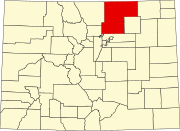
Dick is an extinct town in Weld County, in the U.S. state of Colorado.
History
[edit]The Denver & Boulder Valley Railroad built a rail line to Dick in 1870, and ran its first train to the settlement in December of that year. The rail line connected Boulder to Brighton, and was acquired by the Union Pacific Railroad in 1898.[1] Dick was located adjacent to a railway siding, indicating that it was likely a train station at some point.[2]
Coal mining had a significant presence in the Dick area. The Eagle Mine, which was to the west of Dick, opened in 1939. The Washington and Lincoln mines opened in 1940 and 1948 respectively. The Washington Mine closed in 1967, followed by the closures of the Eagle and Lincoln mines in 1978 and 1979 respectively. The closures of the coal mines likely contributed to the decline of Dick.[3]
In 1966, a railroad bridge over the South Platte River, west of Brighton, was washed out in a flood. This severed rail connections to Brighton, and lead to the abandonment of the rail line east of Dick in 1967.[4] By 1994, the rail line east of St. Vrains was abandoned, cutting off Dick's railway access.[5] The abandonment of the rail line led directly to Dick's desertion, which likely happened in the 1980s.
See also
[edit]- Bibliography of Colorado
- Geography of Colorado
- History of Colorado
- Index of Colorado-related articles
- List of Colorado-related lists
- Outline of Colorado
References
[edit]- ^ Fraser, Clayton, B. (August 31, 1997), The History and Evolution of Colorado's Railroads: 1858-1948 (PDF), Loveland: United States Department of the Interior, p. 101
{{citation}}: CS1 maint: multiple names: authors list (link) - ^ United States Geological Survey (1950). Frederick Quadrangle, Colorado (Map). United States Department of the Interior. Retrieved September 9, 2021.
- ^ Roberts, S., Hynes, L. Woodward, C. (November 30, 2016). Map Showing the Extent of Mining, Locations of Mine Shafts, Adits, Air Shafts, and Bedrock Faults, and Thickness of Overburden Above Abandoned Coal Mines in the Boulder-Weld Coal Field, Boulder, Weld, and Adams Counties, Colorado (PDF) (Map). United States Geological Survey. § Geologic Investigations Series I-2735. Retrieved September 9, 2021.
{{cite map}}: CS1 maint: multiple names: authors list (link) - ^ United States Geological Survey (1967). Brighton Quadrangle, Colorado (Map). United States Department of the Interior. Retrieved September 9, 2021.
- ^ United States Geological Survey (1994). Frederick Quadrangle, Colorado (Map). United States Department of the Interior. Retrieved September 9, 2021.

