
Casper, Wyoming: Difference between revisions
→Notable Residents: rm non-notable |
fixed wikilinks |
||
| Line 61: | Line 61: | ||
|footnotes = |
|footnotes = |
||
}} |
}} |
||
'''Casper''' is the only city in and the [[county seat]] of [[Natrona County, Wyoming|Natrona County]], [[Wyoming]], [[United States]],{{GR|6}} although the county is home to a number of small towns and Casper suburbs. With a population of 49,644, Casper is the second largest city in Wyoming, according to the [[United States Census, 2000|2000 census]]. The [[city]] is located in east-central Wyoming at the foot of [[Casper Mountain]], the north end of the [[Laramie Mountain Range]], along the [[North Platte River]]. [[Interstate 25]] approaches Casper from the North and South and is the main avenue of transportation to and from the city. The towns immediately adjacent to Casper are [[Mills, Wyoming]], [[Evansville, Wyoming]] |
'''Casper''' is the only city in and the [[county seat]] of [[Natrona County, Wyoming|Natrona County]], [[Wyoming]], [[United States]],{{GR|6}} although the county is home to a number of small towns and Casper suburbs. With a population of 49,644, Casper is the second largest city in Wyoming, according to the [[United States Census, 2000|2000 census]]. The [[city]] is located in east-central Wyoming at the foot of [[Casper Mountain]], the north end of the [[Laramie Mountain Range]], along the [[North Platte River]]. [[Interstate 25]] approaches Casper from the North and South and is the main avenue of transportation to and from the city. The towns immediately adjacent to Casper are [[Mills, Wyoming|Mills]], [[Evansville, Wyoming|Evansville]], [[Bar Nunn, Wyoming|Bar Nunn]], and Mountain View. Unincorporated areas include Allendale, Dempsey Acres, Red Buttes, Indian Springs, and several others. |
||
==History== |
==History== |
||
Revision as of 14:28, 12 April 2008
City of Casper, Wyoming | |
|---|---|
 Overview of downtown Casper, looking south toward Casper Mountain, with North Platte River in foreground. | |
 Location in Wyoming | |
| Country | United States |
| State | Wyoming |
| County | Natrona |
| Government | |
| • City Manager | Thomas O. Forslund |
| Area | |
| • City | 24.3 sq mi (62.8 km2) |
| • Land | 24.0 sq mi (62.0 km2) |
| • Water | 0.3 sq mi (0.8 km2) |
| • Metro | 5,376 sq mi sq mi (13,923 km² km2) |
| Elevation | 5,150 ft (1,560 m) |
| Population (2000) | |
| • City | 49,644 |
| • Density | 2,073/sq mi (800.5/km2) |
| • Metro | 66,533 |
| Time zone | UTC-7 (MST) |
| • Summer (DST) | UTC-6 (MDT) |
| ZIP codes | 82601, 82602, 82604, 82605, 82609, 82615, 82630, 82638, 82646 |
| Area code | 307 |
| FIPS code | 56-13150Template:GR |
| GNIS feature ID | 1586424Template:GR |
| Website | http://www.casperwy.gov |
Casper is the only city in and the county seat of Natrona County, Wyoming, United States,Template:GR although the county is home to a number of small towns and Casper suburbs. With a population of 49,644, Casper is the second largest city in Wyoming, according to the 2000 census. The city is located in east-central Wyoming at the foot of Casper Mountain, the north end of the Laramie Mountain Range, along the North Platte River. Interstate 25 approaches Casper from the North and South and is the main avenue of transportation to and from the city. The towns immediately adjacent to Casper are Mills, Evansville, Bar Nunn, and Mountain View. Unincorporated areas include Allendale, Dempsey Acres, Red Buttes, Indian Springs, and several others.
History
The city was established east of the former site of Fort Caspar, which was built during the mid-19th century mass migration of land seekers along the Oregon, California and Mormon trails [1]. The area was the location of several ferries constructed across the North Platte River in the early 1840s. In 1859, In 1859, Louis Guinard built a bridge and trading post near the original ferry locations[2]. A military garrison was soon posted nearby to protect telegraph and mail service under the command of Lieutenant Colonel William O. Collins[1]. Indian attacks increased after the Sand Creek Massacre in Colorado in 1864, bringing more troops to the post, which was by now called Platte Bridge Station. In July of 1865 Lieutenant Caspar Collins (the son of Colonel Collins) was killed near the post by a group of Indian warriors. Three months later the garrison was renamed Fort Caspar after Lieutenant Collins[1]. In 1867 the troops were ordered to abandon Fort Caspar in favor of Fort Fetterman downstream on the North Platte along the Bozeman Trail.
The town of Casper itself was founded well after the fort had been closed. The city was founded as an anticipated stopping point during railroad expansion, and was an early rival to Bessemer, Wyoming and Douglas, Wyoming in commerce. The lack of a railhead doomed Bessemer in favor of Casper, although Douglas, which also had a railhead, survives to the present day. The presence of a railhead caused Casper to figure as the starting off point for the "invaders" in the Johnson County War, as the special chartered train carrying them up from Texas stopped at that point.
Economy
Although relatively small by national standards, its location within the region makes Casper a center of banking and commerce.
Since the discovery of crude oil in the region during the 1890s, Casper became the regional petroleum industry center, and oil has figured prominently in its history from nearly the onset. Oil was first discovered in the famous Salt Creek Oil Field in 1889, approximately 40 miles (64 km) north of Casper, and the first refinery in Casper was built in 1895. The city has featured a refinery ever since, although various refineries have been built and closed over the years. As recently as the early 1980s, the city was near or home to three refineries. Only one remains today, which is actually located in the adjoining town of Evansville, Wyoming. With the development of the Wyoming coal and uranium fields in recent decades, the city has continued its role as an important center for the energy industry.
The town was once significant in the Western sheep industry, although perhaps not to the same extent as some other regional cities. A meat packing plant was established in the neighboring city of Evansville in the 1930s, and was closed in the 1970s.
The city has scheduled air service at Natrona County International Airport, a former army air base built during World War II. The current airport, having been built for World War Two bombers, has large runways and replaced a prior regional airport north of Casper which later became Bar Nunn.
Casper and the rest of Wyoming is served by the Casper Star-Tribune, a newspaper with statewide circulation. Casper is also the site of Casper College. The city is home to the Casper Troopers, a drum and bugle corps in Drum Corps International.
Notable Residents
- Dick Cheney, Vice President of United States under George W. Bush, Secretary of Defense under George H.W. Bush, former CEO of Haliburton Company. Cheney grew up in Casper, having moved there from his birthplace in Nebraska.
- John Barrasso, U.S. Senator for Wyoming
- Mike Devereaux, professional baseball player with World Series rings with Los Angeles Dodgers and Atlanta Braves
- Tom Browning, former major league pitcher, threw perfect game with the Cincinnati Reds
- Mike Lansing, former major league second baseman
- Pete Williams NBC News correspondent, former Assistant Secretary of Defense for Public Affairs
- Ron Franscell, newspaperman and author of novels "Angel Fire" and "The Deadline," and "Fall," a nonfiction about a 1973 crime that rocked Casper
- Jean Henry-Mead, photojournalist, researched and wrote the centennial history of Casper, Wyoming, titled, Casper Country: Wyoming's Heartland, ISBN 0-87108-738-3 (1987); Pruett Publishing; ISBN 1-931415-07-2 (2005) Medallion Books as well as other books about Wyoming.
- Matthew Shepard, gay student, murdered in October 1998 while attending the University of Wyoming in Laramie at the age of 21 in an apparent anti-gay hate crime that received international media attention.
- Rev. James Reeb, Civil Rights activist murdered in Selma, Alabama in 1965.
- Chris LeDoux, country music artist, passed away in Casper in 2005.
In January 2005 Matthew Shepard's former high school classmate Guy V. Padgett III was elected mayor of Casper, having earlier become the first openly gay elected official in Wyoming history when he was elected to the City Council in 2003. NBC newsman Pete Williams has also been a member of the Casper gay community, serving as news director for K2 News before moving on to national broadcasting. [citation needed]
Geography and Climate
Casper is located at 42°50′5″N 106°19′30″W / 42.83472°N 106.32500°WInvalid arguments have been passed to the {{#coordinates:}} function (42.834665, -106.325062)Template:GR. It sits at an average elevation of about 5100 to 5200 ft (just slightly lower than Denver).
According to the United States Census Bureau, the city has a total area of 24.3 square miles (62.8 km²), of which, 24.0 square miles (62.0 km²) of it is land and 0.3 square miles (0.8 km²) of it (1.32%) is water.
| Monthly Normal and Record High and Low Temperatures | ||||||||||||
| Month | Jan | Feb | Mar | Apr | May | Jun | Jul | Aug | Sep | Oct | Nov | Dec |
|---|---|---|---|---|---|---|---|---|---|---|---|---|
| Rec High °F | 60 | 68 | 75 | 84 | 95 | 102 | 104 | 102 | 97 | 87 | 72 | 63 |
| Norm High °F | 32.3 | 37 | 46.9 | 56.1 | 66.4 | 78.8 | 86.8 | 85.3 | 73.4 | 59.5 | 42.6 | 33.6 |
| Norm Low °F | 12.2 | 16.4 | 23.1 | 29.3 | 37.9 | 46.6 | 53.2 | 51.8 | 41.7 | 31.8 | 21.3 | 14 |
| Rec Low °F | -40 | -30 | -21 | -6 | 16 | 28 | 30 | 33 | 16 | -3 | -21 | -41 |
| Precip (in) | 0.58 | 0.64 | 0.9 | 1.52 | 2.38 | 1.43 | 1.29 | 0.73 | 0.98 | 1.14 | 0.82 | 0.62 |
| Source: USTravelWeather.com [1] | ||||||||||||
Demographics
As of the censusTemplate:GR of 2000, there were 49,644 people, 20,343 households, and 13,141 families residing in the city. The population density was 2,073.2 people per square mile (800.3/km²). There were 21,872 housing units at an average density of 913.4/sq mi (352.6/km²). The racial makeup of the city was 94.03% White, 0.86% Black or African American, 1.00% Native American, 0.49% Asian, 0.02% Pacific Islander, 2.04% from other races, and 1.56% from two or more races. 5.35% of the population were Hispanic or Latino of any race.
There were 20,343 households out of which 31.8% had children under the age of 18 living with them, 49.6% were married couples living together, 11.1% had a female householder with no husband present, and 35.4% were non-families. 29.1% of all households were made up of individuals and 10.2% had someone living alone who was 65 years of age or older. The average household size was 2.38 and the average family size was 2.94.
n the city the population was spread out with 25.9% under the age of 18, 10.5% from 18 to 24, 27.7% from 25 to 44, 22.3% from 45 to 64, and 13.6% who were 65 years of age or older. The median age was 36 years. For every 100 females there were 95.0 males. For every 100 females age 18 and over, there were 91.6 males.
The median income for a household in the city was $36,567, and the median income for a family was $46,267. Males had a median income of $34,905 versus $21,810 for females. The per capita income for the city was $19,409. About 8.5% of families and 11.4% of the population were below the poverty line, including 15.4% of those under age 18 and 7.3% of those age 65 or over.
Media
Sports
- Wyoming Cavalry a minor league indoor football team in the American Indoor Football Association.
- Casper Ghosts a minor league baseball team affiliated with the Colorado Rockies.
References
External links
- City website
- Casper Star-Tribune
- Casper Convention & Visitors Bureau
- Casper Area Chamber of Commerce
- Casper Recreation
Municipalities and communities of Natrona County, Wyoming, United States | ||
|---|---|---|
| City | 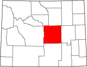 | |
| Towns | ||
| CDPs | ||
| Unincorporated communities | ||
Municipalities and communities of Natrona County, Wyoming, United States | ||
|---|---|---|
| City | | |
| Towns | ||
| CDPs | ||
| Unincorporated communities | ||