
Beit Kahil: Difference between revisions
Content deleted Content added
m →Bibliography: fixing a particular dead link to 1931 Palestine Census using AWB |
Rescuing 1 sources and tagging 0 as dead. #IABot (v1.2.6) |
||
| Line 19: | Line 19: | ||
|mayor= |
|mayor= |
||
}} |
}} |
||
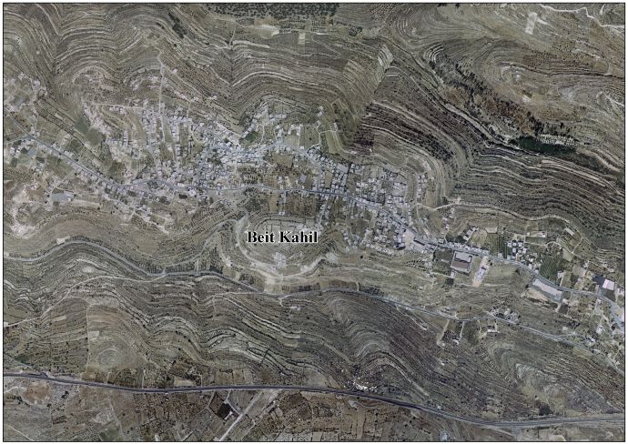
'''Beit Kahil''' ({{lang-ar|<big>بيت كاحل</big>}}) is a [[Palestinian territories|Palestinian]] town in the [[Hebron Governorate]] in the southern [[West Bank]], located seven kilometers northwest of [[Hebron]]. According to the [[Palestinian Central Bureau of Statistics]], Beit Kahil had a population of approximately 6,526 inhabitants in 2007.<ref name="PCBS">[http://www.pcbs.gov.ps/Portals/_PCBS/Downloads/book1487.pdf 2007 PCBS Census] [[Palestinian Central Bureau of Statistics]]. p.118.</ref> The population is made up of several clans, including al-Attawna, al-Assafra, al-Zuhoor, al-Judi, Barham and al-Khateeb. The town's total land area is 5,795 [[dunam]]s.<ref>[http://www.poica.org/editor/case_studies/view.php?recordID=1401 Demolition Warnings for Palestinian Houses in Beit Kahil Village] 1 June 2008.</ref> |
'''Beit Kahil''' ({{lang-ar|<big>بيت كاحل</big>}}) is a [[Palestinian territories|Palestinian]] town in the [[Hebron Governorate]] in the southern [[West Bank]], located seven kilometers northwest of [[Hebron]]. According to the [[Palestinian Central Bureau of Statistics]], Beit Kahil had a population of approximately 6,526 inhabitants in 2007.<ref name="PCBS">[http://www.pcbs.gov.ps/Portals/_PCBS/Downloads/book1487.pdf 2007 PCBS Census] [[Palestinian Central Bureau of Statistics]]. p.118.</ref> The population is made up of several clans, including al-Attawna, al-Assafra, al-Zuhoor, al-Judi, Barham and al-Khateeb. The town's total land area is 5,795 [[dunam]]s.<ref>[http://www.poica.org/editor/case_studies/view.php?recordID=1401 Demolition Warnings for Palestinian Houses in Beit Kahil Village] {{wayback|url=http://www.poica.org/editor/case_studies/view.php?recordID=1401 |date=20090714221155 }} 1 June 2008.</ref> |
||
==References== |
==References== |
||
Revision as of 01:43, 30 October 2016
Template:Infobox Palestinian Authority municipality Beit Kahil (Arabic: بيت كاحل) is a Palestinian town in the Hebron Governorate in the southern West Bank, located seven kilometers northwest of Hebron. According to the Palestinian Central Bureau of Statistics, Beit Kahil had a population of approximately 6,526 inhabitants in 2007.[1] The population is made up of several clans, including al-Attawna, al-Assafra, al-Zuhoor, al-Judi, Barham and al-Khateeb. The town's total land area is 5,795 dunams.[2]
References
Bibliography
- Barron, J. B., ed. (1923). Palestine: Report and General Abstracts of the Census of 1922. Government of Palestine.
- Conder, Claude Reignier; Kitchener, Herbert H. (1883). The Survey of Western Palestine: Memoirs of the Topography, Orography, Hydrography, and Archaeology. Vol. 3. London: Committee of the Palestine Exploration Fund. (p. 303)
- Hadawi, Sami (1970), Village Statistics of 1945: A Classification of Land and Area ownership in Palestine, Palestine Liberation Organization Research Center (pp. 50, 93, 143)
- Mills, E., ed. (1932). Census of Palestine 1931. Population of Villages, Towns and Administrative Areas. Jerusalem: Government of Palestine.
- Palmer, E. H. (1881). The Survey of Western Palestine: Arabic and English Name Lists Collected During the Survey by Lieutenants Conder and Kitchener, R. E. Transliterated and Explained by E.H. Palmer. Committee of the Palestine Exploration Fund. (p. 388)
External links
- Welcome To Bayt Kahil
- Survey of Western Palestine, Map 21: IAA, Wikimedia commons
- Beit Kahil Village (Fact Sheet)
- Beit Kahil Village Profile
- Beit Kahil Village Area Photo
- The priorities and needs for development in Beit Kahil village based on the community and local authorities’ assessment
